Your NOAA weather radio will alert you to every severe weather event in your state if you do not program it with the right county code. That single 6-digit number is the difference between sleeping through a tornado warning three counties away and being woken up for one heading directly toward your home.
The county code for your NOAA weather radio is a 6-digit FIPS (Federal Information Processing Standards) code assigned by the US government to every county and county-equivalent in the United States. Your weather radio uses this code through S.A.M.E. (Specific Area Message Encoding) technology to filter incoming alerts and activate only for the geographic areas you specify.
| Photo | Popular Portable Walkie Talkies | Price |
|---|---|---|
 | SKIWARRIOR Multifunctional Smart Wireless Ski Goggles with Walkie-Talkie, Anti-Fog Zeiss Lens, Music & Call Function (Cylindrical Blue) | Check Price On Amazon |
 | SINORISE Super Mini Walkie Talkies, Two-Way Radios, 3 Pack | Check Price On Amazon |
 | KOSPET Tank M4C Smart Watch Rugged, Dual-Band GPS, 5ATM & IP69K Waterproof | Check Price On Amazon |
 | Retevis RT15 Walkie Talkies 3 Pack, Birthday Gift, Outdoor Adventure Kit | Check Price On Amazon |
 | Rechargeable Walkie Talkies Toys for Kids: DIY Astronaut Walkie Talkies for Boys Christmas Birthday Gifts for 3 4 5 6 7 8 9 10 Boy Walkie Talkie Outdoor Hiking Toy 2 Way Radio Camping Outdoor Game | Check Price On Amazon |
Without the correct code programmed into your radio, you receive every alert broadcast by your nearest NOAA transmitter, which can cover dozens of counties. With the correct code, your radio stays silent for distant counties and wakes you only when your area is under a watch, warning, or advisory.
What Is a NOAA Weather Radio County Code?
A NOAA weather radio county code is the 6-digit FIPS location identifier that your S.A.M.E.-capable weather radio uses to filter alerts by geographic area. The first digit is always 0 for the US, followed by a 2-digit state code and a 3-digit county code. For example, Cook County, Illinois uses FIPS code 017031.
S.A.M.E. technology, developed by NOAA and integrated into the Emergency Alert System (EAS), encodes every weather alert broadcast with a list of affected FIPS codes. Your radio compares those codes against the ones you have programmed. If there is a match, the alert sounds. If there is no match, the radio stays silent.
This is a fundamentally different approach from older weather radios that simply received every broadcast on the NOAA frequency for your region. Those radios could not distinguish between a tornado warning for a county 80 miles away and one for your own neighborhood. S.A.M.E. filtering solves that problem entirely.
According to NOAA’s National Weather Service documentation, S.A.M.E. encoding has been the standard for NOAA Weather Radio All Hazards (NWR) broadcasts since the technology was introduced in the 1990s, and all modern weather radios with alert capability support it. To understand the full scope of what the NWR system covers, the complete overview of how NOAA weather radio works explains the transmitter network, broadcast schedule, and alert categories in detail.
The county code is not the same as a channel number or a privacy code. It is a location identifier, not a radio frequency parameter. Your radio can hold multiple FIPS codes simultaneously, which is useful if you live near a county border or want alerts for nearby areas where family members live.
Every S.A.M.E.-capable weather radio needs at least one FIPS code programmed before its alert filtering works correctly.
By the Numbers
NOAA Weather Radio County Codes – Key Facts
Sources: NOAA National Weather Service, FCC Part 95, FEMA IPAWS documentation.
How to Find Your NOAA Weather Radio County Code: Three Methods
You can find your 6-digit FIPS county code through the official NOAA SAME code lookup tool, a printable NOAA state-by-state FIPS list, or by checking your county government’s official website. The fastest and most reliable method is the NOAA online lookup tool at weather.gov, which lets you search by state and county name and returns the exact 6-digit code you need.
All three methods return the same official FIPS code because the codes are standardized at the federal level by the US Census Bureau and adopted by NOAA for S.A.M.E. broadcasts. The code does not change based on your radio model or manufacturer.
Method 1: Use the Official NOAA SAME Code Lookup Tool
Go to weather.gov/nwr/counties in any web browser. This page hosts the official NOAA county code reference for every state and territory.
Select your state from the list. The page returns a table showing every county and county-equivalent in that state, with the corresponding 6-digit FIPS S.A.M.E. code in the right column.
Find your county name in alphabetical order. Write down the full 6-digit code exactly as shown, including any leading zeros. Leading zeros matter because your radio requires all 6 digits, and omitting a zero produces the wrong code entirely.
If you live near a county border, record the codes for both counties. Most weather radios accept up to 25 S.A.M.E. codes simultaneously, so programming both costs nothing and ensures you receive alerts for either area.
Method 2: Use the NOAA Printable FIPS Code List
NOAA publishes a complete downloadable PDF of all US FIPS county codes on the National Weather Service website. Search for “NOAA SAME FIPS codes PDF” to locate the current version. This document is useful if you are setting up a radio without internet access or want a printed reference to keep with your emergency kit.
The PDF organizes codes by state alphabetically, then by county alphabetically within each state. The format is identical to the online lookup: a 6-digit code next to the county name. Record your code and store the reference with your radio manual.
Method 3: Check Your County Government Website
Your county government website often lists the FIPS code in sections covering emergency management, GIS data, or government records. Search for “[your county name] FIPS code” to find it quickly.
This method is less direct than the NOAA tool but useful as a cross-check if you want to confirm the code you found. The FIPS code on a county government site will always match the NOAA SAME code list because both draw from the same US Census Bureau standard.
For any county, all three methods return the same 6-digit number. Use whichever you find first and verify it matches before programming your radio.
How to Decode the 6-Digit FIPS Code Structure
Every FIPS S.A.M.E. code follows an exact 6-digit structure: a leading 0, a 2-digit state FIPS number, and a 3-digit county FIPS number. Understanding this structure lets you verify any code you find and helps you recognize errors before programming them into your radio.
Here is the breakdown of the format:
- Digit 1: Always 0 for US counties (used to distinguish from non-county geographic areas)
- Digits 2-3: State FIPS code (01 for Alabama, 06 for California, 48 for Texas, and so on through 56 for Wyoming)
- Digits 4-6: County FIPS code within that state (001, 003, 005, etc. – odd numbers only in most states)
As a real example, Jefferson County, Alabama has the FIPS code 001073. Digit 1 is 0 (US county). Digits 2-3 are 01 (Alabama state code). Digits 4-6 are 073 (Jefferson County within Alabama).
For Los Angeles County, California: code 006037. Digit 1 is 0. Digits 2-3 are 06 (California). Digits 4-6 are 037 (Los Angeles County).
This structure also explains why codes for neighboring counties look similar. Travis County, Texas (Austin) is 048453, and neighboring Williamson County, Texas is 048491. The first three digits (048) are identical because both are in Texas (state code 48 with leading 0).
If a code you find has only 5 digits, it is missing the leading 0. Add it back before programming. A 5-digit code entered into your radio will either produce an error or match the wrong location entirely.
Understanding the structure also helps you program codes for entire states. NOAA S.A.M.E. supports a “000” county suffix (for example, 048000 for all of Texas) that triggers alerts for any county in that state. This is useful for travelers but not for home use, where you want county-specific filtering.
The 6-digit structure is standardized and identical across every weather radio brand and model.
Step-by-Step: How to Program Your County Code into a Weather Radio
Programming a S.A.M.E. county code into a weather radio takes under three minutes on most models. The exact button sequence varies by brand, but the core process is the same: enter the S.A.M.E. or programming menu, select a code slot, enter your 6-digit FIPS code, and confirm. Below are the steps for the most common weather radio models.
Before you start, write your 6-digit FIPS code on paper. Entering digits from memory increases the chance of a typo, and a single wrong digit means your radio filters for the wrong location.
Step-by-Step Guide
How to Program a S.A.M.E. County Code into Your Weather Radio
6 steps · Estimated time: 3 minutes · Applies to most S.A.M.E.-capable weather radios
Look up your 6-digit FIPS code before touching the radio
Go to weather.gov/nwr/counties, select your state, and find your county in the alphabetical list. Write the full 6-digit code on paper, including any leading zeros.
Press the MENU or PROGRAM button on your weather radio
Most weather radios label this button “MENU,” “PROG,” or “SET.” On Midland models such as the WR400 and WR120B, it is labeled “MENU.” On Uniden models such as the BC365CRS, it is labeled “PROG/SKIP.”
Navigate to the S.A.M.E. or FIPS code entry screen
Use the arrow or channel buttons to scroll through the menu until you see “SAME,” “FIPS,” “COUNTY,” or “LOCATION.” This setting controls which FIPS codes trigger your alert alarm.
Select a code slot (most radios allow 1 to 25 codes)
Choose slot 1 for your primary county. You can add more codes in additional slots for neighboring counties or for a workplace in a different county. Do not leave slot 1 empty or set to all zeros.
Enter all 6 digits of your FIPS code using the number pad or arrow keys
Enter each digit carefully from left to right. On radios without a number pad (such as the Midland WR120B), use the up/down arrow buttons to scroll each digit position from 0 to 9, then press SELECT or ENTER to advance to the next digit.
Confirm the code and test the alert system
Press ENTER or SELECT to save the code. Most radios display the stored code on screen for confirmation. Press the TEST button if your radio has one to verify the alert alarm sounds correctly with S.A.M.E. filtering active.
Programming the Midland WR120B
The Midland WR120B weather radio programs S.A.M.E. codes using the MENU button and arrow keys. Press MENU, scroll to the S.A.M.E. option, select a county slot, and use the up/down arrows to set each of the 6 digits. Press ENTER after each digit to advance.
The WR120B holds up to 25 S.A.M.E. county codes simultaneously. For a detailed walkthrough of all WR120B settings and features, the full Midland WR120B setup and performance review covers S.A.M.E. programming, alert types, and standby operation in detail.
Key Specifications for the Midland WR120B:
- Frequencies: 162.400 to 162.550 MHz (all 7 NOAA channels)
- S.A.M.E. code slots: Up to 25 programmable county codes
- Alert types: 25 NOAA hazard event types
- Power: AC adapter with 3x AA battery backup
- Display: LED backlit with county code and alert type readout
Programming the Uniden BC365CRS
The Uniden BC365CRS weather radio uses the PROG/SKIP button to enter the S.A.M.E. programming menu. Press PROG/SKIP, select SAME CODE, choose a slot number, and enter the 6-digit FIPS code using the number buttons on the keypad.
The BC365CRS accepts up to 10 S.A.M.E. location codes. It also includes a clock radio and alarm function, which makes the S.A.M.E. programming menu slightly deeper than on dedicated weather-only radios. Refer to page 14 of the BC365CRS manual for the exact menu path if the PROG/SKIP button does not take you directly to the SAME CODE entry screen.
Programming the Sangean CL-100
The Sangean CL-100 table-top weather radio stores up to 25 S.A.M.E. county codes and programs them through a dedicated SAME button on the front panel. Press SAME, use the left/right buttons to select a memory slot, then use the up/down buttons to enter each digit of your FIPS code.
The CL-100 displays the full 6-digit code on its LCD screen as you enter it, making it easier to catch digit errors before confirming. Press MEMORY to save each code slot.
Programming your county code correctly is the single step that separates a useful weather radio from one that either wakes you for irrelevant alerts or fails to alert you when your county is in danger.
What Happens If You Program the Wrong County Code?
Programming the wrong FIPS code into your weather radio causes it to filter alerts for a county that is not yours. Your radio will stay silent when severe weather threatens your actual location and may sound alarms for counties dozens of miles away. This happens because the S.A.M.E. decoder in your radio compares the programmed code against the FIPS codes embedded in each incoming NOAA broadcast, with no awareness of your physical location.
This failure mode is invisible during normal operation. Your radio appears to work correctly in standby mode. You will only discover the error when a tornado warning for your county does not trigger your alarm, or when an alert for a distant county wakes you at 3am.
Common wrong-code mistakes include:
- Missing the leading zero: Entering 17031 instead of 017031 for Cook County, Illinois programs the radio for a different location or produces an error
- Confusing neighboring county codes: State codes differ by only the last 3 digits, so 048453 (Travis County, Texas) and 048491 (Williamson County, Texas) look very similar
- Using a state-level code instead of a county code: Entering 048000 instead of 048453 programs the radio for all of Texas, triggering alerts for the entire state
- Transposing digits: Entering 017301 instead of 017031 assigns a completely different county
- Using an outdated code: FIPS codes rarely change, but county boundary reorganizations do occasionally result in new codes. Always verify your code against the current NOAA SAME code list
To fix a wrong code, return to the S.A.M.E. programming menu on your radio, navigate to the affected code slot, and re-enter the correct 6-digit FIPS code. Most radios let you overwrite an existing slot without clearing all other programmed codes.
After correcting a code, verify it by pressing the TEST button on your radio if available, or by temporarily setting all S.A.M.E. codes to your single correct county and waiting for the next broadcast alert in your area to confirm it triggers the alarm.
One wrong digit in a 6-digit FIPS code silences your radio for every genuine alert in your county.
How to Find County Codes for Multiple Locations
Most S.A.M.E.-capable weather radios accept between 5 and 25 county codes simultaneously, which means you can program alerts for multiple locations at once. This capability is particularly useful if you live near a county line, commute to a different county, have a vacation property, or want alerts for a county where a family member lives.
Programming multiple codes does not reduce sensitivity for your primary county. Your radio monitors all programmed FIPS codes equally and activates for an alert that matches any one of them. There is no priority hierarchy between programmed codes.
Finding Codes for Adjacent Counties
Return to the NOAA SAME code lookup page at weather.gov/nwr/counties and look up each adjacent county by name. Most county boundaries in the central US states follow a grid pattern, so two or three neighboring counties cover the typical commuting or activity radius for most families.
For coastal residents or those in mountainous terrain, the counties that matter most are the ones that share your weather pattern, not necessarily the ones that share a border. A county on the other side of a mountain range may have completely different weather events. Check NOAA’s interactive weather map to see which NWR transmitter serves your area before deciding which additional county codes are worth programming.
Finding Codes for Vacation Properties or Remote Locations
If you use a portable hand-crank weather radio at a campsite or cabin, look up the FIPS code for the county where that property is located before you leave home. Program it as an additional code slot before departure.
Alternatively, some weather radios support “all counties” programming using the state-level code (for example, 048000 for all of Texas). This approach works for travel but sacrifices the precision that makes S.A.M.E. filtering valuable, since you will receive alerts for every county in the state.
Programming Codes for Family Members in Other Counties
Parents, adult children, and elderly relatives in different counties can benefit from having their location code programmed into a shared weather radio kept at a central location. This setup is common in emergency preparedness households where one primary radio monitors multiple family locations.
Use a separate code slot for each family member’s county. Label a printout of your programmed codes and keep it taped to the back of the radio so anyone in the household can cross-reference which slot corresponds to which location.
Programming codes for every location where your family spends significant time is the most practical use of the 25-slot capacity on modern weather radios.
NOAA Weather Radio Frequencies and How They Relate to County Codes
NOAA broadcasts on seven dedicated VHF frequencies between 162.400 MHz and 162.550 MHz, all of which carry S.A.M.E.-encoded alerts with FIPS county codes embedded in each transmission. Your county code filtering works on whichever of the seven frequencies your radio receives, so frequency selection and county code programming are two separate but complementary settings.
The seven NOAA weather radio frequencies are:
- WX1: 162.550 MHz
- WX2: 162.400 MHz
- WX3: 162.475 MHz
- WX4: 162.425 MHz
- WX5: 162.450 MHz
- WX6: 162.500 MHz
- WX7: 162.525 MHz
Each NOAA transmitter broadcasts on one frequency. Your county may be served by a transmitter on WX1 in one region and WX4 in another. Most modern weather radios include an automatic scan function that detects the strongest NOAA signal in your area and locks onto it. If your radio has this function, run the auto-scan before programming your county code to ensure the radio is receiving the correct transmitter for your region.
A weather radio locked to the wrong NWR frequency may receive S.A.M.E.-encoded alerts that do not include your county’s FIPS code, even if your county code is programmed correctly. This happens because NWR transmitters are regional and each covers a specific geographic footprint. If a transmitter on WX1 serves the eastern half of your state and a transmitter on WX3 serves your county, a radio locked to WX1 may never receive an alert with your county’s FIPS code embedded in it.
To find the correct NWR frequency for your county, visit the NOAA NWR station list at weather.gov/nwr/station_listing and search by state. The listing shows which transmitter frequency serves each county. For a complete breakdown of all seven frequencies and their coverage patterns, the detailed guide to NOAA weather radio broadcast frequencies covers regional transmitter assignments, signal strength, and what to do when two transmitters overlap your area.
Correct frequency selection and correct county code programming are both required for reliable S.A.M.E. alert filtering.
Here is a summary table to help you understand the relationship between frequency, transmitter, and county code filtering:
Use the table below to understand how NOAA frequency selection and county code programming work together to deliver accurate alerts.
| Setting | What It Controls | Where to Find the Right Value | What Happens If Wrong |
|---|---|---|---|
| NWR frequency (WX1-WX7) | Which NOAA transmitter your radio receives | weather.gov/nwr/station_listing by state | Radio misses broadcasts that include your county code |
| FIPS county code (6 digits) | Which counties trigger your alert alarm | weather.gov/nwr/counties by state and county | Radio alerts for wrong county or stays silent for yours |
| Alert event types | Which hazard categories activate the alarm | Radio’s alert type menu (enable/disable by event) | Radio silences alert types you need or sounds for low-priority events |
| S.A.M.E. technology | The encoding system that embeds FIPS codes in broadcasts | Must be a feature of your radio model | Without S.A.M.E., county code filtering does not exist |
Does Your Weather Radio Support S.A.M.E. County Code Filtering?
Not every weather radio supports S.A.M.E. county code filtering. Basic weather radios receive NOAA broadcasts but have no ability to filter by FIPS code, which means they activate for every alert broadcast by the nearest NWR transmitter regardless of which counties are affected. If your radio has no MENU, PROG, SAME, or FIPS button on its front panel, it most likely does not support S.A.M.E. filtering.
S.A.M.E.-capable radios always have a menu system for entering location codes. If you are unsure whether your radio supports S.A.M.E., check the product label for the words “S.A.M.E.” or “Specific Area Message Encoding.” You can also search your model number on the NOAA NWR approved radio list at weather.gov/nwr/nwrrcvr.
Common S.A.M.E.-capable weather radio models include:
- Midland WR400 weather radio (25 S.A.M.E. code slots, 25 alert event types)
- Midland WR120B NOAA weather radio (up to 25 S.A.M.E. locations)
- Uniden BC365CRS weather alert radio (up to 10 S.A.M.E. codes)
- Sangean CL-100 table-top weather radio (25 S.A.M.E. code slots)
- Reecom R-1630 weather radio (S.A.M.E. with state/county programming)
If your current weather radio does not support S.A.M.E., it cannot be upgraded through software or settings changes. The S.A.M.E. decoder is a hardware component built into the radio at the time of manufacture. Replacing a non-S.A.M.E. radio with a S.A.M.E.-capable model is the only way to gain county-level alert filtering.
Entry-level S.A.M.E. weather radios start at approximately $25 to $40, and the filtering capability alone justifies the cost for any household in a severe weather region.
Quick Reference: Key Terms for NOAA Weather Radio County Codes
These are the core terms you will encounter when finding, verifying, and programming your county code. Each definition reflects the specific meaning of the term in the context of NOAA weather radio alert systems.
- S.A.M.E. (Specific Area Message Encoding): The NOAA system that encodes geographic location data into weather alert broadcasts, allowing your radio to filter alerts by county. S.A.M.E. is the reason you can program your radio to alert only for your specific area.
- FIPS code: Federal Information Processing Standards code. The 6-digit number identifying each US county or county-equivalent. Your weather radio uses this code as its S.A.M.E. location identifier.
- NWR (NOAA Weather Radio All Hazards): The national broadcast network operated by NOAA that transmits continuous weather and emergency information on seven VHF frequencies between 162.400 and 162.550 MHz.
- EAS (Emergency Alert System): The national public warning system that uses S.A.M.E. encoding. NOAA Weather Radio is one of the primary delivery channels for EAS alerts.
- IPAWS (Integrated Public Alert and Warning System): The FEMA-managed platform that coordinates EAS, Wireless Emergency Alerts, and NOAA Weather Radio into a unified national alerting infrastructure.
- WX1 through WX7: The seven NOAA weather radio channel designations corresponding to the seven broadcast frequencies (162.550 MHz through 162.400 MHz). Your radio tunes to one of these channels to receive broadcasts from the nearest NWR transmitter.
- Alert event type: The hazard category assigned to each NOAA broadcast, such as Tornado Warning, Severe Thunderstorm Warning, Flash Flood Warning, or AMBER Alert. S.A.M.E.-capable radios let you enable or disable alerts by event type in addition to filtering by county.
- S.A.M.E. code slot: A memory location on your weather radio where one FIPS county code is stored. Most radios provide 5 to 25 slots, allowing simultaneous monitoring of multiple counties.
- Leading zero: The first digit of every US FIPS county code, always 0. Omitting this digit when programming your radio produces an incorrect or unrecognized code.
- State FIPS code: The 2-digit number embedded in digits 2-3 of every FIPS county code, identifying the state. For example, 01 for Alabama and 06 for California.
- NWR transmitter: The physical NOAA broadcast station that covers your region. Each transmitter broadcasts on one of the seven NWR frequencies and encodes S.A.M.E. data for the counties within its coverage area.
- All-hazards alert: A NOAA broadcast that covers not just weather events but also non-weather emergencies such as hazardous materials spills, civil emergencies, and AMBER alerts, all encoded with S.A.M.E. FIPS data for targeted geographic delivery.
How S.A.M.E. Technology Filters Alerts at the County Level
S.A.M.E. filtering works because every NOAA alert broadcast includes a digital header that lists the specific FIPS codes of the counties affected by that alert. Your weather radio’s S.A.M.E. decoder chip reads this header before activating the alarm and compares the FIPS codes in the broadcast against the codes you have programmed into the radio’s memory. If any of the broadcast FIPS codes match any of your programmed codes, the alarm activates.
This happens at the hardware level inside your radio, not through an internet connection or a central server. Your weather radio operates completely offline, which is exactly why it remains reliable during power outages, internet disruptions, and cellular network failures that accompany major weather events.
The mechanism that makes this work is a dedicated S.A.M.E. decoder chip that monitors the NWR broadcast signal continuously, even while the radio is in standby mode with its speaker silenced. This chip draws minimal power, which is why weather radios can maintain S.A.M.E. monitoring for days on battery backup without depleting the power source.
The condition required for S.A.M.E. filtering to function is a clean NWR signal strong enough for the decoder chip to read the digital header. If the received signal is too weak or has too much interference, the S.A.M.E. decoder may miss the header and either fail to activate for a valid alert or activate spuriously. This is why antenna placement and proximity to the NWR transmitter matter even for receive-only weather radios.
If your weather radio is triggering alerts for counties you have not programmed, the most common cause is radio frequency interference corrupting the S.A.M.E. header, causing the decoder to misread the FIPS codes. Move the radio away from computers, routers, and other electronics that operate in nearby frequency ranges and retest. To understand the full picture of how S.A.M.E. alert encoding works and what each alert type means for your household, the complete explanation of S.A.M.E. technology and how it protects your family covers alert categories, encoding structure, and false alarm troubleshooting in detail.
S.A.M.E. filtering is only as reliable as the signal quality your radio receives and the accuracy of the FIPS codes you have programmed.
How Many County Codes Should You Program?
Program at minimum 1 county code (your home county) and at most the number of slots your radio provides. For most households, 1 to 3 codes covers home, work, and one adjacent high-risk county. Programming every available slot with loosely related counties defeats the purpose of S.A.M.E. filtering by recreating the all-counties alert behavior of a non-S.A.M.E. radio.
The practical decision rule is this: program a county code if you or a member of your household regularly spends time there and would need to take shelter or take action based on an alert for that county. A county you pass through occasionally on a highway does not meet this threshold.
One Code: Home County Only
Programming your home county code alone is appropriate if you live well away from county borders, do not commute across county lines, and primarily use the weather radio for overnight and at-home alerts. This configuration produces the fewest false wakeups and highest signal-to-noise ratio for your alert experience.
Most counties in the central US cover a large enough geographic area that a single county code captures the full weather threat zone relevant to a resident. Rural counties in states like Kansas, Nebraska, and Oklahoma often span hundreds of square miles, making a single county code a complete and practical choice.
Two to Three Codes: Home Plus Work or Adjacent High-Risk County
Adding your workplace county or a neighboring county with a history of severe weather paths that track toward your home is a practical expansion. Two to three codes keeps alert volume low while covering the locations where you spend the most time.
If your home is within 5 miles of a county line, add the neighboring county. Severe weather alerts are issued for the counties where a storm is located or tracking through. A tornado on the county line may be issued for the adjacent county minutes before it crosses into yours.
Five to Ten Codes: Extended Family or Multi-Property Monitoring
Households with elderly parents in a different county, children at college in another region, or a vacation property in a third location can use the full capacity of a weather radio’s S.A.M.E. code slots to monitor all of those areas from a single device.
At this range of programmed codes, alert frequency increases. Consider enabling only the highest-priority alert event types (Tornado Warning, Severe Thunderstorm Warning, Flash Flood Warning) across all programmed counties, and accepting all alert types only for your home county code.
The right number of county codes is the smallest number that covers every location where someone in your household would need to act on an alert.
Troubleshooting: Why Your Weather Radio Is Not Alerting for Your County
If your S.A.M.E.-programmed weather radio is not activating for alerts that are confirmed to have been issued for your county, the problem falls into one of four categories: wrong FIPS code, wrong NWR frequency, weak NWR signal, or a hardware fault in the S.A.M.E. decoder. Each has a specific diagnosis and fix.
Wrong FIPS Code Programmed
Verify your programmed code by entering the S.A.M.E. menu on your radio and reading back each digit of the stored code. Compare it against the code listed on weather.gov/nwr/counties for your county. A single transposed or missing digit will cause the problem.
If you find a mismatch, overwrite the incorrect code with the verified 6-digit FIPS code. Test by checking whether the next issued alert for your county activates the radio. You can also call your local National Weather Service office and ask them to issue a test alert, or monitor weather.gov for active alerts in your county and verify the radio responds.
Wrong NWR Frequency Selected
If your radio is set to a WX channel that does not serve your county, the S.A.M.E.-encoded broadcasts for your county will not appear in the signal your radio is monitoring. Check the NWR station listing at weather.gov/nwr/station_listing, find your state, and confirm which transmitter and which WX channel frequency covers your county.
Run your radio’s auto-scan function if it has one, or manually select each WX channel and use the signal meter to identify which one provides the strongest signal in your location. Lock the radio to that channel and retest S.A.M.E. alert response.
Weak NWR Signal
NWR transmitters operate in the VHF range (162 MHz band), which requires near-line-of-sight reception. Buildings, terrain, and distance all reduce signal strength. If your radio is inside a basement, behind a concrete wall, or more than 40 miles from the nearest NWR transmitter, the S.A.M.E. digital header in the broadcast may be too corrupted to decode correctly even though the audio is audible.
Move the radio to a higher location, closer to an exterior wall, or to a window. An external outdoor antenna for a NOAA weather radio can significantly improve reception in fringe coverage areas, particularly for homes more than 30 miles from the nearest NWR transmitter. External antennas connect via coaxial cable to the antenna jack on the back of most desktop weather radios.
S.A.M.E. Decoder Hardware Fault
If the radio correctly receives the NWR broadcast audio but still fails to activate for confirmed county alerts after verifying the FIPS code and frequency, the S.A.M.E. decoder chip may have failed. This is uncommon but does occur in older radios that have been exposed to power surges or moisture.
A radio with a failed S.A.M.E. decoder will receive audio normally but cannot filter by county or activate for alerts. The only repair is replacement of the radio. S.A.M.E.-capable weather radios start at approximately $25 to $30, making replacement the practical solution rather than repair. For guidance on replacing the battery backup system that keeps your radio operational during power outages, the guide to weather radio battery backup and replacement intervals covers the battery types, mAh requirements, and replacement schedule for the most common weather radio models.
Confirming that your radio receives NWR audio clearly, has the correct FIPS code stored, and is set to the correct WX frequency eliminates 95% of S.A.M.E. alert failure cases.
County Codes for Special Geographic Areas
FIPS coding covers more than standard counties. NOAA S.A.M.E. also assigns codes to independent cities (in Virginia and a few other states), territories, marine zones, and offshore areas. If you live in one of these non-standard areas, your FIPS code lookup process has minor differences worth knowing.
Independent Cities in Virginia
Virginia has 38 independent cities that are legally separate from surrounding counties and have their own FIPS codes. Cities like Richmond (FIPS 051760), Norfolk (051710), and Alexandria (051510) are not part of any county and will not appear in a county-level lookup. Search specifically for “Virginia independent city FIPS” on the NOAA SAME codes page to find the correct code for your city.
Residents of independent cities who program a neighboring county code (for example, Fairfax County instead of the City of Fairfax) will miss alerts issued specifically for their independent city.
US Territories
Puerto Rico, the US Virgin Islands, Guam, American Samoa, and the Northern Mariana Islands all have FIPS codes and NWR transmitter coverage. NOAA broadcasts S.A.M.E.-encoded alerts for these territories using the same encoding format as mainland counties. Look up territory codes on the NOAA SAME codes page under their respective territory listings.
Marine Zones and Offshore Areas
NOAA issues S.A.M.E.-encoded marine alerts for designated coastal and offshore zones. These zones have their own FIPS-format codes and are listed separately from county codes on the NOAA SAME page. Boaters and coastal residents who want to receive marine alerts on a weather radio must program the relevant marine zone code in addition to their county code.
A full list of marine zone codes is available at weather.gov/nwr/counties under the “Marine Zones” tab for each coastal state.
If you live in or regularly travel to any of these special geographic areas, use the NOAA SAME codes page rather than a generic FIPS lookup to ensure you are using the correct code format for your area type.
How to Use Your Weather Radio Effectively After Programming
Programming the correct county code is the essential first step, but a weather radio provides maximum protection only when it is also set to the right alert event types, kept on continuous standby with working backup power, and positioned for strong NWR signal reception. All of these settings work together, and a gap in any one of them reduces the overall reliability of your alert system.
After programming your county code, review the alert event type settings in your radio’s menu. Most S.A.M.E. radios let you enable or disable specific alert categories independently. At minimum, enable Tornado Warning, Severe Thunderstorm Warning, Flash Flood Warning, and Hurricane Warning for your county. Disable alert types that are not relevant to your region (for example, Tsunami Warning for an inland county) to reduce unnecessary activations.
Check that your battery backup is functional. A weather radio connected only to AC power provides no protection during a power outage, which is precisely when alerts matter most. Replace battery backup batteries annually, or more frequently if your radio is located in a garage or unheated space where temperature extremes accelerate battery discharge. For a complete breakdown of battery types, replacement intervals, and backup power capacity for specific weather radio models, the step-by-step weather radio battery replacement guide covers everything from AA alkaline backup to rechargeable pack options.
Position the radio where its alarm is loud enough to wake sleeping household members. Most weather radio speakers produce 85 to 90 dB at one meter, which is sufficient to wake most adults through a closed interior door. Placing the radio in a central hallway or bedroom maximizes alert audibility throughout the home.
For a complete walkthrough of all weather radio settings beyond county codes, including squelch adjustment, alert volume, and programming multiple WX channels, the complete guide to setting up and using a weather radio correctly covers every configuration step for the most common S.A.M.E.-capable models.
A correctly programmed weather radio with working battery backup, appropriate alert event types enabled, and strong NWR signal reception is one of the most reliable life-safety tools available to any household in a severe weather region.
Use the interactive tool below to identify whether your weather radio setup is optimized for your specific situation and county.
Interactive Tool
Find the Right NOAA Weather Radio Setup for Your Situation
Answer 2 questions to get a specific recommendation for county code programming and radio placement.
How Do I Verify That My County Code Is Working Correctly?
You can verify your S.A.M.E. county code is working correctly by using the TEST button on your weather radio (if present), monitoring your radio during the next issued alert for your county, or calling your local National Weather Service office to request a test broadcast. The TEST function on most radios sends a simulated alert through the speaker to confirm the alarm system is functional, but it does not verify that the specific FIPS code you programmed is correct.
The most reliable verification method is to cross-reference your programmed code against weather.gov/nwr/counties after programming, then confirm the radio activates the next time a weather alert is actually issued for your county. NOAA typically issues test broadcasts on Wednesdays between 11am and noon local time in most regions, which provides a regular verification opportunity without waiting for an actual weather event.
Can I Program County Codes for More Than One State?
Yes, you can program S.A.M.E. county codes for counties in multiple states on the same weather radio. FIPS codes are nationally unique because the state code is embedded in digits 2-3, so there is no conflict between a county code from Texas and one from Oklahoma stored in the same radio. Each code is processed independently by the S.A.M.E. decoder.
This capability is useful for households near state borders, such as the Kansas City metropolitan area (which spans Kansas and Missouri), the Texarkana area (Texas and Arkansas), or the Philadelphia suburbs (Pennsylvania, New Jersey, and Delaware). Look up the 6-digit FIPS code for each county in each state at weather.gov/nwr/counties, entering each code into a separate slot on your radio. The radio will activate for an alert from any of the programmed counties regardless of which state they are in.
What Is the Difference Between a County Code and a Zone Code for Weather Alerts?
A county code (FIPS code) and a zone code are two different geographic identifiers used in the NOAA alert system. County codes identify political county boundaries and are the standard format for S.A.M.E. programming on weather radios. Zone codes identify forecast zones, which are smaller geographic subdivisions used by the National Weather Service for some alert types and may not align exactly with county lines.
For S.A.M.E. weather radio programming, always use the county FIPS code, not the zone code. Most S.A.M.E.-capable weather radios are designed to accept county FIPS codes in the 6-digit format. Zone codes use a different format and are primarily referenced in official NWS text products and GIS mapping tools rather than in consumer weather radio programming. If you search for “weather zone code” for your area and find a code that looks different from the standard 6-digit FIPS format, you are looking at a forecast zone identifier, not the S.A.M.E. county code your radio needs.
Do County Codes Ever Change?
FIPS county codes are very stable and change only when county boundaries are reorganized by state legislation, when new counties are created, or when a county is dissolved. These events are extremely rare in the modern US, occurring fewer than a handful of times per decade nationally. For the vast majority of households, a county code programmed once remains correct indefinitely.
NOAA updates the official S.A.M.E. FIPS code list whenever changes occur. The current list is always available at weather.gov/nwr/counties. If you have owned your weather radio for many years and want to confirm your programmed code is still current, a quick check against the NOAA list takes under 60 seconds. Alaska is the state with the most historical FIPS code changes, due to borough boundary reorganizations. Residents of Alaska should verify their code more frequently than residents of other states.
Why Does My Weather Radio Alert for Counties I Did Not Program?
A weather radio alerting for counties you did not program usually means one of three things: the radio’s S.A.M.E. filtering is disabled and the radio is in “all-alerts” mode, the S.A.M.E. decoder is misreading corrupted broadcast headers due to interference, or the radio’s programmed codes have been reset to factory default (often all zeros or all-counties mode) after a power interruption.
Check the S.A.M.E. programming menu to confirm your county code is still stored in slot 1. Some weather radios reset all settings to factory defaults after extended power loss. If all slots show 000000 or the menu shows no county codes programmed, re-enter your FIPS codes. Position the radio away from electronics that generate RF interference (computers, routers, microwave ovens) to reduce the chance of header corruption. If the problem persists after re-programming your codes and relocating the radio, the S.A.M.E. decoder hardware may be degraded and replacement of the radio is the practical solution.
Can I Use a Weather Radio App Instead of Programming a County Code?
Weather radio apps on smartphones receive NOAA alerts via internet and cellular networks rather than the dedicated 162 MHz VHF broadcast frequencies. They can deliver county-specific alerts through location permissions, but they depend entirely on your phone being powered, cellular networks being operational, and your phone not being on Do Not Disturb. During major severe weather events, cellular networks frequently experience congestion or outages at exactly the moments when alerts are most critical.
A dedicated S.A.M.E. weather radio with a correctly programmed county code operates completely independently of the internet, cellular networks, and your smartphone. It continues to receive NWR broadcasts and activate alerts during power outages (on battery backup), network failures, and situations where your phone battery is depleted. FEMA and NOAA both recommend dedicated weather radios as the primary alert tool for severe weather preparedness precisely because of this independence from infrastructure that can fail during emergencies.
Apps and weather radios serve complementary roles. The app provides convenience and location tracking when you are mobile. The dedicated radio provides reliable independent backup when infrastructure fails. For a household in a severe weather region, using both is the most robust approach.
How Is a County Code Different from a CTCSS Privacy Code on a Two-Way Radio?
A NOAA weather radio county code (FIPS code) is a 6-digit geographic identifier that tells your weather radio which county’s alerts to activate for. A CTCSS (Continuous Tone-Coded Squelch System) privacy code on a two-way radio is a sub-audible tone (between 67.0 Hz and 254.1 Hz) that controls whether your radio’s speaker opens when receiving a signal on a specific channel. These are completely different technologies solving completely different problems.
The FIPS county code is programmed into a weather radio’s S.A.M.E. decoder to filter incoming alert broadcasts by geographic location. The CTCSS code is programmed into a walkie-talkie’s squelch circuit to filter incoming voice transmissions by whether they carry the matching sub-audible tone. A weather radio has no CTCSS function, and a walkie-talkie has no FIPS county code function. The word “code” in both cases refers to entirely different technical systems. For a deeper explanation of what S.A.M.E. technology does and does not do compared to other radio filtering systems, the guide to understanding S.A.M.E. weather radio alert technology explains the encoding system, alert categories, and how S.A.M.E. differs from EAS and Wireless Emergency Alerts.
What Should I Do If My County Is Not Listed on the NOAA SAME Code Page?
If your county does not appear on the NOAA SAME code page at weather.gov/nwr/counties, first confirm you are searching the correct state and that you are spelling the county name as it appears in official records. Some counties have unusual spellings or use “Parish” (Louisiana), “Borough” (Alaska), or “Census Area” (Alaska) instead of “County.” The NOAA list includes all of these county-equivalent designations under their respective states or territories.
If you are in Virginia and cannot find your location under counties, check the independent cities section, as your municipality may be an independent city rather than part of a county. If you are in a US territory, navigate to the territory section rather than the 50 states list. If after all of these checks your location still does not appear, contact your local National Weather Service forecast office directly through weather.gov. NWS staff can provide the correct FIPS code for your specific location and confirm which NWR transmitter serves your area.
Your correct county code exists in the NOAA database. The most common reason for not finding it quickly is searching the wrong geographic category rather than the code being absent.
Knowing your county’s FIPS code and programming it correctly into a S.A.M.E.-capable weather radio is the single most effective step you can take to ensure your radio alerts you only when your area is at risk. The code takes under 60 seconds to find at weather.gov/nwr/counties and under three minutes to program into any modern weather radio. A correctly configured S.A.M.E. NOAA weather alert radio then requires no further attention beyond annual battery checks. Look up your county’s 6-digit FIPS code today, program it into slot 1, and your radio will handle the rest automatically.
| Photo | TOP RATED WALKIE TALKIES | Price |
|---|---|---|
 | Retevis RT628 Kids Walkie Talkies, Toys Gifts for 4-12 Year Old Girl Boy | Check Price On Amazon |
 | Cobra ACXT545 Weather-Resistant Walkie Talkies, Rechargeable, 22 Channels | Check Price On Amazon |
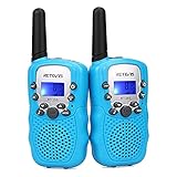 | Retevis RT388 Kids Walkie Talkies, Outdoor Toys for Kids Camping Essentials | Check Price On Amazon |
 | Cobra RX680 Walkie Talkies (2-Pack), IP54 Water Resistant Design | Check Price On Amazon |
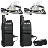 | Retevis RT22 Walkie Talkies Long Range Rechargeable with Earpiece (2 Pack) | Check Price On Amazon |
 | Midland GXT1000VP4 GMRS JIS4 Two-Way Radio, Black,2 Pack | Check Price On Amazon |
 | Retevis RT628 Walkie Talkies for Kids,Toys Gifts for 6-12 Years Old Boys Girls,Long Range 2 Way Radio 22CH VOX,Birthday Gift,Family Walkie Talkie for Camping Hiking Indoor Outdoor | Check Price On Amazon |