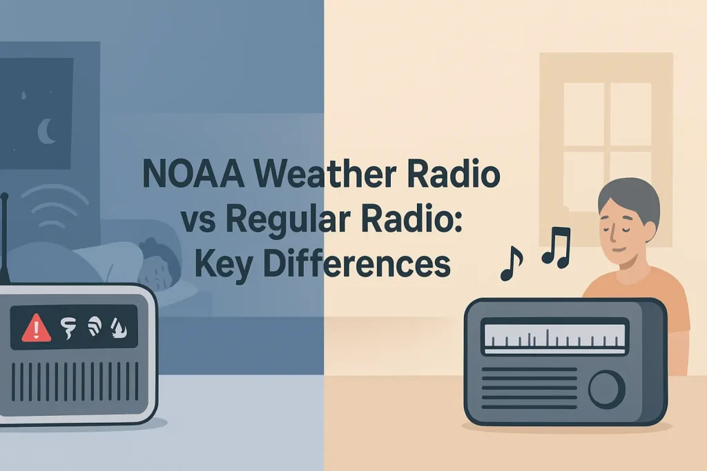
Minnesota sits at the intersection of some of the most severe weather patterns in the continental United States. The state’s NOAA Weather Radio All Hazards network broadcasts alerts 24 hours a day across seven dedicated frequencies between 162.400 and 162.550 MHz, covering tornado warnings, blizzard advisories, flash flood watches, and hazardous materials alerts for every county in the state.
This guide covers every active NOAA weather radio transmitter serving Minnesota, including Twin Cities metro stations, Greater Minnesota stations, and the border stations that overlap into Wisconsin, Iowa, South Dakota, and North Dakota. You will find call signs, frequencies, transmitter locations, and the specific counties each station serves.
| Photo | Popular Portable Walkie Talkies | Price |
|---|---|---|
 | SKIWARRIOR Multifunctional Smart Wireless Ski Goggles with Walkie-Talkie, Anti-Fog Zeiss Lens, Music & Call Function (Cylindrical Blue) | Check Price On Amazon |
 | SINORISE Super Mini Walkie Talkies, Two-Way Radios, 3 Pack | Check Price On Amazon |
 | KOSPET Tank M4C Smart Watch Rugged, Dual-Band GPS, 5ATM & IP69K Waterproof | Check Price On Amazon |
 | Retevis RT15 Walkie Talkies 3 Pack, Birthday Gift, Outdoor Adventure Kit | Check Price On Amazon |
 | Rechargeable Walkie Talkies Toys for Kids: DIY Astronaut Walkie Talkies for Boys Christmas Birthday Gifts for 3 4 5 6 7 8 9 10 Boy Walkie Talkie Outdoor Hiking Toy 2 Way Radio Camping Outdoor Game | Check Price On Amazon |
What Is NOAA Weather Radio and How Does It Work in Minnesota?
NOAA Weather Radio All Hazards (NWR) is a nationwide network of radio stations operated by the National Oceanic and Atmospheric Administration, broadcasting weather forecasts, watches, and warnings continuously on seven VHF frequencies between 162.400 and 162.550 MHz. According to NOAA’s NWR documentation, the network covers approximately 95% of the United States population within 40 miles of a transmitter.
In Minnesota, the NWR network consists of transmitters managed by the National Weather Service offices in Chanhassen (Twin Cities), Duluth, and Aberdeen, South Dakota, with additional coverage overlap from La Crosse, Wisconsin, and Sioux Falls, South Dakota. Each transmitter broadcasts on one of the seven standard WX channels.
The seven standard NOAA weather radio frequencies are as follows.
- WX1: 162.550 MHz
- WX2: 162.400 MHz
- WX3: 162.475 MHz
- WX4: 162.425 MHz
- WX5: 162.450 MHz
- WX6: 162.500 MHz
- WX7: 162.525 MHz
A NOAA weather radio receiver without S.A.M.E. technology (Specific Area Message Encoding) will activate for every alert broadcast by the transmitter, covering all counties in the transmitter’s range. S.A.M.E. technology lets you program your radio with a 6-digit FIPS code so alerts only activate for your specific county or counties.
S.A.M.E. is what separates a basic weather radio from a genuinely useful emergency device in a state like Minnesota, where a single transmitter can cover 20 or more counties across hundreds of square miles.
Twin Cities NOAA Weather Radio Stations: Frequencies and Coverage
The Twin Cities metro area is served primarily by the Chanhassen, Minnesota NWS forecast office, which operates several transmitters covering the seven-county metro and surrounding region. The main Twin Cities station broadcasts on 162.550 MHz (WX1) from the Chanhassen transmitter site.
Minnesota Public Radio and local emergency management agencies coordinate with the Chanhassen NWS office to relay alerts through the Emergency Alert System (EAS), but the NWR network operates independently on dedicated VHF frequencies that do not require cellular service, internet connectivity, or broadcast television reception.
Use the table below to identify the correct frequency and call sign for your location in the Twin Cities metro area and surrounding counties.
| Call Sign | Frequency | WX Channel | Transmitter Location | Primary Counties Served |
|---|---|---|---|---|
| WXL58 | 162.550 MHz | WX1 | Chanhassen, MN | Hennepin, Ramsey, Anoka, Dakota, Washington, Carver, Scott |
| WXK49 | 162.400 MHz | WX2 | Redwood Falls, MN | Redwood, Renville, Brown, Cottonwood, Watonwan |
| WXM98 | 162.475 MHz | WX3 | St. Cloud, MN | Stearns, Benton, Sherburne, Wright, Meeker, Kandiyohi |
| WWF58 | 162.425 MHz | WX4 | Mankato, MN | Blue Earth, Nicollet, Le Sueur, Sibley, Waseca, Steele, Faribault |
| WXK48 | 162.450 MHz | WX5 | Litchfield, MN | Meeker, Kandiyohi, McLeod, Hutchinson area |
| WXL61 | 162.500 MHz | WX6 | Rochester, MN | Olmsted, Winona, Goodhue, Wabasha, Dodge, Mower, Fillmore, Houston |
| WXK47 | 162.525 MHz | WX7 | Faribault, MN | Rice, Steele, Faribault, Freeborn, Waseca |
Residents in the core Twin Cities metro (Minneapolis, St. Paul, Bloomington, Brooklyn Park, Plymouth, Edina, Eagan, Burnsville, and surrounding cities) should tune to WXL58 on 162.550 MHz as their primary station.
If you live in the western suburbs or outer ring counties such as Wright, Sherburne, or Carver, you may receive stronger signal from WXM98 on 162.475 MHz out of St. Cloud, particularly during severe weather when the Chanhassen transmitter’s broadcast area is congested with alert data.
Greater Minnesota NOAA Weather Radio Stations: Full Statewide List
Minnesota’s geography requires an extensive transmitter network. The northern half of the state includes dense forest, lake country, and remote terrain that demands higher transmitter power and carefully chosen tower sites to achieve reliable NWR coverage. The National Weather Service offices in Duluth and Chanhassen together manage the statewide network, with additional coverage support from neighboring NWS offices.
According to NOAA NWR station documentation, Minnesota’s transmitter network covers the full state with some signal overlap from Wisconsin, Iowa, South Dakota, and North Dakota transmitters along border regions.
Use the table below to find the NOAA weather radio station serving your region of Greater Minnesota.
| Call Sign | Frequency | Transmitter Location | Region | Primary Counties Served |
|---|---|---|---|---|
| WXK80 | 162.550 MHz | Duluth, MN | Northeast MN | St. Louis, Lake, Cook, Carlton, Itasca (northern portions) |
| WXL57 | 162.400 MHz | Brainerd, MN | Central MN | Crow Wing, Cass, Morrison, Todd, Wadena |
| WXJ22 | 162.475 MHz | International Falls, MN | North-Central MN | Koochiching, Itasca, Lake of the Woods (partial) |
| KHB35 | 162.400 MHz | Bemidji, MN | Northwest-Central MN | Beltrami, Clearwater, Hubbard, Mahnomen, Red Lake |
| WXJ89 | 162.550 MHz | Thief River Falls, MN | Northwest MN | Pennington, Marshall, Roseau, Kittson, Red Lake (partial) |
| KEC83 | 162.400 MHz | Detroit Lakes, MN | West-Central MN | Becker, Otter Tail, Clay, Norman, Mahnomen |
| WXJ81 | 162.475 MHz | Moorhead, MN | Northwest MN / Red River Valley | Clay, Polk, Norman, Wilkin |
| WXL87 | 162.550 MHz | Alexandria, MN | West-Central MN | Douglas, Grant, Stevens, Pope, Big Stone, Traverse |
| WXM84 | 162.400 MHz | Willmar, MN | Southwest-Central MN | Kandiyohi, Chippewa, Swift, Lac qui Parle, Yellow Medicine |
| WXJ55 | 162.525 MHz | Worthington, MN | Southwest MN | Nobles, Jackson, Murray, Pipestone, Rock, Lincoln |
| WWG67 | 162.475 MHz | Virginia, MN | Iron Range / Northeast MN | St. Louis (Iron Range), Itasca, Aitkin, Koochiching (southern) |
| WXJ21 | 162.400 MHz | Grand Rapids, MN | North-Central MN | Itasca, Cass, Aitkin (northern), Beltrami (eastern) |
| KZZ44 | 162.550 MHz | Baudette, MN | Lake of the Woods | Lake of the Woods, Roseau (partial) |
| WXL82 | 162.500 MHz | Owatonna, MN | South-Central MN | Steele, Dodge, Waseca, Rice, Freeborn (northern) |
If you live in a border county or a region where two transmitters overlap, program both frequencies into your S.A.M.E.-capable weather radio and let the radio receive whichever signal is stronger at the time of an alert broadcast.
The key to using this table correctly is matching your county to the transmitter listed, not the transmitter closest to your city name.
How to Find Your S.A.M.E. FIPS Code for Minnesota Counties
S.A.M.E. (Specific Area Message Encoding) uses 6-digit FIPS (Federal Information Processing Standards) codes to identify counties. Programming your county’s FIPS code into your weather radio means the alert tone only activates for warnings in your area, not for every county in the transmitter’s broadcast footprint.
According to NOAA NWR technical specifications, S.A.M.E. codes for Minnesota counties follow the format 027XXX, where 027 is Minnesota’s state FIPS prefix and the final three digits identify the specific county.
The most frequently needed S.A.M.E. codes for Minnesota counties are listed below.
| County | S.A.M.E. FIPS Code | Primary NWR Station | Frequency |
|---|---|---|---|
| Hennepin (Minneapolis) | 027053 | WXL58 | 162.550 MHz |
| Ramsey (St. Paul) | 027123 | WXL58 | 162.550 MHz |
| Anoka | 027003 | WXL58 | 162.550 MHz |
| Dakota | 027037 | WXL58 | 162.550 MHz |
| Washington | 027163 | WXL58 | 162.550 MHz |
| Scott | 027139 | WXL58 | 162.550 MHz |
| Carver | 027019 | WXL58 | 162.550 MHz |
| St. Louis (Duluth) | 027137 | WXK80 | 162.550 MHz |
| Olmsted (Rochester) | 027109 | WXL61 | 162.500 MHz |
| Stearns (St. Cloud) | 027145 | WXM98 | 162.475 MHz |
| Blue Earth (Mankato) | 027013 | WWF58 | 162.425 MHz |
| Crow Wing (Brainerd) | 027035 | WXL57 | 162.400 MHz |
| Clay (Moorhead) | 027027 | WXJ81 | 162.475 MHz |
| Beltrami (Bemidji) | 027007 | KHB35 | 162.400 MHz |
| Koochiching (Intl. Falls) | 027071 | WXJ22 | 162.475 MHz |
| Lake of the Woods | 027077 | KZZ44 | 162.550 MHz |
For counties not listed here, the full FIPS code list is available through the NOAA NWR SAME code database, which is organized by state and county and searchable by county name.
To learn more about how S.A.M.E. encoding works and how to configure county-level filtering on your specific receiver model, see this guide on how S.A.M.E. technology filters weather alerts by county.
Programming the correct FIPS code for your county is the single most important configuration step for any Minnesota weather radio owner.
Which Weather Radio Should You Choose for Minnesota?
The best weather radio for Minnesota is a S.A.M.E.-capable desktop or portable receiver with battery backup, because Minnesota’s tornado and winter storm seasons both create scenarios where power outages accompany the most dangerous alerts. A radio without battery backup will go silent precisely when you need it most.
According to the National Weather Service Chanhassen office, Minnesota averages more than 40 tornadoes per year, concentrated in the spring and early summer months. Winter storms, blizzards, and ice storms produce additional high-priority alerts from October through April.
The three most important features to look for in a Minnesota weather radio are S.A.M.E. alert filtering, battery backup capability, and alert memory for multiple counties (useful for people who commute across county lines or have family in other parts of the state).
The Midland WR400 weather radio is a strong choice for most Minnesota households.
- Frequency coverage: 162.400 to 162.550 MHz (all 7 NOAA WX channels)
- S.A.M.E. alert types: 25 programmable hazard categories
- Alert memory: Up to 50 S.A.M.E. location codes
- Power: AC adapter with 6x AA battery backup
- Alert output: Audible alarm plus digital display with alert type and county name
The Uniden BC365CRS weather radio adds a clock radio function and AM/FM reception alongside full NWR coverage.
- Frequency coverage: 162.400 to 162.550 MHz
- S.A.M.E. programming: County-level filtering with alarm tone
- Additional bands: AM 520-1710 kHz, FM 87.5-108 MHz
- Power: AC with battery backup
- Display: Digital clock with alarm function
For portable use, cabin trips, or emergency go-bags, the Midland ER310 emergency weather crank radio covers all seven NOAA WX channels and includes a hand-crank generator, solar panel, and USB charging port.
- Frequency coverage: 162.400 to 162.550 MHz (all 7 WX channels) plus AM/FM
- Power options: Internal Li-ion battery, hand crank, solar panel, USB-C
- S.A.M.E.: County-level alert filtering
- Additional features: LED flashlight, USB phone charging port
- Weight: Approximately 1.2 lbs
The right radio for your situation depends on whether your primary use is home monitoring with power backup, portable use at a cabin or campsite, or a combination of both.
Here is the widget for this section, showing Minnesota weather radio preparedness across the seasons:
Minnesota’s severe weather threat changes significantly from month to month, and the table below maps peak alert activity by season to help you know when to test your radio and which hazard types to expect.
Seasonal Guide
Minnesota Weather Radio Alert Calendar – Month by Month
Peak hazard types and recommended radio checks by month. Source: NWS Chanhassen climatological data.
Moderate or transitional activity
How to Program a Minnesota Weather Radio: Step-by-Step Setup
Programming a S.A.M.E. weather radio for Minnesota takes less than five minutes once you have your FIPS county code ready. The process involves selecting the correct NWR frequency for your transmitter, entering your 6-digit FIPS code, and choosing which of the 25 alert categories will trigger the alarm.
The setup process varies slightly between brands, but the underlying steps are the same across all S.A.M.E.-capable receivers. The following steps apply to the Midland WR400, Midland ER310, and most Uniden NWR receivers.
- Power on the radio and press the MENU or PROGRAM button. The display will show a channel or frequency selection screen.
- Select your NWR frequency. For Twin Cities (Hennepin, Ramsey, Anoka, Dakota, Washington, Scott, Carver counties), select 162.550 MHz. Refer to the transmitter table above for other Minnesota counties.
- Enter SAME programming mode. This is usually labeled SAME, FIPS, or COUNTY on the keypad or menu.
- Enter your 6-digit FIPS code. For Hennepin County, enter 027053. For Ramsey County, enter 027123. Use the table above for other Minnesota counties.
- Select alert types to activate. At minimum, enable Tornado Warning (TOA), Severe Thunderstorm Warning (SVA), Flash Flood Warning (FFA), and Winter Storm Warning (WSA) for most Minnesota locations.
- Set the alert volume and alarm tone. Most models offer a choice between a voice alert, a loud siren tone, or both. The siren tone is more effective as a wake-up alarm.
- Test the radio. Hold the TEST button for three seconds. The radio should confirm it is receiving the programmed frequency and FIPS code.
If the radio does not receive a signal during testing, try the alternate frequency for your region. In some border counties and fringe coverage areas, a neighboring transmitter on a different frequency may provide a stronger signal than the primary station listed for your county.
Programming multiple FIPS codes lets you receive alerts for neighboring counties, which is useful if you live near a county border or regularly travel between areas.
NWS Forecast Offices Serving Minnesota: Chanhassen, Duluth, and Beyond
Minnesota’s NOAA weather radio network is maintained by three primary National Weather Service forecast offices. The NWS office in Chanhassen, Minnesota, serves the Twin Cities metro and most of southern and central Minnesota. The NWS office in Duluth serves northeastern Minnesota, including the Iron Range, Lake Superior shoreline, and border counties near Canada.
The NWS office in Aberdeen, South Dakota, provides forecast support and NWR transmitter coverage for portions of western Minnesota, including counties along the South Dakota border. The NWS offices in La Crosse, Wisconsin, and Sioux Falls, South Dakota, provide additional border-region coverage overlap.
Each NWS forecast office is responsible for issuing the alerts that are encoded and broadcast over the NWR transmitters in its service area. A Tornado Warning issued by NWS Chanhassen for Hennepin County will be encoded with the S.A.M.E. FIPS code 027053 and broadcast on WXL58 at 162.550 MHz.
The transmitter network is designed so that no single point of failure can silence all alerts across the state. If a transmitter goes offline for maintenance, adjacent transmitters with overlapping coverage areas continue broadcasting.
For a complete overview of how NOAA weather radio stations are organized across all 50 states, our resource on NOAA weather radio transmitter coverage by state includes call signs, frequencies, and county maps for every NWR station in the country.
Understanding which NWS office issues alerts for your county helps you know whose voice you are hearing on the NWR broadcast and which weather phenomena that office prioritizes in your region.
Alert Types Broadcast on Minnesota NOAA Weather Radio Stations
NOAA Weather Radio All Hazards broadcasts more than 70 distinct event codes for weather and non-weather emergencies. In Minnesota, the most frequently activated alert categories are Tornado Warning, Severe Thunderstorm Warning, Winter Storm Warning, Blizzard Warning, Flash Flood Warning, and Wind Chill Advisory.
According to NOAA NWR documentation, the S.A.M.E. system encodes each alert with a three-letter Event Code (e.g. TOR for Tornado Warning, SVR for Severe Thunderstorm Warning) along with the FIPS county code, issuance time, and expiration time. Your weather radio decodes this header and compares it against your programmed county code and alert category settings.
The most critical alert categories for Minnesota residents to enable on their weather radios are as follows.
| Event Code | Alert Type | Season | Priority for MN |
|---|---|---|---|
| TOR | Tornado Warning | Apr-Sep | Critical |
| SVR | Severe Thunderstorm Warning | Apr-Sep | Critical |
| BZW | Blizzard Warning | Oct-Apr | Critical |
| WSW | Winter Storm Warning | Oct-Apr | Critical |
| FFW | Flash Flood Warning | Apr-Sep | High |
| WCW | Wind Chill Warning | Dec-Mar | High |
| EVI | Evacuation Immediate | Year-round | High |
| HMW | Hazardous Materials Warning | Year-round | High |
| CEM | Civil Emergency Message | Year-round | High |
| CAE | Child Abduction Emergency (AMBER) | Year-round | Standard |
Not every S.A.M.E.-capable radio allows you to select individual event codes. Some models use tiered alert levels (all alerts, weather only, or emergency only) rather than granular event code selection.
If your radio offers individual event code programming, enable at minimum TOR, SVR, BZW, WSW, FFW, WCW, EVI, HMW, and CEM for complete Minnesota hazard coverage year-round.
Minnesota Border Counties: Cross-State NWR Coverage Overlap
Counties along Minnesota’s borders with Wisconsin, Iowa, South Dakota, and North Dakota often receive usable signals from both Minnesota NWR transmitters and transmitters from neighboring states. This overlap can be an advantage (two signal sources for the same alert) or a source of confusion (receiving alerts for counties in a neighboring state).
Programming your radio with your specific Minnesota county FIPS code prevents false activations from Iowa, Wisconsin, or South Dakota alerts that do not apply to your location.
The following border counties have documented cross-state NWR signal overlap.
- Houston County (MN) / La Crosse area (WI): Receives signal from both WXL61 (Rochester, 162.500 MHz) and La Crosse, Wisconsin NWR transmitters on 162.400 MHz. Program FIPS 027055 to filter for Houston County only.
- Rock County and Nobles County (SW Minnesota): May receive signal from Sioux Falls, South Dakota NWR and Worthington, Minnesota NWR (WXJ55, 162.525 MHz). Program FIPS 027133 (Rock) or 027105 (Nobles).
- Kittson County and Roseau County (NW Minnesota): Overlap zone between Thief River Falls NWR (WXJ89, 162.550 MHz) and Winnipeg-area Canadian weather radio transmissions. Canadian broadcasts do not use S.A.M.E. encoding, so a properly programmed U.S. NWR receiver will not activate for Canadian alerts.
- Polk County and Clay County (Red River Valley): Receive signal from both Moorhead, Minnesota NWR (WXJ81, 162.475 MHz) and Fargo, North Dakota NWR transmitters. Program FIPS 027119 (Polk) or 027027 (Clay) to filter correctly.
The cross-state overlap situation reinforces why S.A.M.E. county filtering is not optional in Minnesota. Without it, you will receive alerts from across the entire NWR broadcast area, which in border regions can span multiple states.
Choosing the right frequency for your Minnesota county is covered in detail in our guide to NOAA weather radio broadcast frequencies and how to tune your receiver, which explains how signal strength varies by distance from the transmitter and what to do when two stations are equally strong at your location.
What to Do When Your Minnesota Weather Radio Cannot Receive a Signal
A weather radio that cannot lock onto a signal will not alarm during severe weather. The most common cause is selecting the wrong frequency for your county. VHF signals at 162 MHz travel in a mostly line-of-sight path, which means terrain, buildings, and distance all reduce signal strength from the transmitter.
This happens because VHF signals at 162 MHz do not follow the curvature of the earth the way AM broadcast signals do. They travel in straight lines from the transmitter antenna, and anything blocking that line (hills, buildings, dense forest) reduces the signal level at your receiver.
If your Minnesota weather radio shows a weak signal or no signal, work through the following steps in order.
- Verify you have selected the correct frequency for your county. Use the transmitter tables above. Many receivers default to 162.550 MHz, which is not the correct frequency for every Minnesota county.
- Move the radio to a window or exterior wall. Interior rooms in concrete or brick buildings attenuate VHF signals significantly. Moving six feet closer to an exterior wall can make the difference between a marginal and a strong signal.
- Extend the antenna fully. Desktop weather radios with collapsible antennas perform significantly worse when the antenna is folded down. Extend it vertically for best reception.
- Try an alternate frequency. If you are in an overlap zone, try the neighboring transmitter’s frequency. In St. Cloud for example, both WXM98 on 162.475 MHz and WXL58 on 162.550 MHz may provide usable signals depending on your exact location.
- Add an external antenna. A VHF external antenna for weather radios mounted in an attic or on an exterior wall can dramatically improve reception in rural areas or fringe coverage zones.
- Check for interference sources. Some LED light bulbs, switching power supplies, and solar inverters generate broadband RF noise that can desensitize a weather radio receiver. Move the radio away from these devices or connect it to a different outlet circuit.
If none of these steps resolve the issue, your location may be in a genuine coverage gap. Contact your local emergency management office to report the gap, as NOAA NWR engineers use coverage gap reports to prioritize transmitter upgrades and new transmitter site installations.
A properly positioned receiver with a fully extended antenna should lock onto a clean signal from the correct Minnesota NWR transmitter anywhere in the state’s primary coverage areas.
Minnesota Weather Radio for Emergency Preparedness and Severe Weather Planning
A dedicated NOAA weather radio is more reliable than any smartphone-based alert system for tornado and blizzard warnings in Minnesota. Wireless Emergency Alerts (WEA) delivered via cell towers depend on cellular network availability. During the most severe Minnesota storms, cell towers can fail, lose power, or become congested precisely when you need them most.
The NWR network operates on VHF frequencies that are independent of the internet, cellular infrastructure, and commercial power grids. NWR transmitters are equipped with generator backup power so they continue broadcasting through extended power outages.
For Minnesota households in tornado-prone regions (particularly the southern and western parts of the state), emergency preparedness experts recommend placing a S.A.M.E. weather radio in the bedroom so the alarm functions as a nighttime wake-up system. According to FEMA emergency preparedness guidance, many tornado fatalities occur when people are asleep and do not receive adequate warning time.
A bedroom weather radio with S.A.M.E. alarm programmed to your specific county will only sound for warnings that directly affect your location, eliminating the nuisance alerts that cause people to disable the alarm function entirely.
For Minnesota cabin and lake home owners, the hand-crank solar emergency weather radio provides NWR reception without any dependence on AC power or batteries that may have discharged over the winter.
Emergency preparedness planning for Minnesota should account for both tornado season (April through September, peaking in May and June) and winter storm season (October through April). A single properly configured S.A.M.E. weather radio handles both threat types from the same device.
For a comprehensive guide on integrating NOAA weather radio into a complete home emergency plan, our resource on using weather radio as part of an emergency preparedness system covers alert response protocols, backup communication options, and how to create a household alert plan.
The combination of correct frequency selection, county FIPS code programming, and battery backup turns a weather radio from a passive receiver into an active life-safety device.
How Minnesota NWR Stations Broadcast Alerts: The Technical Process
NOAA weather radio alerts in Minnesota originate at the National Weather Service forecast office, where meteorologists encode each alert with the S.A.M.E. digital header, the specific Event Code, the affected FIPS county codes, and the expiration time. The encoded alert is then transmitted to the NWR transmitter site over a dedicated communications link and broadcast on the assigned VHF frequency.
This works because the S.A.M.E. digital burst (transmitted at the beginning of every alert) uses AFSK (Audio Frequency Shift Keying) modulation at 1050 bps. Your weather radio’s built-in S.A.M.E. decoder chip receives this digital burst, extracts the FIPS codes, compares them against your programmed codes, and either activates the alarm or remains silent depending on the match.
The condition for your alarm to activate is that your programmed FIPS code must exactly match one of the FIPS codes contained in the alert broadcast header. If a Tornado Warning is issued for Hennepin County (027053) and you have programmed 027053 into your radio, the alarm will sound. If you have programmed 027123 (Ramsey County) and the warning does not include Ramsey in its affected counties, the radio will remain silent.
If the S.A.M.E. decoder chip in your radio fails or if the digital burst is corrupted by a weak signal, the radio may not trigger the alarm even during a genuine warning. This is why clear signal reception is not just a convenience issue but a safety issue.
The NWR broadcast cycle also includes routine weather forecasts read by NWS meteorologists, marine forecasts for Lake Superior (relevant to Cook, Lake, and St. Louis counties), and agricultural weather advisories. These routine broadcasts do not trigger the alarm. Only alerts with matching FIPS codes and enabled event codes activate the alert tone.
To understand the full technical structure of NOAA weather radio from transmitter to receiver, including how the network is organized nationwide and the difference between watches, warnings, and advisories, our detailed explanation of what NOAA weather radio is and how the alert system works covers the complete system architecture.
Understanding the technical process helps you diagnose why an alert did or did not trigger on your radio and fix the configuration before the next severe weather event.
Frequently Asked Questions About Minnesota Weather Radio Stations
What frequency should I use for NOAA weather radio in Minneapolis and St. Paul?
Minneapolis and St. Paul are served by NWR station WXL58 broadcasting on 162.550 MHz (WX1) from the transmitter site in Chanhassen, Minnesota. This station covers all seven counties in the Twin Cities metro including Hennepin, Ramsey, Anoka, Dakota, Washington, Scott, and Carver.
Tune your receiver to 162.550 MHz and program FIPS code 027053 for Hennepin County or 027123 for Ramsey County. If you receive a weak signal on 162.550 MHz from a location in the outer ring suburbs, try 162.475 MHz (WXM98, St. Cloud) as an alternate source.
How many NOAA weather radio transmitters does Minnesota have?
Minnesota has more than 20 active NOAA Weather Radio All Hazards transmitters covering the entire state. The transmitter network is maintained by the NWS offices in Chanhassen, Duluth, and Aberdeen, South Dakota, with additional border coverage from La Crosse, Wisconsin, and Sioux Falls, South Dakota transmitters.
The transmitter count includes main stations and fill-in repeater sites in areas where primary transmitter coverage is limited by terrain or distance. The complete current transmitter list is maintained in NOAA’s NWR transmitter database.
Can I receive NOAA weather radio alerts on a regular scanner radio?
A standard scanner radio can receive the audio of NOAA weather radio broadcasts on 162.400 to 162.550 MHz, but it cannot decode S.A.M.E. digital headers or trigger a county-specific alarm. You will hear everything the transmitter broadcasts, including all alert audio and routine forecasts, with no filtering by county or alert type.
A dedicated S.A.M.E. weather radio receiver is required for county-level alert filtering and automated alarm activation. Scanners are useful as a backup monitor but should not replace a dedicated weather radio for primary alert notification.
What is the difference between a Tornado Watch and a Tornado Warning on Minnesota weather radio?
A Tornado Watch (S.A.M.E. code TOA) means conditions are favorable for tornado development in the watch area, typically covering multiple counties or a large region, and is issued hours before severe weather arrives. A Tornado Warning (S.A.M.E. code TOR) means a tornado has been detected on radar or confirmed by a spotter and is imminent or occurring in the warned area.
On your S.A.M.E. weather radio, a Tornado Warning triggers the loudest alarm tone and requires immediate action. A Tornado Watch triggers a lower-priority alert. Enable both codes on your Minnesota weather radio but treat the Warning tone as a take-shelter-immediately signal.
Why did my Minnesota weather radio not go off during a recent tornado warning?
The most common reasons a S.A.M.E. weather radio fails to activate during a genuine warning are an incorrect FIPS county code, a weak or no signal from the transmitter, the wrong frequency selected for your county, or alert categories that are turned off in the radio’s programming. Check all four settings before concluding the radio is defective.
A second common cause is signal interruption during the S.A.M.E. digital burst transmission at the start of the alert. If the radio loses signal for even one second during the burst, it may not decode the FIPS code correctly and will not activate. Moving the radio closer to a window or adding an external antenna reduces this risk.
Do I need a separate weather radio for my Minnesota cabin if it is in a different county than my home?
You do not need a second radio if your current radio supports multiple S.A.M.E. location codes, which most modern receivers do. The Midland WR400 stores up to 50 FIPS codes, allowing you to program both your home county and your cabin county into the same radio and carry it between locations.
If your cabin is served by a different NWR transmitter on a different frequency, you will need to manually retune the radio when you arrive at the cabin. Some advanced weather radios can store multiple frequency and FIPS code combinations and switch between them automatically based on signal strength.
Is it legal to rebroadcast NOAA weather radio audio over a local FM transmitter or PA system?
Rebroadcasting NOAA weather radio audio without authorization may violate FCC rules under 47 CFR Part 73 governing broadcast stations and Part 15 governing unlicensed transmitters. Low-power FM rebroadcast of NWR audio requires FCC authorization and is typically used only by licensed broadcasters and emergency management agencies.
For school, business, or facility-wide alert systems, the FCC-approved method is to use a dedicated receiver with a line output connected to an existing PA system amplifier, with the NWR audio used as a monitoring source rather than a rebroadcast signal. Contact your local emergency management office for guidance on compliant facility alert system configurations in Minnesota.
What is the difference between WX1 and the other NOAA weather radio channels?
WX1 through WX7 are channel labels that correspond to the seven standard NOAA weather radio frequencies: WX1 is 162.550 MHz, WX2 is 162.400 MHz, WX3 is 162.475 MHz, WX4 is 162.425 MHz, WX5 is 162.450 MHz, WX6 is 162.500 MHz, and WX7 is 162.525 MHz. The channel numbers are just shorthand labels assigned to each frequency for convenience on receivers without a numeric frequency display.
There is no difference in the type of content broadcast on WX1 versus WX7. Each transmitter uses whichever frequency NOAA assigned to that site based on regional frequency coordination. In Minnesota, different transmitters use different WX channels, so the correct channel for your location depends on which transmitter serves your county, not which channel number sounds most official.
Can my weather radio pick up alerts from Canadian weather services near the Minnesota border?
Canadian weather radio, operated by Environment and Climate Change Canada (ECCC), broadcasts on some of the same seven VHF frequencies used by NOAA NWR. Canadian transmitters near the Manitoba and Ontario borders may be receivable in far northern Minnesota counties including Koochiching, Lake of the Woods, and Roseau.
However, Canadian weather radio uses a different alert encoding protocol that is not compatible with the S.A.M.E. system used by U.S. NWR receivers. Your S.A.M.E. radio will receive the audio of Canadian broadcasts but will not trigger a county-specific alarm based on Canadian alerts. For the most reliable tornado and winter storm alerting in northern Minnesota border counties, use the NOAA NWR station listed for your specific county in the transmitter tables above.
How do I know if my county is in a NOAA weather radio coverage gap in Minnesota?
A coverage gap exists when your properly tuned weather radio cannot receive a clean, reliable signal from any NWR transmitter on any of the seven WX frequencies at your location. Fringe coverage areas in Minnesota include portions of remote northern counties (parts of Lake, Cook, and northern St. Louis County) and some valleys and terrain-shadowed areas in southeastern Minnesota.
You can verify coverage at your specific address using the NOAA NWR coverage map tool available on the NWS website, which shows predicted signal strength contours for each Minnesota transmitter. If you are confirmed to be in a gap, report it to the NWS Chanhassen or Duluth office. NOAA NWR engineers track coverage gap reports and use them to identify locations for new fill-in transmitter sites.
What S.A.M.E. codes should I program if I live in the Twin Cities but work in a different county?
Program both your home county FIPS code and your work county FIPS code into your weather radio. Most S.A.M.E. receivers accept between 5 and 50 location codes simultaneously. Programming multiple codes means the radio will alert you when severe weather threatens either location, which is especially useful during your commute hours when a warning in your work county may affect you before you return home.
For example, a resident of Ramsey County (027123) who works in Hennepin County (027053) should program both codes. During tornado season, a warning issued for either county will trigger the alarm regardless of where you are at that moment. This multi-county approach costs nothing additional and significantly improves your advance warning time during fast-moving spring storm systems.
Are there any Minnesota weather radio frequencies that require special equipment to receive?
All seven NOAA weather radio frequencies (162.400 to 162.550 MHz) fall within the standard VHF high band and are receivable on any consumer weather radio, most GMRS and ham radio handhelds programmed to that frequency range, and scanner radios covering VHF frequencies. No special equipment is required beyond a basic weather radio receiver.
Some older AM/FM clock radios and emergency radios manufactured before the early 2000s do not include the 162 MHz weather band. Verify that any radio you intend to use for NOAA alerts specifically lists WX channels or the 162 MHz frequency range in its specifications before purchasing it for weather monitoring use.
Putting It All Together: Your Minnesota Weather Radio Setup Checklist
Setting up a Minnesota weather radio correctly takes less than ten minutes and requires three pieces of information: your county’s primary NWR station and frequency, your 6-digit FIPS code, and the alert categories most relevant to your region and season.
For most Minnesota residents, the correct station is WXL58 on 162.550 MHz for the Twin Cities metro, WXK80 on 162.550 MHz for the Duluth region, or the appropriate transmitter from the statewide station tables above for Greater Minnesota locations. Program your county’s FIPS code, enable Tornado Warning, Severe Thunderstorm Warning, Blizzard Warning, Winter Storm Warning, and Flash Flood Warning at minimum, and verify the alarm works by pressing the test button.
A properly programmed S.A.M.E. desktop weather radio is the single most reliable severe weather alert tool available to Minnesota residents regardless of cellular service availability, power grid status, or internet connectivity. Keep it plugged in with battery backup installed, and test it at the start of each severe weather season.
| Photo | TOP RATED WALKIE TALKIES | Price |
|---|---|---|
 | Retevis RT628 Kids Walkie Talkies, Toys Gifts for 4-12 Year Old Girl Boy | Check Price On Amazon |
 | Cobra ACXT545 Weather-Resistant Walkie Talkies, Rechargeable, 22 Channels | Check Price On Amazon |
 | Retevis RT388 Kids Walkie Talkies, Outdoor Toys for Kids Camping Essentials | Check Price On Amazon |
 | Cobra RX680 Walkie Talkies (2-Pack), IP54 Water Resistant Design | Check Price On Amazon |
 | Retevis RT22 Walkie Talkies Long Range Rechargeable with Earpiece (2 Pack) | Check Price On Amazon |
 | Midland GXT1000VP4 GMRS Two-Way Radios with Headsets, Black, 2 Pack | Check Price On Amazon |
 | Retevis RT628 Walkie Talkies for Kids,Toys Gifts for 6-12 Years Old Boys Girls,Long Range 2 Way Radio 22CH VOX,Birthday Gift,Family Walkie Talkie for Camping Hiking Indoor Outdoor | Check Price On Amazon |