Shortwave radio carries weather broadcasts that no other medium can match. A receiver tuned to 5.000 MHz (WWV, Fort Collins, Colorado) gives you precise storm timing, sea state data, and geophysical alerts sourced directly from NOAA’s National Weather Service, updated every hour around the clock. This guide covers every major shortwave weather broadcast frequency, who operates them, what they transmit, and how to extract the most useful information from each one.
What Is Shortwave Radio Weather Broadcasting and Why Does It Still Matter?
Shortwave radio weather broadcasting delivers official meteorological data over frequencies between 1.6 MHz and 30 MHz, using ionospheric propagation to reach receivers thousands of miles from the transmitter. A single 10 kW shortwave transmitter on 13.845 MHz can provide tropical cyclone advisories to mariners and aviators across an entire ocean basin with zero cellular infrastructure required.
| Photo | Popular Portable Walkie Talkies | Price |
|---|---|---|
 | SKIWARRIOR Multifunctional Smart Wireless Ski Goggles with Walkie-Talkie, Anti-Fog Zeiss Lens, Music & Call Function (Cylindrical Blue) | Check Price On Amazon |
 | SINORISE Super Mini Walkie Talkies, Two-Way Radios, 3 Pack | Check Price On Amazon |
 | KOSPET Tank M4C Smart Watch Rugged, Dual-Band GPS, 5ATM & IP69K Waterproof | Check Price On Amazon |
 | Retevis RT15 Walkie Talkies 3 Pack, Birthday Gift, Outdoor Adventure Kit | Check Price On Amazon |
 | Rechargeable Walkie Talkies Toys for Kids: DIY Astronaut Walkie Talkies for Boys Christmas Birthday Gifts for 3 4 5 6 7 8 9 10 Boy Walkie Talkie Outdoor Hiking Toy 2 Way Radio Camping Outdoor Game | Check Price On Amazon |
According to NOAA’s National Weather Service, the WWV and WWVH time and frequency stations broadcast continuously on 2.5, 5, 10, 15, and 20 MHz, embedding marine storm warnings and geophysical alerts between their standard time ticks. These broadcasts reach receivers in remote wilderness, offshore vessels, and disaster zones where internet and cellular networks are completely unavailable.
The practical advantage is infrastructure independence. No cell tower, no satellite subscription, and no commercial power grid is required to receive a shortwave weather broadcast. A portable shortwave radio receiver running on four AA batteries can pull in NOAA’s official tropical storm advisories from 3,000 miles away.
Shortwave weather broadcasting is especially critical for offshore sailors, backcountry expedition teams, and emergency managers in areas where the power grid has failed. A weather forecast delivered over 8.764 MHz (USCG NMN, Chesapeake, Virginia) carries the same official authority as a National Weather Service forecast office product, but it requires nothing beyond a receiver and an antenna.
The ionosphere reflects shortwave signals back to Earth at distances that vary by frequency, time of day, and solar activity. Lower frequencies (2.5 and 5 MHz) propagate best at night, while higher frequencies (15 and 20 MHz) provide better daytime reach. Understanding this propagation pattern lets you choose the right frequency at the right time to get a clean, readable weather broadcast.
Shortwave weather broadcasts remain the only globally standardized, license-free-to-receive, infrastructure-independent source of official meteorological data available to any person with a basic receiver.
The Seven Core Shortwave Weather Broadcast Frequencies You Need to Know
The most reliable shortwave weather broadcasts operate on seven primary frequencies between 2.5 MHz and 20 MHz, transmitted by NOAA’s WWV (Fort Collins, CO), WWVH (Kauai, HI), the U.S. Coast Guard, and international meteorological agencies. Each frequency serves a different propagation window and geographic coverage area.
According to NIST (National Institute of Standards and Technology), WWV and WWVH transmit on 2.5, 5, 10, 15, and 20 MHz simultaneously, 24 hours per day, with marine storm warnings broadcast in voice at specific minute marks each hour. The USCG Marine Broadcast stations (NMN, NMC, NMF) transmit weather facsimile (WEFAX) and voice on 4.426, 6.501, 8.764, 13.089, and 17.314 MHz, with schedules published in the USCG Light List.
Use the table below to identify which frequency to monitor based on your location and time of day.
Frequency Reference
Shortwave Weather Broadcast Frequencies – Station, Coverage, and Schedule
Primary shortwave weather frequencies by station and propagation window. Source: NIST, NOAA NWS, USCG Light List.
| Frequency | Station / Callsign | Location | Best Propagation | Weather Content | Coverage Region |
|---|---|---|---|---|---|
| 2.5 MHz | WWV / WWVH | Fort Collins CO / Kauai HI | Night, short skip | Marine storm warnings, geophysical alerts | 0-1,500 miles |
| 5.0 MHz | WWV / WWVH | Fort Collins CO / Kauai HI | Night, moderate skip | Marine storm warnings, geophysical alerts at :18 and :45 min | 0-3,000 miles |
| 8.764 MHz | NMN (USCG) | Chesapeake, VA | Day and night | Offshore marine forecasts, NAVTEX, high seas weather | Western North Atlantic |
| 10.0 MHz | WWV / WWVH | Fort Collins CO / Kauai HI | Day and night | Marine storm warnings, solar flux index, geophysical alerts | 0-5,000 miles |
| 13.089 MHz | NMN / NMC (USCG) | Chesapeake VA / Point Reyes CA | Day, long skip | High seas forecasts, tropical cyclone advisories | Atlantic and Pacific Ocean |
| 15.0 MHz | WWV / WWVH | Fort Collins CO / Kauai HI | Daytime only | Marine storm warnings, geophysical alerts at :18 and :45 min | 1,000-7,000 miles |
| 20.0 MHz | WWV | Fort Collins, CO | Daytime, very long skip | Marine storm warnings, geophysical alerts | 2,000-10,000 miles |
Source: NIST Special Publication 432, USCG Light List Vol. I-VII, NOAA NWS Marine Forecast schedules. Propagation distances are approximate and vary with solar conditions, season, and ionospheric state.
The single most reliable all-purpose shortwave weather frequency for continental North America is 10.0 MHz (WWV). It provides good propagation during both day and night from most locations in the lower 48 states.
WWV and WWVH: Decoding the Minute-by-Minute Weather Broadcast Schedule
WWV (Fort Collins, Colorado) and WWVH (Kauai, Hawaii) transmit marine storm warnings and geophysical alerts on a precise minute-mark schedule within each hour. Marine storm warnings air at minute 8 (WWV) and minute 48 (WWVH) on 2.5, 5, 10, 15, and 20 MHz, giving you two opportunities every hour to hear official National Weather Service marine storm data without scanning frequencies.
According to NIST Special Publication 432, the geophysical alert (covering solar flux, geomagnetic field activity, and ionospheric conditions) airs at minute 18 on WWV and minute 45 on WWVH. The solar flux index in this alert directly predicts shortwave propagation quality for the next 24 hours, which is critical data for both weather reception planning and amateur radio operations.
Understanding the minute-mark layout turns passive listening into structured monitoring. The WWV broadcast schedule within each hour is as follows:
- Minutes 00-01: Universal Coordinated Time (UTC) announcement and standard time ticks
- Minute 08 (WWV only): NOAA marine storm warning for the Atlantic and Pacific
- Minute 10: Omega Navigation System status (historical, now used for GPS notices)
- Minute 14-15: GPS satellite status from USCG Navigation Center
- Minute 18 (WWV) / Minute 45 (WWVH): Geophysical alert including solar flux, geomagnetic A and K indices, and propagation forecast
- Minute 48 (WWVH only): Marine storm warning for the Pacific Ocean
- All other minutes: Continuous 100 Hz audio tone with 1 Hz time ticks
A shortwave receiver with a digital frequency display set to 10.0 MHz USB (upper sideband) will deliver the clearest WWV audio on most portable radios. USB mode reduces adjacent channel interference and improves intelligibility of the voice announcements at minute 8 and minute 18.
The geophysical alert’s K-index reading is especially useful. A K-index below 3 means good propagation on all shortwave frequencies. A K-index of 5 or above indicates a geomagnetic storm in progress, which can completely black out shortwave reception on frequencies above 10 MHz and shift usable frequencies down to 2.5 or 5 MHz.
Monitoring WWV on 10.0 MHz at minute 8 and minute 18 gives you both an official storm warning and a propagation quality forecast within 10 minutes of each other, every single hour.
U.S. Coast Guard High Seas and Marine Weather Broadcasts: Frequencies and Schedule
The U.S. Coast Guard operates two primary marine weather broadcast stations for North American waters: NMN (Chesapeake, Virginia) for the Atlantic, and NMC (Point Reyes, California) for the Pacific. NMN transmits voice weather on 4.426 MHz and 6.501 MHz during nighttime and morning hours, and on 8.764 MHz and 13.089 MHz during daytime, following propagation windows that shift the usable frequency upward as the sun rises.
According to the USCG Light List Volume I, NMN broadcasts high seas forecasts for the Western North Atlantic (including the Gulf of Mexico and Caribbean) at scheduled times twice daily. The broadcasts include wind speed and direction by sea area, wave height in feet, visibility, and tropical system advisories when applicable.
The USCG WEFAX (weather facsimile) service transmits graphical weather charts over 8.764 MHz and 17.314 MHz. A software-defined radio (SDR) dongle paired with free decoding software (fldigi or JVComm32) will decode these WEFAX charts and display them as readable weather maps on your laptop screen, giving you exactly the same graphical product a USCG watch officer monitors.
NMC (Point Reyes, CA) covers the Eastern North Pacific and Hawaiian waters, broadcasting on 4.426, 8.764, 12.786, 17.314, and 22.527 MHz. The correct frequency to use for NMC Pacific broadcasts depends on your distance from Point Reyes and the time of day.
Use the table below to select the correct USCG station and frequency for your position.
Frequency Reference
USCG Marine Weather Broadcast Stations – Frequencies and Coverage Areas
Voice and WEFAX schedules for NMN, NMC, and NMF. Source: USCG Light List, NOAA Marine Forecast schedules.
| Station | Callsign | Location | Voice Frequencies | WEFAX Frequencies | Coverage Area |
|---|---|---|---|---|---|
| NMN | NMN | Chesapeake, VA | 4.426, 6.501, 8.764, 13.089 MHz | 8.764, 17.314 MHz | W. North Atlantic, Gulf of Mexico, Caribbean |
| NMC | NMC | Point Reyes, CA | 4.426, 8.764, 12.786, 17.314 MHz | 8.764, 12.786 MHz | E. North Pacific, Hawaii waters |
| NMF | NMF | Boston, MA (via Marshfield) | 4.235, 8.764 MHz | 6.340, 9.110 MHz | N. Atlantic, Gulf of Maine, Georges Bank |
| NOJ | NOJ | Kodiak, AK | 4.426, 8.764, 12.786 MHz | 8.503 MHz | Alaska coastal waters, Bering Sea |
Source: USCG Light List Volumes I-VII. Frequencies and schedules subject to change. Verify current schedules via USCG Navigation Center (navcen.uscg.gov) before offshore passage.
For offshore sailors on the East Coast, tune to NMN on 8.764 MHz during daylight hours and switch to 4.426 MHz after sunset for the most reliable USCG voice weather reception.
Shortwave Weather Frequencies for Aviation: VOLMET and HF SELCAL
Aviation VOLMET stations transmit continuous weather reports for major airports over shortwave HF frequencies between 2.8 MHz and 13.3 MHz, providing en-route weather data to trans-oceanic aircraft operating beyond VHF range. The North Atlantic VOLMET system uses five dedicated frequencies: 3.485, 5.505, 8.957, 13.264, and 6.604 MHz, transmitting METAR (Meteorological Aerodrome Report) weather observations for major international airports in a continuous round-robin cycle.
According to ICAO Annex 3 (Meteorological Service for International Air Navigation), VOLMET broadcasts are standardized globally, with each station transmitting in USB (upper sideband) mode using the ICAO phonetic alphabet and standard meteorological code groups. The broadcast cycle repeats every five minutes, giving pilots a continuous update of ceiling, visibility, wind direction and speed, altimeter setting, and significant weather phenomena at destination and alternate airports.
New York Radio (VOLMET) transmits on 6.604 MHz and 10.051 MHz, covering the North Atlantic tracks and the eastern U.S. seaboard. Shannon Volmet (Ireland) broadcasts on 3.413, 5.505, 8.957, and 13.264 MHz for the North Atlantic Organized Track System (NAT-OTS), and is receivable in the eastern United States on 13.264 MHz during daylight hours.
Key Specifications for North Atlantic VOLMET (New York Radio):
- Primary frequencies: 6.604 MHz and 10.051 MHz (USB mode)
- Broadcast cycle: Continuous, 5-minute repetition interval
- Weather content: METAR for JFK, BOS, ORD, ATL, MIA, and other major airports
- Transmit power: Typically 10-15 kW from coastal HF transmitter sites
- Reception range: Up to 3,000 nautical miles in daylight conditions on 10.051 MHz
A shortwave radio capable of upper sideband (USB) reception is required to decode VOLMET transmissions clearly. AM mode will produce an unintelligible double-sideband signal when tuned to USB aviation broadcasts.
VOLMET stations are the aviation equivalent of NOAA’s continuous marine weather broadcasts, and any shortwave receiver with USB capability can monitor them from anywhere within propagation range of the transmitter.
International Shortwave Weather Services: What the World Broadcasts and Where to Find It
Meteorological agencies in Canada, the United Kingdom, Germany, and Japan operate their own shortwave weather broadcast services on frequencies between 3.0 MHz and 22.5 MHz, giving shortwave listeners access to official weather data for every ocean basin and polar region on the planet. Environment and Climate Change Canada (ECCC) operates VAN (Vancouver, BC) and VAX, transmitting Pacific and Arctic weather on 4.357, 8.722, and 12.980 MHz.
The UK Met Office’s Bracknell Meteo station broadcasts WEFAX charts over 4.610, 8.040, and 14.436 MHz for the North Atlantic and European waters. Germany’s Deutscher Wetterdienst (DWD) Hamburg transmits WEFAX and voice on 3.855, 7.880, and 13.882.5 MHz. Japan’s JMH (Tokyo) broadcasts WEFAX for the North Pacific and Western Pacific on 3.622.5, 7.795, and 13.988.5 MHz.
The following international shortwave weather services are reliably receivable in North America under appropriate propagation conditions.
- ECCC Vancouver (VAN/VAX), Canada: 4.357, 8.722, 12.980 MHz. Pacific and Arctic marine weather. Best reception on the U.S. West Coast on 8.722 MHz during daylight.
- DHJ91 / DWD Hamburg, Germany: 3.855, 7.880, 13.882.5 MHz. North Atlantic WEFAX charts. Receivable on the U.S. East Coast on 13.882.5 MHz from approximately 0800-1800 UTC.
- JMH Tokyo, Japan: 3.622.5, 7.795, 13.988.5 MHz. North Pacific and Western Pacific weather fax. Receivable on the U.S. West Coast on 13.988.5 MHz during daytime hours.
- GYA Northwood (UK Met Office): 2.618.5, 4.610, 8.040, 11.086.5 MHz. North Atlantic and European weather charts. Occasionally receivable in the northeastern U.S. on 8.040 MHz at night.
- VMC Charleville, Australia: 2.628, 5.100, 11.030 MHz. Southwest Pacific marine weather. Receivable in Hawaii and the U.S. Pacific territories.
A Tecsun PL880 or similar multi-band shortwave receiver with SSB capability will reliably decode voice broadcasts from all of these stations. For graphical WEFAX decoding, pair any shortwave receiver with a free software decoder and an audio cable connecting the radio’s headphone output to your laptop’s microphone input.
International shortwave weather services extend your situational awareness far beyond North American waters, providing official government forecasts for any ocean region your voyage or flight plan crosses.
How to Receive Shortwave Weather Broadcasts: Equipment and Antenna Setup
Receiving shortwave weather broadcasts reliably requires a radio capable of SSB (single sideband) reception, a frequency range covering at least 1.6 to 30 MHz, and an antenna longer than 10 feet. A basic Kaito KA500 emergency shortwave radio will receive AM-mode broadcasts from WWV and WWVH on all five frequencies without modification. For USCG voice broadcasts and aviation VOLMET in USB mode, a receiver with SSB demodulation is mandatory.
The antenna is the single biggest factor in shortwave weather reception quality. The built-in telescoping antenna on a portable shortwave radio performs adequately for strong stations like WWV on 10 MHz from within 2,000 miles, but a simple external wire antenna improves weak-signal reception dramatically.
Portable Shortwave Radios That Receive Weather Broadcasts
The best portable shortwave receivers for weather monitoring combine SSB capability, wide frequency coverage, and a sensitivity figure below 1 microvolt for SSB signals. The Tecsun PL600 covers 0.1 to 30 MHz with SSB and costs approximately $70, making it the most affordable option for USCG and VOLMET monitoring.
Key Specifications for Entry-Level Shortwave Weather Receivers:
- Frequency coverage: 1.6-30 MHz (shortwave) minimum for all weather broadcast ranges
- Demodulation modes: AM and SSB (USB/LSB) required for USCG and VOLMET broadcasts
- Sensitivity: 1 microvolt or better for SSB signals at 10 MHz
- Power: AA batteries or USB rechargeable for portable emergency use
- Antenna connector: 3.5mm external antenna jack for adding a wire antenna
The Grundig Satellit 750 represents the mid-range option at approximately $200, with synchronous AM detection, SSB, and a large display showing signal strength in S-units. The Icom IC-R75 tabletop HF receiver is the professional-grade choice at approximately $550, with 100 Hz resolution and selectivity filters down to 250 Hz for extracting weak USCG voice broadcasts from adjacent channel interference.
Antenna Options for Shortwave Weather Reception
A 30-foot piece of insulated wire connected to your receiver’s external antenna jack and stretched out a window or across a room will improve signal strength by 10-15 dB compared to the built-in telescoping rod, which is enough to bring in stations that were previously inaudible. Elevation matters: the same 30-foot wire placed 20 feet off the ground performs 6-8 dB better than the same wire lying on the floor.
A random wire antenna kit with a 9:1 unun transformer optimizes impedance matching between a portable shortwave receiver and a long wire, reducing noise and improving signal intelligibility across the entire 2-30 MHz shortwave range. For marine use, a 23-foot backstay antenna connected through an antenna coupler achieves excellent shortwave weather reception on all USCG broadcast frequencies.
The single most cost-effective antenna upgrade for shortwave weather monitoring is a 33-foot insulated wire ($8-15 at any hardware store) connected to the external antenna jack and suspended as high as possible from the listening location.
Decoding WEFAX: Getting Graphical Weather Charts from Shortwave
Weather facsimile (WEFAX) is an analog image transmission system used by NOAA, the USCG, and international meteorological services to broadcast graphical weather charts over shortwave frequencies between 3.6 MHz and 22.5 MHz. WEFAX transmits at 120 revolutions per minute (RPM) with an index of cooperation (IOC) of 576, producing weather maps, wave height charts, wind barb analyses, and sea surface temperature graphics receivable with nothing more than a shortwave radio and free decoding software.
According to the USCG Navigation Center, NMC (Point Reyes, CA) transmits WEFAX on 8.682 MHz and 12.786 MHz, broadcasting North Pacific surface analysis charts, 24-hour and 48-hour forecast charts, wind and sea state graphics, and tropical weather outlooks on a schedule published in the USCG Radiofax Schedule document. The same charts are available from the internet, but the shortwave WEFAX signal works when the internet does not.
To decode WEFAX, you need three things: a shortwave receiver with SSB (USB mode), an audio cable from the receiver’s headphone output to your laptop’s microphone input, and a free decoding program. The most widely used free WEFAX decoders are:
- fldigi (free, cross-platform): Most widely used amateur radio digital mode decoder, includes WEFAX capability
- JVComm32 (free, Windows): Dedicated WEFAX and SSTV decoder with high-quality image output
- MultiPSK (free with registration, Windows): Decodes over 90 digital modes including WEFAX, NAVTEX, and RTTY weather bulletins
- Black Cat WEFAX (paid, macOS): Polished WEFAX decoder for Mac users, approximately $20
A RTL-SDR V3 software-defined radio dongle paired with a shortwave upconverter enables WEFAX decoding on a laptop for approximately $35 total, making it the most affordable complete WEFAX receiving station available. Tune the SDR to the WEFAX frequency in USB mode, open fldigi, and the chart begins printing to screen within 10-15 seconds of the transmission start tone.
WEFAX decoding gives you the same official graphical weather products that a USCG District Command Center monitors, completely offline and without any subscription service.
NAVTEX: The Digital Shortwave Weather Broadcast System Every Mariner Should Know
NAVTEX (Navigational Telex) is a narrow-band direct-printing radio system that broadcasts maritime safety information, weather forecasts, and navigational warnings over 518 kHz (international) and 490 kHz (national/domestic) in English, and 4.209.5 MHz for long-range HF coverage. A dedicated NAVTEX receiver automatically decodes and displays these text-based weather bulletins on a built-in screen, requiring no operator action beyond turning the unit on.
According to IMO (International Maritime Organization) SOLAS Chapter IV, all SOLAS-convention vessels are required to carry a NAVTEX receiver covering 518 kHz. The 518 kHz international NAVTEX frequency is receivable up to 400 nautical miles offshore along the U.S. East and Gulf Coasts, the West Coast, and Alaska coastal waters, with USCG transmitters at Boston, Portsmouth (VA), New Orleans, San Francisco, and Kodiak.
Key Specifications for NAVTEX Weather Reception:
- International frequency: 518 kHz (covers up to 400 nautical miles offshore)
- Domestic/national frequency: 490 kHz (in-shore and coastal waters, 200 NM range)
- HF long-range: 4.209.5 MHz (global deep-ocean coverage via coastal transmitters)
- Mode: SITOR-B (narrow-band direct printing), 100 Baud, FSK
- Message types: Navigational warnings (B-code), weather warnings (W-code), SAR info (A-code), meteorological forecasts (F-code)
The NAVTEX message header identifies the transmitter station by single letter (Boston = F, Portsmouth = N, New Orleans = G) and the message type by a second letter (W = weather forecast, U = ice reports, A = SAR). Receivers can be programmed to accept only specific station letters and message types, filtering out repeats and irrelevant traffic.
A standalone NAVTEX receiver such as the Furuno NX700 NAVTEX receiver costs approximately $350 and delivers official USCG weather text directly to a display screen. For a no-cost alternative, any SSB-capable shortwave receiver connected to a laptop running MultiPSK or fldigi can decode 518 kHz NAVTEX in software with identical results.
NAVTEX provides the same official marine weather text that the USCG publishes on NOAA’s marine zone forecast website, delivered continuously over radio to any vessel within 400 miles of a transmitter.
Shortwave Weather Broadcasts for Emergency Preparedness: What to Keep in Your Go-Bag
A shortwave receiver in your emergency kit gives you access to official NOAA weather data, USCG marine forecasts, and international meteorological broadcasts when cellular networks fail, commercial power is out, and internet access is unavailable. The minimum effective shortwave emergency kit consists of a receiver covering 2.5-15 MHz with AM and SSB modes, a wire antenna at least 20 feet long, and fresh batteries sufficient for 12-24 hours of operation.
According to FEMA’s Emergency Supply List (updated guidance under REP-3), battery-powered or hand-crank radios are recommended emergency preparedness items for every household. A shortwave-capable receiver extends that emergency communication capability from simple broadcast AM and NOAA WX alerts to global weather intelligence and official marine forecasts.
The Eton FR500 hand-crank emergency radio covers AM, FM, NOAA weather (162.400-162.550 MHz), and shortwave from 3-22 MHz, making it one of the most versatile emergency receivers available under $60. It does not have SSB capability, so USCG voice broadcasts in USB mode will sound distorted, but WWV on 5 and 10 MHz in AM mode will come in clearly enough to copy marine storm warnings.
For a more capable emergency kit without breaking budget, the Tecsun PL310ET covers 2.3-21.85 MHz shortwave in both AM and SSB modes for approximately $55. It runs on 3x AA batteries for 10-12 hours of continuous reception. Pairing it with a 30-foot external wire antenna brought in through a window gives effective coverage of all WWV frequencies, USCG 8.764 MHz, and aviation VOLMET on 10.051 MHz.
The three frequencies you should program into your emergency shortwave receiver as presets are 5.0 MHz (WWV, night), 10.0 MHz (WWV, day and night), and 8.764 MHz (USCG NMN, marine and coastal weather). These three cover the most critical official weather broadcasts for continental North America at any hour of the day.
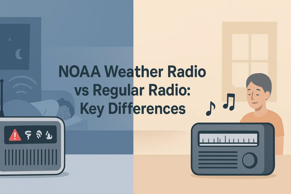
For those also preparing for local severe weather emergencies, understanding how NOAA weather radio alerts work and what the different alert tones mean rounds out your emergency monitoring capability beyond shortwave into the dedicated NOAA WX band.
Ham Radio Operators and Shortwave Weather Net Frequencies
Licensed amateur radio operators use shortwave HF frequencies to operate weather information networks (nets) that compile and distribute real-time weather observations from hundreds of voluntary reporting stations across broad geographic areas. The most important of these is the Hurricane Watch Net (HWN), which activates on 14.325 MHz (USB) during Atlantic hurricane season and relays position, intensity, wind speed, and track data directly to the National Hurricane Center (NHC) in Miami.
According to the ARRL (American Radio Relay League) Emergency Communication Handbook, the Skywarn (Severe Weather) recognition program trains ham radio operators to report and relay severe weather observations to National Weather Service forecast offices in real time over VHF and HF frequencies. The Skywarn HF net frequency varies by NWS forecast office region, but 3.975 MHz LSB (lower sideband) serves as a common informal coordination frequency during widespread severe weather events in the eastern United States.
Key amateur radio weather net frequencies for shortwave monitoring:
- 14.325 MHz USB: Hurricane Watch Net (HWN) primary frequency. Activates during named Atlantic storms. NHC coordinators monitor this frequency.
- 14.275 MHz USB: Hurricane Watch Net secondary frequency when 14.325 MHz is congested
- 3.975 MHz LSB: Informal Skywarn coordination frequency, eastern U.S., active during severe weather events
- 7.268 MHz LSB: Skywarn coordination for central U.S. regions during tornado season
- 14.200 MHz USB: Maritime Mobile Service Net (MMSN), relays tropical weather for offshore sailors
- 14.300 MHz USB: Intercontintental Traffic Net, used for general HF weather relay
You do not need an amateur radio license to listen to these nets. A shortwave receiver with SSB capability tuned to 14.325 MHz USB during an active hurricane will deliver real-time position and intensity data from volunteer ham operators stationed in or near the storm, sometimes hours ahead of official NHC updates.
The Hurricane Watch Net has provided continuous storm data to the National Hurricane Center during every major Atlantic hurricane since the net’s founding in 1965, demonstrating the enduring operational value of shortwave HF amateur radio in official weather data collection. If you want to extend your weather monitoring further into the ham radio world, our coverage of dedicated ham radio frequencies used for weather reporting and Skywarn nets provides a complete frequency directory by NWS region.
Shortwave vs NOAA Weather Radio: Which Should You Use and When?
NOAA Weather Radio All Hazards (NWR) broadcasts on seven VHF frequencies between 162.400 and 162.550 MHz, covering 95% of the U.S. population within 40 miles of a transmitter. Shortwave weather broadcasts on 2.5-20 MHz cover hundreds to thousands of miles from a single transmitter but require more receiver capability and antenna. The choice between them depends on your location, the geographic scale of weather information you need, and whether you are within NWR coverage range.
According to NOAA’s National Weather Radio All Hazards technical documentation, NWR transmitters operate at 300-1,000 watts ERP, providing reliable coverage within 40 miles of each transmitter site. Outside that 40-mile radius, NWR signal strength drops below the threshold for reliable S.A.M.E. alert decoding, even if you can still hear audio.
Use the table below to decide which system fits your situation.
Signal Guide
NOAA Weather Radio vs Shortwave Weather Broadcasts – When to Use Each
Coverage, equipment requirements, and use cases compared. Source: NOAA NWS, NIST, USCG Light List.
| Factor | NOAA Weather Radio (NWR) | Shortwave Weather |
|---|---|---|
| Frequency range | 162.400-162.550 MHz (7 channels) | 2.5-22.5 MHz (multiple stations) |
| Coverage range | 40 miles from transmitter | 500-10,000 miles (frequency-dependent) |
| Alert capability | S.A.M.E. county-specific alerts | No automatic alerting (manual monitoring) |
| Minimum receiver cost | $25-40 (basic S.A.M.E. weather radio) | $50-70 (portable shortwave with SSB) |
| Antenna required | Built-in whip adequate within 40 miles | External wire recommended for best results |
| Geographic content | Local county/region (NWS forecast office area) | Ocean basin, regional, or global |
| Best use case | Home, local emergency, S.A.M.E. alerts | Offshore sailing, remote wilderness, travel |
| Broadcast authority | National Weather Service local offices | NWS, USCG, NIST, ICAO, IMO |
| Works without grid power | Yes (battery-powered receiver) | Yes (battery-powered receiver) |
Coverage and range figures are typical values. NWR S.A.M.E. alert decoding requires signal strength above approximately 12 dBuV/m. Shortwave propagation varies with solar cycle, time of day, and season.
If you are within 40 miles of a NOAA NWR transmitter and need county-specific severe weather alerts, a dedicated weather radio with S.A.M.E. filtering is the right primary tool. If you are offshore, in a remote area beyond NWR coverage, or need weather data for an ocean crossing, shortwave is the only viable option. For the most comprehensive comparison of dedicated NOAA weather radio options and receiver features, the top-rated NOAA weather radios reviewed by reception quality and S.A.M.E. performance covers every major model tier in detail.
The ideal emergency communication kit contains both: a NOAA weather radio for local severe weather alerts and a shortwave receiver for regional and offshore weather intelligence.
Here is the shortwave weather broadcast finder widget, which helps you identify the right frequency based on your situation and time of day.
Interactive Tool
Find the Right Shortwave Weather Frequency for Your Situation
Answer 2 questions to get a specific frequency recommendation for your shortwave weather monitoring.
Troubleshooting Shortwave Weather Reception: Common Problems and Fixes
The most common shortwave weather reception problem is not a broken receiver. It is the wrong frequency for the current time of day and propagation conditions. If WWV on 10.0 MHz sounds weak or absent during the day, the ionosphere’s F2 layer may be in a high-absorption state, meaning 10.0 MHz is propagating too far past your location to return a usable ground wave. Drop to 5.0 MHz and reception typically restores immediately.
According to NIST, the usable shortwave frequency range shifts upward as solar activity increases and downward as it decreases. A solar flux index (SFI) above 150 (reported by WWV at minute 18) means higher frequencies (15-20 MHz) are open and lower frequencies (2.5-5 MHz) may be noisy with daytime absorption. An SFI below 70 collapses the usable range, making 2.5 and 5 MHz the only reliable bands for medium-distance coverage.
Common shortwave weather reception problems and specific fixes:
- Problem: WWV signal absent or very weak on 10.0 MHz during daytime. Cause: D-layer ionospheric absorption at mid-frequency during high solar activity, or the skip zone placing the refracted signal beyond your location. Fix: Switch to 5.0 MHz (shorter skip) or 15.0 MHz (longer skip past the dead zone). The correct frequency is the one where WWV sounds loudest.
- Problem: USCG NMN voice broadcast sounds garbled or like two overlapping voices. Cause: Receiver is in AM mode rather than USB (upper sideband) mode. Fix: Switch receiver mode to SSB/USB. All USCG weather voice broadcasts use upper sideband, not AM.
- Problem: WEFAX chart prints as slanted diagonal lines rather than a recognizable map. Cause: Audio input level is either too high (clipping) or too low (no signal). Fix: Reduce receiver volume until the audio input meter in fldigi reads approximately -6 dB below clipping. Adjust until diagonal lines straighten into horizontal chart rows.
- Problem: Strong local electrical noise (buzzing or hash) on all shortwave frequencies. Cause: Conducted or radiated noise from switching power supplies, LED lighting, or solar inverters in the same building. Fix: Move the external antenna outside and as far from the building as possible. A 30-foot wire outside a window reduces building-sourced noise by 20-30 dB compared to an indoor wire.
- Problem: Weather broadcast audio fades in and out every 3-10 seconds. Cause: Multipath fading from two ionospheric propagation paths arriving at the antenna slightly out of phase. Fix: This is a propagation phenomenon, not a receiver or antenna fault. Wait 10-15 minutes for propagation to stabilize, or shift to a nearby frequency (e.g. from 10.0 to 9.995 or 10.005 MHz) to find a cleaner path.
- Problem: WWV broadcast at minute 8 contains no storm warning, just a tone. Cause: No active marine storm warnings are in effect at that broadcast time. Fix: This is the correct behavior when no warnings exist. The absence of a warning announcement is itself useful information confirming current conditions are below warning threshold.
The most effective shortwave troubleshooting workflow is frequency-first: confirm you are on the correct frequency for the current time of day before adjusting any hardware or software settings.
Shortwave Weather Broadcasts by Region: Which Stations Are Most Useful for Your Location
Your geographic location determines which shortwave weather broadcast stations are most useful, because ionospheric propagation at different frequencies produces reliable coverage over specific distance ranges. A receiver on the U.S. East Coast gets the best marine weather from USCG NMN (Chesapeake, VA) at 8.764 MHz, while a receiver on the U.S. West Coast monitors USCG NMC (Point Reyes, CA) at the same frequency. An operator in Alaska primarily monitors USCG NOJ (Kodiak) on 8.764 MHz and 4.426 MHz.
For inland continental locations more than 500 miles from the coast, WWV on 10.0 MHz is the primary shortwave weather source, providing official marine storm warnings and geophysical alerts without requiring proximity to any coastal transmitter. Inland locations in the central United States are typically within the 10.0 MHz skip zone for most of the day, making it the single most reliable shortwave weather frequency for Chicago, Dallas, Denver, and similar locations.
Regional shortwave weather monitoring recommendations:
- U.S. East Coast (Boston to Miami): Primary: USCG NMN 8.764 MHz (day) / 4.426 MHz (night). Backup: WWV 10.0 MHz. Supplement: USCG NMF 4.235 MHz for Georges Bank and Gulf of Maine coverage.
- U.S. Gulf Coast (New Orleans to Corpus Christi): Primary: USCG NMN 8.764 MHz. The Gulf of Mexico and Caribbean are covered under NMN’s Western North Atlantic service area. WWV 10.0 MHz for storm warning confirmation.
- U.S. West Coast (Seattle to San Diego): Primary: USCG NMC 8.764 MHz (day) / 4.426 MHz (night). Supplement: ECCC Vancouver 8.722 MHz for northern Pacific coverage extending to the Gulf of Alaska.
- Alaska and Pacific Northwest: Primary: USCG NOJ 8.764 MHz (Kodiak). Supplement: ECCC Vancouver 4.357 MHz (night) / 8.722 MHz (day).
- Hawaii and Central Pacific: Primary: WWVH 10.0 MHz (Kauai). Supplement: USCG NMC 12.786 MHz for offshore Pacific marine forecasts.
- Continental interior (Midwest, Mountain West): Primary: WWV 10.0 MHz. Backup: WWV 5.0 MHz (night). No dedicated USCG station serves interior continental locations; WWV is the primary official weather broadcast source.
- Caribbean and offshore Atlantic passages: Primary: USCG NMN 13.089 MHz for daytime. At 0518 UTC and 1118 UTC, NMN broadcasts high seas forecasts for the Western North Atlantic including all Caribbean sea areas.
Regardless of location, WWV on 10.0 MHz at minute 8 provides a reliable baseline marine storm warning broadcast that is worth monitoring as a daily check-in regardless of whether you are near coastal waters.
If your weather monitoring also includes marine VHF channels for coastal and inshore conditions, our guide to marine VHF weather channels and when to use WX versus offshore shortwave explains how to integrate both systems for complete coastal coverage.
Advanced Shortwave Weather Monitoring: Solar Data, Propagation Forecasts, and Geomagnetic Alerts
WWV and WWVH broadcast three specific geophysical data products at minute 18 (WWV) and minute 45 (WWVH) every hour: the solar flux index (SFI), the geomagnetic A-index, and the geomagnetic K-index. These three numbers, when understood correctly, tell you exactly how well shortwave is propagating right now, what it will do for the next 24-48 hours, and whether a geomagnetic storm is in progress that could black out HF communication entirely.
According to NIST Special Publication 432, the solar flux index (SFI) measures the intensity of solar radio emissions at 2,800 MHz (10.7 cm wavelength), reported in solar flux units (SFU). The SFI correlates directly with ionospheric electron density and therefore with the maximum usable frequency (MUF) for shortwave propagation. A higher SFI means higher MUF and better propagation on higher shortwave frequencies.
Practical interpretation of the geophysical alert data broadcast on WWV at minute 18:
- Solar Flux Index (SFI):
- SFI below 70: Poor propagation. Usable range limited to 2.5-7 MHz. Avoid frequencies above 10 MHz.
- SFI 70-100: Moderate propagation. 10-15 MHz usable for mid-distance paths. Good for WWV and USCG weather monitoring.
- SFI 100-150: Good propagation. All standard weather frequencies (5-15 MHz) performing well. 20 MHz occasionally usable.
- SFI above 150: Excellent propagation. 15-20 MHz frequencies open to long-range paths. Best time for international weather broadcasts.
- Geomagnetic A-index: A daily average of geomagnetic activity, expressed as a number from 0 to 400. Below 10 is quiet (good propagation). 10-29 is unsettled. 30-49 is active. Above 50 indicates a geomagnetic storm that will degrade high-frequency propagation, particularly on polar paths.
- Geomagnetic K-index: A 3-hour rolling index from 0 to 9. K below 3 means good shortwave conditions. K of 5 or above signals a geomagnetic storm in progress: high-latitude paths will be severely degraded or blacked out, and frequencies above 10 MHz may become unreliable even at mid-latitudes.
An A shortwave radio capable of receiving WWV on multiple frequencies lets you cross-compare signal strength on 5.0, 10.0, and 15.0 MHz simultaneously, which is the most practical real-time propagation assessment method available without any software or special equipment.
If the K-index reported at minute 18 is 5 or higher, immediately drop your monitoring frequency to 5.0 MHz and expect degraded reception on everything above 8 MHz for the next 12-24 hours.
The Complete Shortwave Weather Broadcast Frequency Directory
The following directory consolidates every major shortwave weather broadcast frequency by station, mode, and content type. Use it as a quick reference when scanning for weather broadcasts on an unfamiliar receiver or in a new operating location.
Frequency Reference
Complete Shortwave Weather Broadcast Frequency Directory
All major weather broadcast frequencies by station, mode, and content. Source: NIST, USCG Light List, ICAO, IMO, national meteorological services.
| Frequency (MHz) | Station | Mode | Content | Schedule | Region |
|---|---|---|---|---|---|
| 2.500 | WWV/WWVH | AM | Marine storm warnings, geophysical alert | Continuous; weather at :08/:18 (WWV), :45/:48 (WWVH) | Short range (0-1,500 mi) |
| 4.235 | USCG NMF | USB | Marine voice weather, N. Atlantic | Scheduled broadcasts, see USCG Light List | Gulf of Maine, Georges Bank |
| 4.357 | ECCC VAN | USB | Pacific/Arctic marine weather (Canada) | Scheduled twice daily | NE Pacific, Gulf of Alaska |
| 4.426 | USCG NMN/NMC | USB | Marine voice weather | Nighttime primary frequency | Atlantic and Pacific |
| 5.000 | WWV/WWVH | AM | Marine storm warnings, geophysical alert | Continuous; weather at :08/:18 (WWV), :45/:48 (WWVH) | Night (0-3,000 mi) |
| 6.501 | USCG NMN | USB | Marine voice weather, W. Atlantic | Morning transition frequency | W. North Atlantic |
| 6.604 | New York VOLMET | USB | Aviation METAR weather reports | Continuous 5-minute cycle | N. Atlantic flight region |
| 8.764 | USCG NMN/NOJ | USB / WEFAX | Marine voice + graphical weather charts | Primary daytime marine frequency | Atlantic, Alaska coastal |
| 10.000 | WWV/WWVH | AM | Marine storm warnings, solar/geo alert | Continuous; weather at :08/:18 (WWV), :45/:48 (WWVH) | All-day (0-5,000 mi) |
| 10.051 | New York VOLMET | USB | Aviation METAR weather reports | Continuous 5-minute cycle | N. Atlantic flight region |
| 13.089 | USCG NMN/NMC | USB | High seas forecasts, tropical advisories | Scheduled twice daily (0518 / 1118 UTC) | Atlantic and Pacific Ocean |
| 14.325 | Hurricane Watch Net (ham) | USB | Real-time tropical storm relay to NHC | Activates during named Atlantic storms | Atlantic hurricane region |
| 15.000 | WWV/WWVH | AM | Marine storm warnings, geophysical alert | Continuous; weather at :08/:18 (WWV), :45/:48 (WWVH) | Daytime only (1,000-7,000 mi) |
| 17.314 | USCG NMN/NMC | WEFAX | Graphical weather charts, long-range Atlantic/Pacific | Daytime WEFAX schedule | Deep ocean, long-range daytime |
| 20.000 | WWV only | AM | Marine storm warnings, geophysical alert | Continuous; weather at :08/:18 | Very long daytime skip (2,000-10,000 mi) |
Source: NIST Special Publication 432, USCG Light List Volumes I-VII, ICAO Annex 3, IMO SOLAS Chapter IV. All frequencies in MHz. Verify current USCG schedules at navcen.uscg.gov before offshore departure.
This directory covers every shortwave weather broadcast source regularly monitored by mariners, pilots, emergency managers, and shortwave enthusiasts in the Western Hemisphere.
For a deeper comparison of all the NOAA broadcast frequencies available on your weather radio’s WX channels, our guide to all seven NOAA weather radio VHF frequencies and which one covers your county explains how to identify the strongest NWR signal for your specific location.
Frequently Asked Questions About Shortwave Radio and Weather Broadcasts
What frequency does WWV broadcast on and when does the weather forecast air?
WWV (Fort Collins, Colorado) broadcasts simultaneously on 2.5, 5, 10, 15, and 20 MHz, 24 hours a day, 365 days a year. Marine storm warnings air at minute 8 of every hour on WWV. Geophysical alerts (solar flux, A-index, K-index) air at minute 18 of every hour. WWVH (Kauai, Hawaii) airs its marine storm warning at minute 48 and geophysical alert at minute 45.
The 10.0 MHz frequency is the most reliable for most North American listeners during both day and night. If 10.0 MHz sounds weak, switch to 5.0 MHz at night or 15.0 MHz during the day.
Do I need an amateur radio license to listen to shortwave weather broadcasts?
No license of any kind is required to receive shortwave weather broadcasts. The FCC’s Part 97 amateur radio rules cover only transmission, not reception. Anyone can tune a shortwave receiver to WWV, USCG NMN, aviation VOLMET, or any other shortwave weather station without a license, registration, or any other authorization.
Only if you wish to transmit on amateur HF frequencies (such as the Hurricane Watch Net on 14.325 MHz) would you need an FCC amateur radio license. Listening requires nothing beyond a receiver.
What is the difference between WWV and NOAA Weather Radio on 162.400 MHz?
WWV on 2.5-20 MHz and NOAA Weather Radio on 162.400-162.550 MHz are two completely separate broadcast systems operated by different NOAA entities. WWV is operated by NIST (National Institute of Standards and Technology) and broadcasts marine storm warnings plus geophysical data to a national and international audience with effective range measured in thousands of miles. NOAA Weather Radio is operated by the National Weather Service and broadcasts local severe weather alerts for specific counties, with coverage limited to approximately 40 miles from each transmitter site.
WWV does not broadcast local tornado warnings or county-specific S.A.M.E. alerts. NOAA Weather Radio does not broadcast marine storm warnings for ocean areas or global geophysical data. You need both systems for complete weather monitoring coverage.
Why does the USCG weather broadcast on 8.764 MHz sound garbled when I tune to it?
The USCG broadcasts all HF voice weather on USB (upper sideband) mode, not AM. If your receiver is in AM mode, you will hear a distorted double-sideband signal that sounds like two overlapping voices. Switch your receiver to SSB mode and select USB (upper sideband). The voice should immediately become clear and intelligible.
If the audio is still unclear after switching to USB, the frequency may be experiencing ionospheric fading. Try 6.501 MHz as an alternative for NMN at night, or 13.089 MHz during the day for longer-distance coverage.
Can I receive WEFAX weather charts without any special equipment?
You can receive WEFAX weather charts with a standard shortwave receiver and a free software decoder, using only the audio cable that came with your radio. Connect the receiver’s headphone output to your laptop’s microphone input with a 3.5mm audio cable (approximately $5-10). Download fldigi (free) or JVComm32 (free), set the software to WEFAX mode (120 RPM, IOC 576), tune the receiver to 8.764 MHz in USB mode, and the chart begins printing to your screen within seconds of the WEFAX start tone.
The only mandatory hardware is a shortwave receiver with USB (single sideband) demodulation. A receiver with AM mode only will not produce a clean enough audio signal to decode WEFAX charts reliably.
What is the Hurricane Watch Net and how do I listen to it?
The Hurricane Watch Net (HWN) is a volunteer amateur radio network that activates on 14.325 MHz USB whenever a named Atlantic tropical storm or hurricane is in progress. Licensed ham operators positioned in or near the storm’s path report real-time wind speed, barometric pressure, storm surge, and rainfall data directly to National Hurricane Center meteorologists, who use this ground-truth data to refine official track and intensity forecasts.
Anyone with a shortwave receiver capable of 14.325 MHz USB can monitor the HWN during an active storm. No license is required to listen. The net activates when a tropical cyclone reaches 35-knot intensity, which is the Named Storm threshold used by NHC. HWN activation announcements are posted at hwn.org.
Which shortwave weather frequency should I program first on a new receiver?
Program WWV on 10.0 MHz (AM mode) as your first preset. This single frequency provides marine storm warnings at minute 8, geophysical alerts at minute 18, and reliable propagation during most daylight and nighttime hours from any location in the continental United States. It requires no SSB capability, no external antenna, and no schedule lookup.
Add 5.0 MHz as a second preset for nighttime coverage within 2,000 miles, and 8.764 MHz (USB mode) as a third preset for USCG marine weather broadcasts. These three frequencies cover the essential shortwave weather monitoring needs for the vast majority of North American listeners.
Can a $30 portable shortwave radio receive USCG weather broadcasts?
A $30 portable shortwave receiver with AM mode only can receive WWV weather broadcasts on 5.0 and 10.0 MHz clearly, because WWV transmits in standard AM. It cannot properly decode USCG NMN voice broadcasts on 8.764 MHz or aviation VOLMET on 10.051 MHz, because those stations use USB (upper sideband) mode, which requires SSB demodulation capability not present in basic AM-only receivers.
For a complete shortwave weather monitoring station covering both WWV and USCG broadcasts, the minimum useful receiver is one with SSB capability, which typically starts at approximately $50-70 for portable units like the Tecsun PL310ET or Tecsun PL600.
How is NAVTEX different from a standard shortwave weather broadcast?
NAVTEX is a narrow-band direct-printing digital radio system transmitting on 518 kHz (medium frequency, not shortwave) that automatically decodes and displays text-format weather bulletins without any operator input. Standard shortwave weather broadcasts (WWV, USCG NMN) require a listener to tune in at the correct time and copy the voice or WEFAX transmission manually. NAVTEX prints the official weather text to a screen or printer automatically every time the USCG transmits an update.
NAVTEX on 518 kHz covers up to 400 nautical miles offshore along both U.S. coasts. The HF NAVTEX frequency of 4.209.5 MHz extends coverage to deep ocean areas beyond that range, making it the offshore mariner’s preferred automatic weather monitoring system.
What does the geomagnetic K-index in the WWV broadcast mean for shortwave reception?
The K-index reported by WWV at minute 18 measures geomagnetic activity on a 0-9 scale for the most recent 3-hour period. A K-index below 3 means the ionosphere is quiet and shortwave propagation is performing normally across all standard weather frequencies. A K-index of 5 or above means a geomagnetic storm is in progress, which typically degrades shortwave propagation on frequencies above 10 MHz and can cause complete blackouts on polar propagation paths.
When WWV reports K5 or higher, immediately switch your monitoring frequency from 10.0 or 15.0 MHz down to 5.0 MHz. The lower frequency is less affected by geomagnetic disturbances because it relies on the lower D and E ionospheric layers rather than the F2 layer that geomagnetic storms most severely disrupt.
Is it legal to decode WEFAX weather charts off shortwave in the United States?
Decoding WEFAX weather charts from USCG, NOAA, or international meteorological services is completely legal in the United States. These are publicly transmitted broadcasts intended for reception by any mariner, aviator, or member of the public with appropriate receiving equipment. The FCC’s rules on radio interception (47 CFR Part 2.103) do not restrict reception of signals transmitted for public use.
The only FCC restriction relevant to receiving shortwave weather broadcasts is that you may not divulge or publish the contents of private communications not intended for the general public. USCG, NOAA, and NWS weather broadcasts are explicitly intended for general public reception and carry no such restriction.
Why does my shortwave radio receive WWV clearly on some days but not others?
WWV signal strength varies daily because the ionosphere changes its reflective properties with the solar cycle, time of day, season, and geomagnetic activity. The F2 layer, which reflects shortwave signals back to Earth, rises to higher altitude during the day and reaches maximum height in early afternoon local time, shifting the skip zone distance outward and sometimes placing nearby listeners in a dead zone where the refracted signal passes overhead without returning to the ground.
The practical fix is to keep three WWV frequencies programmed: 5.0 MHz, 10.0 MHz, and 15.0 MHz. When one sounds weak or absent, switch to the next frequency up or down. One of the three will almost always be receivable from any North American location at any time of day or year.
What shortwave weather information is available for sailing an offshore Atlantic passage?
For an offshore Atlantic sailing passage, the most important shortwave weather sources are USCG NMN voice on 8.764 MHz (daytime) and 4.426 MHz (night) for high seas forecasts, NMN WEFAX on 8.764 MHz and 17.314 MHz for graphical surface analysis and forecast charts, and the Maritime Mobile Service Net on 14.300 MHz USB for real-time weather relay from other vessels. The NMN high seas voice broadcast at 0518 UTC and 1118 UTC covers all Atlantic sea areas from the U.S. coast to 35 degrees West longitude.
Supplement these with NAVTEX on 518 kHz when within 400 nautical miles of the U.S. coast, and the Herb Hilgenberg South Bound II net on 12.359 MHz USB at 2000 UTC for detailed personalized weather routing popular with Atlantic sailors. Carry a dedicated marine SSB transceiver rather than a portable shortwave receiver for offshore passages, as marine SSB units provide significantly better receiver sensitivity and antenna coupling than portable consumer shortwave radios.
For deeper guidance on integrating VHF and HF weather monitoring for coastal and offshore passages, our guide to choosing between VHF weather channels and HF shortwave for offshore passage planning walks through exactly when to switch between each system.
Shortwave Weather Broadcasts and SiriusXM: How They Compare for Mobile Weather Monitoring
SiriusXM Weather broadcasts graphical weather data, NEXRAD radar, lightning strike data, and winds-aloft information to subscribers using the SiriusXM satellite network on dedicated data channels processed by compatible aviation and marine devices. Shortwave weather broadcasts transmit voice and WEFAX charts from terrestrial HF stations at no subscription cost. The two systems serve fundamentally different use cases and are more complementary than competitive.
SiriusXM Weather requires a subscription (approximately $25-50 per month depending on service tier), a compatible device (Garmin, Jeppesen, or marine chartplotter with SiriusXM WX module), and satellite signal line of sight. Shortwave weather requires only a receiver, operates at zero recurring cost, and works without any satellite infrastructure.
SiriusXM delivers graphical NEXRAD radar, METAR text, and winds-aloft charts at update intervals of 5-10 minutes. Shortwave WEFAX delivers synoptic-scale surface analysis and 24-96-hour forecast charts updated every 6-12 hours from USCG stations. For tactical short-range weather avoidance, SiriusXM’s radar data is superior. For oceanic passage planning beyond radar range, shortwave WEFAX is the tool of choice.
If your primary use case involves satellite weather services for aviation or marine navigation, our comparison of SiriusXM weather channels and what data each tier delivers provides a complete breakdown of subscription levels and compatible hardware.
Building a Complete Shortwave Weather Monitoring Station Under $150
A fully functional shortwave weather monitoring station capable of receiving WWV, USCG marine voice broadcasts, aviation VOLMET, and WEFAX graphical charts can be assembled for under $150 using three components: a portable SSB-capable shortwave receiver, a 30-foot external wire antenna, and a laptop with free decoding software.
The recommended component list for a $100-150 complete station:
- Receiver: Tecsun PL660 (approximately $85). Covers 0.1-30 MHz with AM, SSB, and sync detection. External antenna jack. Runs on 4x AA batteries for 15 hours. Includes earphone and carrying pouch.
- Antenna: 30 feet of 26 AWG insulated hookup wire from any hardware store ($5-8). Connect to the receiver’s external antenna jack using a 3.5mm mono plug soldered or crimped to one end. Suspend horizontally outside a window at maximum height.
- Decoding software: fldigi (free, cross-platform) for WEFAX, NAVTEX, and digital mode decoding. Audio cable from the radio’s headphone jack to the laptop’s microphone input ($5-8).
- Reference: USCG Light List (free PDF from navcen.uscg.gov) for current broadcast schedules and frequency assignments for all USCG stations.
This $100-150 station receives every shortwave weather broadcast listed in this guide. The Tecsun PL660’s synchronous detector provides noticeably cleaner AM reception of WWV compared to standard envelope-detector AM, reducing the impact of ionospheric fading on voice intelligibility.
For a complete review of weather radio hardware options at every price point, including dedicated NOAA weather radios, combination shortwave/weather receivers, and portable emergency units, the step-by-step guide to choosing the right weather radio for your situation and budget covers every major category in detail.
Shortwave weather monitoring at this level gives you official NOAA, USCG, and international meteorological data completely independent of cellular networks, internet infrastructure, and commercial power.
The three frequencies that matter most are 10.0 MHz (WWV, all-purpose), 8.764 MHz (USCG marine voice and WEFAX), and 14.325 MHz (Hurricane Watch Net, active during named Atlantic storms). Program those three, add a 30-foot wire antenna outside your window, and you have a weather intelligence capability that works when every other information system has failed.
| Photo | TOP RATED WALKIE TALKIES | Price |
|---|---|---|
 | Retevis RT628 Kids Walkie Talkies, Toys Gifts for 4-12 Year Old Girl Boy | Check Price On Amazon |
 | Cobra ACXT545 Weather-Resistant Walkie Talkies, Rechargeable, 22 Channels | Check Price On Amazon |
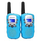 | Retevis RT388 Kids Walkie Talkies, Outdoor Toys for Kids Camping Essentials | Check Price On Amazon |
 | Cobra RX680 Walkie Talkies (2-Pack), IP54 Water Resistant Design | Check Price On Amazon |
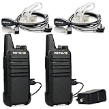 | Retevis RT22 Walkie Talkies Long Range Rechargeable with Earpiece (2 Pack) | Check Price On Amazon |
 | Midland GXT1000VP4 GMRS Two-Way Radios with Headsets, Black, 2 Pack | Check Price On Amazon |
 | Retevis RT628 Walkie Talkies for Kids,Toys Gifts for 6-12 Years Old Boys Girls,Long Range 2 Way Radio 22CH VOX,Birthday Gift,Family Walkie Talkie for Camping Hiking Indoor Outdoor | Check Price On Amazon |