Seven NOAA weather radio transmitters serve the Kansas City metro area, broadcasting continuously on frequencies between 162.400 and 162.550 MHz. If your weather radio is picking up the wrong counties or missing alerts entirely, the problem is almost always a mismatch between the transmitter you are receiving and the S.A.M.E. codes you have programmed.
This guide covers every active NOAA weather radio station serving Kansas City, the exact frequencies each one broadcasts on, which counties each transmitter covers, and how to program your radio to receive only the alerts that matter to your location.
| Photo | Popular Portable Walkie Talkies | Price |
|---|---|---|
 | SKIWARRIOR Multifunctional Smart Wireless Ski Goggles with Walkie-Talkie, Anti-Fog Zeiss Lens, Music & Call Function (Cylindrical Blue) | Check Price On Amazon |
 | SINORISE Super Mini Walkie Talkies, Two-Way Radios, 3 Pack | Check Price On Amazon |
 | KOSPET Tank M4C Smart Watch Rugged, Dual-Band GPS, 5ATM & IP69K Waterproof | Check Price On Amazon |
 | Retevis RT15 Walkie Talkies 3 Pack, Birthday Gift, Outdoor Adventure Kit | Check Price On Amazon |
 | Rechargeable Walkie Talkies Toys for Kids: DIY Astronaut Walkie Talkies for Boys Christmas Birthday Gifts for 3 4 5 6 7 8 9 10 Boy Walkie Talkie Outdoor Hiking Toy 2 Way Radio Camping Outdoor Game | Check Price On Amazon |
What Is NOAA Weather Radio and How Does It Serve Kansas City?
NOAA Weather Radio All Hazards (NWR) is a nationwide network of radio transmitters operated by the National Weather Service, broadcasting weather alerts, emergency warnings, and public safety information 24 hours a day on seven dedicated VHF frequencies between 162.400 and 162.550 MHz. The Kansas City area is served by multiple transmitters because no single station can reliably cover the entire metro and surrounding region through buildings, terrain, and distance.
According to NOAA’s National Weather Service documentation, the NWR network covers approximately 95% of the U.S. population within reception range of at least one transmitter. The Kansas City metro sits at the boundary of several NWR broadcast zones, which means your receiver may pick up two or three overlapping signals depending on your location.
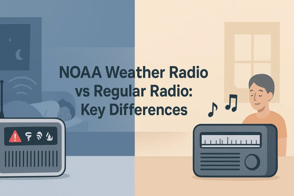
A NOAA weather alert radio with S.A.M.E. technology lets you program specific county codes so the alarm only sounds for your area, rather than waking you for every alert across the entire broadcast region. S.A.M.E. stands for Specific Area Message Encoding, and it is the system that allows your radio to filter alerts by 6-digit FIPS county code.
Without S.A.M.E. programming, a Kansas City weather radio receiving the Topeka or Pleasant Hill transmitter will alarm for tornado warnings in counties more than 100 miles away. Correct transmitter selection and S.A.M.E. code entry eliminate false alarms entirely.
The most important step before programming your weather radio is identifying which transmitter provides the strongest signal at your specific address, then entering the correct FIPS codes for your county and any adjacent counties where you spend time.
Kansas City NOAA Weather Radio Stations: Complete Frequency and Location Guide
The Kansas City metro area is served by four primary NWR transmitters, with additional stations in surrounding areas providing backup coverage for outlying counties. Each transmitter broadcasts on one of the seven standard NOAA weather radio frequencies and uses a unique four-letter call sign assigned by NOAA.
Use the table below to identify which station and frequency applies to your location in the Kansas City region.
| Call Sign | Frequency (MHz) | Transmitter Location | ERP (Watts) | Primary Counties Served | NWS Forecast Office |
|---|---|---|---|---|---|
| WXL58 | 162.400 | Kansas City, MO | 1,000 | Jackson, Clay, Platte, Cass (MO); Wyandotte, Johnson, Leavenworth (KS) | NWS Kansas City/Pleasant Hill |
| WXK78 | 162.475 | Pleasant Hill, MO | 300 | Cass, Henry, Johnson (MO); Linn, Miami (KS) | NWS Kansas City/Pleasant Hill |
| WWG20 | 162.550 | Topeka, KS | 1,000 | Shawnee, Douglas, Jefferson, Osage, Wabaunsee (KS) | NWS Topeka |
| WXJ22 | 162.425 | Chillicothe, MO | 300 | Livingston, Carroll, Chariton, Linn, Sullivan (MO) | NWS Kansas City/Pleasant Hill |
| WXL48 | 162.500 | Sedalia, MO | 300 | Pettis, Benton, Morgan, Moniteau, Cole (MO) | NWS Kansas City/Pleasant Hill |
| KHB35 | 162.425 | Ottawa, KS | 300 | Franklin, Anderson, Miami, Coffey (KS) | NWS Topeka |
| WXK28 | 162.475 | St. Joseph, MO | 300 | Buchanan, Andrew, DeKalb, Clinton, Caldwell (MO) | NWS Kansas City/Pleasant Hill |
Source: NOAA National Weather Service NWR transmitter database. ERP = Effective Radiated Power. Coverage areas are primary service zones; actual reception may extend beyond listed counties.
WXL58 on 162.400 MHz is the primary transmitter for the Kansas City urban core and is the correct frequency for most addresses in Jackson, Clay, Platte, and Wyandotte counties. The 1,000-watt transmitter provides strong signal coverage throughout the metro area.
If you live in southern Johnson County, Kansas, or Cass County, Missouri, you may receive both WXL58 and WXK78 at similar signal strength. In that case, program your radio for WXL58 first and use the S.A.M.E. county code filtering to limit alerts to your specific county.
Which Kansas City Weather Radio Frequency Should You Use?
For most Kansas City residents inside the I-435 beltway, 162.400 MHz (WXL58) is the correct primary frequency. This transmitter broadcasts from within the metro at 1,000 watts effective radiated power, making it the strongest and most reliable signal for the urban core on both the Missouri and Kansas sides.
The frequency your weather radio should be set to depends entirely on your physical address, not on your city name or ZIP code. Kansas City spans two states and multiple NWS forecast zone boundaries, so a single “Kansas City frequency” does not exist.
Use the breakdown below to match your location to the correct primary station.
- Kansas City, MO (downtown, midtown, south KC): 162.400 MHz (WXL58)
- North Kansas City, Gladstone, Liberty, Kearney: 162.400 MHz (WXL58)
- Independence, Blue Springs, Lee’s Summit: 162.400 MHz (WXL58)
- Overland Park, Olathe, Lenexa, Shawnee (KS): 162.400 MHz (WXL58)
- Lawrence, KS: 162.550 MHz (WWG20, Topeka) or 162.400 MHz (WXL58, both receivable)
- Harrisonville, Belton, Raymore (Cass Co., MO): 162.475 MHz (WXK78, Pleasant Hill)
- St. Joseph, MO: 162.475 MHz (WXK28)
- Chillicothe, Trenton (north MO): 162.425 MHz (WXJ22)
- Sedalia, Warrensburg (east of KC): 162.500 MHz (WXL48)
- Ottawa, Paola (southern KS): 162.425 MHz (KHB35)
A Midland WR400 weather radio can scan all seven NOAA frequencies automatically and lock onto the strongest signal, which is a useful feature if you are uncertain which transmitter provides the best coverage at your address.
Key Specifications (Midland WR400):
- Frequencies: 162.400, 162.425, 162.450, 162.475, 162.500, 162.525, 162.550 MHz (all 7 NOAA channels)
- S.A.M.E. programmable codes: 50 location codes
- Alert types recognized: 25 event types
- Power: AC adapter with 6x AA battery backup
- Display: Digital clock with AM/FM reception
The correct frequency is the one that delivers the strongest, clearest signal at your specific address. If two stations both cover your area, always choose the transmitter operated by the NWS forecast office responsible for your county, as that office issues the alerts most relevant to you.
The Seven Standard NOAA Weather Radio Frequencies Explained
NOAA weather radio transmitters use exactly seven frequencies, all in the VHF high band between 162.400 and 162.550 MHz. These frequencies are reserved exclusively for government weather broadcasts under FCC regulations and are not shared with any commercial or amateur radio service. No license is required to receive them.
According to FCC Part 90 and NOAA’s NWR technical documentation, these seven frequencies are standardized nationwide so that any NOAA-compatible receiver can access any transmitter in the country without reprogramming.
| Channel | Frequency (MHz) | Common Designation | Used by KC-Area Station |
|---|---|---|---|
| WX1 | 162.550 | Channel 1 | WWG20 (Topeka, KS) |
| WX2 | 162.400 | Channel 2 | WXL58 (Kansas City, MO) |
| WX3 | 162.475 | Channel 3 | WXK78 (Pleasant Hill, MO); WXK28 (St. Joseph, MO) |
| WX4 | 162.425 | Channel 4 | WXJ22 (Chillicothe, MO); KHB35 (Ottawa, KS) |
| WX5 | 162.450 | Channel 5 | Not a primary KC-area frequency |
| WX6 | 162.500 | Channel 6 | WXL48 (Sedalia, MO) |
| WX7 | 162.525 | Channel 7 | Not a primary KC-area frequency |
Source: NOAA National Weather Service NWR frequency allocation. Channels WX5 and WX7 are not used by primary Kansas City-area transmitters but may be receivable from distant stations under certain atmospheric conditions.
The 162.450 MHz (WX5) and 162.525 MHz (WX7) channels are not used by any primary Kansas City-area transmitter. You may occasionally receive weak signals on these frequencies from transmitters in Springfield, MO or Wichita, KS during periods of enhanced VHF propagation, but they are not reliable for local alerts.
For a complete overview of all seven NOAA frequencies and how NWR channel assignments work nationwide, the national NOAA weather radio frequency breakdown with channel-by-channel details provides transmitter lookup tools and regional frequency maps.
Understanding which channels are active in your region is the foundation of reliable weather alert reception, since programming an inactive frequency produces silence during severe weather events.
S.A.M.E. County Codes for Kansas City Area Counties
S.A.M.E. (Specific Area Message Encoding) uses 6-digit FIPS (Federal Information Processing Standards) codes to identify counties. When you program these codes into your weather radio, the alarm only activates when the NWS issues an alert specifically for that county. Without S.A.M.E. programming, the radio alarms for every county within the transmitter’s coverage area, which can mean unwanted alerts from counties 150 miles away.
According to NOAA NWR technical documentation, each S.A.M.E. code follows the format: state FIPS code (2 digits) followed by county FIPS code (3 digits), preceded by a leading zero for the full 6-digit entry. A Uniden BC365CRS weather radio with S.A.M.E. alert filtering accepts up to 25 programmable county codes, allowing you to monitor your home county plus adjacent counties you travel through regularly.
| County | State | S.A.M.E. FIPS Code | Primary NWR Station | Frequency (MHz) |
|---|---|---|---|---|
| Jackson | MO | 029095 | WXL58 | 162.400 |
| Clay | MO | 029047 | WXL58 | 162.400 |
| Platte | MO | 029165 | WXL58 | 162.400 |
| Cass | MO | 029037 | WXK78 | 162.475 |
| Ray | MO | 029177 | WXL58 | 162.400 |
| Lafayette | MO | 029107 | WXL58 | 162.400 |
| Buchanan | MO | 029021 | WXK28 | 162.475 |
| Johnson (MO) | MO | 029101 | WXK78 | 162.475 |
| Wyandotte | KS | 020209 | WXL58 | 162.400 |
| Johnson (KS) | KS | 020091 | WXL58 | 162.400 |
| Leavenworth | KS | 020103 | WXL58 | 162.400 |
| Miami (KS) | KS | 020121 | WXK78 | 162.475 |
| Douglas (KS) | KS | 020045 | WWG20 | 162.550 |
| Shawnee (KS) | KS | 020177 | WWG20 | 162.550 |
| Franklin (KS) | KS | 020059 | KHB35 | 162.425 |
Source: NOAA FIPS county code database and NWS Kansas City/Pleasant Hill transmitter coverage documentation. Missouri FIPS state code: 029. Kansas FIPS state code: 020.
Always program your home county code first, then add adjacent counties where you commute or travel frequently. A resident of Overland Park, Kansas (Johnson County, KS) should program 020091 as the primary code and may also want 020209 (Wyandotte) and 029095 (Jackson, MO) for work commutes across the state line.
For a deeper explanation of how S.A.M.E. encoding works and why the 6-digit FIPS format matters for precise alert filtering, the complete explanation of S.A.M.E. weather radio technology and code programming walks through the encoding system step by step.
Correctly entered S.A.M.E. codes eliminate nearly all false alarms while ensuring you receive every warning issued for the counties that actually affect you.
Here is the Widget A SVG data chart placed after the S.A.M.E. section, where frequency-specific data for Kansas City NWR stations is most relevant to the reader:
The chart below shows the effective radiated power of each Kansas City-area NOAA weather radio transmitter, which directly determines signal reliability at locations on the edge of coverage zones.
How to Program Your Weather Radio for Kansas City Alerts
Programming a weather radio for Kansas City requires three steps: selecting the correct frequency for your transmitter, entering the S.A.M.E. FIPS code for your county, and enabling the alert tone function so the alarm activates automatically. Skipping the S.A.M.E. code entry means your radio will alarm for every alert across the entire broadcast region, including counties more than 100 miles away.
The exact button sequence varies by manufacturer, but the logical process is the same for all S.A.M.E.-capable receivers. The steps below apply to Midland weather radios with S.A.M.E. programming, which represent the most common desktop weather alert receiver format.
- Power on and press the Menu or Setup button. Navigate to the frequency or channel selection option. Select the correct NWR channel for your location (for most KC residents: WX2, which corresponds to 162.400 MHz).
- Enter S.A.M.E. programming mode. On most Midland and Uniden units, this is a dedicated “S.A.M.E.” button or a menu option labeled “SAME” or “Area.” The display will prompt you to enter a code.
- Enter your 6-digit county FIPS code. Use the number keys to type the code (example: 029095 for Jackson County, MO). Confirm with the Enter or Set button.
- Add additional county codes if needed. Most radios accept 5 to 50 codes. Add adjacent counties where you work or commute.
- Set the alert type preferences. Select which event types trigger the alarm (Tornado Warning, Severe Thunderstorm Warning, Flash Flood Warning, and Civil Emergency are minimum recommended selections for Kansas City).
- Enable the alarm tone output. Confirm the alert mode is set to “Alarm” not “Standby” or “Silent.” The radio must be in alarm-enabled mode to sound the alert horn at night.
- Test the programming. Press the Test button to verify the unit broadcasts the NOAA test message for your selected county. If no audio plays, recheck the frequency selection and FIPS code entry.
A Sangean CL-100 tabletop weather radio displays the incoming S.A.M.E. alert text on a scrolling LCD screen, which lets you read the exact warning details and affected counties before the alarm sounds in full.
Key Specifications (Sangean CL-100):
- NWR frequencies: all 7 NOAA channels (162.400 to 162.550 MHz)
- S.A.M.E. codes: programmable for multiple counties
- Display: LCD with scrolling alert text
- Power: AC with battery backup
- Additional: AM/FM reception, alarm clock
If the alarm fails to trigger during a live weather event in your county, the most common cause is a mismatch between your programmed FIPS code and the code broadcast in the NWS alert message. Verify your code against the official NOAA FIPS database and re-enter it manually.
Kansas City Weather Radio Reception: What Affects Signal Quality
NOAA weather radio signals in the 162 MHz VHF band travel as line-of-sight transmissions, meaning any physical obstruction between the transmitter and your receiver reduces signal strength. In Kansas City, the primary causes of poor reception are building construction materials, distance from the transmitter, and terrain features that block the signal path from transmitter to receiver.
This happens because VHF signals at 162 MHz do not penetrate reinforced concrete and steel-framed structures efficiently. The signal attenuates sharply when it must pass through multiple exterior walls, which is why a receiver that works well in a living room near a window may lose the signal entirely in a basement or interior office.
The following conditions reduce Kansas City NWR reception reliability:
- Basement location: Reduces signal strength by 15-25 dB compared to above-grade placement. A basement weather radio may require an external antenna routed to an above-ground location.
- Distance beyond 40 miles from transmitter: The 300-watt outlying stations (WXK78, WXJ22, WXL48) have reliable coverage radii of approximately 40 miles under normal conditions. At distances beyond that, signal quality degrades.
- Metal roof or foil-backed insulation: Acts as a partial Faraday cage. Repositioning the radio to an exterior wall or window typically restores reception.
- Co-channel interference: WXK28 (St. Joseph) and WXK78 (Pleasant Hill) both broadcast on 162.475 MHz. If you are located equidistant between both transmitters, the signals may cancel each other. Tune to WXL58 on 162.400 MHz instead.
An external indoor antenna for NOAA weather radio reception improves signal quality significantly for basement installations. A simple whip antenna with a BNC or SMA connector, placed at window height and connected to your receiver, can recover 10-15 dB of lost signal in below-grade locations.
If two Kansas City NWR stations broadcast on the same frequency (WXK28 and WXK78 both use 162.475 MHz), the receiver locks onto whichever transmitter provides the stronger signal at your location. You cannot simultaneously monitor both stations on the same frequency, so confirm which one serves your county before relying on that channel for alerts.
Strong, clear reception from the correct transmitter is the single most important factor in weather alert reliability, more important than any specific radio model or feature set.
Alert Types Broadcast by Kansas City NWR Stations
The NWS Kansas City/Pleasant Hill forecast office (which operates WXL58, WXK78, WXK28, WXJ22, and WXL48) broadcasts 25 distinct EAS (Emergency Alert System) event types over the NOAA weather radio network. Kansas City sits in Tornado Alley, making tornado and severe thunderstorm alerts the most frequently activated warning types, but the full alert list covers hazards well beyond severe weather.
According to FEMA’s Integrated Public Alert and Warning System (IPAWS) documentation, NWR broadcasts are a component of the Emergency Alert System infrastructure that also activates Wireless Emergency Alerts on cell phones. The two systems operate independently, so a power outage that disables cellular service does not affect your dedicated weather radio receiver.
| Alert Type | EAS Code | Trigger Condition | Alarm Priority |
|---|---|---|---|
| Tornado Warning | TOR | Confirmed tornado on ground or radar-indicated rotation | Highest |
| Severe Thunderstorm Warning | SVR | Wind 58+ mph or hail 1 inch+ diameter | High |
| Flash Flood Warning | FFW | Imminent or ongoing flash flooding | High |
| Tornado Watch | TOA | Conditions favorable for tornado development | Medium |
| Winter Storm Warning | WSW | Heavy snow, ice, or blizzard conditions expected | Medium |
| Extreme Wind Warning | EWW | Sustained winds 115+ mph or gusts 130+ mph | Medium |
| Civil Emergency Message | CEM | Non-weather public safety emergency | High |
| Hazardous Materials Warning | HMW | Chemical spill, gas leak, or industrial accident | High |
| AMBER Alert | CAE | Child abduction emergency | Standard |
| National Information Center | NIC | Presidential national emergency message | Highest |
Source: FEMA IPAWS EAS event code list and NWS Kansas City/Pleasant Hill alert documentation. S.A.M.E. radios allow individual alert types to be enabled or disabled by event code.
The NIC (National Information Center) alert is the highest-priority broadcast in the system and cannot be filtered by S.A.M.E. coding. Every weather radio will activate for a presidential national emergency message regardless of your S.A.M.E. county programming.
Kansas City’s position in the central plains means Tornado Warning (TOR) and Severe Thunderstorm Warning (SVR) alerts are the most frequently activated event types during spring and early summer. Enabling alarm output for both of these events, plus Flash Flood Warning (FFW), covers the three most life-threatening weather scenarios for the metro area.
Understanding the full range of alerts your weather radio can receive shows why a dedicated receiver provides broader emergency coverage than smartphone weather apps, which typically only push tornado and severe thunderstorm notifications.
Portable and Battery-Powered Weather Radio Options for Kansas City
A portable weather radio with battery backup or hand-crank power ensures alert reception during the power outages that often accompany the severe storms Kansas City experiences in spring and summer. A weather radio that loses power at the moment a tornado warning is issued provides no protection at all.
The three power source categories for portable weather radios each have distinct advantages for Kansas City users.
A Midland ER310 emergency hand-crank weather radio operates on AC power, a built-in rechargeable lithium battery, 3x AA batteries, solar panel input, or hand-crank generation. This redundancy means the radio functions even after an extended outage depletes the internal battery.
Key Specifications (Midland ER310):
- NWR frequencies: all 7 NOAA channels
- S.A.M.E.: yes, programmable county codes
- Power sources: AC, rechargeable Li-ion, 3x AA, solar, hand crank
- Hand-crank output: approximately 1 minute of play per 2 minutes of cranking
- Additional: AM/FM, USB phone charging port, LED flashlight, SOS beacon
A Kaito KA500 solar and hand-crank emergency radio is a lower-cost alternative that covers all seven NOAA frequencies with S.A.M.E. alert capability and includes five power input options including a solar panel on the top face of the unit.
For a bedroom or kitchen installation where AC power is always available, a Uniden BC365CRS desktop weather alert radio provides a large display, clock radio functionality, and battery backup in AA format. Its 25-county S.A.M.E. code capacity covers most multi-county commuting patterns in the Kansas City metro.
Key Specifications (Uniden BC365CRS):
- NWR frequencies: all 7 NOAA channels (162.400-162.550 MHz)
- S.A.M.E. codes: 25 programmable location codes
- Power: AC adapter with 3x AA battery backup
- Display: LCD with time and alert status
- Additional: AM/FM, alarm clock, large speaker
For Kansas City households, the ideal setup is a desktop unit with battery backup in the bedroom for overnight alerts, combined with a portable hand-crank unit stored in an emergency kit for use during extended power outages.
If you want to understand how NOAA weather radio fits into a broader emergency communication plan for your household, the guide to building a weather radio emergency preparedness kit with backup communication tools covers equipment selection, power backup strategies, and family alert protocols.
NWS Kansas City/Pleasant Hill: Understanding Your Local Forecast Office
The National Weather Service forecast office responsible for most of the Kansas City metro is located in Pleasant Hill, Missouri, approximately 30 miles southeast of downtown Kansas City. This office (abbreviated NWS KC/PLH or KEAX) issues all severe weather watches, warnings, and advisories for its coverage zone and scripts the voice broadcasts transmitted over WXL58, WXK78, WXK28, WXJ22, and WXL48.
The NWS Kansas City/Pleasant Hill office is responsible for weather forecasting and alerting across approximately 44 counties in western Missouri and eastern Kansas, according to NWS office zone documentation. The office operates 24 hours a day and can issue an alert for transmission within minutes of radar confirmation of a severe weather threat.
Counties in the Lawrence, KS area and Topeka metro fall under the NWS Topeka (TOP) forecast office, which operates WWG20 on 162.550 MHz. If you live in Douglas or Shawnee County, Kansas, your alerts are scripted by NWS Topeka, not NWS Kansas City, even though you may be able to receive WXL58 from the Kansas City transmitter.
Receiving the wrong forecast office’s transmitter means your alerts may be delayed, mismatched, or formatted for the wrong geographic zone. Always confirm that the transmitter you are monitoring is operated by the NWS office responsible for issuing alerts for your specific county.
The Pleasant Hill office’s coverage zone boundary runs roughly along the Kansas-Missouri state line and the I-35 corridor for the Kansas counties, and extends east to about the I-70 corridor in Missouri. Counties near these boundaries should verify transmitter assignment using the NOAA NWR transmitter lookup tool at the NWS website.
Knowing which forecast office issues your alerts is as important as knowing which transmitter to monitor, since the office boundary determines both what you hear and whether the warnings are geographically relevant to your location.
Kansas City Weather Radio on Smartphones and Other Devices
A dedicated NOAA weather radio receiver provides more reliable alert delivery than smartphone applications for Kansas City residents because it operates independently of cellular networks, internet connectivity, and application push notification settings. During the most severe storms, when cellular towers are overloaded or damaged, a dedicated weather radio continues to receive NWR broadcasts as long as power is available.
Smartphone-based NOAA weather radio applications work by streaming NWR audio over the internet, which means they depend on an active cellular or Wi-Fi data connection. When a tornado warning is issued and thousands of Kansas City residents simultaneously check their phones, network congestion can delay push notifications by 2 to 5 minutes, according to documented WEA (Wireless Emergency Alert) performance reports.
A portable NOAA weather radio receiver receives the 162 MHz RF signal directly with no internet dependency. The alert activates within seconds of the NWS transmitter broadcasting the encoded S.A.M.E. message, regardless of cellular network load.
Some newer handheld VHF radios like the Baofeng UV-5R can be programmed to receive NWR frequencies in receive-only mode. The UV-5R covers the 136-174 MHz VHF high band, which includes all seven NOAA weather radio channels. This makes it useful as a backup weather receiver, though it lacks the S.A.M.E. alert tone functionality of a dedicated weather radio.
For Kansas City residents who want weather radio capability on a mobile device without carrying a separate receiver, the full comparison of NOAA weather radio apps and dedicated receiver performance on mobile devices covers the key differences in alert timing, reliability, and offline capability between the two approaches.
A dedicated weather radio is the more reliable choice for overnight alert reception, particularly for the June and July overnight tornado events that the Kansas City area experiences during active severe weather seasons.
Seasonal Severe Weather Patterns in Kansas City and Alert Frequency
Kansas City’s position in the central plains creates one of the highest severe weather alert frequencies of any major U.S. metro area. The NWS Kansas City/Pleasant Hill office issues tornado warnings for the metro area on average multiple times per year, with severe thunderstorm warnings significantly more frequent during the spring and early summer months.
Understanding the seasonal alert calendar helps Kansas City residents know when to keep their weather radios powered, charged, and programmed with current S.A.M.E. codes.
- March through May: Peak tornado and severe thunderstorm season. Strongest storm systems typically track from southwest to northeast across the metro. Keep the weather radio alarm enabled at night during this period.
- June through July: Overnight convective events are common, including derechos (fast-moving, widespread windstorm events) that can generate winds exceeding 80 mph across the entire metro in under 30 minutes. NWR flash flood warnings are also frequent during heavy summer rainfall events.
- August through September: Reduced tornado frequency but continued severe thunderstorm and flash flood risk. Heat advisories and excessive heat warnings are transmitted on NWR during extended heat events.
- October through February: Winter storm warnings, ice storm warnings, and wind chill advisories dominate NWR broadcast content. The Kansas City area receives an average of 2 to 4 significant winter precipitation events per season that trigger NWR watches or warnings.
A weather radio with rechargeable battery backup should be tested and charged at the start of each severe weather season. The most common failure point in weather radio preparedness is a dead backup battery discovered during the first power outage of the tornado season.
The Kansas City metro spans Tornado Alley’s most active zone, and the combination of spring atmospheric instability with frequent nighttime storm development makes a functioning, alarmed weather radio one of the most practical life-safety devices available to households in the region.
Troubleshooting Kansas City Weather Radio Problems
The most common weather radio problems in the Kansas City area fall into four categories: no signal reception, false alarm for wrong counties, alarm failure during a live event, and static or audio distortion. Each has a specific cause and a specific fix.
Problem 1: No audio or signal on selected frequency
The cause is almost always incorrect frequency selection or a physical obstruction blocking the signal. Confirm you have selected 162.400 MHz (WXL58) for the KC urban core and not an inactive frequency like 162.450 or 162.525. Move the radio to an exterior wall or window, and verify the telescoping antenna is fully extended and vertical.
If no signal is present on 162.400 MHz from an above-grade exterior location, the transmitter may be off-air for scheduled maintenance. NOAA maintains a transmitter status page where outage notifications are posted. Try an alternate frequency: 162.475 MHz (WXK78) provides coverage throughout much of the metro as a backup signal source.
Problem 2: Alarm activates for counties outside your area
This is a S.A.M.E. coding problem. The radio either has no S.A.M.E. codes programmed (causing it to alarm for all counties in the broadcast zone) or has an incorrect FIPS code entered. Navigate to the S.A.M.E. programming menu, clear any existing codes, and re-enter your county’s 6-digit FIPS code from the table above. Confirm the code is entered as a 6-digit number with the leading zero (example: 029095 for Jackson County, not 29095).
Problem 3: No alarm during a live tornado warning for your county
The alarm function is disabled or the S.A.M.E. code is mismatched with the county code used in the NWS alert message. First, verify the alert mode is set to “Alarm” or “Warning Alarm” and not to “Standby” or “Monitor.” Second, confirm that the county in the NWS warning message matches the FIPS code you programmed. Some NWS warnings are issued for specific “warning areas” using non-standard zone codes instead of county codes, which may not match your programmed FIPS code.
Problem 4: Static, squelch noise, or poor audio quality
Static on NWR frequencies in Kansas City is most commonly caused by co-channel interference on 162.475 MHz (where WXK78 and WXK28 both broadcast) or by a damaged or misaligned antenna. If static is present on 162.475 MHz, switch to 162.400 MHz (WXL58), which has no co-channel interference in the metro area. If static is present on 162.400 MHz, inspect the antenna connection and try repositioning the unit.
Replacing the stock telescoping antenna with a dedicated outdoor VHF antenna for NOAA weather radio resolves persistent signal quality issues, particularly for locations more than 30 miles from the transmitter or in below-grade installations.
Most weather radio problems have straightforward solutions, and a radio that alarms reliably for the correct counties requires nothing more than correct frequency selection and accurate S.A.M.E. code programming.
Frequently Asked Questions About Kansas City Weather Radio Stations and Frequencies
What frequency should I use for NOAA weather radio in Kansas City, Missouri?
Most Kansas City, Missouri residents should use 162.400 MHz, which is broadcast by station WXL58 from within the metro at 1,000 watts effective radiated power. This frequency serves Jackson, Clay, Platte, and surrounding Missouri counties, as well as Wyandotte and Johnson counties on the Kansas side.
If your radio receives a weak or noisy signal on 162.400 MHz, try 162.475 MHz (WXK78, Pleasant Hill) as a secondary option. Both stations are operated by the NWS Kansas City/Pleasant Hill forecast office and broadcast the same alert content for the metro area.
What is the S.A.M.E. code for Jackson County, Missouri?
The S.A.M.E. FIPS code for Jackson County, Missouri is 029095. This 6-digit code follows the standard NOAA FIPS format: 029 is Missouri’s state code, and 095 is Jackson County’s county code. Enter this number exactly as shown, including the leading zero, when programming your weather radio.
If you work or commute regularly to Clay County (029047) or Platte County (029165), add those codes as secondary entries so your radio alerts you for events affecting the entire metro area where you spend time.
What is the difference between a Tornado Watch and a Tornado Warning on Kansas City weather radio?
A Tornado Watch (EAS code TOA) means atmospheric conditions are favorable for tornado development across a broad area, typically several counties or an entire region. A Tornado Warning (EAS code TOR) means a tornado has been confirmed by radar or a trained storm spotter and is imminent or occurring in a specific location. The warning requires immediate protective action.
A S.A.M.E.-equipped weather radio can be programmed to alarm for Tornado Warnings only, filtering out Tornado Watch notifications if you prefer to receive only the most urgent alerts. However, NWS recommends enabling both event codes during active severe weather seasons in the Kansas City area.
Can I use a handheld ham radio or walkie-talkie to receive Kansas City weather radio broadcasts?
Yes, any VHF radio that receives the 162 MHz band can monitor NOAA weather radio frequencies in receive-only mode. A Yaesu FT-70DR dual-band handheld radio covers 144-148 MHz (2-meter amateur band) and 430-450 MHz (70-centimeter band) and can also receive VHF weather channels. The Baofeng UV-5R covers 136-174 MHz VHF, which includes all seven NWR frequencies.
These radios can receive audio from NWR transmitters but do not have S.A.M.E. decoder circuits, so they will not activate an alert alarm automatically. They function only as passive receivers. A dedicated weather radio remains necessary for overnight alert activation.
Why does my Kansas City weather radio alarm for counties in other states?
This occurs when S.A.M.E. codes are not programmed, causing the radio to alarm for every county within the transmitter’s entire coverage area. The WXL58 transmitter on 162.400 MHz covers counties in both Missouri and Kansas, and without county code filtering, all alerts for both states trigger the alarm. Program your specific county’s 6-digit FIPS code to limit alarms to your location.
A second possible cause is reception of a distant transmitter from another NWS forecast office during periods of enhanced VHF propagation, which occasionally allows Kansas City receivers to pick up transmitters from Springfield, MO or Wichita, KS. If this occurs intermittently, your S.A.M.E. codes will still filter correctly as long as they are properly programmed for your home county.
Do I need a license to receive NOAA weather radio in Kansas City?
No license is required to receive NOAA weather radio broadcasts. The seven NWR frequencies between 162.400 and 162.550 MHz are designated as government broadcast frequencies under FCC rules, and listening to them is unrestricted. Any person may operate a weather radio receiver without any FCC permit, registration, or license of any kind.
The no-license requirement applies to receive-only operation only. Transmitting on NWR frequencies is strictly prohibited and reserved for NOAA-operated transmitters. The FCC does not authorize any private party to transmit on 162 MHz weather radio frequencies.
How do I find out if my Kansas City weather radio station is off the air?
NOAA publishes transmitter status updates on the NWS website under the NWR transmitter status page. Scheduled maintenance for Kansas City-area transmitters (particularly WXL58 and WXK78) is announced in advance with the expected outage window and the recommended alternate frequency to monitor. Unplanned outages are typically noted within hours of the event.
If WXL58 (162.400 MHz) is off-air, switch to WXK78 (162.475 MHz) operated from Pleasant Hill, which provides overlapping coverage for most of the metro. For Kansas-side listeners, WWG20 (162.550 MHz, Topeka) can serve as a backup, though its primary coverage zone is oriented toward the Topeka-Lawrence corridor rather than the KC metro.
What is the difference between NWS Kansas City and NWS Topeka for weather radio alerts?
NWS Kansas City/Pleasant Hill (KEAX) issues forecasts and warnings for approximately 44 counties in western Missouri and eastern Kansas, including all core Kansas City metro counties. NWS Topeka (KTOP) is responsible for north-central and northeast Kansas, including Shawnee (Topeka), Douglas (Lawrence), and surrounding counties. The two offices have a geographic boundary that runs roughly through the eastern Kansas counties.
If you live in Lawrence, KS, you are in NWS Topeka’s forecast zone and should monitor WWG20 on 162.550 MHz for alerts issued by that office. Monitoring WXL58 (NWS Kansas City) from Lawrence may provide reception but will not include all Topeka-issued alerts for your county on the correct timeline.
Can a weather radio in Kansas City receive alerts for tornadoes forming in rural areas before they reach the city?
Yes. NWS Kansas City/Pleasant Hill issues tornado warnings for rural counties in its coverage zone as soon as radar or storm spotters confirm rotation, regardless of whether the storm is approaching a populated area. Because Kansas City tornadoes typically track from the southwest, warnings issued for outlying rural counties like Miami or Linn County, Kansas often provide 15 to 30 minutes of advance notice before a storm reaches the metro core.
Programming adjacent rural county S.A.M.E. codes into your weather radio (in addition to your home county code) allows your radio to alarm when a warning is issued for an approaching storm, even before it crosses into your county boundary. For Kansas City residents, adding S.A.M.E. codes for Miami County, KS (020121) and Cass County, MO (029037) to the southwest provides earlier warning for storms tracking on the most common severe weather approach vectors.
Why does my weather radio not alarm even though I can hear the broadcast clearly?
Clear audio reception and alarm activation are two separate functions. The alarm activates only when the radio’s S.A.M.E. decoder circuit receives a correctly encoded digital header containing an event code that matches your alert settings and a county code that matches your programmed FIPS codes. A radio receiving clean audio from WXL58 but with no S.A.M.E. codes programmed, or with the alarm mode disabled, will broadcast audio but never trigger the alert horn.
Check three settings: first, confirm the alarm mode is enabled (not set to Monitor or Standby). Second, verify at least one S.A.M.E. county code is programmed. Third, confirm the event types you care about (TOR, SVR, FFW) are enabled in the alert event settings. All three conditions must be met simultaneously for the alarm to function.
Is 162.400 MHz or 162.550 MHz better for Overland Park, Kansas?
For Overland Park, Kansas (Johnson County), 162.400 MHz (WXL58, Kansas City) is the recommended primary frequency. Overland Park falls within WXL58’s primary coverage zone, and Johnson County, KS (S.A.M.E. code 020091) is listed in WXL58’s served county area. The NWS Kansas City/Pleasant Hill office issues warnings for Johnson County, KS, and those alerts are broadcast over WXL58.
The 162.550 MHz frequency (WWG20, Topeka) is receivable in Overland Park but is operated by NWS Topeka, which does not issue primary alerts for Johnson County, KS. Monitoring the Topeka transmitter from Overland Park could result in missed or delayed alerts for your county. Use 162.400 MHz as your primary and program FIPS code 020091 for Johnson County, KS.
How many S.A.M.E. codes should I program into my Kansas City weather radio?
Program a minimum of one code (your home county) and a recommended maximum that covers the counties where you regularly spend time, up to the limit your radio accepts. Most desktop weather radios accept 5 to 50 codes. A practical Kansas City setup for a resident of Jackson County, MO who commutes to Johnson County, KS would include three codes: 029095 (Jackson, MO), 020091 (Johnson, KS), and either 029047 (Clay, MO) or 029165 (Platte, MO) depending on your commute route.
Adding too many codes beyond your regular travel area defeats the purpose of S.A.M.E. filtering and reintroduces the false alarm problem. Limit your programmed codes to counties where you or your household members are physically present on a regular basis.
For more information about how to use NOAA weather radio as part of a complete emergency communication strategy, the complete introduction to how NOAA weather radio works and why it matters covers the NWR network structure, transmitter operation, and receiver selection from the ground up.
For Kansas City residents who want to explore weather radio station coverage across Missouri and Kansas more broadly, the state-by-state directory of NOAA weather radio stations and their coverage zones provides a complete transmitter listing with frequencies and county assignments for the entire region.
NOAA weather radio in Kansas City works reliably when you have the right frequency, the right S.A.M.E. codes, and a receiver with the alarm function enabled. WXL58 on 162.400 MHz is the primary transmitter for the urban core on both sides of the state line, with S.A.M.E. code 029095 for Jackson County, MO and 020091 for Johnson County, KS covering the two largest population centers. Set those three values correctly, keep the backup battery charged before tornado season, and your weather radio will do exactly what it is designed to do.
| Photo | TOP RATED WALKIE TALKIES | Price |
|---|---|---|
 | Retevis RT628 Kids Walkie Talkies, Toys Gifts for 4-12 Year Old Girl Boy | Check Price On Amazon |
 | Cobra ACXT545 Weather-Resistant Walkie Talkies, Rechargeable, 22 Channels | Check Price On Amazon |
 | Retevis RT388 Kids Walkie Talkies, Outdoor Toys for Kids Camping Essentials | Check Price On Amazon |
 | Cobra RX680 Walkie Talkies (2-Pack), IP54 Water Resistant Design | Check Price On Amazon |
 | Retevis RT22 Walkie Talkies Long Range Rechargeable with Earpiece (2 Pack) | Check Price On Amazon |
 | Midland GXT1000VP4 GMRS Two-Way Radios with Headsets, Black, 2 Pack | Check Price On Amazon |
 | Retevis RT628 Walkie Talkies for Kids,Toys Gifts for 6-12 Years Old Boys Girls,Long Range 2 Way Radio 22CH VOX,Birthday Gift,Family Walkie Talkie for Camping Hiking Indoor Outdoor | Check Price On Amazon |