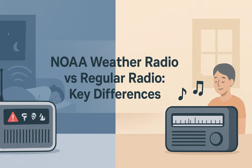
SiriusXM weather channels and NOAA Weather Radio All Hazards both deliver meteorological information, but they serve fundamentally different purposes. NOAA Weather Radio broadcasts on seven dedicated VHF frequencies between 162.400 and 162.550 MHz, operates 24 hours a day, and triggers audible alerts directly on a standalone receiver when a warning is issued for your specific county. SiriusXM weather is a subscription satellite service designed primarily for in-vehicle or aviation use, delivering visual weather data to a display rather than issuing tone-alert warnings to a dedicated emergency receiver.
Understanding which system fits your situation requires comparing alert speed, coverage reliability, cost, and the hardware each system requires. This guide covers both services across every relevant dimension, including S.A.M.E. alert filtering, satellite footprint, subscription costs, and the specific scenarios where each system outperforms the other.
| Photo | Popular Portable Walkie Talkies | Price |
|---|---|---|
 | SKIWARRIOR Multifunctional Smart Wireless Ski Goggles with Walkie-Talkie, Anti-Fog Zeiss Lens, Music & Call Function (Cylindrical Blue) | Check Price On Amazon |
 | SINORISE Super Mini Walkie Talkies, Two-Way Radios, 3 Pack | Check Price On Amazon |
 | KOSPET Tank M4C Smart Watch Rugged, Dual-Band GPS, 5ATM & IP69K Waterproof | Check Price On Amazon |
 | Retevis RT15 Walkie Talkies 3 Pack, Birthday Gift, Outdoor Adventure Kit | Check Price On Amazon |
 | Rechargeable Walkie Talkies Toys for Kids: DIY Astronaut Walkie Talkies for Boys Christmas Birthday Gifts for 3 4 5 6 7 8 9 10 Boy Walkie Talkie Outdoor Hiking Toy 2 Way Radio Camping Outdoor Game | Check Price On Amazon |
What Is NOAA Weather Radio All Hazards and How Does It Work?
NOAA Weather Radio All Hazards (NWR) is a nationwide network of radio stations operated by the National Oceanic and Atmospheric Administration, broadcasting continuous weather information on seven VHF frequencies from 162.400 to 162.550 MHz. According to NOAA’s NWR documentation, the network covers approximately 95% of the US population within 40 miles of at least one transmitter. A dedicated NOAA weather alert radio receiver monitors these frequencies passively and sounds an alarm the moment an alert is broadcast for your programmed location.
The system uses S.A.M.E. technology (Specific Area Message Encoding), which allows your receiver to filter alerts by county using a six-digit FIPS (Federal Information Processing Standards) code. Without S.A.M.E. filtering, a weather radio alerts for every county served by that transmitter, which can mean dozens of counties per broadcast. With S.A.M.E. programmed correctly, you only hear alerts relevant to your location.
How S.A.M.E. Alert Filtering Works
S.A.M.E. technology encodes a six-digit FIPS county code into the digital header of every NWR broadcast. Your receiver compares the incoming code against the FIPS codes you have stored in memory and only triggers the alarm if there is a match.
The Midland WR400 weather radio stores up to 50 programmable S.A.M.E. codes, which allows you to monitor multiple counties simultaneously from one device. Most entry-level S.A.M.E. receivers store between 5 and 25 codes.
Key Specifications (Midland WR400):
- Frequencies: 162.400 to 162.550 MHz (all 7 NOAA WX channels)
- S.A.M.E. programmable codes: up to 50
- Alert types monitored: 25 event types including Tornado Warning, Hurricane Warning, and AMBER Alert
- Power: AC adapter with 6x AA battery backup
- Display: backlit LCD with alert type and county name
If you program the wrong FIPS code, the receiver will not alert for your county even when a warning is active. You can look up your county’s correct six-digit FIPS code through the NOAA NWR SAME code database at weather.gov.
The Seven NOAA WX Broadcast Frequencies
NOAA broadcasts on exactly seven VHF frequencies, each assigned to a specific transmitter region. Your receiver scans all seven and locks onto the strongest signal, typically the transmitter closest to your location.
The seven frequencies are: WX1 at 162.550 MHz, WX2 at 162.400 MHz, WX3 at 162.475 MHz, WX4 at 162.425 MHz, WX5 at 162.450 MHz, WX6 at 162.500 MHz, and WX7 at 162.525 MHz. In areas with overlapping transmitter coverage, some receivers may pick up two or more frequencies simultaneously, but the S.A.M.E. filter ensures only relevant county alerts trigger the alarm.
NWR Alert Types Covered
NOAA Weather Radio All Hazards broadcasts more than weather warnings. According to NOAA’s NWR program documentation, the system is authorized to broadcast all EAS (Emergency Alert System) message types, including non-weather emergencies.
Alert types include: Tornado Warning, Severe Thunderstorm Warning, Flash Flood Warning, Hurricane Warning and Watch, Winter Storm Warning, High Wind Warning, Hazardous Materials Warning, Civil Emergency Message, Law Enforcement Warning, Nuclear Power Plant Warning, 911 Telephone Outage, and AMBER Alert. The “All Hazards” designation specifically refers to this expanded alert scope beyond weather events alone.
NOAA Weather Radio All Hazards is the only free, hardware-based system that delivers tone-alert warnings for all of these event types simultaneously, without requiring a cellular network, internet connection, or subscription. For a deeper look at how NWR compares to phone-based alerts, the differences between dedicated weather radios and wireless emergency alert systems explain the key gaps in cellular coverage reliability during major disasters.
What Is SiriusXM Weather and How Does It Deliver Data?
SiriusXM weather is a subscription-based satellite weather data service that delivers graphical weather overlays to a compatible display device, typically a vehicle navigation system, aviation GPS, or marine chartplotter. It does not broadcast on VHF frequencies and does not issue tone alerts. SiriusXM weather data is transmitted via the SiriusXM satellite network and received by a compatible SiriusXM antenna module connected to a display unit.
The service is designed for situational awareness during travel, not for passive home monitoring. A driver, pilot, or boater uses the SiriusXM weather overlay to see precipitation, NEXRAD radar, lightning strikes, and storm cells plotted on a moving map. The system does not wake you up at 3:00 AM when a tornado warning is issued for your county.
SiriusXM Weather Subscription Tiers and Costs
SiriusXM offers weather data services primarily through two channels: SiriusXM Aviation Weather and SiriusXM Marine Weather, plus ground vehicle weather overlays through compatible in-dash navigation systems. Subscription costs vary by tier and compatible hardware.
SiriusXM Aviation Weather plans (called SiriusXM Pilot Weather or datalink weather) range from approximately $49.99 to $99.99 per month depending on the data tier. Marine weather plans are typically $24.99 to $49.99 per month. Ground vehicle weather overlays through compatible Garmin or Kenwood navigation systems vary by device. You can review current SiriusXM weather antenna modules for vehicle and aviation use to understand the hardware investment alongside the subscription.
For a detailed breakdown of what each SiriusXM tier delivers, the full guide to the SiriusXM weather channel service tiers and data types covers what is included at each subscription level.
What SiriusXM Weather Data Includes
SiriusXM weather data products vary by subscription tier but typically include NEXRAD mosaic radar (updated every 2.5 to 5 minutes), METARs (Meteorological Aerodrome Reports, updated every 20 minutes), TAFs (Terminal Aerodrome Forecasts), SIGMETs (significant meteorological information for aviation hazards), TFRs (Temporary Flight Restrictions), cloud tops and ceiling data, icing and turbulence forecasts for aviation, and lightning strike data updated every minute.
Marine tiers typically add buoy data, coastal marine forecasts, sea surface temperatures, and wave height data. Ground vehicle weather overlays typically deliver radar and severe weather alert boundaries as map overlays without dedicated tone alerts.
SiriusXM Weather Hardware Requirements
SiriusXM weather requires a compatible receiver module (typically the SiriusXM GDL 52, GDL 39, or equivalent for aviation; or a vehicle-specific module for ground use) and a display device with SiriusXM weather capability. Popular aviation devices include Garmin aera 660 and Garmin GTN series navigators. Marine chartplotters from Garmin, Humminbird, and Lowrance support SiriusXM marine weather with the appropriate receiver module.
The hardware investment for aviation SiriusXM weather typically runs $500 to $2,500 for the display and receiver module combination, before any subscription costs. Ground vehicle SiriusXM weather overlays are available through compatible OEM navigation systems in select vehicles. There is no standalone tone-alert SiriusXM weather radio receiver equivalent to a NOAA desktop alert radio.
SiriusXM Weather vs NOAA Weather Radio: Direct Comparison
These two systems are not competing products in the same category. NOAA Weather Radio is a passive, always-on, tone-alert warning system for home, office, and emergency preparedness use. SiriusXM weather is an active, subscription-based, graphical situational awareness tool for mobile use. Most users who need serious weather awareness benefit from having both, but if you must choose one, the right answer depends entirely on your primary use case.
Use the table below to compare the two systems across the dimensions that matter most for a purchasing decision.
Product Comparison
SiriusXM Weather vs NOAA Weather Radio – Side by Side
Key specifications compared. Sources: NOAA NWR program documentation, SiriusXM service descriptions, FCC Part 95.
| Specification | NOAA Weather Radio (NWR) | SiriusXM Weather |
|---|---|---|
| Broadcast frequency | 162.400 to 162.550 MHz (7 VHF channels) | SiriusXM satellite (2.3 GHz S-band) |
| Subscription required | No (free broadcast) | Yes ($24.99 to $99.99/month) |
| Hardware cost | $30 to $130 (standalone receiver) | $500 to $2,500+ (display and module) |
| Tone alert capability | Yes (audible alarm on warning) | No (visual overlay only) |
| County-level filtering | Yes (S.A.M.E. FIPS code filtering) | No (map overlay, not county filter) |
| Works without power grid | Yes (battery or hand-crank backup) | Depends on display device power |
| NEXRAD radar data | No (audio and text alerts only) | Yes (updated every 2.5 to 5 minutes) |
| Primary use case | Home, office, emergency preparedness | Aviation, marine, vehicle navigation |
| Alert types covered | 25 EAS event types including non-weather | Weather and NWS products only |
| Works during internet outage | Yes (independent of internet) | Yes (satellite-based, not internet) |
| Our verdict | Best for home emergency alerting | Best for in-flight or on-water navigation |
NOAA NWR coverage data from NOAA’s NWR program overview. SiriusXM subscription pricing verified at time of publication and subject to change.
The most important distinction in this comparison is that NOAA Weather Radio wakes you up. SiriusXM weather shows you a map. Those are not the same function, and they serve different moments of danger.
Alert Speed: Which System Warns You Faster?
NOAA Weather Radio issues alerts faster for ground-level severe weather events because NWS meteorologists send warning text directly to the NWR transmitter network the moment a warning is issued, with typical broadcast latency of under 60 seconds from warning issuance. SiriusXM weather data, including NEXRAD radar and NWS warning boundaries, is updated on a refresh cycle rather than pushed instantly, with radar updates every 2.5 to 5 minutes and METARs updated every 20 minutes depending on the subscription tier.
According to NOAA’s NWR technical documentation, the tone alert on a properly configured S.A.M.E. receiver typically activates within 30 to 90 seconds of a National Weather Service warning being issued. This speed advantage is most critical for tornado warnings, where the average NWS lead time before a tornado touches down is approximately 13 minutes, according to NOAA’s Storm Prediction Center data.
Why Latency Matters More Than Data Volume
SiriusXM delivers more data types than NOAA Weather Radio, but data volume does not equal warning speed. NEXRAD radar, icing forecasts, and cloud top data help a pilot or mariner navigate around a developing storm system over hours or miles. That information is not designed for a 13-minute tornado warning window.
A 5-minute-old radar mosaic on a SiriusXM display shows where a storm was, not where it is. A 60-second NWR tone alert tells you that a trained meteorologist has determined a tornado is on the ground or indicated by radar right now. For life-safety decisions in a residential setting, the NWR tone alert is the faster and more actionable signal.
SiriusXM Weather Excels for Proactive Planning
SiriusXM weather’s data latency is not a flaw for its intended use case. A pilot checking SiriusXM datalink weather 45 minutes before departure uses NEXRAD, SIGMETs, and TFRs to decide whether to fly at all, which route to take, and where to expect turbulence or icing. That proactive, visual, multi-hour planning window is exactly what SiriusXM is designed for.
NOAA Weather Radio cannot replicate that function. NWR audio broadcasts deliver current conditions and NWS text forecasts, but there is no graphical radar overlay, no icing forecast, and no moving-map storm cell tracking. For a pilot or boater making a go or no-go decision, SiriusXM provides information that NWR simply does not broadcast.
Coverage Reliability: Satellite vs VHF Terrestrial
NOAA Weather Radio transmitters are ground-based VHF stations operating at up to 1,000 watts, covering a radius of roughly 40 miles per transmitter at the 162 MHz frequency range. SiriusXM uses a combination of geostationary and inclined-orbit satellites operating in the 2.3 GHz S-band, providing coverage across the contiguous United States, portions of Canada, and surrounding ocean areas. Each system has a distinct coverage failure mode, and understanding those failure modes determines which one you should rely on for a given location.
This happens because VHF signals at 162 MHz propagate along a line-of-sight path with some ground-wave extension, meaning mountainous terrain, building density, and distance from the transmitter all reduce signal strength. Satellite signals at 2.3 GHz have a much higher elevation angle and are not blocked by ground-level terrain in the same way, but they can be attenuated by heavy precipitation, structural interference, or a blocked antenna view of the sky.
NOAA NWR Coverage Gaps and Dead Zones
NOAA’s NWR transmitter network covers approximately 95% of the US population, but that leaves meaningful geographic gaps in rural, mountainous, and coastal areas. The remaining 5% are often the locations where severe weather preparedness matters most: remote valleys, mountain communities, rural farmland, and offshore areas.
You can verify your specific address against current NWR transmitter coverage using the NOAA transmitter map, which shows each transmitter’s broadcast range and the counties it serves. If you are on the edge of a transmitter’s coverage area, a directional outdoor antenna for your weather radio can improve signal reception significantly. For a complete view of transmitter locations and their coverage zones, the interactive NOAA transmitter location map and coverage data shows which counties are served by which stations nationwide.
SiriusXM Satellite Coverage Strengths and Weaknesses
SiriusXM’s satellite footprint covers the contiguous US and significant ocean areas, making it the clear choice for offshore marine use and transcontinental aviation routes where NWR ground transmitters do not reach. SiriusXM’s XM WX Aviator weather service is designed specifically for IFR (instrument flight rules) pilots who need in-flight datalink weather beyond line of sight of any ground station.
SiriusXM satellite signal degrades or loses lock when the receiving antenna is blocked from the satellite’s position in the sky. Inside a building, inside a hangar, inside a dense urban canyon, or under heavy tree canopy, signal strength drops. This is the primary limitation of any satellite-based data service compared to a ground-based VHF broadcast. The SiriusXM GDL 52 receiver, for example, requires an unobstructed view of the sky and performs best when the antenna is mounted externally on the aircraft or vessel.
Cost of Ownership: NWR vs SiriusXM Over 5 Years
NOAA Weather Radio is free to receive. You pay once for the hardware and receive the service indefinitely at no additional cost. SiriusXM weather is a recurring subscription with hardware costs on top. The 5-year total cost of ownership comparison is significant and often overlooked when evaluating the two systems.
Use the table below to compare the 5-year total cost for each system across common use scenarios.
Cost Reference
NOAA Weather Radio vs SiriusXM Weather – 5-Year Cost of Ownership
Hardware plus subscription costs over 60 months. Subscription prices verified at time of publication.
| Scenario | Hardware Cost | Monthly Fee | 5-Year Total | Primary Use |
|---|---|---|---|---|
| NOAA WR (entry-level) | $30 to $50 | $0 | $30 to $50 | Home alerting |
| NOAA WR (S.A.M.E. model) | $60 to $130 | $0 | $60 to $130 | Home, S.A.M.E. filtering |
| SiriusXM Marine Weather | $200 to $600 | $24.99 to $49.99 | $1,700 to $3,600 | Offshore navigation |
| SiriusXM Aviation (entry) | $800 to $1,500 | $49.99 to $69.99 | $3,800 to $5,700 | VFR/IFR flight planning |
| SiriusXM Aviation (full tier) | $1,500 to $2,500 | $89.99 to $99.99 | $7,900 to $8,500 | Full IFR datalink weather |
SiriusXM subscription costs are estimates based on published tier pricing and are subject to change. NOAA WR hardware costs reflect current retail pricing for popular models.
For home emergency preparedness, NOAA Weather Radio delivers substantially more value per dollar than any SiriusXM subscription tier. The cost difference is only justified when the SiriusXM data types (NEXRAD, SIGMET, icing) are genuinely required for your use case.
Which System Is Better for Home Emergency Preparedness?
NOAA Weather Radio is the correct choice for home emergency preparedness. A properly configured S.A.M.E. weather radio mounted in a bedroom or kitchen will audibly alert you at any hour when a Tornado Warning, Flash Flood Warning, or other life-safety alert is issued for your county. No subscription is required, no internet connection is required, and a battery backup or hand-crank model continues to operate during a power outage, which often coincides with the most severe weather events.
SiriusXM weather does not replicate this function. There is no SiriusXM receiver that sits on a nightstand, monitors your county continuously, and sounds an alarm when the National Weather Service issues a warning. SiriusXM is a data service for mobile navigation displays, not a tone-alert warning receiver.
Best NOAA Weather Radios for Home Use
The Uniden BC365CRS weather radio includes a digital clock, alarm, and S.A.M.E. alert filtering with a backlit display that shows the alert type and the county name. It is one of the most popular home S.A.M.E. receivers for its combination of ease of programming and audio clarity.
Key Specifications (Uniden BC365CRS):
- Frequencies: 162.400 to 162.550 MHz (all 7 NOAA WX channels)
- S.A.M.E. codes: programmable county filtering
- Display: backlit LCD showing alert type and county
- Power: AC adapter with battery backup capability
- Additional features: AM/FM radio, digital clock, sleep timer
The Midland WR120B weather radio is a reliable entry-level S.A.M.E. receiver for under $40, covering all 7 NWR frequencies with county-level alert filtering and a battery backup. For families in tornado-prone or hurricane-risk areas, a dedicated S.A.M.E. weather radio is a non-negotiable piece of emergency preparedness equipment at a fraction of the cost of any satellite weather service.
To understand the complete function and setup process for a dedicated NWR receiver, the detailed explanation of how NOAA Weather Radio works and what each alert type means covers every element from S.A.M.E. programming to battery backup setup.
Hand-Crank and Solar Weather Radios for Emergency Preparedness
A hand-crank or solar-powered weather radio eliminates battery dependency during extended power outages. The Midland ER310 emergency crank weather radio combines NOAA weather radio reception, a hand-crank generator, solar panel charging, a 2,000 mAh internal battery for USB device charging, and a 130 dB emergency flashlight and siren into one unit.
Key Specifications (Midland ER310):
- Frequencies: 162.400 to 162.550 MHz (all 7 NOAA WX channels) plus AM/FM
- S.A.M.E. alert filtering: yes, county-level
- Internal battery: 2,000 mAh lithium with USB charging output
- Charging: hand crank, solar panel, USB-C input
- Additional features: 130 dB siren, LED flashlight, red emergency beacon
Hand-crank weather radios are the preferred option for go-bags and storm shelters because they require no grid power, no batteries, and no subscription to function at full capability.
Which System Is Better for Aviation Use?
SiriusXM Aviation Weather is the superior system for in-flight weather awareness, and NOAA Weather Radio plays no meaningful role in airborne operations. NWR transmitters are designed for ground-based reception within 40 miles. In-flight, an aircraft at cruise altitude may be within range of multiple transmitters simultaneously, but the audio format and lack of graphical radar data make NWR impractical for aviation decision-making during flight.
According to FAA Advisory Circular AC 00-45, pilots operating under instrument flight rules rely on NEXRAD radar, AIRMETs, SIGMETs, PIREPs, and TAFs for weather avoidance. SiriusXM Aviation Weather delivers all of these products through the cockpit display. NOAA Weather Radio delivers none of them.
SiriusXM Aviation Products: What Pilots Actually Use
The SiriusXM Pilot Weather subscription (accessed through compatible receivers like the Garmin GDL 52 or the Garmin GDL 52 portable SiriusXM ADS-B and weather receiver) delivers NEXRAD mosaic radar updated every 2.5 minutes, in-flight visible and infrared satellite imagery, lightning strike data updated every minute, METAR and TAF text data, SIGMETs, Convective SIGMETs, AIRMETs, TFRs, and icing and turbulence forecast products.
The GDL 52 pairs with Garmin Pilot, ForeFlight, or WingX Pro via Bluetooth, displaying all weather products on a tablet EFB (Electronic Flight Bag) app. This combination of SiriusXM datalink weather plus an EFB app has replaced dedicated aviation weather avoidance radar for most general aviation pilots flying under 25,000 feet.
NOAA WX Frequencies Are Still Relevant Pre-Flight on the Ground
NOAA Weather Radio is not useless for aviators; its role is just ground-based. A handheld aviation transceiver with a NOAA WX receive capability, such as the Yaesu FTA-250L handheld aviation transceiver, can monitor NWR frequencies in the 162 MHz band before departure, giving the pilot access to local NWS forecasts, current conditions, and any active warnings before engine start.
Once airborne, SiriusXM Aviation Weather takes over. Most experienced general aviation pilots use both resources: NWR on the ground for a quick local briefing and SiriusXM in the air for graphical weather avoidance and systematic weather analysis. The two systems complement rather than compete with each other in the aviation context, and understanding how solar and space weather events affect radio reliability at altitude is an additional consideration covered in the guide to how space weather and solar activity affect VHF and HF radio propagation.
Which System Is Better for Marine Use?
Marine operators need both systems for different functions, but SiriusXM Marine Weather provides data that NOAA Weather Radio cannot match for offshore use. NWR transmitter coverage ends roughly 40 miles offshore from the nearest coastal transmitter. Beyond that range, SiriusXM’s satellite footprint provides the only real-time weather data available short of HF radio broadcasts from USCG Radiofax.
NOAA Weather Radio is essential for coastal and inshore boaters within transmitter range. A handheld marine VHF radio with NOAA weather scan capability monitors NWR frequencies automatically and alerts you to any NWS marine warning or advisory broadcast for your coastal zone. This covers everything from Small Craft Advisories to Gale Warnings within transmitter range.
SiriusXM Marine Weather Data Products
SiriusXM Marine Weather delivers NEXRAD radar, animated radar loops, NWS marine zone forecasts, coastal marine text forecasts, buoy observations, sea surface temperatures, wave height forecasts, wind speed and direction forecasts at the surface, and tropical storm tracking data when applicable. These products are displayed as overlays on a compatible marine chartplotter such as Garmin’s GPSMAP series or Humminbird’s HELIX series.
Key Specifications (SiriusXM Marine Weather on compatible chartplotter):
- NEXRAD radar update rate: every 2.5 to 5 minutes
- Marine zone forecasts: NWS coastal and offshore text forecasts
- Wave height data: model-based forecast updated every 3 to 6 hours
- Sea surface temperature: updated every 24 hours
- Lightning strike data: updated every minute
For offshore passage planning where NWR transmitters are out of range, SiriusXM Marine Weather is the only real-time graphical weather tool available without satellite internet service. For inshore day sailing and power boating within 30 miles of the coast, NWR via a marine VHF radio’s weather scan provides adequate warning capability at zero subscription cost.
Portable and Hand-Held Options: Can You Get Both Systems in One Device?
There is no single portable device that receives both NOAA Weather Radio and SiriusXM weather data. The two systems use fundamentally incompatible signal types. NWR is a VHF FM broadcast at 162 MHz, receivable by any standard VHF FM receiver. SiriusXM is a proprietary satellite data service at 2.3 GHz that requires a licensed SiriusXM receiver module and a paid subscription. No off-the-shelf device combines both in a single handheld unit.
Portable NOAA weather radios are widely available as standalone units ranging from $30 for a basic receiver to $130 for a full-featured S.A.M.E. model with battery backup. The Sangean CL-100 desktop NOAA weather alert radio is a well-regarded S.A.M.E. receiver with a large display, easy programming interface, and a 9-volt battery backup that maintains alert monitoring for up to 24 hours during a power outage.
Key Specifications (Sangean CL-100):
- Frequencies: 162.400 to 162.550 MHz (all 7 NOAA WX channels) plus AM/FM
- S.A.M.E. alert types: 60 programmable event categories
- Display: large LCD with alert county name and event type
- Power: AC adapter with 9V battery backup
- Alert memory: programmable S.A.M.E. county codes stored in non-volatile memory
Portable SiriusXM weather receivers such as the Garmin GDL 52 pair with a tablet or smartphone and require an active SiriusXM subscription, making them a different category of investment than a standalone NWR receiver entirely.
How to Program a S.A.M.E. Weather Radio for County-Specific Alerts
Programming a S.A.M.E. weather radio requires knowing your six-digit FIPS county code, which you can look up at the NOAA S.A.M.E. code lookup page at weather.gov. This process takes less than 5 minutes on most modern S.A.M.E. receivers and is the single most important setup step for eliminating false alarms from neighboring counties.
These steps apply to most S.A.M.E.-capable NOAA weather alert radios, including models from Midland, Uniden, and Sangean. Consult your specific model’s manual for exact button sequences, as menu structures vary between manufacturers.
- Look up your FIPS code: Go to weather.gov and navigate to the NWR S.A.M.E. code lookup. Enter your state and county. Write down the six-digit code shown. The code is formatted as SSCCC where SS is the state FIPS number and CCC is the county number.
- Power on your weather radio and enter programming mode: Most S.A.M.E. radios use a dedicated “Program” or “Menu” button. Press it once to access the S.A.M.E. programming menu.
- Navigate to the county code entry screen: Use the arrow or channel buttons to select “S.A.M.E. Code” or “Location” from the menu. The display will show a blank six-digit entry field.
- Enter your six-digit FIPS code: Use the number keypad or up/down buttons to enter each digit of your county FIPS code. Confirm each digit as you go. The display should show the county name once the correct code is entered, if your radio has a code database.
- Save the code and add additional counties if needed: Press the “Enter” or “Store” button to save the code. If you want alerts for neighboring counties, repeat steps 3 and 4 for each additional FIPS code, up to your radio’s maximum stored codes.
- Enable the alert function and set the alarm volume: Navigate to the alert enable menu and confirm the alert function is set to “On.” Set the alarm volume to maximum for overnight use so the alert is audible from a bedroom.
- Test the programming: Many S.A.M.E. radios include a test function that plays the alert tone without waiting for an actual warning. Use this to confirm your programming is active and the alarm volume is adequate.
A correctly programmed S.A.M.E. weather radio should only alarm for event types and counties you specified. If your radio alarms for counties you did not program, verify that you saved the code correctly and that the alert type filter is set to your preferred event types rather than “All Alerts.”
SiriusXM Weather vs NOAA Weather Radio for Vehicle Use
Most vehicles do not have a dedicated NOAA weather radio receiver. Many newer vehicles include a SiriusXM-capable infotainment system, but weather data overlays require a separate SiriusXM subscription above the basic satellite radio tier. A standalone NOAA S.A.M.E. weather radio in a vehicle provides tone-alert warning capability that the infotainment system cannot match.
A portable 12V-compatible NOAA weather radio for vehicle use can be powered from a cigarette lighter adapter and mounted on the dashboard, providing county-level S.A.M.E. alerting while driving. This is particularly useful for long-distance driving through tornado-prone areas, where you may cross multiple NWS forecast zones and county boundaries over the course of a drive.
SiriusXM weather map overlays in a vehicle, where available, show where storms are on a moving map relative to your route. This is a complementary function to the NWR tone alert, not a replacement. A driver who wants both situational awareness and tone alerting needs both systems, or a compatible navigation system that pairs SiriusXM weather overlays with a separate S.A.M.E. weather radio mounted within earshot.
Weather Radio Frequencies Used by NOAA: A Technical Overview
All seven NOAA NWR broadcast frequencies fall within the VHF high band (136 to 174 MHz), specifically clustered between 162.400 and 162.550 MHz. This frequency range was chosen for its ground-wave propagation characteristics, which allow a 1,000-watt transmitter to cover a roughly 40-mile radius at the low antenna heights typical of NWR transmitter sites. The 162 MHz band is also resistant to the ionospheric skip propagation that can cause interference on lower-frequency HF bands, making NWR transmissions reliable and geographically predictable.
This matters because the seven NWR frequencies are not interchangeable. Each transmitter in a given region is assigned a specific frequency, and adjacent transmitters in overlapping coverage areas use different frequencies to avoid co-channel interference. Your receiver scans all seven and locks onto the strongest signal automatically.
For context on how weather frequencies interact with broader VHF radio propagation and how space weather events such as solar flares can occasionally affect VHF reception, the guide on how weather affects radio propagation across VHF and HF frequencies explains the atmospheric mechanisms in detail.
Comparing Emergency Preparedness Value: The Scenarios That Matter
The correct comparison between SiriusXM weather and NOAA Weather Radio is not “which one is better” in the abstract. The correct question is “which one alerts me before I am in danger in the specific scenarios I face.” Those scenarios differ by where you live, how you travel, and what kind of weather events are most likely to affect you.
Use the table below to identify which system delivers the most value for your primary risk scenario.
Quick Reference
Which Weather System to Use by Scenario
Best option for each use case based on alert speed, coverage, and hardware requirements.
| Scenario | Best System | Why |
|---|---|---|
| Overnight tornado alerting at home | NOAA NWR | Tone alert within 60 seconds, county-specific, no subscription |
| Cross-country VFR flight weather avoidance | SiriusXM Aviation | In-flight NEXRAD, SIGMETs, icing forecasts unavailable on NWR |
| Offshore sailing beyond 40 miles from coast | SiriusXM Marine | NWR transmitters do not reach beyond 40 miles offshore |
| Camping or hiking in severe weather season | NOAA NWR (portable) | Battery-powered S.A.M.E. receiver covers most campgrounds within NWR range |
| Emergency shelter without grid power | NOAA NWR (hand-crank) | Hand-crank models operate with zero grid power or subscription |
| Inshore coastal boating (within 30 miles) | NOAA NWR via marine VHF | Marine VHF weather scan covers all NWR frequencies at no subscription cost |
| Long-distance driving through tornado alley | Both (NWR portable + SiriusXM map) | NWR alerts as you cross county lines; SiriusXM shows storm position on map |
NWR coverage radius estimates based on NOAA’s NWR transmitter documentation. Offshore range is approximate and varies by transmitter height and terrain.
For most households in the contiguous United States, a $40 to $100 S.A.M.E. weather radio is the single highest-value investment in weather preparedness available, delivering life-safety alerts at no recurring cost. SiriusXM weather is a justified expense for pilots, offshore mariners, and serious travelers who need graphical weather data during mobile operation.
Here is the comparison widget placed at the most relevant section immediately following the key comparison overview:
Decision Tool
SiriusXM Weather or NOAA Weather Radio: Which Do You Need?
Answer three quick questions to get a recommendation based on your actual use case.
Frequently Asked Questions About SiriusXM Weather and NOAA Weather Radio
Can SiriusXM weather replace a NOAA weather radio for home emergency alerting?
SiriusXM weather cannot replace a NOAA weather radio for home emergency alerting because it does not issue tone alerts. There is no SiriusXM receiver that monitors your county passively and sounds an audible alarm when a Tornado Warning or Flash Flood Warning is issued. NOAA Weather Radio receivers tuned to 162.400 to 162.550 MHz are the only hardware-based, subscription-free systems that deliver this function.
SiriusXM weather displays graphical data on a navigation screen. That requires you to be actively looking at the screen to notice a warning boundary. A NOAA S.A.M.E. radio wakes you up at 3:00 AM without any action on your part.
What is the difference between NOAA Weather Radio and Wireless Emergency Alerts on my phone?
NOAA Weather Radio operates independently of cellular networks and delivers alerts even during a power grid failure or network outage, which frequently coincides with major severe weather events. Wireless Emergency Alerts (WEA) rely on cellular tower infrastructure, which can fail during the same storms that trigger the most critical warnings.
A dedicated NWR receiver with battery backup continues alerting even when cell towers are down, power is out, and internet is unavailable. For households in tornado-prone areas, this independence from the cellular network is the primary reason emergency management professionals recommend a dedicated weather radio alongside WEA. The detailed comparison between dedicated weather radios and wireless emergency alert systems during power outages explains the network dependency differences in full.
Does SiriusXM weather work without a cell signal or internet connection?
Yes. SiriusXM weather is satellite-based, not internet-based, and does not require a cellular signal or internet connection to receive data. The SiriusXM satellite network transmits weather data directly to a compatible receiver module using the 2.3 GHz S-band. This makes SiriusXM aviation and marine weather reliable in remote areas far beyond cell coverage.
The display device (tablet, chartplotter, or navigation system) must have the SiriusXM receiver module connected and an active SiriusXM subscription. The receiver’s antenna needs an unobstructed view of the sky. Heavy precipitation can cause brief signal degradation at 2.3 GHz, though this is uncommon with a properly mounted external antenna.
How many NOAA weather radio frequencies are there and which one should I tune to?
There are exactly seven NOAA NWR broadcast frequencies: 162.400 MHz (WX2), 162.425 MHz (WX4), 162.450 MHz (WX5), 162.475 MHz (WX3), 162.500 MHz (WX6), 162.525 MHz (WX7), and 162.550 MHz (WX1). You do not need to choose one manually. Modern NOAA weather radios scan all seven frequencies automatically and lock onto the strongest signal.
If your radio has manual frequency selection and you are unsure which frequency your local transmitter uses, look up your county’s NWR transmitter at weather.gov/nwr. The database lists each transmitter’s assigned frequency, call sign, and coverage area by county.
Is SiriusXM weather accurate enough for flight planning under instrument flight rules?
SiriusXM Aviation Weather is specifically designed to support IFR flight planning and in-flight weather avoidance. The service delivers FAA-approved datalink weather products including NEXRAD radar mosaics (updated every 2.5 minutes), METARs, TAFs, SIGMETs, Convective SIGMETs, and PIREPs, all of which are the standard NWS and FAA products used for IFR weather analysis.
The FAA addresses the use of datalink weather (including SiriusXM) in Advisory Circular AC 00-45, noting that datalink NEXRAD products have inherent latency compared to ground-based radar and should not be used as the sole basis for convective weather avoidance at close range. Pilots should cross-reference SiriusXM NEXRAD with ATC advisories and onboard weather avoidance radar (if equipped) for proximity thunderstorm avoidance during active convection.
Can I use a NOAA weather radio receiver on a boat offshore?
You can use a NOAA weather radio receiver on a boat, but NWR transmitter coverage ends approximately 40 miles from the nearest coastal transmitter. Beyond that range, you will not receive a reliable NWR signal regardless of your receiver’s sensitivity. Any marine VHF radio monitors NWR frequencies automatically using its weather scan function, which is the standard way inshore boaters access NWR broadcasts.
For offshore use beyond NWR range, SiriusXM Marine Weather, HF/SSB radio with NOAA marine broadcast reception, or satellite-based weather services provide the only real-time weather data. The USCG also broadcasts marine weather forecasts on VHF Marine Channel 22A (157.100 MHz) and WX channels within coastal range.
Why does my NOAA weather radio alert for counties I did not program?
If your weather radio alerts for counties outside your programmed S.A.M.E. codes, the most common cause is that the S.A.M.E. code was entered incorrectly, the radio was not saved properly after entry, or the radio’s alert function is set to “All Alerts” rather than “County Specific.” Re-enter your six-digit FIPS code carefully and confirm you press the save or enter button after each code is entered.
A second common cause is receiving a transmitter from a neighboring region whose broadcast footprint overlaps your location. If your correct FIPS code is stored but alerts still come through for other counties, your radio may be parsing transmissions from a distant transmitter whose coverage edge just reaches your location. Pointing a directional antenna toward your primary transmitter can reduce this overlap interference.
Do I need both SiriusXM weather and NOAA Weather Radio?
You need both only if your activities include both stationary home emergency monitoring and mobile navigation where graphical weather data is required. Most households need only a NOAA S.A.M.E. weather radio. Pilots and offshore boaters who already have SiriusXM installed still benefit from a separate NOAA weather radio at home or in a go-bag for grid-independent alerting.
The two systems do not overlap in function. NOAA Weather Radio is passive, always-on, and issues tone alerts. SiriusXM weather requires active use of a display device and delivers visual data products. Owning both costs under $100 in hardware for the NWR side (plus an ongoing SiriusXM subscription for the satellite side) for users who genuinely need both capabilities.
What is the NOAA Weather Radio S.A.M.E. system and why does it matter?
S.A.M.E. (Specific Area Message Encoding) is the digital alert filtering system that allows a NOAA weather radio to trigger only for the specific counties you select, rather than every county served by the nearest transmitter. Without S.A.M.E., a weather radio in a metropolitan area might alarm for 30 or more counties, producing constant alerts for events hundreds of miles away.
S.A.M.E. works by encoding a six-digit FIPS county identifier into the digital header of each NWR broadcast. Your receiver stores up to 50 FIPS codes and compares each incoming broadcast header against your stored codes. The alarm only activates on a match, eliminating irrelevant alerts and reducing alert fatigue that causes people to disable their weather radios entirely.
Can a NOAA weather radio receive SiriusXM satellite signals?
No. A NOAA weather radio receiver is a VHF FM receiver tuned to 162.400 to 162.550 MHz. SiriusXM transmits on the 2.3 GHz S-band using a proprietary digital encoding format that requires a licensed SiriusXM receiver module. The two frequencies are separated by more than 2,100 MHz, and the signal formats are completely incompatible. No modification or antenna upgrade allows a standard NOAA weather radio to receive SiriusXM data.
Conversely, a SiriusXM receiver module cannot receive NWR broadcasts. The two systems require separate, dedicated hardware and serve different functions.
How do I know if NOAA Weather Radio covers my address?
NOAA provides an official transmitter map and coverage lookup tool at weather.gov/nwr. You can enter your zip code or county to see which NWR transmitter is assigned to your area, its broadcast frequency, its call sign, and the counties it covers. The map also shows estimated coverage contours, though actual reception at any specific address depends on terrain, building materials, and distance from the transmitter.
If your address falls in a coverage gap, a VHF outdoor antenna for NOAA weather radio reception mounted on a roofline or exterior wall can extend usable range significantly beyond what an indoor whip antenna achieves. A half-wave dipole antenna cut for 162.5 MHz provides approximately 2.15 dBi of gain over the built-in antenna on most tabletop receivers.
Does SiriusXM weather update in real time?
SiriusXM weather updates on a fixed refresh cycle, not continuously in real time. NEXRAD radar mosaics update every 2.5 to 5 minutes depending on the subscription tier. METARs update every 20 to 30 minutes as new surface observations are issued. SIGMETs and AIRMETs update when NWS issues or amends them. Lightning strike data updates approximately every minute.
For in-flight weather avoidance, the 2.5-minute NEXRAD refresh rate means the radar image you see is at minimum 2.5 minutes old. In rapidly developing convective situations, a storm cell can travel 0.5 to 1 mile in that window. The FAA advisory circular on datalink weather (AC 00-45) notes this latency explicitly and recommends pilots not use datalink NEXRAD for close-proximity avoidance of active thunderstorm cells.
What alert types does NOAA Weather Radio cover beyond weather?
NOAA Weather Radio All Hazards broadcasts all EAS (Emergency Alert System) event types, not only weather warnings. Non-weather alerts issued over NWR include AMBER Alerts (missing children), Civil Emergency Messages, Law Enforcement Warnings, Hazardous Materials Warnings, Nuclear Power Plant Warnings, Radiological Hazard Warnings, Biological Hazard Warnings, Chemical Hazard Warnings, and 911 Telephone Outage Messages.
The “All Hazards” designation in the network’s name specifically refers to this expanded non-weather alert capability. S.A.M.E. receivers allow you to filter which of these event types trigger the alarm tone, so you can choose to alarm for all event types or only specific weather-related categories. Most emergency management professionals recommend enabling all event types for maximum preparedness coverage.
Conclusion
NOAA Weather Radio All Hazards, broadcasting on 162.400 to 162.550 MHz, is the only free, hardware-based, county-specific tone-alert system available for home emergency preparedness. A properly programmed S.A.M.E. receiver costing $40 to $130 delivers this life-safety function at zero subscription cost, making it the highest-value weather safety investment for any household in the contiguous United States.
SiriusXM weather is the correct tool for pilots, offshore mariners, and vehicle navigators who need real-time graphical weather data during mobile operation beyond the reach of NWR transmitters. The two systems do not compete; they serve different moments and different users. Start by verifying your NWR coverage at weather.gov/nwr and programming a S.A.M.E. receiver for your county. If your activities then take you beyond NWR range, add SiriusXM for the specific tier your aviation, marine, or navigation use case requires.
| Photo | TOP RATED WALKIE TALKIES | Price |
|---|---|---|
 | Retevis RT628 Kids Walkie Talkies, Toys Gifts for 4-12 Year Old Girl Boy | Check Price On Amazon |
 | Cobra ACXT545 Weather-Resistant Walkie Talkies, Rechargeable, 22 Channels | Check Price On Amazon |
 | Retevis RT388 Kids Walkie Talkies, Outdoor Toys for Kids Camping Essentials | Check Price On Amazon |
 | Cobra RX680 Walkie Talkies (2-Pack), IP54 Water Resistant Design | Check Price On Amazon |
 | Retevis RT22 Walkie Talkies Long Range Rechargeable with Earpiece (2 Pack) | Check Price On Amazon |
 | Midland GXT1000VP4 GMRS Two-Way Radios with Headsets, Black, 2 Pack | Check Price On Amazon |
 | Retevis RT628 Walkie Talkies for Kids,Toys Gifts for 6-12 Years Old Boys Girls,Long Range 2 Way Radio 22CH VOX,Birthday Gift,Family Walkie Talkie for Camping Hiking Indoor Outdoor | Check Price On Amazon |