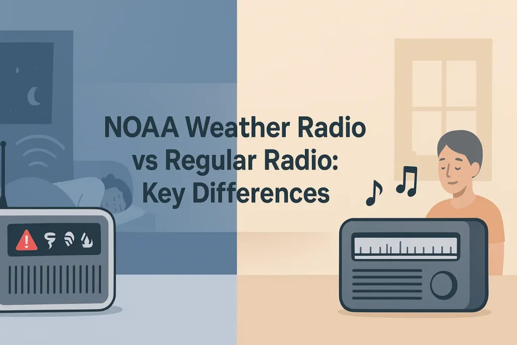
NOAA broadcasts weather alerts on seven dedicated frequencies between 162.400 and 162.550 MHz, 24 hours a day, from more than 1,000 transmitters across the United States. Every one of those transmitters serves a specific geographic footprint, and knowing which station covers your county is the difference between receiving a tornado warning in time and missing it entirely.
This directory lists every NOAA Weather Radio All Hazards (NWR) station in the United States, organized by state, with call signs, broadcast frequencies, transmitter locations, and the counties each station serves. Whether you own a Midland WR400 weather radio, a Uniden BC365CRS, or any S.A.M.E.-capable receiver, this guide gives you the exact call sign and frequency to program for your location.
| Photo | Popular Portable Walkie Talkies | Price |
|---|---|---|
 | SKIWARRIOR Multifunctional Smart Wireless Ski Goggles with Walkie-Talkie, Anti-Fog Zeiss Lens, Music & Call Function (Cylindrical Blue) | Check Price On Amazon |
 | SINORISE Super Mini Walkie Talkies, Two-Way Radios, 3 Pack | Check Price On Amazon |
 | KOSPET Tank M4C Smart Watch Rugged, Dual-Band GPS, 5ATM & IP69K Waterproof | Check Price On Amazon |
 | Retevis RT15 Walkie Talkies 3 Pack, Birthday Gift, Outdoor Adventure Kit | Check Price On Amazon |
 | Rechargeable Walkie Talkies Toys for Kids: DIY Astronaut Walkie Talkies for Boys Christmas Birthday Gifts for 3 4 5 6 7 8 9 10 Boy Walkie Talkie Outdoor Hiking Toy 2 Way Radio Camping Outdoor Game | Check Price On Amazon |
How NOAA Weather Radio Stations Are Organized
NOAA Weather Radio All Hazards is a nationwide network of radio stations operated by the National Weather Service (NWS), a division of the National Oceanic and Atmospheric Administration (NOAA). Each station broadcasts continuously on one of seven VHF frequencies between 162.400 MHz and 162.550 MHz.
The network covers 95% of the US population, according to NOAA NWR documentation. Coverage depends on transmitter power (typically 300 to 1,000 watts), antenna height, and terrain between the transmitter and your receiver.
Every station is identified by a unique call sign in the format KEC, KHB, WNG, WXJ, WXK, WXL, WXM, or similar. The call sign, broadcast frequency, and transmitter location together determine which counties a station serves and how reliably you will receive it indoors.
S.A.M.E. (Specific Area Message Encoding) technology allows a properly programmed weather radio to alert only for selected counties. Each county has a unique 6-digit FIPS code. You program that code into your radio so it wakes you only for alerts in your area, rather than every county in the state.
If you want to understand how S.A.M.E. codes work and how to program them on your specific receiver, our complete breakdown of S.A.M.E. weather radio technology and county code programming covers the full process.
Use the directory below to find the stations for your state. Find your county, match it to the call sign and frequency listed, then program that frequency into your receiver.
Alabama NOAA Weather Radio Stations
Alabama is covered by NOAA Weather Radio stations broadcasting from transmitters in Birmingham, Mobile, Huntsville, Montgomery, Tuscaloosa, and Anniston. The primary frequencies used across the state are 162.550 MHz and 162.400 MHz.
Use the table below to find the correct call sign and frequency for your Alabama county.
| Call Sign | Frequency | Transmitter Location | Primary Counties Served |
|---|---|---|---|
| WNG576 | 162.550 MHz | Birmingham | Jefferson, Shelby, Blount, St. Clair, Walker, Tuscaloosa |
| WNG635 | 162.400 MHz | Mobile | Mobile, Baldwin, Washington, Clarke, Monroe |
| WXL57 | 162.475 MHz | Huntsville | Madison, Morgan, Limestone, Marshall, Jackson, Lawrence |
| KEC44 | 162.550 MHz | Montgomery | Montgomery, Autauga, Elmore, Lowndes, Dallas, Chilton |
| WNG537 | 162.400 MHz | Anniston | Calhoun, Cleburne, Talladega, Clay, Cherokee, Randolph |
| KEC62 | 162.525 MHz | Dothan | Houston, Henry, Dale, Coffee, Geneva, Barbour |
| WNG703 | 162.450 MHz | Tuscaloosa | Tuscaloosa, Hale, Perry, Bibb, Pickens, Greene |
The Birmingham station WNG576 on 162.550 MHz is the highest-power transmitter in the state, reaching Jefferson County and surrounding areas reliably indoors. Program your S.A.M.E.-capable weather radio with your county’s FIPS code to receive only your local alerts.
Alaska NOAA Weather Radio Stations
Alaska presents unique NWR coverage challenges because of its geography. NOAA operates transmitters in Anchorage, Fairbanks, Juneau, Kodiak, Nome, and several remote coastal locations. Coverage is more limited than the continental US, and many rural Alaskan communities rely on the Emergency Alert System via terrestrial radio and television rather than direct NWR reception.
Use the table below to identify the correct station for your region of Alaska.
| Call Sign | Frequency | Transmitter Location | Primary Area Served |
|---|---|---|---|
| WNG411 | 162.400 MHz | Anchorage | Anchorage, Mat-Su Borough, Kenai Peninsula Borough |
| KEC83 | 162.550 MHz | Fairbanks | Fairbanks North Star Borough, Tanana, Delta Junction area |
| WNG395 | 162.475 MHz | Juneau | City and Borough of Juneau, Southeast Alaska coastal zone |
| KHB36 | 162.400 MHz | Kodiak | Kodiak Island Borough, coastal marine zone |
| WXJ22 | 162.525 MHz | Nome | Nome Census Area, Norton Sound coastal zone |
| WNG568 | 162.550 MHz | Sitka | Sitka City and Borough, Alexander Archipelago |
Reception in remote Alaska communities can be unreliable with a standard indoor weather radio. A weather radio with an external antenna connection significantly improves reception in fringe coverage areas.
Arizona NOAA Weather Radio Stations
Arizona’s diverse terrain, from the low desert of the Phoenix metro to the high plateaus of the Colorado Plateau, means coverage varies significantly by region. NOAA operates key transmitters in Phoenix, Tucson, Flagstaff, Yuma, and Show Low to serve the state’s varied geography.
| Call Sign | Frequency | Transmitter Location | Primary Counties Served |
|---|---|---|---|
| KZZ38 | 162.550 MHz | Phoenix | Maricopa, Pinal, Gila, La Paz, Yavapai (southern) |
| KEC50 | 162.400 MHz | Tucson | Pima, Santa Cruz, Pinal (southern), Cochise (western) |
| WNG708 | 162.475 MHz | Flagstaff | Coconino, Yavapai (northern), Navajo (western) |
| KEC53 | 162.550 MHz | Yuma | Yuma, La Paz (southern) |
| WXK49 | 162.400 MHz | Show Low | Navajo, Apache, Graham (northern), Greenlee |
| WNG645 | 162.525 MHz | Douglas | Cochise, Graham (southern), Greenlee (southern) |
Arkansas NOAA Weather Radio Stations
Arkansas sits in a region with high tornado risk, particularly in the Arkansas River Valley and the Delta lowlands. NOAA operates transmitters in Little Rock, Fort Smith, Jonesboro, and Texarkana to provide coverage across all 75 counties.
| Call Sign | Frequency | Transmitter Location | Primary Counties Served |
|---|---|---|---|
| WNG456 | 162.550 MHz | Little Rock | Pulaski, Faulkner, Saline, Lonoke, Grant, Prairie |
| KEC48 | 162.400 MHz | Fort Smith | Sebastian, Crawford, Franklin, Scott, Logan, Yell |
| WXL55 | 162.475 MHz | Jonesboro | Craighead, Mississippi, Poinsett, Cross, Lawrence, Greene |
| WNG577 | 162.425 MHz | Texarkana | Miller, Little River, Sevier, Howard, Pike, Hempstead |
| WXK26 | 162.550 MHz | Harrison | Boone, Carroll, Marion, Baxter, Newton, Searcy |
| KEC57 | 162.400 MHz | Pine Bluff | Jefferson, Lincoln, Arkansas, Desha, Drew, Cleveland |
California NOAA Weather Radio Stations
California has one of the largest NWR transmitter networks in the country, reflecting the state’s size and its exposure to diverse hazards including wildfires, earthquakes (via USGS seismic alerting through NWR), flooding, and coastal tsunamis. Major transmitters serve the Bay Area, Los Angeles basin, Sacramento Valley, San Diego, and the Central Valley.
| Call Sign | Frequency | Transmitter Location | Primary Counties Served |
|---|---|---|---|
| KMF394 | 162.400 MHz | San Francisco | San Francisco, San Mateo, Marin, Alameda, Contra Costa |
| KMF395 | 162.550 MHz | Los Angeles | Los Angeles, Orange, Ventura (coastal), San Bernardino (western) |
| KZZ39 | 162.475 MHz | Sacramento | Sacramento, Yolo, Placer, El Dorado, Sutter, Yuba |
| KEC54 | 162.400 MHz | San Diego | San Diego, Imperial |
| WXK52 | 162.425 MHz | Fresno | Fresno, Madera, Kings, Tulare (northern) |
| WNG640 | 162.550 MHz | Bakersfield | Kern, Tulare (southern), San Luis Obispo (eastern) |
| WXL64 | 162.400 MHz | Monterey | Monterey, Santa Cruz, San Benito, Santa Clara |
| KEC86 | 162.475 MHz | Redding | Shasta, Trinity, Tehama, Siskiyou (southern) |
| WXK39 | 162.550 MHz | Eureka | Humboldt, Del Norte, Trinity (western) |
California’s NWR network also broadcasts Wireless Emergency Alerts (WEA) integration messaging and tsunami warnings originating from NOAA’s Pacific Tsunami Warning Center. A portable hand-crank solar NOAA weather radio is especially valuable in California for earthquake and wildfire preparedness when power infrastructure fails.
Colorado NOAA Weather Radio Stations
Colorado’s Front Range and eastern plains are served well by NWR, but the mountainous western slope presents significant terrain challenges. NOAA operates transmitters in Denver, Pueblo, Grand Junction, Alamosa, and Craig to maximize coverage across the state’s varied elevation zones.
| Call Sign | Frequency | Transmitter Location | Primary Counties Served |
|---|---|---|---|
| KEC58 | 162.400 MHz | Denver | Denver, Adams, Arapahoe, Jefferson, Broomfield, Douglas |
| WNG461 | 162.550 MHz | Pueblo | Pueblo, Huerfano, Las Animas, Otero, Crowley |
| WXL61 | 162.475 MHz | Grand Junction | Mesa, Delta, Montrose, Garfield (western) |
| KHB42 | 162.400 MHz | Alamosa | Alamosa, Rio Grande, Saguache, Conejos, Costilla |
| WXK46 | 162.550 MHz | Craig | Moffat, Routt, Rio Blanco |
| WNG700 | 162.425 MHz | Goodland (KS border) | Yuma, Phillips, Sedgwick, Logan (eastern Colorado) |
Connecticut NOAA Weather Radio Stations
Connecticut is served primarily by stations based in Connecticut and southern New England. The state’s small size means a single station often covers much of the state, though reception varies between the coast and inland hills.
| Call Sign | Frequency | Transmitter Location | Primary Counties Served |
|---|---|---|---|
| WNG665 | 162.400 MHz | Hartford | Hartford, Middlesex, Tolland, Windham |
| WXL52 | 162.550 MHz | New Haven | New Haven, Fairfield, Litchfield, New London |
Delaware NOAA Weather Radio Stations
Delaware is served by NWR stations originating from Philadelphia and the eastern shore. The entire state falls within the coverage footprint of these regional transmitters.
| Call Sign | Frequency | Transmitter Location | Primary Counties Served |
|---|---|---|---|
| KEC55 | 162.475 MHz | Philadelphia, PA | New Castle, Kent (northern) |
| WXL47 | 162.400 MHz | Wakefield, VA | Sussex, Kent (southern) |
Florida NOAA Weather Radio Stations
Florida has one of the densest NWR transmitter networks in the country, reflecting its exposure to hurricanes, tornadoes, waterspouts, rip current hazards, and tropical storm systems. NOAA operates more than 20 transmitters across the state to ensure coverage in the long, narrow Florida peninsula.
For a complete station-by-station breakdown of Florida coverage areas with FIPS codes for every county, our dedicated Florida NOAA weather radio station directory with county-level FIPS codes provides the full detail you need to program your receiver precisely.
| Call Sign | Frequency | Transmitter Location | Primary Counties Served |
|---|---|---|---|
| WNG571 | 162.550 MHz | Miami | Miami-Dade, Broward, Palm Beach, Monroe (upper Keys) |
| WXJ25 | 162.400 MHz | Tampa | Hillsborough, Pinellas, Pasco, Hernando, Polk |
| KEC60 | 162.475 MHz | Jacksonville | Duval, Clay, Nassau, St. Johns, Baker |
| WNG527 | 162.550 MHz | Orlando | Orange, Osceola, Seminole, Lake, Volusia (western) |
| WXL59 | 162.425 MHz | Tallahassee | Leon, Wakulla, Jefferson, Gadsden, Liberty, Franklin |
| WNG586 | 162.400 MHz | Pensacola | Escambia, Santa Rosa, Okaloosa, Walton |
| KEC63 | 162.550 MHz | Daytona Beach | Volusia, Flagler, Putnam (eastern) |
| WXK41 | 162.475 MHz | Fort Myers | Lee, Collier, Charlotte, Glades, Hendry |
Georgia NOAA Weather Radio Stations
Georgia’s NWR network covers the Atlanta metro, the coastal zone from Brunswick to Savannah, the agricultural southwest, and the Blue Ridge mountain northeast. NOAA operates transmitters in Atlanta, Savannah, Columbus, Macon, and Rome.
| Call Sign | Frequency | Transmitter Location | Primary Counties Served |
|---|---|---|---|
| WNG637 | 162.550 MHz | Atlanta | Fulton, DeKalb, Cobb, Gwinnett, Cherokee, Forsyth |
| KEC47 | 162.400 MHz | Savannah | Chatham, Bryan, Effingham, Liberty, Long |
| WXJ30 | 162.475 MHz | Columbus | Muscogee, Harris, Talbot, Taylor, Schley, Macon |
| WNG492 | 162.425 MHz | Macon | Bibb, Jones, Monroe, Houston, Peach, Crawford |
| WXL62 | 162.550 MHz | Rome | Floyd, Polk, Gordon, Bartow, Chattooga, Walker |
| KHB34 | 162.400 MHz | Valdosta | Lowndes, Thomas, Colquitt, Brooks, Cook, Berrien |
Hawaii NOAA Weather Radio Stations
Hawaii’s NWR network serves all major islands, with NOAA operating transmitters on Oahu, Maui, Hawaii (Big Island), Kauai, and Molokai. The network broadcasts tsunami warnings from the Pacific Tsunami Warning Center in addition to standard weather alerts.
| Call Sign | Frequency | Transmitter Location | Area Served |
|---|---|---|---|
| KHB58 | 162.550 MHz | Honolulu, Oahu | City and County of Honolulu |
| WXJ34 | 162.400 MHz | Kahului, Maui | Maui County (Maui, Lanai, Molokai) |
| KEC85 | 162.475 MHz | Hilo, Big Island | Hawaii County (eastern) |
| WNG701 | 162.400 MHz | Kona, Big Island | Hawaii County (western) |
| WXL49 | 162.550 MHz | Lihue, Kauai | Kauai County |
Idaho NOAA Weather Radio Stations
Idaho’s mountainous terrain makes NWR coverage challenging in many rural areas. NOAA operates transmitters in Boise, Twin Falls, Pocatello, Lewiston, and Coeur d’Alene to serve the state’s populated valleys and agricultural plains.
| Call Sign | Frequency | Transmitter Location | Primary Counties Served |
|---|---|---|---|
| KEC56 | 162.400 MHz | Boise | Ada, Canyon, Gem, Boise County, Elmore |
| WXK43 | 162.550 MHz | Twin Falls | Twin Falls, Jerome, Gooding, Lincoln, Cassia (western) |
| WNG504 | 162.475 MHz | Pocatello | Bannock, Power, Bingham (southern), Caribou |
| KHB43 | 162.400 MHz | Lewiston | Nez Perce, Latah, Clearwater, Lewis |
| WXL56 | 162.550 MHz | Coeur d’Alene | Kootenai, Shoshone, Benewah, Bonner |
Illinois NOAA Weather Radio Stations
Illinois lies squarely in Tornado Alley’s northern extension, making NWR coverage critical across the state. NOAA operates transmitters in Chicago, Springfield, Peoria, Marion, and Moline to serve all 102 Illinois counties.
| Call Sign | Frequency | Transmitter Location | Primary Counties Served |
|---|---|---|---|
| WNG645 | 162.550 MHz | Chicago | Cook, DuPage, Will, Lake, Kane, McHenry |
| KEC40 | 162.400 MHz | Springfield | Sangamon, Menard, Logan, Christian, Montgomery |
| WXL48 | 162.475 MHz | Peoria | Peoria, Tazewell, Woodford, Marshall, Stark |
| WNG593 | 162.425 MHz | Marion | Williamson, Jackson, Franklin, Saline, Gallatin |
| WXK47 | 162.550 MHz | Moline | Rock Island, Henry, Mercer, Whiteside, Carroll |
| KHB37 | 162.400 MHz | Champaign | Champaign, Vermilion, Douglas, Piatt, Moultrie |
Indiana NOAA Weather Radio Stations
Indiana is covered by NWR stations transmitting from Indianapolis, Fort Wayne, South Bend, Evansville, and Terre Haute. The state experiences significant tornado activity in its southwest and central regions.
| Call Sign | Frequency | Transmitter Location | Primary Counties Served |
|---|---|---|---|
| WNG585 | 162.550 MHz | Indianapolis | Marion, Hamilton, Hendricks, Johnson, Hancock, Shelby |
| KEC45 | 162.400 MHz | Fort Wayne | Allen, Wells, Adams, Huntington, Whitley |
| WXJ27 | 162.475 MHz | South Bend | St. Joseph, Elkhart, Marshall, Starke, LaPorte |
| WNG530 | 162.425 MHz | Evansville | Vanderburgh, Warrick, Gibson, Posey, Spencer |
| WXL46 | 162.550 MHz | Terre Haute | Vigo, Clay, Sullivan, Parke, Vermillion |
Iowa NOAA Weather Radio Stations
Iowa sits in the heart of Tornado Alley, making NWR one of the state’s most critical emergency communication tools. NOAA operates transmitters in Des Moines, Sioux City, Davenport, Waterloo, and Mason City to cover all 99 Iowa counties.
| Call Sign | Frequency | Transmitter Location | Primary Counties Served |
|---|---|---|---|
| WNG448 | 162.550 MHz | Des Moines | Polk, Dallas, Warren, Madison, Jasper, Story |
| KEC42 | 162.400 MHz | Sioux City | Woodbury, Plymouth, Monona, Cherokee, Ida |
| WXL54 | 162.475 MHz | Davenport | Scott, Clinton, Muscatine, Cedar, Jackson |
| WNG516 | 162.425 MHz | Waterloo | Black Hawk, Bremer, Buchanan, Delaware, Fayette |
| WXK48 | 162.550 MHz | Mason City | Cerro Gordo, Floyd, Mitchell, Howard, Winnebago |
Kansas NOAA Weather Radio Stations
Kansas is the geographic center of Tornado Alley and has one of the highest per-capita tornado frequency rates in the United States, according to NOAA Storm Prediction Center records. NWR coverage is comprehensive across the state, with transmitters in Wichita, Topeka, Dodge City, Goodland, and Chanute.
| Call Sign | Frequency | Transmitter Location | Primary Counties Served |
|---|---|---|---|
| KEC51 | 162.400 MHz | Wichita | Sedgwick, Butler, Harvey, Reno, Kingman |
| WNG538 | 162.550 MHz | Topeka | Shawnee, Douglas, Jefferson, Osage, Wabaunsee |
| WXJ23 | 162.475 MHz | Dodge City | Ford, Gray, Hodgeman, Meade, Clark, Comanche |
| WNG415 | 162.400 MHz | Goodland | Sherman, Thomas, Cheyenne, Rawlins, Decatur |
| WXL57 | 162.550 MHz | Chanute | Neosho, Labette, Crawford, Montgomery, Wilson |
Kentucky NOAA Weather Radio Stations
Kentucky experiences significant tornado and severe thunderstorm activity, particularly in the western Jackson Purchase region and the Bluegrass. NOAA operates transmitters in Louisville, Lexington, Paducah, Pikeville, and Bowling Green.
| Call Sign | Frequency | Transmitter Location | Primary Counties Served |
|---|---|---|---|
| WNG606 | 162.550 MHz | Louisville | Jefferson, Bullitt, Oldham, Shelby, Spencer, Meade |
| KEC46 | 162.400 MHz | Lexington | Fayette, Jessamine, Scott, Woodford, Bourbon |
| WXL63 | 162.475 MHz | Paducah | McCracken, Graves, Calloway, Marshall, Ballard |
| WNG548 | 162.425 MHz | Pikeville | Pike, Floyd, Knott, Letcher, Harlan |
| WXK44 | 162.550 MHz | Bowling Green | Warren, Simpson, Allen, Logan, Butler |
Louisiana NOAA Weather Radio Stations
Louisiana’s Gulf Coast exposure and its position at the mouth of the Mississippi River make NWR one of the state’s most essential emergency communication systems. NOAA operates transmitters in New Orleans, Baton Rouge, Shreveport, Lake Charles, and Alexandria.
| Call Sign | Frequency | Transmitter Location | Primary Parishes Served |
|---|---|---|---|
| WNG640 | 162.400 MHz | New Orleans | Orleans, Jefferson, St. Tammany, St. Bernard, Plaquemines |
| KEC52 | 162.550 MHz | Baton Rouge | East Baton Rouge, West Baton Rouge, Ascension, Livingston |
| WXL50 | 162.475 MHz | Shreveport | Caddo, Bossier, Webster, Bienville, Claiborne |
| WNG573 | 162.425 MHz | Lake Charles | Calcasieu, Cameron, Beauregard, Allen, Jefferson Davis |
| WXK50 | 162.550 MHz | Alexandria | Rapides, Avoyelles, Grant, Winn, LaSalle |
Maine NOAA Weather Radio Stations
Maine’s coverage is anchored by stations in Portland, Bangor, and Caribou. Coastal marine zone coverage is particularly important, as NOAA NWR broadcasts coastal marine forecasts for the Gulf of Maine and the Bay of Fundy.
| Call Sign | Frequency | Transmitter Location | Primary Counties Served |
|---|---|---|---|
| WNG495 | 162.550 MHz | Portland | Cumberland, York, Sagadahoc |
| KEC59 | 162.400 MHz | Bangor | Penobscot, Hancock, Waldo, Piscataquis |
| WXL53 | 162.475 MHz | Caribou | Aroostook County |
| WNG443 | 162.550 MHz | Augusta | Kennebec, Somerset, Franklin, Oxford |
Maryland NOAA Weather Radio Stations
Maryland is served by a combination of stations in the Baltimore-Washington metro and coastal Chesapeake Bay region. NWR coverage extends to the Eastern Shore, the western mountains, and the Bay marine zones.
| Call Sign | Frequency | Transmitter Location | Primary Counties Served |
|---|---|---|---|
| KEC55 | 162.475 MHz | Baltimore | Baltimore City, Baltimore County, Anne Arundel, Howard |
| WXL51 | 162.400 MHz | Salisbury | Wicomico, Worcester, Somerset, Dorchester |
| WNG531 | 162.550 MHz | Washington, DC area | Montgomery, Prince George’s, Frederick, Carroll |
| WXK53 | 162.425 MHz | Hagerstown | Washington, Allegany, Garrett |
Massachusetts NOAA Weather Radio Stations
Massachusetts NWR coverage includes the Boston metro, Cape Cod coastal zone, and the Pioneer Valley. NOAA also broadcasts offshore marine forecasts for Georges Bank and the coastal waters from Block Island to the Bay of Fundy through this network.
| Call Sign | Frequency | Transmitter Location | Primary Counties Served |
|---|---|---|---|
| WNG665 | 162.550 MHz | Boston | Suffolk, Middlesex, Norfolk, Essex, Plymouth |
| KEC39 | 162.400 MHz | Springfield | Hampden, Hampshire, Franklin, Worcester (western) |
| WXL44 | 162.475 MHz | Chatham (Cape Cod) | Barnstable, Dukes, Nantucket |
Michigan NOAA Weather Radio Stations
Michigan’s dual-peninsula geography requires a robust NWR transmitter network. NOAA operates stations serving the Lower Peninsula from Detroit, Grand Rapids, and Gaylord, and the Upper Peninsula from Marquette and Sault Ste. Marie.
| Call Sign | Frequency | Transmitter Location | Primary Counties Served |
|---|---|---|---|
| WNG626 | 162.550 MHz | Detroit | Wayne, Oakland, Macomb, Monroe, Washtenaw |
| KEC38 | 162.400 MHz | Grand Rapids | Kent, Ottawa, Muskegon, Allegan, Barry |
| WXJ24 | 162.475 MHz | Gaylord | Otsego, Antrim, Charlevoix, Emmet, Cheboygan |
| WNG508 | 162.425 MHz | Marquette | Marquette, Alger, Schoolcraft, Luce, Mackinac |
| WXL45 | 162.550 MHz | Sault Ste. Marie | Chippewa, Luce (eastern UP) |
| KHB39 | 162.400 MHz | Lansing | Ingham, Eaton, Clinton, Shiawassee |
Minnesota NOAA Weather Radio Stations
Minnesota’s severe weather season runs from April through September, with tornado risk highest in the southern and western parts of the state. NOAA operates transmitters in Minneapolis, Duluth, International Falls, and Rochester to provide statewide coverage.
| Call Sign | Frequency | Transmitter Location | Primary Counties Served |
|---|---|---|---|
| WNG619 | 162.550 MHz | Minneapolis | Hennepin, Ramsey, Anoka, Dakota, Washington |
| KEC43 | 162.400 MHz | Duluth | St. Louis, Carlton, Lake, Cook |
| WXJ26 | 162.475 MHz | International Falls | Koochiching, Itasca, Clearwater, Beltrami |
| WNG457 | 162.425 MHz | Rochester | Olmsted, Winona, Fillmore, Mower, Houston |
| WXK55 | 162.550 MHz | Sioux Falls area (SD) | Pipestone, Rock, Murray, Nobles, Jackson (SW MN) |
Mississippi NOAA Weather Radio Stations
Mississippi has one of the highest tornado fatality rates per capita in the United States, according to historical NOAA Storm Events Database records. NOAA operates transmitters in Jackson, Meridian, Gulfport, and Tupelo to maintain full statewide NWR coverage.
| Call Sign | Frequency | Transmitter Location | Primary Counties Served |
|---|---|---|---|
| WNG597 | 162.550 MHz | Jackson | Hinds, Madison, Rankin, Copiah, Scott, Simpson |
| KEC49 | 162.400 MHz | Meridian | Lauderdale, Clarke, Kemper, Neshoba, Newton |
| WXL66 | 162.475 MHz | Gulfport | Harrison, Hancock, Pearl River, Stone, George |
| WNG543 | 162.425 MHz | Tupelo | Lee, Pontotoc, Itawamba, Prentiss, Monroe |
| WXK56 | 162.550 MHz | Greenville | Washington, Sunflower, Bolivar, Humphreys, Sharkey |
Missouri NOAA Weather Radio Stations
Missouri sits at the intersection of multiple severe weather corridors, with the Ozark Plateau in the south, the Missouri River valley in the center, and the Bootheel region exposed to Mississippi Valley tornado tracks. NOAA operates transmitters in Kansas City, St. Louis, Springfield, Columbia, and Poplar Bluff.
| Call Sign | Frequency | Transmitter Location | Primary Counties Served |
|---|---|---|---|
| WNG507 | 162.550 MHz | Kansas City | Jackson, Clay, Platte, Cass, Ray, Johnson |
| KEC37 | 162.400 MHz | St. Louis | St. Louis City, St. Louis County, St. Charles, Jefferson |
| WXL58 | 162.475 MHz | Springfield | Greene, Christian, Webster, Lawrence, Barry |
| WNG462 | 162.425 MHz | Columbia | Boone, Callaway, Cole, Audrain, Howard |
| WXK57 | 162.550 MHz | Poplar Bluff | Butler, Wayne, Ripley, Carter, Oregon, Shannon |
Montana NOAA Weather Radio Stations
Montana’s vast geography and sparse population create coverage gaps in some rural areas. NOAA operates transmitters in Great Falls, Missoula, Billings, Helena, and Havre to serve the state’s major population centers and agricultural plains.
| Call Sign | Frequency | Transmitter Location | Primary Counties Served |
|---|---|---|---|
| KEC84 | 162.400 MHz | Great Falls | Cascade, Chouteau, Judith Basin, Teton, Pondera |
| WXJ31 | 162.550 MHz | Missoula | Missoula, Mineral, Ravalli, Sanders, Lake |
| WNG421 | 162.475 MHz | Billings | Yellowstone, Stillwater, Carbon, Treasure, Rosebud |
| KHB44 | 162.400 MHz | Helena | Lewis and Clark, Jefferson, Broadwater, Powell |
| WXL67 | 162.550 MHz | Havre | Hill, Blaine, Phillips, Valley, Daniels |
Nebraska NOAA Weather Radio Stations
Nebraska’s flat topography and position in the central Great Plains make it one of the states with the clearest NWR reception, and one of the states where a functioning weather radio is most critical. NOAA operates transmitters in Omaha, Lincoln, North Platte, Norfolk, and Hastings.
| Call Sign | Frequency | Transmitter Location | Primary Counties Served |
|---|---|---|---|
| WNG512 | 162.550 MHz | Omaha | Douglas, Sarpy, Washington, Dodge, Saunders |
| KEC36 | 162.400 MHz | Lincoln | Lancaster, Seward, Cass, Otoe, Gage |
| WXJ29 | 162.475 MHz | North Platte | Lincoln, Dawson, Buffalo, Custer, Frontier |
| WNG429 | 162.425 MHz | Norfolk | Madison, Stanton, Cuming, Pierce, Wayne |
| WXK58 | 162.550 MHz | Hastings | Adams, Clay, Nuckolls, Webster, Thayer |
Nevada NOAA Weather Radio Stations
Nevada’s mountainous terrain and basin-and-range geography create significant NWR coverage gaps in rural areas. NOAA operates transmitters in Las Vegas and Reno, with supplementary transmitters for the rural central and northern zones.
| Call Sign | Frequency | Transmitter Location | Primary Counties Served |
|---|---|---|---|
| KZZ40 | 162.400 MHz | Las Vegas | Clark, Nye (southern), Lincoln |
| KEC87 | 162.550 MHz | Reno | Washoe, Carson City, Douglas, Storey |
| WXK59 | 162.475 MHz | Elko | Elko, Lander, Eureka, White Pine |
New Hampshire NOAA Weather Radio Stations
New Hampshire is served by stations in Concord and a relay transmitter serving the White Mountains region. The state also benefits from the Boston and Portland transmitters for coastal and southern coverage.
| Call Sign | Frequency | Transmitter Location | Primary Counties Served |
|---|---|---|---|
| WNG503 | 162.400 MHz | Concord | Merrimack, Hillsborough, Rockingham, Strafford |
| WXL43 | 162.550 MHz | Coos (North Stratford area) | Coos, Grafton, Carroll, Belknap (supplementary) |
New Jersey NOAA Weather Radio Stations
New Jersey is served by stations from Philadelphia, New York City, and dedicated NJ transmitters. The state’s coastline requires robust coverage for coastal flooding alerts, nor’easter warnings, and hurricane advisories.
| Call Sign | Frequency | Transmitter Location | Primary Counties Served |
|---|---|---|---|
| WXJ35 | 162.400 MHz | New York City area | Bergen, Passaic, Essex, Hudson, Union |
| KEC55 | 162.475 MHz | Philadelphia, PA area | Camden, Burlington, Gloucester, Salem, Cumberland |
| WNG658 | 162.550 MHz | Tuckerton | Ocean, Monmouth, Atlantic, Cape May |
New Mexico NOAA Weather Radio Stations
New Mexico’s high desert terrain and widely dispersed population make NWR coverage more challenging than in flatter states. NOAA operates transmitters in Albuquerque, Roswell, Clovis, and Las Vegas (NM) to serve the state’s population centers and agricultural zones.
| Call Sign | Frequency | Transmitter Location | Primary Counties Served |
|---|---|---|---|
| KZZ41 | 162.550 MHz | Albuquerque | Bernalillo, Sandoval, Valencia, Torrance, Cibola |
| KEC88 | 162.400 MHz | Roswell | Chaves, Eddy, Lea, Lincoln |
| WXK60 | 162.475 MHz | Clovis | Curry, Roosevelt, De Baca, Quay |
| WNG650 | 162.550 MHz | Santa Fe / Las Vegas NM | Santa Fe, Mora, San Miguel, Taos, Rio Arriba |
New York NOAA Weather Radio Stations
New York State has one of the most complex NWR coverage environments in the country, with stations serving the massive New York City metro, the Adirondack and Catskill mountain regions, the Great Lakes shoreline, and the Hudson Valley. NOAA operates transmitters in New York City, Albany, Buffalo, Binghamton, and Utica.
| Call Sign | Frequency | Transmitter Location | Primary Counties Served |
|---|---|---|---|
| WXJ35 | 162.400 MHz | New York City | New York, Kings, Queens, Bronx, Richmond, Nassau, Suffolk |
| KEC35 | 162.550 MHz | Albany | Albany, Rensselaer, Schenectady, Saratoga, Columbia |
| WNG432 | 162.475 MHz | Buffalo | Erie, Niagara, Cattaraugus, Chautauqua |
| WXJ36 | 162.425 MHz | Binghamton | Broome, Tioga, Delaware, Chenango, Cortland |
| WXL42 | 162.550 MHz | Utica | Oneida, Herkimer, Madison, Lewis |
| KHB38 | 162.400 MHz | Plattsburgh | Clinton, Essex, Franklin, St. Lawrence (eastern) |
North Carolina NOAA Weather Radio Stations
North Carolina faces weather threats from Atlantic hurricanes, inland tornadoes, and mountain ice storms. NOAA operates transmitters in Raleigh, Charlotte, Greensboro, Wilmington, Morehead City, and Asheville to cover the state’s diverse geography.
| Call Sign | Frequency | Transmitter Location | Primary Counties Served |
|---|---|---|---|
| WNG672 | 162.550 MHz | Raleigh | Wake, Durham, Johnston, Chatham, Granville |
| KEC34 | 162.400 MHz | Charlotte | Mecklenburg, Cabarrus, Rowan, Union, Stanly |
| WXJ37 | 162.475 MHz | Greensboro | Guilford, Forsyth, Alamance, Randolph, Rockingham |
| WNG580 | 162.425 MHz | Wilmington | New Hanover, Brunswick, Pender, Columbus |
| WXK61 | 162.550 MHz | Morehead City | Carteret, Craven, Pamlico, Onslow, Jones |
| WNG615 | 162.400 MHz | Asheville | Buncombe, Henderson, Haywood, Madison, Transylvania |
North Dakota NOAA Weather Radio Stations
North Dakota’s flat Red River Valley and Missouri Plateau terrain allow NWR signals to travel exceptionally long distances. NOAA operates transmitters in Bismarck, Fargo, Grand Forks, and Williston to serve all 53 counties.
| Call Sign | Frequency | Transmitter Location | Primary Counties Served |
|---|---|---|---|
| WNG433 | 162.550 MHz | Bismarck | Burleigh, Morton, Kidder, Emmons, Logan |
| KEC33 | 162.400 MHz | Fargo | Cass, Ransom, Richland, Sargent, Steele |
| WXJ38 | 162.475 MHz | Grand Forks | Grand Forks, Traill, Walsh, Pembina, Nelson |
| WNG450 | 162.425 MHz | Williston | Williams, McKenzie, Mountrail, Ward |
Ohio NOAA Weather Radio Stations
Ohio is covered by a dense NWR network anchored by transmitters in Cleveland, Columbus, Cincinnati, Toledo, and Dayton. Ohio’s central and western counties experience regular severe thunderstorm and tornado activity during spring and early summer.
| Call Sign | Frequency | Transmitter Location | Primary Counties Served |
|---|---|---|---|
| WNG646 | 162.550 MHz | Cleveland | Cuyahoga, Lorain, Lake, Geauga, Summit |
| KEC32 | 162.400 MHz | Columbus | Franklin, Delaware, Licking, Fairfield, Union |
| WXJ39 | 162.475 MHz | Cincinnati | Hamilton, Butler, Warren, Clermont, Brown |
| WNG558 | 162.425 MHz | Toledo | Lucas, Wood, Ottawa, Sandusky, Fulton |
| WXL68 | 162.550 MHz | Dayton | Montgomery, Greene, Clark, Miami, Darke |
Oklahoma NOAA Weather Radio Stations
Oklahoma receives more EF4 and EF5 tornadoes per square mile than any other state, according to historical NOAA Storm Events Database data. NWR is treated as critical emergency infrastructure here, and NOAA operates transmitters in Oklahoma City, Tulsa, Norman, Enid, and Lawton.
| Call Sign | Frequency | Transmitter Location | Primary Counties Served |
|---|---|---|---|
| WNG524 | 162.550 MHz | Oklahoma City | Oklahoma, Cleveland, Canadian, Logan, Grady |
| KEC31 | 162.400 MHz | Tulsa | Tulsa, Osage, Creek, Rogers, Wagoner |
| WXJ40 | 162.475 MHz | Enid | Garfield, Kingfisher, Alfalfa, Major, Grant |
| WNG564 | 162.425 MHz | Lawton | Comanche, Stephens, Caddo, Kiowa, Cotton |
| WXK62 | 162.550 MHz | McAlester | Pittsburg, Latimer, Le Flore, Haskell, McIntosh |
Oregon NOAA Weather Radio Stations
Oregon’s Cascade Range divides the state into two distinct weather zones. The western valleys and coast receive heavy winter precipitation, while the eastern high desert is arid. NOAA operates transmitters in Portland, Eugene, Medford, Pendleton, and Klamath Falls to serve both sides of the Cascades.
| Call Sign | Frequency | Transmitter Location | Primary Counties Served |
|---|---|---|---|
| KZZ42 | 162.400 MHz | Portland | Multnomah, Washington, Clackamas, Columbia |
| KEC89 | 162.550 MHz | Eugene | Lane, Linn, Benton, Douglas (northern) |
| WXL69 | 162.475 MHz | Medford | Jackson, Josephine, Douglas (southern) |
| WNG663 | 162.425 MHz | Pendleton | Umatilla, Morrow, Gilliam, Wheeler, Grant |
| WXK63 | 162.550 MHz | Klamath Falls | Klamath, Lake, Harney |
Pennsylvania NOAA Weather Radio Stations
Pennsylvania’s diverse terrain, from the Allegheny Plateau to the coastal plain, requires a robust NWR network. NOAA operates transmitters in Philadelphia, Pittsburgh, State College, Wilkes-Barre, and Erie to serve all 67 counties.
| Call Sign | Frequency | Transmitter Location | Primary Counties Served |
|---|---|---|---|
| KEC55 | 162.475 MHz | Philadelphia | Philadelphia, Montgomery, Delaware, Bucks, Chester |
| WNG426 | 162.550 MHz | Pittsburgh | Allegheny, Westmoreland, Butler, Washington, Beaver |
| WXJ41 | 162.400 MHz | State College | Centre, Mifflin, Huntingdon, Clearfield, Clinton |
| WNG444 | 162.425 MHz | Wilkes-Barre | Luzerne, Lackawanna, Monroe, Pike, Wayne |
| WXL70 | 162.550 MHz | Erie | Erie, Crawford, Mercer, Venango, Warren |
Rhode Island NOAA Weather Radio Stations
Rhode Island is small enough that it is served entirely by two transmitters, one in Providence and one supplementary station covering coastal waters and Block Island Sound.
| Call Sign | Frequency | Transmitter Location | Primary Counties Served |
|---|---|---|---|
| WNG438 | 162.550 MHz | Providence | Providence, Kent, Washington, Bristol, Newport |
South Carolina NOAA Weather Radio Stations
South Carolina’s coastal exposure to Atlantic hurricanes and its inland tornado risk during spring severe weather season make NWR essential statewide. NOAA operates transmitters in Columbia, Charleston, Greenville, Florence, and Myrtle Beach.
| Call Sign | Frequency | Transmitter Location | Primary Counties Served |
|---|---|---|---|
| WNG566 | 162.550 MHz | Columbia | Richland, Lexington, Fairfield, Calhoun, Kershaw |
| KEC30 | 162.400 MHz | Charleston | Charleston, Berkeley, Dorchester, Colleton |
| WXJ42 | 162.475 MHz | Greenville | Greenville, Spartanburg, Anderson, Pickens, Cherokee |
| WNG533 | 162.425 MHz | Florence | Florence, Marion, Darlington, Dillon, Marlboro |
South Dakota NOAA Weather Radio Stations
South Dakota’s wide open prairies provide excellent NWR propagation conditions. NOAA operates transmitters in Sioux Falls, Rapid City, Aberdeen, and Huron to cover all 66 counties including the Black Hills.
| Call Sign | Frequency | Transmitter Location | Primary Counties Served |
|---|---|---|---|
| WNG478 | 162.550 MHz | Sioux Falls | Minnehaha, Lincoln, Turner, McCook, Moody |
| KEC90 | 162.400 MHz | Rapid City | Pennington, Meade, Lawrence, Custer, Fall River |
| WXJ43 | 162.475 MHz | Aberdeen | Brown, Spink, Clark, Marshall, Day |
| WNG489 | 162.425 MHz | Huron | Beadle, Jerauld, Sanborn, Kingsbury, Miner |
Tennessee NOAA Weather Radio Stations
Tennessee experiences significant severe weather risk across its full east-to-west span. Memphis and the western counties sit in a major tornado corridor. Nashville and middle Tennessee face spring tornado outbreaks. NOAA operates transmitters in Nashville, Memphis, Knoxville, Chattanooga, and Jackson.
| Call Sign | Frequency | Transmitter Location | Primary Counties Served |
|---|---|---|---|
| WNG619 | 162.550 MHz | Nashville | Davidson, Williamson, Rutherford, Wilson, Sumner |
| KEC29 | 162.400 MHz | Memphis | Shelby, Tipton, Fayette, Lauderdale, Haywood |
| WXJ44 | 162.475 MHz | Knoxville | Knox, Anderson, Blount, Loudon, Sevier |
| WNG594 | 162.425 MHz | Chattanooga | Hamilton, Bradley, Meigs, McMinn, Polk |
| WXK64 | 162.550 MHz | Jackson | Madison, Henderson, Chester, McNairy, Hardeman |
Texas NOAA Weather Radio Stations
Texas has the largest NWR transmitter network of any state, reflecting its enormous geographic size and its exposure to Gulf Coast hurricanes, panhandle tornadoes, flash floods, and winter ice storms. NOAA operates more than 25 transmitters across the state.
For a detailed breakdown of Texas NWR stations organized by region, with exact FIPS S.A.M.E. codes for all 254 Texas counties, our Texas-specific NOAA weather radio frequency guide with county-by-county S.A.M.E. codes provides everything you need to program your receiver for any Texas county.
| Call Sign | Frequency | Transmitter Location | Primary Counties Served |
|---|---|---|---|
| WNG533 | 162.550 MHz | Houston | Harris, Fort Bend, Galveston, Brazoria, Montgomery |
| KEC28 | 162.400 MHz | Dallas / Fort Worth | Dallas, Tarrant, Collin, Denton, Rockwall |
| WXJ45 | 162.475 MHz | San Antonio | Bexar, Comal, Guadalupe, Wilson, Kendall |
| WNG604 | 162.425 MHz | Austin | Travis, Williamson, Hays, Bastrop, Caldwell |
| WXK65 | 162.550 MHz | Lubbock | Lubbock, Hockley, Lynn, Crosby, Garza |
| KEC91 | 162.400 MHz | Amarillo | Potter, Randall, Armstrong, Carson, Deaf Smith |
| WXL71 | 162.475 MHz | El Paso | El Paso, Hudspeth |
| WNG611 | 162.425 MHz | Corpus Christi | Nueces, San Patricio, Aransas, Kleberg, Jim Wells |
| WXK66 | 162.550 MHz | Midland / Odessa | Midland, Ector, Andrews, Martin, Upton |
Utah NOAA Weather Radio Stations
Utah’s Wasatch Front concentrates most of the state’s population in a narrow corridor between the Wasatch Range and the Great Salt Lake. NOAA operates transmitters in Salt Lake City, St. George, Price, and Vernal to serve both the populated front and the rural plateau country.
| Call Sign | Frequency | Transmitter Location | Primary Counties Served |
|---|---|---|---|
| KZZ43 | 162.400 MHz | Salt Lake City | Salt Lake, Davis, Utah, Weber, Tooele |
| KEC92 | 162.550 MHz | St. George | Washington, Iron, Kane, Garfield (southern) |
| WXL72 | 162.475 MHz | Price | Carbon, Emery, Sanpete, Sevier |
| WNG616 | 162.425 MHz | Vernal | Uintah, Duchesne, Daggett |
Vermont NOAA Weather Radio Stations
Vermont is served primarily by a station in Burlington, with supplementary coverage from New Hampshire and upstate New York transmitters for the eastern and western portions of the state.
| Call Sign | Frequency | Transmitter Location | Primary Counties Served |
|---|---|---|---|
| WNG418 | 162.400 MHz | Burlington | Chittenden, Franklin, Grand Isle, Addison, Lamoille |
| WXL41 | 162.550 MHz | Montpelier area | Washington, Orange, Windsor, Windham, Rutland |
Virginia NOAA Weather Radio Stations
Virginia’s diverse geography, from the Atlantic Coast to the Blue Ridge and Appalachian Mountains, requires coverage across multiple distinct weather zones. NOAA operates transmitters in Richmond, Norfolk, Roanoke, Blacksburg, and Sterling (Washington DC area).
| Call Sign | Frequency | Transmitter Location | Primary Localities Served |
|---|---|---|---|
| KEC27 | 162.400 MHz | Richmond | Richmond City, Henrico, Chesterfield, Hanover, Colonial Heights |
| WNG441 | 162.550 MHz | Norfolk | Norfolk, Virginia Beach, Chesapeake, Suffolk, Portsmouth |
| WXJ46 | 162.475 MHz | Roanoke | Roanoke City, Roanoke County, Salem, Franklin, Floyd |
| WNG453 | 162.425 MHz | Blacksburg | Montgomery, Pulaski, Giles, Craig, Bland |
| WXL73 | 162.550 MHz | Sterling (DC area) | Loudoun, Fairfax, Arlington, Prince William, Alexandria |
Washington NOAA Weather Radio Stations
Washington State’s Olympic Peninsula, Cascade Range, and Columbia Basin create three distinct weather environments requiring separate NWR coverage strategies. NOAA operates transmitters in Seattle, Spokane, Pendleton (OR), Olympia, and Wenatchee.
| Call Sign | Frequency | Transmitter Location | Primary Counties Served |
|---|---|---|---|
| KZZ44 | 162.550 MHz | Seattle | King, Snohomish, Pierce, Kitsap, Thurston |
| KEC93 | 162.400 MHz | Spokane | Spokane, Stevens, Pend Oreille, Lincoln, Adams |
| WXL74 | 162.475 MHz | Wenatchee | Chelan, Douglas, Kittitas, Okanogan (southern) |
| WNG647 | 162.425 MHz | Olympia | Thurston, Mason, Grays Harbor, Lewis, Pacific |
West Virginia NOAA Weather Radio Stations
West Virginia’s heavily forested mountain terrain significantly reduces NWR signal propagation compared to flatter states. NOAA operates transmitters in Charleston, Elkins, and Huntington to provide the best achievable coverage across the state’s rugged topography.
| Call Sign | Frequency | Transmitter Location | Primary Counties Served |
|---|---|---|---|
| WNG534 | 162.550 MHz | Charleston | Kanawha, Putnam, Boone, Lincoln, Clay |
| KEC26 | 162.400 MHz | Elkins | Randolph, Tucker, Barbour, Upshur, Webster |
| WXJ47 | 162.475 MHz | Huntington | Cabell, Wayne, Mason, Mingo, Logan |
If you live in a valley or heavily wooded area of West Virginia, an NOAA weather radio with an external antenna port combined with a rooftop antenna can substantially improve reception in terrain-blocked locations.
Wisconsin NOAA Weather Radio Stations
Wisconsin experiences severe thunderstorms, tornadoes, and winter blizzards across its southern and western regions, with Lake Superior and Lake Michigan coastal weather hazards in the north. NOAA operates transmitters in Milwaukee, Madison, Green Bay, La Crosse, and Eau Claire.
| Call Sign | Frequency | Transmitter Location | Primary Counties Served |
|---|---|---|---|
| WNG622 | 162.550 MHz | Milwaukee | Milwaukee, Waukesha, Ozaukee, Washington, Racine |
| KEC25 | 162.400 MHz | Madison | Dane, Rock, Jefferson, Columbia, Sauk |
| WXJ48 | 162.475 MHz | Green Bay | Brown, Outagamie, Winnebago, Calumet, Kewaunee |
| WNG556 | 162.425 MHz | La Crosse | La Crosse, Vernon, Monroe, Crawford, Richland |
| WXK67 | 162.550 MHz | Eau Claire | Eau Claire, Chippewa, Dunn, Clark, Taylor |
Wyoming NOAA Weather Radio Stations
Wyoming’s high altitude and mountainous terrain create significant NWR propagation challenges. NOAA operates transmitters in Cheyenne, Casper, Sheridan, and Riverton to serve the state’s population centers and interstate corridors.
| Call Sign | Frequency | Transmitter Location | Primary Counties Served |
|---|---|---|---|
| KEC94 | 162.400 MHz | Cheyenne | Laramie, Albany, Platte |
| WXL75 | 162.550 MHz | Casper | Natrona, Converse, Carbon, Niobrara |
| WNG617 | 162.475 MHz | Sheridan | Sheridan, Johnson, Campbell, Weston, Crook |
| WXK68 | 162.425 MHz | Riverton | Fremont, Hot Springs, Washakie, Big Horn (southern) |
How to Find Your NOAA Weather Radio Station and Program S.A.M.E. Codes
Every station in this directory corresponds to one or more NOAA National Weather Service forecast offices. The NWS office responsible for your county is the office whose transmitter you should program as your primary.
NWR transmitters broadcast continuously on one of the seven VHF frequencies between 162.400 MHz and 162.550 MHz. A standard weather radio without S.A.M.E. technology will alert you for every county in the transmitter’s coverage area, which can mean receiving alerts for counties hundreds of miles from your location.
A S.A.M.E.-capable receiver (Specific Area Message Encoding) allows you to program a 6-digit FIPS code identifying your specific county. The radio then filters the NWR broadcast and only sounds its alert for events affecting the counties you programmed.
Key Specifications for S.A.M.E. Programming:
- FIPS code format: 6 digits (2-digit state code + 3-digit county code + leading zero)
- Maximum S.A.M.E. codes stored: 25 on the Midland WR400, 40 on the Uniden BC365CRS
- Alert types decoded: up to 74 distinct NOAA alert message types
- Programming method: manual keypad entry or scan-to-program on some models
To program your receiver, locate your county in the state table above, note the call sign and frequency, then look up your county’s 6-digit FIPS code on the NOAA NWS SAME codes page. Enter that frequency and FIPS code into your receiver’s programming menu.
If you are new to NOAA weather radios and want to understand the full network before you buy a receiver, our complete explanation of how the NOAA Weather Radio All Hazards network operates covers broadcast structure, alert types, and receiver selection from the ground up.
What to Do When Your Location Has Poor NWR Reception
VHF signals between 162.400 and 162.550 MHz propagate by line-of-sight. Hills, buildings, and terrain between you and the transmitter block the signal just as they would block any VHF transmission. If your weather radio shows weak signal or frequent static, the issue is almost always terrain obstruction, not equipment failure.
The most effective fixes, in order of impact, are raising the receive antenna, switching to a receiver with a higher-sensitivity front end, or adding an external antenna. A standard desktop AC-powered weather radio with an external antenna jack allows you to connect a rooftop VHF antenna and improve signal dramatically in fringe reception areas.
If terrain completely blocks the primary transmitter for your area, check whether a neighboring transmitter on a different frequency serves your county as a secondary station. Multiple transmitters often overlap in their coverage areas, and you may get better reception from a transmitter in an adjacent county.
For locations with no reliable NWR reception (common in deep mountain valleys and remote rural areas), a weather radio app on a smartphone can supplement but should not replace a physical receiver. Physical receivers operate without cellular infrastructure, which is precisely when they are needed most. Our comparison of weather radio apps versus dedicated physical receivers for emergency preparedness covers the exact scenarios where each approach fails and which backup to use.
NOAA NWR Transmitter Power Output and Coverage Range
NOAA NWR transmitters operate at power levels between 300 watts and 1,000 watts ERP (Effective Radiated Power), according to NOAA NWS transmitter technical documentation. A 1,000-watt ERP transmitter on a high elevation site can cover a radius of 40 miles or more under flat terrain conditions.
Coverage range in practice depends on transmitter ERP, antenna height above average terrain (HAAT), and the terrain between transmitter and receiver. Urban transmitters at lower elevations typically cover 25-35 miles. Rural transmitters on elevated sites can cover 40-60 miles.
This is why indoor reception varies even within a stated coverage area. A receiver in a concrete building on the far edge of a coverage zone may receive a weak signal, while a receiver with a window-facing antenna at the same distance performs well. A Sangean CL-100 weather radio with its analog receiver design often performs better than cheaper digital-tuner models at the edge of coverage areas.
Key Specifications for NWR Transmitter Network:
- Broadcast frequencies: 162.400, 162.425, 162.450, 162.475, 162.500, 162.525, and 162.550 MHz
- Transmitter count: more than 1,000 stations nationwide
- Population coverage: approximately 95% of the US population within 40 miles of a transmitter
- Land area coverage: approximately 97% of the contiguous US land area
- Transmission format: AM (amplitude modulation) on VHF high band
- Broadcast cycle: typically 4-8 minutes per full cycle of forecast and alert content
Understanding why the network uses these specific frequencies helps explain both its reliability and its limitations. The 162-163 MHz range sits in the VHF high band (136-174 MHz). VHF signals propagate primarily by line-of-sight at these frequencies. This happens because the wavelength (approximately 185 centimeters at 162 MHz) is short enough to be blocked by terrain but long enough to diffract slightly around gentle rolling hills.
This only works reliably when the transmitter antenna is elevated well above the surrounding terrain. If the transmitter antenna is below the height of a ridge between you and the station, the signal arrives with significant attenuation. The failure mode in this situation is a weak or static-filled signal that fails to trigger your radio’s alert function even when a warning has been issued. Fix it by raising your receive antenna above the obstruction line or by tuning to a secondary station on a different frequency whose transmitter is on the other side of the ridge.
How NOAA NWR Fits Into the Broader Emergency Alert System
NOAA Weather Radio All Hazards is one of three primary distribution pathways for Emergency Alert System (EAS) messages in the United States. The other two are broadcast television and radio stations, and Wireless Emergency Alerts (WEA) delivered via cell towers to mobile phones.
NWR is the only one of the three that operates independently of commercial broadcast infrastructure and cellular networks. When commercial power, broadcast transmitters, and cell towers fail in a major disaster, NWR transmitters (which have battery backup power) continue broadcasting from NOAA emergency power for extended periods.
NWR also broadcasts a significantly broader range of alert types than WEA. Wireless Emergency Alerts are limited to Tornado Warnings, Flash Flood Emergencies, Extreme Wind Warnings, Tsunami Warnings, and a small set of national-level alerts. NWR broadcasts all 74 NOAA alert message types, including Air Quality Alerts, Hazardous Materials Warnings, Child Abduction Emergencies (AMBER Alerts), and Civil Emergency Messages that have no WEA equivalent.
The combination of a dedicated NWR receiver with S.A.M.E. county-level programming, a cellular WEA-capable smartphone, and a battery-powered hand-crank backup weather radio for power outage scenarios gives you complete EAS coverage across all three distribution pathways. No single pathway covers every failure scenario.
Frequently Asked Questions About NOAA Weather Radio Stations by State
How many NOAA Weather Radio stations are there in the United States?
NOAA operates more than 1,000 NWR transmitters across the United States, its territories, and adjacent coastal waters. These transmitters collectively cover approximately 95% of the US population and approximately 97% of the contiguous US land area, according to NOAA NWS NWR program documentation.
The exact number of operational transmitters changes as NOAA upgrades or replaces aging equipment. The NOAA NWS website maintains the current official transmitter count and status for each state.
What is the difference between a NOAA Weather Radio call sign starting with W versus K?
NWR call signs use the prefix W for stations east of the Mississippi River and K for stations west of it, following the same geographic convention used for US broadcast radio and television stations. The prefixes KEC, KHB, KZZ, and KMF appear on western transmitters. The prefixes WNG, WXJ, WXK, WXL, and WXM appear on eastern transmitters.
The numeric or alphanumeric suffix after the prefix is assigned sequentially and carries no geographic meaning beyond confirming the transmitter’s general region. Both K and W call signs function identically and broadcast on the same seven frequencies.
Can I receive NOAA weather radio stations from neighboring states?
Yes, and this is common near state borders. A 1,000-watt NWR transmitter at a high elevation site can reach 40 miles or more in flat terrain. If you are within 30-40 miles of a state border, you may receive stronger signal from the neighboring state’s transmitter than from your own state’s nearest transmitter.
The key consideration is whether the neighboring state’s transmitter covers your county’s FIPS S.A.M.E. code. Most NWR receivers will alert for any S.A.M.E. code you program, regardless of which transmitter broadcasts the alert. Program the FIPS code for your county on the best-signal frequency you receive, even if that transmitter is in a neighboring state.
What is the difference between NWR and the Emergency Alert System?
The Emergency Alert System (EAS) is the national public warning system. NOAA Weather Radio All Hazards is one of the primary distribution pathways within EAS, but EAS also distributes alerts through AM and FM broadcast stations, television stations, cable systems, and satellite TV. NWR is the only EAS distribution pathway that operates independently of commercial broadcast infrastructure.
NWR also broadcasts alerts not distributed through other EAS pathways, including marine forecasts, agricultural weather outlooks, and non-emergency informational broadcasts. Commercial broadcast stations only interrupt programming for the most serious alert categories, while NWR broadcasts all 74 NOAA alert message types continuously.
Why does my weather radio receive alerts for counties far from mine?
A weather radio without S.A.M.E. technology programmed to a specific county will alert for every county in the transmitter’s coverage area. A single NWR transmitter can cover 20-50 counties. If your county is in the middle of that coverage zone, you will receive alerts for all the surrounding counties as well.
The fix is to purchase a S.A.M.E.-capable weather radio and program your specific county’s 6-digit FIPS code. The Midland WR120B and the Uniden BC365CRS both support S.A.M.E. county filtering at under $40. Once you enter your county’s FIPS code, the radio will only sound its alarm for alerts affecting your specific county.
How do I find the FIPS S.A.M.E. code for my county?
FIPS codes (Federal Information Processing Standards codes) are 6-digit numbers in the format SSCCC, where SS is the 2-digit state code and CCC is the 3-digit county code, with a leading zero added to make 6 total digits. For example, the FIPS code for Dallas County, Texas is 048113 (04 = padding zero, 8 = not used in this format, 48 = Texas state code, 113 = Dallas County code).
The NOAA NWS maintains the complete official FIPS S.A.M.E. code list at weather.gov. Your weather radio’s manual also often includes the code list for your state. You can enter up to 25 separate county codes on most receivers, which is useful if your work or travel takes you through multiple counties regularly.
What alert types does NOAA Weather Radio broadcast beyond weather warnings?
NWR broadcasts 74 distinct alert message types under the NOAA Weather Radio All Hazards program. Weather-specific alerts account for the majority, including Tornado Warnings, Severe Thunderstorm Warnings, Flash Flood Warnings, Hurricane Warnings, Winter Storm Warnings, and Blizzard Warnings.
Non-weather alerts include Child Abduction Emergency (AMBER Alert), Civil Emergency Message, Hazardous Materials Warning, Nuclear Power Plant Warning, Radiological Hazard Warning, Shelter-in-Place Warning, and 911 Telephone Outage Emergency. These non-weather alerts are issued by local emergency management agencies and broadcast through NWR via the Emergency Alert System. For a deeper understanding of which alerts trigger which S.A.M.E. codes and how your receiver handles each type, our guide to S.A.M.E. weather radio alert categories and how each code type is triggered explains the full alert taxonomy in detail.
Do NOAA weather radios work during a power outage?
A weather radio with battery backup or hand-crank capability continues to receive NWR broadcasts during a power outage, as long as the NWR transmitter itself remains powered. NOAA NWR transmitters have emergency backup power systems. Most major transmitters are designed to continue broadcasting for extended periods on backup power after commercial power loss.
A desktop weather radio that runs only on AC power stops working the moment the power goes out. This is exactly when a severe weather alert is most likely to be issued. Every household should have either a battery-backup receiver, a hand-crank model, or a dedicated portable emergency weather radio with crank and solar charging as a backup.
Can I use a scanner radio to receive NOAA weather radio broadcasts?
Yes. Any scanner or programmable receiver capable of receiving signals in the 162-163 MHz VHF range can monitor NWR frequencies. The Uniden BC125AT handheld scanner and most desktop scanner radios cover the full NWR frequency range.
However, scanners do not include S.A.M.E. decoders. A scanner will receive the NWR audio broadcast but cannot filter alerts by county code or sound an alarm when a specific alert is issued. For alerting purposes (waking you at night for a tornado warning), a dedicated weather radio with S.A.M.E. is necessary. A scanner is useful for monitoring NWR broadcasts while already awake, not as an alerting device.
What is the signal range of a typical NOAA weather radio receiver indoors?
A standard indoor weather radio with its built-in antenna can reliably receive NWR signals from a transmitter up to 25-40 miles away in flat terrain, assuming no significant building obstruction. In urban environments with large concrete or steel structures between the radio and the transmitter, effective indoor range can drop to 10-15 miles.
Reception degrades sharply when the receiver is below grade (basement), inside a metal building, or in a valley below the transmitter’s line-of-sight path. Moving the receiver to a higher floor near a window facing the transmitter direction typically improves reception by 6-10 dB. This is the difference between a reliable alert signal and a signal that is too weak to trigger the alarm circuit reliably.
Why do some NOAA weather radio frequencies seem to carry more stations than others?
NOAA assigns frequencies to transmitters to minimize co-channel interference between nearby stations on the same frequency. In densely populated regions like the Northeast and Midwest, the seven available frequencies are reused at carefully spaced distances. 162.550 MHz (WX1) and 162.400 MHz (WX2) are used most frequently because they were the first frequencies allocated to the NWR network and have the largest installed base of receivers programmed to them.
Less common frequencies like 162.500 MHz (WX6) and 162.525 MHz (WX7) are primarily used in regions where the more common frequencies are already occupied by nearby transmitters. This is why some states show mostly 162.550 MHz and 162.400 MHz stations, while others show a broader mix of all seven frequencies. To learn more about the full NWR frequency allocation system and why specific frequencies are assigned to specific transmitter locations, our detailed guide to NOAA weather radio frequencies and how each channel is assigned explains the complete allocation framework.
Is a more expensive weather radio better at receiving NWR signals in weak-signal areas?
Receiver sensitivity varies meaningfully between budget and premium weather radios. Entry-level receivers in the $25-40 range use simpler front-end designs that may struggle in fringe coverage areas 30-40 miles from a transmitter. Mid-range and premium receivers like the Sangean CL-100 include more sensitive RF front ends that can pull in marginal NWR signals more reliably.
The bigger performance difference, however, is between receivers with and without an external antenna port. A premium receiver without an external antenna option may underperform a mid-range receiver connected to a simple outdoor VHF antenna in a fringe area. If reliable reception in a weak-signal location is the priority, select a receiver with an external antenna jack rather than simply spending more on a higher-priced model without that capability.
Every household in an area exposed to severe weather, flooding, hurricanes, tornadoes, or wildfire should have a functioning, properly programmed NOAA weather radio on the correct frequency for their county, with their county’s S.A.M.E. FIPS code entered. The stations in this directory give you every piece of information you need to configure your receiver correctly for any county in the United States.
| Photo | TOP RATED WALKIE TALKIES | Price |
|---|---|---|
 | Retevis RT628 Kids Walkie Talkies, Toys Gifts for 4-12 Year Old Girl Boy | Check Price On Amazon |
 | Cobra ACXT545 Weather-Resistant Walkie Talkies, Rechargeable, 22 Channels | Check Price On Amazon |
 | Retevis RT388 Kids Walkie Talkies, Outdoor Toys for Kids Camping Essentials | Check Price On Amazon |
 | Cobra RX680 Walkie Talkies (2-Pack), IP54 Water Resistant Design | Check Price On Amazon |
 | Retevis RT22 Walkie Talkies Long Range Rechargeable with Earpiece (2 Pack) | Check Price On Amazon |
 | Midland GXT1000VP4 GMRS Two-Way Radios with Headsets, Black, 2 Pack | Check Price On Amazon |
 | Retevis RT628 Walkie Talkies for Kids,Toys Gifts for 6-12 Years Old Boys Girls,Long Range 2 Way Radio 22CH VOX,Birthday Gift,Family Walkie Talkie for Camping Hiking Indoor Outdoor | Check Price On Amazon |