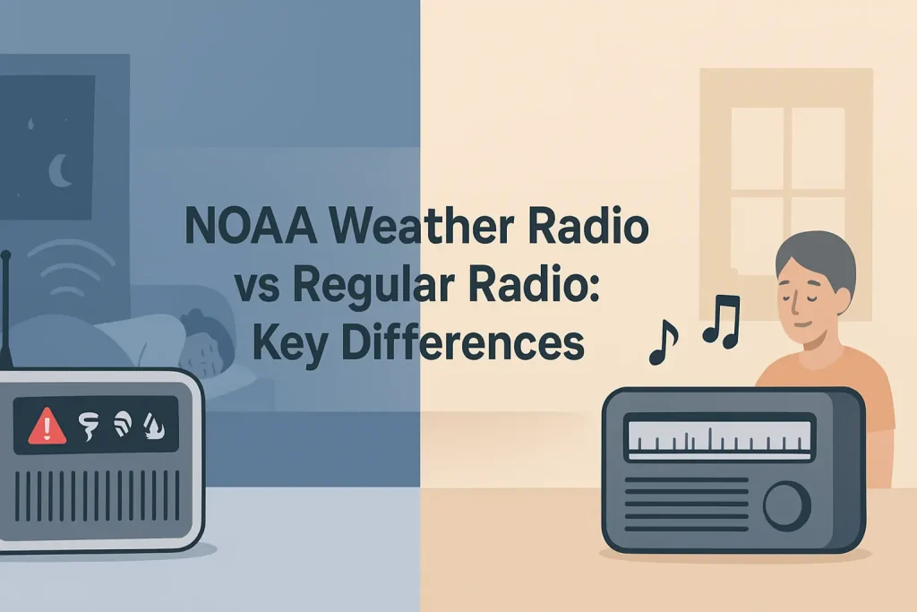
Texas sits in the heart of some of the most active severe weather territory in the country. The seven NOAA Weather Radio All Hazards frequencies broadcast 24 hours a day across the state, covering tornadoes, flash floods, and severe thunderstorms for every county. Knowing which specific frequency serves Dallas-Fort Worth, Houston, or Austin is the difference between receiving an alert the moment it is issued and missing it entirely.
This guide covers every active NOAA weather radio transmitter in Texas, with exact frequencies in MHz, transmitter call signs, coverage areas, and S.A.M.E. (Specific Area Message Encoding) county codes for DFW, Houston, and Austin.
| Photo | Popular Portable Walkie Talkies | Price |
|---|---|---|
 | SKIWARRIOR Multifunctional Smart Wireless Ski Goggles with Walkie-Talkie, Anti-Fog Zeiss Lens, Music & Call Function (Cylindrical Blue) | Check Price On Amazon |
 | SINORISE Super Mini Walkie Talkies, Two-Way Radios, 3 Pack | Check Price On Amazon |
 | KOSPET Tank M4C Smart Watch Rugged, Dual-Band GPS, 5ATM & IP69K Waterproof | Check Price On Amazon |
 | Retevis RT15 Walkie Talkies 3 Pack, Birthday Gift, Outdoor Adventure Kit | Check Price On Amazon |
 | Rechargeable Walkie Talkies Toys for Kids: DIY Astronaut Walkie Talkies for Boys Christmas Birthday Gifts for 3 4 5 6 7 8 9 10 Boy Walkie Talkie Outdoor Hiking Toy 2 Way Radio Camping Outdoor Game | Check Price On Amazon |
What Are the NOAA Weather Radio Frequencies Used in Texas?
NOAA Weather Radio All Hazards broadcasts on seven dedicated VHF frequencies between 162.400 MHz and 162.550 MHz. These seven frequencies are the only ones used by the NWR network across the entire United States, and Texas transmitters use the same set.
According to NOAA’s National Weather Service technical documentation, all NWR transmitters operate between 162.400 and 162.550 MHz in the VHF high band, with each transmitter assigned one of the seven standardized frequencies to minimize co-channel interference between adjacent coverage areas.
The seven NOAA weather radio frequencies are listed below. Use the table to identify which frequency is most likely active in your region of Texas before scanning for your local transmitter.
Use the table below to identify the seven standardized NWR broadcast frequencies and their typical Texas usage patterns.
| Frequency (MHz) | Channel Designation | Common Texas Assignment |
|---|---|---|
| 162.400 MHz | WX1 | Houston metro (KEC83), parts of South Texas |
| 162.425 MHz | WX2 | Austin area (WXL58), Central Texas |
| 162.450 MHz | WX3 | DFW metro (KWO35), North Texas |
| 162.475 MHz | WX4 | East Texas, Tyler/Longview area |
| 162.500 MHz | WX5 | West Texas, Lubbock/Midland area |
| 162.525 MHz | WX6 | San Antonio area, South-Central Texas |
| 162.550 MHz | WX7 | Panhandle, Amarillo area, overlap fill |
Source: NOAA National Weather Service NWR transmitter database. Frequency assignments vary by transmitter location and may overlap between metro areas.
Your NOAA weather radio with S.A.M.E. alert technology can be programmed to scan all seven channels and lock onto the strongest signal automatically, but manually entering your county’s primary frequency produces faster alert response times.
Knowing your primary frequency is only half the setup. Programming the correct S.A.M.E. FIPS code for your county ensures your radio activates only for alerts in your area, rather than sounding for every county in the state.
Dallas-Fort Worth NOAA Weather Radio Frequencies and Transmitters
The primary NOAA weather radio transmitter serving the Dallas-Fort Worth metro area broadcasts on 162.450 MHz from the NWS Fort Worth office transmitter designated KWO35. This transmitter covers Dallas, Tarrant, Collin, Denton, and surrounding counties at a radiated power output sufficient to reach most of the 13-county DFW metroplex.
According to NOAA NWS Fort Worth documentation, the KWO35 transmitter operates at 162.450 MHz and is the primary broadcast point for all severe weather, tornado, and flash flood alerts issued by the NWS Fort Worth Weather Forecast Office (WFO FWD).
Key Specifications for KWO35 (DFW Primary Transmitter):
- Call sign: KWO35
- Frequency: 162.450 MHz (WX3)
- Issuing office: NWS Fort Worth (WFO FWD)
- Primary coverage: Dallas, Tarrant, Collin, Denton, Rockwall, Ellis, Johnson, Parker counties
- S.A.M.E. alert source: NWS Fort Worth
The DFW area also receives overlapping coverage from secondary transmitters on adjacent frequencies, which matters during active severe weather when the primary transmitter may broadcast continuous programming that delays updates. If KWO35 on 162.450 MHz is congested during a tornado outbreak, a secondary transmitter on 162.400 MHz or 162.550 MHz may carry alternate NWS Fort Worth alerts.
Use the table below to compare the primary and secondary transmitters covering the DFW metro area.
| Call Sign | Frequency (MHz) | Location | Primary Counties Served | NWS Office |
|---|---|---|---|---|
| KWO35 | 162.450 MHz | Fort Worth | Dallas, Tarrant, Collin, Denton, Rockwall, Ellis, Johnson, Parker | NWS Fort Worth |
| WXJ22 | 162.400 MHz | Greenville area | Hunt, Hopkins, Rains, Delta, Lamar (eastern DFW fringe) | NWS Fort Worth |
| WXL57 | 162.550 MHz | Gainesville area | Cooke, Wise, Montague (northern DFW counties) | NWS Fort Worth |
| KEC79 | 162.475 MHz | Corsicana area | Navarro, Henderson, Kaufman (southeastern DFW fringe) | NWS Fort Worth |
Source: NOAA NWR transmitter database and NWS Fort Worth WFO documentation. Coverage overlaps between transmitters are normal and intentional for redundancy.
For residents in Dallas County or Tarrant County, program your Midland WR400 NOAA weather radio to 162.450 MHz as the primary channel and enter S.A.M.E. FIPS code 048113 for Dallas County or 048439 for Tarrant County.
The NWS Fort Worth office issues alerts for 38 counties across North Texas, so using S.A.M.E. county-level filtering on 162.450 MHz is essential to avoid receiving alerts for counties more than 100 miles from your location.
S.A.M.E. FIPS Codes for DFW Counties
S.A.M.E. (Specific Area Message Encoding) uses 6-digit FIPS (Federal Information Processing Standards) codes to identify which counties should receive a given weather alert. Without programming the correct FIPS code into your weather radio, the radio will alarm for every alert broadcast by the KWO35 transmitter, which covers 38 counties across North Texas.
According to NOAA’s NWR S.A.M.E. technical documentation, every NWR alert broadcast includes a FIPS header that lists the specific counties affected. A weather radio programmed with a matching FIPS code will only activate its alarm when that county is included in the alert header.
Use the table below to find the correct S.A.M.E. FIPS code for your DFW-area county and program it into your weather radio’s S.A.M.E. memory bank.
| County | S.A.M.E. FIPS Code | Major Cities | Primary Transmitter |
|---|---|---|---|
| Dallas County | 048113 | Dallas, Irving, Garland, Mesquite | KWO35 / 162.450 MHz |
| Tarrant County | 048439 | Fort Worth, Arlington, Mansfield | KWO35 / 162.450 MHz |
| Collin County | 048085 | Plano, McKinney, Frisco, Allen | KWO35 / 162.450 MHz |
| Denton County | 048121 | Denton, Lewisville, Flower Mound | KWO35 / 162.450 MHz |
| Rockwall County | 048397 | Rockwall, Heath | KWO35 / 162.450 MHz |
| Ellis County | 048139 | Waxahachie, Ennis, Midlothian | KWO35 / 162.450 MHz |
| Johnson County | 048251 | Cleburne, Burleson, Joshua | KWO35 / 162.450 MHz |
| Parker County | 048367 | Weatherford, Aledo | KWO35 / 162.450 MHz |
Source: NOAA S.A.M.E. FIPS code database. State prefix for Texas is 048. Six-digit FIPS codes are required for S.A.M.E. programming. Verify your code at the NOAA NWR website before programming.
Most S.A.M.E.-capable weather radios allow you to store up to 25 county codes simultaneously, which is useful if you commute between Dallas County and Collin County or travel frequently through the DFW metro area.
For more background on how S.A.M.E. technology works and why county-level filtering matters for nighttime alert reliability, the full explanation of how S.A.M.E. encoding filters county-specific emergency alerts covers the technical process in detail.
Houston NOAA Weather Radio Frequencies and Transmitters
The primary NOAA weather radio transmitter serving the Houston metro area broadcasts on 162.400 MHz under call sign KEC83. This transmitter is operated by the NWS Houston/Galveston Weather Forecast Office (WFO HGX) and covers Harris, Fort Bend, Brazoria, Galveston, Montgomery, and surrounding coastal and inland counties.
According to NOAA NWS Houston/Galveston documentation, KEC83 operates at 162.400 MHz and serves as the primary broadcast point for all tropical storm, hurricane, severe thunderstorm, tornado, and coastal flood alerts issued by WFO HGX. The Houston area is one of the most weather-active NWS forecast zones in the country due to its Gulf Coast exposure and frequent convective weather patterns.
Key Specifications for KEC83 (Houston Primary Transmitter):
- Call sign: KEC83
- Frequency: 162.400 MHz (WX1)
- Issuing office: NWS Houston/Galveston (WFO HGX)
- Primary coverage: Harris, Fort Bend, Brazoria, Galveston, Montgomery, Liberty, Chambers, Waller counties
- Alert types: tornado, severe thunderstorm, flash flood, tropical storm, hurricane, coastal flood, hazmat
The Uniden BC365CRS weather radio is a reliable choice for Houston-area residents because it supports S.A.M.E. county filtering and can be programmed to 162.400 MHz as a dedicated primary channel.
Houston’s coastal geography means the NWS HGX office issues alert types not commonly seen in inland Texas metros. Hurricane warnings, storm surge alerts, and coastal flood statements all broadcast over KEC83 on 162.400 MHz, making it critical to keep this frequency clear of S.A.M.E. programming errors during Atlantic hurricane season, which runs June 1 through November 30.
Use the table below to compare the primary and secondary transmitters covering the Greater Houston area, including the Beaumont and Galveston Island overlap zones.
| Call Sign | Frequency (MHz) | Location | Primary Counties Served | NWS Office |
|---|---|---|---|---|
| KEC83 | 162.400 MHz | Houston metro | Harris, Fort Bend, Brazoria, Galveston, Montgomery, Liberty, Chambers, Waller | NWS Houston/Galveston |
| WXL61 | 162.550 MHz | Conroe area | Montgomery, San Jacinto, Walker (northern Houston counties) | NWS Houston/Galveston |
| KHB35 | 162.475 MHz | Beaumont area | Jefferson, Orange, Hardin (Southeast Texas / Louisiana border) | NWS Lake Charles |
| WXK48 | 162.425 MHz | Victoria area | Victoria, Jackson, Calhoun (southwest Houston coastal fringe) | NWS Corpus Christi |
Source: NOAA NWR transmitter database, NWS Houston/Galveston WFO HGX documentation. Beaumont-area residents may receive alerts from NWS Lake Charles (Louisiana) depending on proximity to the Texas-Louisiana state line.
Harris County residents should program their weather radio to 162.400 MHz with S.A.M.E. FIPS code 048201. Galveston County residents on Galveston Island or the Bolivar Peninsula should use FIPS code 048167 to receive coastal storm surge alerts specific to their barrier island location.
Keeping your Houston-area weather radio programmed correctly before hurricane season begins each June is the single most important preparedness step for Gulf Coast residents.
S.A.M.E. FIPS Codes for Houston Metro Counties
The KEC83 transmitter on 162.400 MHz covers more than 2.5 million square miles of the Texas Gulf Coast region. Without S.A.M.E. county filtering, a weather radio in downtown Houston will alarm for tornado warnings in Matagorda County more than 80 miles away.
NOAA’s S.A.M.E. system encodes every alert with a list of affected FIPS county codes. A receiver programmed with a matching code activates only when that code appears in the alert header, which is the core technical function described in NOAA’s NWR receiver specification documentation.
Use the table below to find the correct FIPS code for your Houston-area county before programming your weather radio.
| County | S.A.M.E. FIPS Code | Major Cities | Primary Transmitter |
|---|---|---|---|
| Harris County | 048201 | Houston, Pasadena, Baytown, Spring | KEC83 / 162.400 MHz |
| Fort Bend County | 048157 | Sugar Land, Missouri City, Katy | KEC83 / 162.400 MHz |
| Brazoria County | 048039 | Pearland, Alvin, Lake Jackson, Clute | KEC83 / 162.400 MHz |
| Galveston County | 048167 | Galveston, Texas City, League City, Friendswood | KEC83 / 162.400 MHz |
| Montgomery County | 048339 | The Woodlands, Conroe, Humble | KEC83 / 162.400 MHz |
| Liberty County | 048291 | Liberty, Dayton, Baytown (east) | KEC83 / 162.400 MHz |
| Chambers County | 048071 | Anahuac, Winnie, Stowell | KEC83 / 162.400 MHz |
| Waller County | 048473 | Hempstead, Brookshire, Katy (west) | KEC83 / 162.400 MHz |
Source: NOAA S.A.M.E. FIPS code database. State prefix for Texas is 048. Verify all codes at the official NOAA NWR S.A.M.E. county code lookup before programming.
Houston residents who live near county lines, such as in Katy (split between Fort Bend and Harris counties) or Friendswood (split between Galveston and Harris counties), should program both relevant FIPS codes into their weather radio to ensure coverage from either issuing jurisdiction.
Programming two or three county codes instead of one is the most practical upgrade for Houston-area residents in border communities, requiring no additional hardware.
Austin NOAA Weather Radio Frequencies and Transmitters
The primary NOAA weather radio transmitter serving the Austin area broadcasts on 162.425 MHz under call sign WXL58. This transmitter is managed by the NWS Austin/San Antonio Weather Forecast Office (WFO EWX) and covers Travis, Williamson, Hays, Bastrop, Caldwell, and surrounding counties in the Central Texas Hill Country and Balcones Escarpment region.
According to NOAA NWS Austin/San Antonio documentation, WXL58 operates at 162.425 MHz and issues flash flood warnings, severe thunderstorm warnings, tornado watches, and wildfire-related air quality statements for the Central Texas region. Austin sits at the Balcones Fault Zone, where Gulf moisture interacts with Hill Country topography to produce flash flood conditions with very short lead times, making real-time NWR monitoring especially important.
Key Specifications for WXL58 (Austin Primary Transmitter):
- Call sign: WXL58
- Frequency: 162.425 MHz (WX2)
- Issuing office: NWS Austin/San Antonio (WFO EWX)
- Primary coverage: Travis, Williamson, Hays, Bastrop, Caldwell, Blanco, Burnet counties
- Special hazard types: flash flood (high frequency), wildfire weather watches, extreme heat advisories
The Sangean CL-100 NOAA weather radio is a good fit for Austin residents because it supports up to 25 S.A.M.E. location codes, battery backup, and a dedicated weather alert lamp that activates without audio for daytime awareness.
Use the table below to identify the transmitters covering the Austin metro area and the Hill Country counties that fall under WFO EWX coverage.
| Call Sign | Frequency (MHz) | Location | Primary Counties Served | NWS Office |
|---|---|---|---|---|
| WXL58 | 162.425 MHz | Austin metro | Travis, Williamson, Hays, Bastrop, Caldwell, Blanco, Burnet | NWS Austin/San Antonio |
| KEC80 | 162.450 MHz | San Marcos area | Hays, Guadalupe, Comal (south Austin fringe) | NWS Austin/San Antonio |
| KHB36 | 162.400 MHz | Waco area | McLennan, Bell, Coryell (north Austin corridor) | NWS Fort Worth |
| WXK57 | 162.550 MHz | Llano area | Llano, Mason, Kimble (Hill Country west of Austin) | NWS Austin/San Antonio |
Source: NOAA NWR transmitter database, NWS Austin/San Antonio WFO EWX documentation. Residents in Hays and Caldwell counties may receive overlapping coverage from both WXL58 and KEC80 depending on terrain.
Austin residents in Travis County should program their weather radio to 162.425 MHz with S.A.M.E. FIPS code 048453. Those in Williamson County (Round Rock, Georgetown, Cedar Park) should use FIPS code 048491.
Programming the correct frequency and FIPS code for your Austin-area county ensures you receive the flash flood emergency alerts that are most relevant to your specific watershed location, which is particularly important for residents near Onion Creek, Barton Creek, or the Highland Lakes chain.
S.A.M.E. FIPS Codes for Austin Metro Counties
The WXL58 transmitter on 162.425 MHz covers a broad swath of Central Texas that includes both urban Travis County and rural Hill Country counties with very different risk profiles. S.A.M.E. filtering ensures that a flash flood emergency alert for a low-water crossing in Blanco County does not alarm a weather radio in north Austin, where that specific creek is not relevant.
NOAA’s S.A.M.E. system transmits a digital header burst at the start of every alert that contains the event type, the affected FIPS codes, the duration of the event, and the issuing NWS office. A receiver compares its stored FIPS codes against the header and activates the alarm only on a match, as described in NOAA’s NWR receiver technical specification document.
Use the table below to find the correct S.A.M.E. FIPS code for your Austin-area county.
| County | S.A.M.E. FIPS Code | Major Cities | Primary Transmitter |
|---|---|---|---|
| Travis County | 048453 | Austin, West Lake Hills, Manor, Pflugerville | WXL58 / 162.425 MHz |
| Williamson County | 048491 | Round Rock, Georgetown, Cedar Park, Leander | WXL58 / 162.425 MHz |
| Hays County | 048209 | San Marcos, Kyle, Buda, Wimberley | WXL58 / 162.425 MHz |
| Bastrop County | 048021 | Bastrop, Elgin, Smithville | WXL58 / 162.425 MHz |
| Caldwell County | 048055 | Lockhart, Luling, Gonzales (partial) | WXL58 / 162.425 MHz |
| Blanco County | 048031 | Blanco, Johnson City | WXL58 / 162.425 MHz |
| Burnet County | 048053 | Burnet, Marble Falls, Llano (partial) | WXL58 / 162.425 MHz |
Source: NOAA S.A.M.E. FIPS code database. State prefix for Texas is 048. Residents in Hays County may also receive coverage from the KEC80 transmitter on 162.450 MHz depending on location within the county.
For Austin-area residents near the Pedernales River, Onion Creek, or Barton Springs watershed, programming both Travis County (048453) and Hays County (048209) FIPS codes into the same weather radio provides the earliest possible flash flood warning coverage for both watershed systems.
The correct FIPS code combination for your Austin location is the single most important configuration step for reliable night time flash flood alerts in Central Texas.
How to Program a Texas NOAA Weather Radio: Step-by-Step
Programming a NOAA weather radio for a specific Texas county requires three inputs: the correct broadcast frequency in MHz, the 6-digit S.A.M.E. FIPS code for your county, and the alert types you want to activate the alarm. Getting all three right ensures the radio wakes you during a tornado warning at 2 a.m. and stays silent for a winter weather advisory 200 miles away.
According to NOAA’s NWR receiver programming guidelines, S.A.M.E.-capable receivers must store at least one FIPS code and one alert event code to deliver county-specific alerting. Most consumer weather radios from brands like Midland, Uniden, and Sangean support 25 or more county codes and all standard NWS alert types.
Step-by-Step Guide
How to Program a NOAA Weather Radio for Texas County Alerts
6 steps · Estimated time: 5-10 minutes
Identify your primary NWR frequency
DFW residents use 162.450 MHz (KWO35). Houston residents use 162.400 MHz (KEC83). Austin residents use 162.425 MHz (WXL58). Look up your city in the transmitter tables above if you are outside these three metros.
Look up your county S.A.M.E. FIPS code
Find your county in the FIPS tables above. All Texas county codes begin with 048. Write down the full 6-digit code before starting programming, as most radios time out the input screen in under 30 seconds.
Enter the frequency on your weather radio
Press the channel selector or manual tune button and dial to the correct channel (WX1 through WX7). On most Midland and Uniden models, you can also enter the frequency directly using the keypad if the radio supports manual MHz entry.
Navigate to the S.A.M.E. programming menu
On most Midland models, press and hold the S.A.M.E. or PROG button until the display shows a flashing FIPS entry prompt. On Uniden models, press MENU, then navigate to SAME LOCATION. Refer to your manual for the exact button sequence for your model.
Enter your 6-digit FIPS code and confirm
Type the full 6-digit FIPS code for your county using the number pad. Press ENTER or CONFIRM to save. Most radios allow you to add multiple codes one at a time, up to the model’s maximum (typically 25). Add adjacent county codes now if you commute across county lines.
Test the alarm using the radio’s test function
Press and hold the TEST button (on Midland models) or access the alarm test via the menu to verify the alarm volume and lamp function. NWS broadcasts a weekly test of the EAS system every Wednesday between 11 a.m. and noon local time, which you can also use to verify your S.A.M.E. programming is receiving correctly.
The Midland WR120 weather radio is one of the most common S.A.M.E.-capable radios used in Texas homes because it allows up to 25 county codes and includes a battery backup tray for AA alkaline batteries.
Completing all six steps correctly means your weather radio will activate only for your county, at any hour, even during a power outage when it is running on battery backup.
Which Weather Radio Works Best for Texas Reception Conditions?
Texas NWR transmitters operate at effective radiated power levels ranging from 300 watts to 1,000 watts, but the flat terrain of North Texas, the coastal humidity of the Houston area, and the Hill Country topography around Austin each create different signal reception challenges. A weather radio with a built-in telescoping antenna performs well in open suburban environments but may struggle inside concrete or steel-framed buildings in downtown Houston or Austin.
According to NOAA’s NWR coverage map documentation, the 162.400-162.550 MHz VHF band provides line-of-sight propagation with a typical reliable reception radius of 40 miles from each transmitter under normal atmospheric conditions. Signal attenuation increases significantly inside buildings with metal framing, concrete walls, or energy-efficient window coatings that reflect VHF frequencies.
Use the table below to compare the most widely used weather radios available for Texas residents by key specifications.
| Model | S.A.M.E. Codes | Battery Backup | Alert Lamp | Antenna | Price (approx.) |
|---|---|---|---|---|---|
| Midland WR400 | 50 | 6x AA | Yes | Built-in telescoping | $55-70 |
| Midland WR120 | 25 | 3x AA | Yes | Built-in telescoping | $30-40 |
| Uniden BC365CRS | 25 | 3x AA | Yes | Built-in telescoping | $35-50 |
| Sangean CL-100 | 25 | 3x AA | Yes | Built-in + ext. jack | $45-60 |
| Reecom R-1630 | 25 | 3x AA | Yes (visual strobe) | Built-in telescoping | $50-65 |
| Midland ER310 | 25 | Li-ion + hand crank + solar | Yes | Built-in telescoping | $60-80 |
Prices verified at time of publication. S.A.M.E. code counts and battery backup configurations from manufacturer data sheets. The Sangean CL-100 includes an external antenna jack, which allows connection to an outdoor VHF antenna for improved building penetration.
For residents in high-rise buildings or concrete construction in downtown Houston or Austin where the internal telescoping antenna produces unreliable signal, the Sangean CL-100’s external antenna jack accepts a standard BNC connector, allowing connection to an outdoor VHF weather radio antenna mounted on a balcony or rooftop.
The right weather radio for Texas use is any S.A.M.E.-capable model with battery backup, because the most critical alerts (tornado warnings, flash flood emergencies) often occur during power outages caused by the same storm generating the alert.
Texas NOAA Weather Radio Alert Types and What They Mean
NOAA Weather Radio All Hazards broadcasts more than just tornado warnings. The NWR network carries 73 event codes covering severe weather, non-weather emergencies, and hazardous environmental conditions. Texas residents in the DFW, Houston, and Austin metros will encounter a specific subset of these alert types that reflects the regional hazard profile of each area.
According to NOAA’s EAS (Emergency Alert System) event code documentation, all NWR broadcast alerts are encoded with a three-character event code that S.A.M.E.-capable receivers use to determine whether to activate the alarm. Most consumer weather radios let you select which event types trigger the alarm and which play silently or not at all.
Use the table below to understand which alert types are most relevant to each Texas metro and how to configure your radio’s alert filter settings.
| Alert Type | EAS Code | DFW | Houston | Austin | Wake-up priority |
|---|---|---|---|---|---|
| Tornado Warning | TOR | High | High | High | Always enable alarm |
| Flash Flood Emergency | FFE | Moderate | High | High | Always enable alarm |
| Severe Thunderstorm Warning | SVR | High | High | High | Enable for nighttime |
| Hurricane Warning | HUW | Low | Critical | Low | Essential for coastal counties |
| Storm Surge Warning | SSW | None | Critical | None | Galveston/coastal Harris only |
| Winter Storm Warning | WSW | High | Low | Moderate | Priority in DFW after Feb 2021 |
| Extreme Heat Warning | EHW | Moderate | Moderate | Moderate | Enable during summer months |
| AMBER Alert | CAE | Optional | Optional | Optional | User preference |
Source: NOAA EAS event code list, NOAA NWR All Hazards program documentation. EAS codes are 3-character identifiers transmitted in the S.A.M.E. digital header. Not all weather radios support individual event code filtering; check your model’s manual.
Houston residents in Galveston, Chambers, and Brazoria counties should enable both the Hurricane Warning (HUW) and Storm Surge Warning (SSW) event codes as active alarm triggers, because storm surge events can develop rapidly with little advance notice during the latter stages of a tropical system making landfall.
Configuring your alert types to match your location’s specific risk profile, rather than accepting the default “all alerts” setting, prevents alert fatigue that causes residents to disable their weather radios entirely after receiving too many low-relevance notifications.
Texas NOAA Weather Radio Coverage Gaps and What to Do About Them
No NWR transmitter achieves 100% coverage throughout its intended service area. Texas has specific terrain and geography features that create reception gaps the standard telescoping antenna cannot overcome. Rural areas west of the Hill Country, the eastern Piney Woods, and certain low-lying flood plains near the Gulf Coast can fall below reliable signal threshold for the nearest transmitter.
According to NOAA’s NWR coverage gap documentation, areas beyond 40 miles from a transmitter in flat terrain or beyond 20 miles in hilly terrain are considered marginal reception zones where signal reliability drops below 90%. A weather radio in these zones may receive intermittent broadcast audio but fail to decode the digital S.A.M.E. header reliably, which means the alarm may not activate even when a valid alert is broadcast.
This happens because NWR transmitters use omnidirectional VHF antennas that radiate equally in all directions from the tower. Signal strength falls off as the inverse square of distance from the transmitter. At marginal distances, the signal-to-noise ratio drops below the threshold required for the S.A.M.E. decoder chip in the receiver to parse the digital header correctly, even when the analog audio is audible.
This only occurs when the received signal level falls below approximately 0.5 microvolts at the receiver antenna input, which is the standard minimum sensitivity specification for S.A.M.E.-capable receivers per NOAA’s NWR receiver performance criteria.
If your weather radio receives clear audio but does not activate S.A.M.E. alarms during NWS weekly tests, the fix is not a new radio. It is an external antenna. Connecting an outdoor VHF weather radio antenna with 3-5 dBi of gain, mounted at least 10 feet above the roofline, typically resolves marginal S.A.M.E. decode failures in reception-challenged locations.
For homes beyond reliable NWR range, a combination approach using a weather radio for primary alerting and a portable hand-crank emergency weather radio with battery backup provides dual redundancy that survives both power outages and signal gaps.
Addressing your local coverage gap before severe weather season begins, rather than discovering the problem during an actual tornado warning, is the only reliable preparedness strategy for rural Texas residents.
How Smartphone Weather Alerts Compare to a Dedicated NOAA Weather Radio
Wireless Emergency Alerts (WEA) delivered to smartphones use the cellular network, which means they depend on cell tower availability, battery power, and data connectivity. A dedicated NOAA weather radio on 162.400-162.550 MHz receives alerts directly from the NWR transmitter over the air with no cellular infrastructure required, no app to update, and no account to maintain.
According to FEMA’s IPAWS (Integrated Public Alert and Warning System) documentation, WEA alerts are transmitted via the Commercial Mobile Alert System (CMAS) using Cell Broadcast technology on LTE and 5G networks. This technology sends alerts to all capable phones within a cell tower’s coverage area, but it depends on active cellular service, which is frequently disrupted during major severe weather events when towers lose power or become overloaded with simultaneous traffic.
A dedicated weather radio receives NWR broadcasts independently of the cellular network, independently of internet connectivity, and independently of commercial power when battery backup is installed. This makes the NWR system the only alert mechanism that remains fully operational under the conditions (power outage, cellular overload, internet disruption) most commonly associated with major Texas severe weather events including tornadic supercells, direct hurricane landfall, and the type of widespread winter storm that caused the February 2021 Texas grid failure.
For a deeper comparison of how mobile apps handle NOAA alert delivery versus dedicated receiver hardware, the full breakdown of receiving NOAA weather alerts on your phone versus a dedicated radio covers the technical differences and reliability trade-offs in detail.
A smartphone is a useful supplement to a weather radio, but it is not a substitute for one in a state where tornado season overlaps with hurricane season, flash flood season, and ice storm season within the same calendar year.
Other Major Texas NOAA Weather Radio Transmitters Outside DFW, Houston, and Austin
Texas has more than 35 active NWR transmitters covering all 254 counties. Residents in San Antonio, Corpus Christi, El Paso, Lubbock, Amarillo, Waco, Beaumont, and the Rio Grande Valley each have specific transmitter assignments and primary frequencies different from the three major metro transmitters covered above.
According to NOAA’s NWR transmitter status page, every Texas NWR transmitter is assigned to one of five National Weather Service forecast offices: Fort Worth (WFO FWD), Houston/Galveston (WFO HGX), San Antonio/Austin (WFO EWX), Corpus Christi (WFO CRP), Lubbock (WFO LUB), Amarillo (WFO AMA), El Paso (WFO EPZ), Midland/Odessa (WFO MAF), or Lake Charles, Louisiana (WFO LCH) for extreme eastern Texas border counties.
Use the table below to find the primary NWR transmitter and frequency for other major Texas cities outside the DFW, Houston, and Austin metro areas.
| City / Region | Call Sign | Frequency (MHz) | NWS Office | Primary Counties |
|---|---|---|---|---|
| San Antonio | KEC80 | 162.425 MHz | NWS Austin/San Antonio | Bexar, Comal, Guadalupe, Kendall |
| Corpus Christi | WXJ57 | 162.550 MHz | NWS Corpus Christi | Nueces, San Patricio, Aransas, Kleberg |
| Waco | KHB36 | 162.400 MHz | NWS Fort Worth | McLennan, Bell, Falls, Coryell |
| Lubbock | KEC78 | 162.400 MHz | NWS Lubbock | Lubbock, Hale, Crosby, Garza, Lynn |
| Amarillo | KHB34 | 162.550 MHz | NWS Amarillo | Potter, Randall, Armstrong, Donley |
| El Paso | KEC76 | 162.475 MHz | NWS El Paso | El Paso, Hudspeth, Culberson (west Texas) |
| Midland/Odessa | KHB37 | 162.525 MHz | NWS Midland | Midland, Ector, Martin, Andrews, Upton |
| Beaumont/Port Arthur | KHB35 | 162.475 MHz | NWS Lake Charles | Jefferson, Orange, Hardin, Jasper |
Source: NOAA NWR transmitter database. Call signs and frequencies verified against the NOAA NWR All Hazards transmitter status table. Frequencies are subject to change if NOAA reallocates transmitter assignments; verify at weather.gov/nwr before programming.
For a complete listing of all active NOAA transmitters serving every state, including all Texas NWS forecast office coverage zones mapped by county, the comprehensive directory of NOAA weather radio stations organized by state and county provides a searchable reference for all 50 states.
Residents in border counties near the Louisiana state line should note that Beaumont-area coverage is managed by NWS Lake Charles, Louisiana, not NWS Houston, which means your S.A.M.E. alert issuing office differs from your geographic location in Texas.
Texas Severe Weather Seasons and When to Check Your Weather Radio Setup
Texas experiences severe weather in every calendar month, but the specific hazard type changes significantly by season and by region. A weather radio programmed correctly in January for ice storm events in DFW may need alert type reconfiguration in June for hurricane and flash flood alerts in the Houston area.
According to NWS Fort Worth and NWS Houston/Galveston historical climatology data, the primary severe weather threats by season in Texas are: tornado season (March through May, with a secondary season in October and November), hurricane and tropical storm season (June 1 through November 30), flash flood season (April through October with peak activity in May and October), and winter storm season (December through February with peak impact events in January and February).
Seasonal Guide
Texas NOAA Weather Radio – Month-by-Month Setup and Check Guide
What to check, test, or reconfigure each month for reliable Texas weather alert coverage. Source: NWS Fort Worth, NWS Houston/Galveston seasonal climatology.
Lower activity: maintain current setup
Replacing weather radio batteries at the start of each high-activity season (March for tornado season, June for hurricane season, December for winter storm season) is the simplest annual maintenance habit that ensures battery backup is available exactly when the power grid is most likely to fail.
Keeping your weather radio configured for the correct season-specific alert types prevents both missed alerts and alarm fatigue throughout the year.
Frequently Asked Questions About Texas NOAA Weather Radio Frequencies
What frequency should I program for Dallas-Fort Worth weather alerts?
Program your weather radio to 162.450 MHz (channel WX3) for the primary DFW transmitter KWO35. This transmitter is operated by NWS Fort Worth and covers Dallas, Tarrant, Collin, Denton, Rockwall, Ellis, Johnson, and Parker counties. Enter your county’s 6-digit S.A.M.E. FIPS code alongside this frequency to ensure you only receive alerts for your specific county rather than all 38 counties in the NWS Fort Worth coverage area.
What frequency does the Houston NOAA weather radio transmitter use?
The primary Houston NWR transmitter, call sign KEC83, broadcasts on 162.400 MHz. It is operated by NWS Houston/Galveston (WFO HGX) and covers Harris, Fort Bend, Brazoria, Galveston, Montgomery, Liberty, Chambers, and Waller counties. Galveston Island and Bolivar Peninsula residents should program FIPS code 048167 alongside 162.400 MHz to receive storm surge and hurricane-specific alerts distinct from inland Harris County alerts.
What is the Austin NOAA weather radio frequency?
Austin’s primary NWR transmitter is WXL58, broadcasting on 162.425 MHz. It is managed by NWS Austin/San Antonio (WFO EWX) and covers Travis, Williamson, Hays, Bastrop, Caldwell, Blanco, and Burnet counties. Travis County residents should program S.A.M.E. FIPS code 048453 alongside 162.425 MHz to filter alerts to their specific county and avoid receiving flash flood warnings issued for Hill Country counties upstream of their watershed.
Can I use the same weather radio for both DFW and Houston if I travel between the two cities?
Yes. Most S.A.M.E.-capable weather radios allow you to store multiple FIPS codes and scan all seven NWR frequencies simultaneously. Program both Dallas County (048113) and Harris County (048201) into your radio’s S.A.M.E. memory bank. The radio will activate when either county’s code appears in an alert header. Set the radio to scan all seven WX channels rather than a single frequency so it locks onto the strongest signal automatically as you travel.
What is the difference between a Tornado Watch and a Tornado Warning on NOAA weather radio?
A Tornado Watch (EAS code TOA) means atmospheric conditions are favorable for tornado development in your area and you should monitor the weather closely. A Tornado Warning (EAS code TOR) means a tornado has been detected by radar or confirmed by a spotter and is either occurring or imminent in the specified counties. The Tornado Warning carries S.A.M.E. event code TOR and should always be configured as an active alarm trigger on your weather radio, while a Tornado Watch (TOA) is a lower-urgency event some users configure as a tone-only alert without the full alarm.
Why does my weather radio alarm for counties far away from me?
Your weather radio is not programmed with a S.A.M.E. FIPS code for your specific county. Without a stored FIPS code, the radio activates for every alert broadcast on that frequency, which covers dozens of counties. Navigate to your radio’s S.A.M.E. or location programming menu, enter the 6-digit FIPS code for your county (find it in the tables above), and save it. The radio will then alarm only when your county’s code appears in the broadcast alert header.
Do I need a special weather radio for hurricane alerts in coastal Texas?
No special hardware is required, but you need to ensure your weather radio supports Storm Surge Warning (SSW) and Hurricane Warning (HUW) as separate, configurable alarm events. Not all budget weather radios distinguish between alert event types. The Midland WR400 and Uniden BC365CRS both support individual event code configuration, which allows Galveston and Brazoria county residents to set SSW and HUW as maximum-priority alarms while keeping less urgent advisory-level events as tone-only notifications.
How far does a Texas NOAA weather radio transmitter reach?
Under normal atmospheric conditions, Texas NWR transmitters reliably cover a radius of approximately 40 miles over flat terrain. The 162.400-162.550 MHz VHF band provides line-of-sight propagation, so signal strength degrades with distance, building obstructions, and terrain. In the Hill Country west of Austin, signal range from the WXL58 transmitter may be reduced to 15-20 miles in deep river valleys. An outdoor VHF antenna with 3-5 dBi of gain mounted above the roofline typically restores reliable S.A.M.E. decoding in marginal-coverage locations.
Can I listen to Texas NOAA weather radio on a regular FM or AM radio?
No. NOAA weather radio broadcasts on seven dedicated VHF frequencies between 162.400 and 162.550 MHz, which fall outside both the AM band (535-1705 kHz) and the FM broadcast band (87.8-108.0 MHz). You need a dedicated weather radio, a scanner radio that covers the 162 MHz range, or a handheld transceiver that receives VHF frequencies. Some multi-band portable radios and GMRS handheld radios include a WX-band receive function for monitoring NWR frequencies without transmitting.
What is the S.A.M.E. FIPS code for Travis County, Texas?
The S.A.M.E. FIPS code for Travis County, Texas is 048453. The first three digits (048) are the state code for Texas, and the last three digits (453) identify Travis County specifically within the state. Enter all six digits when programming the S.A.M.E. location memory on your weather radio. If your radio requires you to enter the state and county codes separately, enter 048 for the state and 453 for the county.
What is the S.A.M.E. FIPS code for Harris County, Texas?
The S.A.M.E. FIPS code for Harris County, Texas is 048201. This code covers the City of Houston and surrounding unincorporated Harris County areas. Residents in The Woodlands (Montgomery County, FIPS 048339) or Sugar Land (Fort Bend County, FIPS 048157) should enter their own county’s code rather than Harris County’s code, since NWS alerts are issued by county boundaries, not city limits.
Why does my NOAA weather radio not alarm during official NWS weekly tests?
The most common cause is a S.A.M.E. FIPS mismatch. NWS weekly tests on Wednesday between 11 a.m. and noon include the affected county FIPS codes in the S.A.M.E. header. If your programmed FIPS code does not match any code in the test broadcast’s county list, the radio will not activate its alarm. Verify you have entered the correct 6-digit FIPS code for your county exactly as listed in the NOAA S.A.M.E. database. A common error is entering a 5-digit code or omitting the leading zero in codes that begin with 048 (Texas state prefix).
Is it legal to transmit on NOAA weather radio frequencies in Texas?
No. The 162.400-162.550 MHz NWR frequencies are exclusively licensed to NOAA for government broadcasting and are not available for private two-way communication under any FCC license class. Transmitting on these frequencies without authorization violates FCC Part 90 rules governing government radio services and can result in FCC enforcement action including fines starting at $10,000 per violation. Weather radios are receive-only devices by design; no consumer weather radio transmits on these frequencies.
Can a GMRS or FRS walkie-talkie receive NOAA weather radio alerts?
Some GMRS and FRS radios include a dedicated WX channel receive function that monitors one or more of the seven NWR frequencies passively. These radios receive the NWR audio broadcast but typically do not include S.A.M.E. decoding hardware, meaning they cannot perform county-level alert filtering or automatically activate an alarm for your specific county. A dedicated weather radio with S.A.M.E. technology is a separate and more capable device for alerting purposes. The WX receive function on walkie-talkies is useful for listening to current conditions while outdoors but is not a substitute for a home S.A.M.E.-capable weather radio.
How do I find the NWR frequency for a Texas county not listed in this article?
Visit the NOAA NWR All Hazards transmitter status page at weather.gov/nwr and use the interactive map or state-by-state listing to find your county’s assigned transmitter call sign, frequency, and S.A.M.E. FIPS code. You can also look up your county directly in the NOAA S.A.M.E. county code database by selecting Texas and your county from the dropdown menu. For a reference covering all Texas NWR transmitters in one place, the full guide to all seven NOAA weather radio broadcast frequencies and their nationwide assignments includes frequency-to-coverage mapping for the entire NWR network.
Texas experiences severe weather year-round, and the NWR network on 162.400-162.550 MHz remains the most reliable early warning system available because it operates independently of cellular infrastructure and commercial power. Program the correct frequency for your metro area (162.450 MHz for DFW, 162.400 MHz for Houston, 162.425 MHz for Austin), enter your county’s 6-digit S.A.M.E. FIPS code, install fresh AA alkaline batteries in the backup tray, and your weather radio will function reliably through the power outages that most commonly accompany the severe weather events it is designed to warn you about.
For a broader understanding of how the NOAA Weather Radio All Hazards network operates as a system, including how NWS forecast offices generate and encode the alerts your radio receives, the complete overview of what NOAA Weather Radio is and how the broadcast network functions provides the full technical and operational background.
| Photo | TOP RATED WALKIE TALKIES | Price |
|---|---|---|
 | Retevis RT628 Kids Walkie Talkies, Toys Gifts for 4-12 Year Old Girl Boy | Check Price On Amazon |
 | Cobra ACXT545 Weather-Resistant Walkie Talkies, Rechargeable, 22 Channels | Check Price On Amazon |
 | Retevis RT388 Kids Walkie Talkies, Outdoor Toys for Kids Camping Essentials | Check Price On Amazon |
 | Cobra RX680 Walkie Talkies (2-Pack), IP54 Water Resistant Design | Check Price On Amazon |
 | Retevis RT22 Walkie Talkies Long Range Rechargeable with Earpiece (2 Pack) | Check Price On Amazon |
 | Midland GXT1000VP4 GMRS Two-Way Radios with Headsets, Black, 2 Pack | Check Price On Amazon |
 | Retevis RT628 Walkie Talkies for Kids,Toys Gifts for 6-12 Years Old Boys Girls,Long Range 2 Way Radio 22CH VOX,Birthday Gift,Family Walkie Talkie for Camping Hiking Indoor Outdoor | Check Price On Amazon |