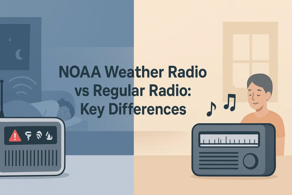
Indiana sits in the heart of Tornado Alley’s northern edge, where severe thunderstorms, tornadoes, and flash floods can develop with little warning. NOAA Weather Radio All Hazards broadcasts continuously on seven dedicated VHF frequencies between 162.400 MHz and 162.550 MHz, covering 95% of the U.S. population within 40 miles of a transmitter.
Indiana has multiple NWR transmitters strategically positioned across the state to minimize coverage gaps. Knowing which station serves your county, and programming its exact frequency into your NOAA weather alert radio, is the single most important step in building a reliable home emergency alert system.
| Photo | Popular Portable Walkie Talkies | Price |
|---|---|---|
 | SKIWARRIOR Multifunctional Smart Wireless Ski Goggles with Walkie-Talkie, Anti-Fog Zeiss Lens, Music & Call Function (Cylindrical Blue) | Check Price On Amazon |
 | SINORISE Super Mini Walkie Talkies, Two-Way Radios, 3 Pack | Check Price On Amazon |
 | KOSPET Tank M4C Smart Watch Rugged, Dual-Band GPS, 5ATM & IP69K Waterproof | Check Price On Amazon |
 | Retevis RT15 Walkie Talkies 3 Pack, Birthday Gift, Outdoor Adventure Kit | Check Price On Amazon |
 | Rechargeable Walkie Talkies Toys for Kids: DIY Astronaut Walkie Talkies for Boys Christmas Birthday Gifts for 3 4 5 6 7 8 9 10 Boy Walkie Talkie Outdoor Hiking Toy 2 Way Radio Camping Outdoor Game | Check Price On Amazon |
What Is the NOAA Weather Radio Network and How Does It Work in Indiana?
NOAA Weather Radio All Hazards (NWR) is a nationwide network of radio stations broadcasting continuous weather information directly from National Weather Service offices. In Indiana, broadcasts originate from NWS offices in Indianapolis, Northern Indiana (Syracuse), Louisville (covering southern Indiana), and Wilmington (covering southeastern Indiana).
NWR transmitters operate on one of seven designated VHF-FM frequencies. All seven frequencies fall within the 162 MHz band, which the FCC has allocated exclusively to NOAA under its regulatory authority over government radio services.
The seven NWR broadcast frequencies are:
- 162.400 MHz (WX4)
- 162.425 MHz (WX5)
- 162.450 MHz (WX6)
- 162.475 MHz (WX7)
- 162.500 MHz (WX3)
- 162.525 MHz (WX2)
- 162.550 MHz (WX1)
Each transmitter broadcasts on exactly one of these frequencies. No two transmitters in the same geographic area share a frequency, which prevents interference between adjacent stations.
The NWR system works because VHF-FM signals at 162 MHz propagate effectively over relatively flat terrain, which describes most of Indiana. Line-of-sight propagation at this frequency covers a reliable radius of 25 to 40 miles from each transmitter under normal atmospheric conditions.
This only works when your receiver is within that radius and is tuned to the correct frequency. If you are in a fringe coverage area between two transmitters, your weather radio with S.A.M.E. technology may receive signals from both, but alerts will only be activated by the station serving your programmed county code.
NWR broadcasts 24 hours a day, 365 days a year. Content includes current conditions, forecasts, warnings, watches, advisories, and non-weather hazard alerts including AMBER Alerts, hazardous materials incidents, and national security information under the Integrated Public Alert and Warning System (IPAWS).
The key fact for Indiana residents is this: programming the correct station frequency for your county, combined with the correct 6-digit FIPS S.A.M.E. code, ensures your radio alerts you only for your specific county rather than for every county in a multi-state broadcast area.
Indiana NOAA Weather Radio Stations: Complete Frequency and Location List
Indiana is served by 12 primary NWR transmitters, covering all 92 counties. The table below lists every active station with its call sign, broadcast frequency, transmitter location, NWS office of origin, and the primary counties served.
Use the table below to identify which station and frequency serves your Indiana county.
| Call Sign | Frequency (MHz) | Transmitter Location | NWS Office | Primary Coverage Area |
|---|---|---|---|---|
| WXL58 | 162.550 | Indianapolis, IN | NWS Indianapolis | Central Indiana (Marion, Hamilton, Hendricks, Johnson, Boone, Hancock) |
| WXK49 | 162.475 | Connersville, IN | NWS Indianapolis | East-central Indiana (Fayette, Rush, Decatur, Shelby, Franklin, Union) |
| WXJ22 | 162.400 | Bloomington, IN | NWS Indianapolis | South-central Indiana (Monroe, Lawrence, Owen, Morgan, Greene, Brown) |
| WXL57 | 162.525 | Terre Haute, IN | NWS Indianapolis | West-central Indiana (Vigo, Clay, Parke, Vermillion, Sullivan, Putnam) |
| KEC83 | 162.550 | Muncie, IN | NWS Indianapolis | East-central Indiana (Delaware, Randolph, Henry, Madison, Grant, Blackford) |
| WXK77 | 162.425 | Fort Wayne, IN | NWS Northern Indiana | Northeast Indiana (Allen, DeKalb, Noble, Whitley, Wells, Adams) |
| WXL37 | 162.500 | South Bend, IN | NWS Northern Indiana | North-central Indiana (St. Joseph, Elkhart, Marshall, Kosciusko, Starke) |
| WXK29 | 162.400 | Rensselaer, IN | NWS Northern Indiana | Northwest Indiana (Jasper, Newton, Benton, White, Pulaski, Fulton) |
| WXL56 | 162.550 | Gary/Valparaiso, IN | NWS Chicago | Northwest corner of Indiana (Lake, Porter, LaPorte, Starke) |
| WXK74 | 162.475 | Seymour, IN | NWS Louisville | South-central Indiana (Jackson, Bartholomew, Jennings, Jefferson, Scott, Washington) |
| WXJ20 | 162.400 | Evansville, IN | NWS Paducah | Southwest Indiana (Vanderburgh, Warrick, Posey, Gibson, Pike, Dubois) |
| WWG58 | 162.525 | Lawrenceburg, IN | NWS Wilmington | Southeast Indiana (Dearborn, Ohio, Switzerland, Ripley, Jefferson) |
Indiana borders five states and is served by six different NWS offices, which is why some Indiana counties receive alerts from offices in Louisville, Paducah, Chicago, or Wilmington rather than from the Indianapolis or Northern Indiana offices.
Indiana NOAA Weather Radio Frequencies by County: The Complete Reference
Every Indiana county is assigned to a primary NWR transmitter. Programming the frequency for your specific county ensures the strongest possible signal and the most accurate alert targeting. The table below maps all 92 Indiana counties to their primary NWR station and frequency.
Use the table below to find your county’s primary NOAA Weather Radio frequency and the correct station to program into your receiver.
| County | Frequency (MHz) | Station | NWS Office |
|---|---|---|---|
| Adams | 162.425 | WXK77 Fort Wayne | NWS Northern Indiana |
| Allen | 162.425 | WXK77 Fort Wayne | NWS Northern Indiana |
| Bartholomew | 162.475 | WXK74 Seymour | NWS Louisville |
| Benton | 162.400 | WXK29 Rensselaer | NWS Northern Indiana |
| Blackford | 162.550 | KEC83 Muncie | NWS Indianapolis |
| Boone | 162.550 | WXL58 Indianapolis | NWS Indianapolis |
| Brown | 162.400 | WXJ22 Bloomington | NWS Indianapolis |
| Carroll | 162.550 | WXL58 Indianapolis | NWS Indianapolis |
| Cass | 162.500 | WXL37 South Bend | NWS Northern Indiana |
| Clark | 162.475 | WXK74 Seymour | NWS Louisville |
| Clay | 162.525 | WXL57 Terre Haute | NWS Indianapolis |
| Clinton | 162.550 | WXL58 Indianapolis | NWS Indianapolis |
| Crawford | 162.400 | WXJ20 Evansville | NWS Paducah |
| Daviess | 162.400 | WXJ20 Evansville | NWS Paducah |
| Dearborn | 162.525 | WWG58 Lawrenceburg | NWS Wilmington |
| Decatur | 162.475 | WXK49 Connersville | NWS Indianapolis |
| DeKalb | 162.425 | WXK77 Fort Wayne | NWS Northern Indiana |
| Delaware | 162.550 | KEC83 Muncie | NWS Indianapolis |
| Dubois | 162.400 | WXJ20 Evansville | NWS Paducah |
| Elkhart | 162.500 | WXL37 South Bend | NWS Northern Indiana |
| Fayette | 162.475 | WXK49 Connersville | NWS Indianapolis |
| Floyd | 162.475 | WXK74 Seymour | NWS Louisville |
| Fountain | 162.525 | WXL57 Terre Haute | NWS Indianapolis |
| Franklin | 162.475 | WXK49 Connersville | NWS Indianapolis |
| Fulton | 162.400 | WXK29 Rensselaer | NWS Northern Indiana |
| Gibson | 162.400 | WXJ20 Evansville | NWS Paducah |
| Grant | 162.550 | KEC83 Muncie | NWS Indianapolis |
| Greene | 162.400 | WXJ22 Bloomington | NWS Indianapolis |
| Hamilton | 162.550 | WXL58 Indianapolis | NWS Indianapolis |
| Hancock | 162.550 | WXL58 Indianapolis | NWS Indianapolis |
| Harrison | 162.475 | WXK74 Seymour | NWS Louisville |
| Hendricks | 162.550 | WXL58 Indianapolis | NWS Indianapolis |
| Henry | 162.550 | KEC83 Muncie | NWS Indianapolis |
| Howard | 162.550 | WXL58 Indianapolis | NWS Indianapolis |
| Huntington | 162.425 | WXK77 Fort Wayne | NWS Northern Indiana |
| Jackson | 162.475 | WXK74 Seymour | NWS Louisville |
| Jasper | 162.400 | WXK29 Rensselaer | NWS Northern Indiana |
| Jay | 162.425 | WXK77 Fort Wayne | NWS Northern Indiana |
| Jefferson | 162.525 | WWG58 Lawrenceburg | NWS Wilmington |
| Jennings | 162.475 | WXK74 Seymour | NWS Louisville |
| Johnson | 162.550 | WXL58 Indianapolis | NWS Indianapolis |
| Knox | 162.525 | WXL57 Terre Haute | NWS Indianapolis |
| Kosciusko | 162.500 | WXL37 South Bend | NWS Northern Indiana |
| LaGrange | 162.500 | WXL37 South Bend | NWS Northern Indiana |
| Lake | 162.550 | WXL56 Gary/Valparaiso | NWS Chicago |
| LaPorte | 162.550 | WXL56 Gary/Valparaiso | NWS Chicago |
| Lawrence | 162.400 | WXJ22 Bloomington | NWS Indianapolis |
| Madison | 162.550 | KEC83 Muncie | NWS Indianapolis |
| Marion | 162.550 | WXL58 Indianapolis | NWS Indianapolis |
| Marshall | 162.500 | WXL37 South Bend | NWS Northern Indiana |
| Martin | 162.400 | WXJ22 Bloomington | NWS Indianapolis |
| Miami | 162.500 | WXL37 South Bend | NWS Northern Indiana |
| Monroe | 162.400 | WXJ22 Bloomington | NWS Indianapolis |
| Montgomery | 162.550 | WXL58 Indianapolis | NWS Indianapolis |
| Morgan | 162.400 | WXJ22 Bloomington | NWS Indianapolis |
| Newton | 162.400 | WXK29 Rensselaer | NWS Northern Indiana |
| Noble | 162.425 | WXK77 Fort Wayne | NWS Northern Indiana |
| Ohio | 162.525 | WWG58 Lawrenceburg | NWS Wilmington |
| Orange | 162.400 | WXJ22 Bloomington | NWS Indianapolis |
| Owen | 162.400 | WXJ22 Bloomington | NWS Indianapolis |
| Parke | 162.525 | WXL57 Terre Haute | NWS Indianapolis |
| Perry | 162.400 | WXJ20 Evansville | NWS Paducah |
| Pike | 162.400 | WXJ20 Evansville | NWS Paducah |
| Porter | 162.550 | WXL56 Gary/Valparaiso | NWS Chicago |
| Posey | 162.400 | WXJ20 Evansville | NWS Paducah |
| Pulaski | 162.400 | WXK29 Rensselaer | NWS Northern Indiana |
| Putnam | 162.525 | WXL57 Terre Haute | NWS Indianapolis |
| Randolph | 162.550 | KEC83 Muncie | NWS Indianapolis |
| Ripley | 162.525 | WWG58 Lawrenceburg | NWS Wilmington |
| Rush | 162.475 | WXK49 Connersville | NWS Indianapolis |
| Scott | 162.475 | WXK74 Seymour | NWS Louisville |
| Shelby | 162.475 | WXK49 Connersville | NWS Indianapolis |
| Spencer | 162.400 | WXJ20 Evansville | NWS Paducah |
| Starke | 162.500 | WXL37 South Bend | NWS Northern Indiana |
| Steuben | 162.425 | WXK77 Fort Wayne | NWS Northern Indiana |
| St. Joseph | 162.500 | WXL37 South Bend | NWS Northern Indiana |
| Sullivan | 162.525 | WXL57 Terre Haute | NWS Indianapolis |
| Switzerland | 162.525 | WWG58 Lawrenceburg | NWS Wilmington |
| Tippecanoe | 162.550 | WXL58 Indianapolis | NWS Indianapolis |
| Tipton | 162.550 | WXL58 Indianapolis | NWS Indianapolis |
| Union | 162.475 | WXK49 Connersville | NWS Indianapolis |
| Vanderburgh | 162.400 | WXJ20 Evansville | NWS Paducah |
| Vermillion | 162.525 | WXL57 Terre Haute | NWS Indianapolis |
| Vigo | 162.525 | WXL57 Terre Haute | NWS Indianapolis |
| Wabash | 162.500 | WXL37 South Bend | NWS Northern Indiana |
| Warren | 162.525 | WXL57 Terre Haute | NWS Indianapolis |
| Warrick | 162.400 | WXJ20 Evansville | NWS Paducah |
| Washington | 162.475 | WXK74 Seymour | NWS Louisville |
| Wayne | 162.475 | WXK49 Connersville | NWS Indianapolis |
| Wells | 162.425 | WXK77 Fort Wayne | NWS Northern Indiana |
| White | 162.400 | WXK29 Rensselaer | NWS Northern Indiana |
| Whitley | 162.425 | WXK77 Fort Wayne | NWS Northern Indiana |
Once you know your county’s primary frequency, the next step is finding and programming the correct 6-digit FIPS S.A.M.E. code to filter alerts down to your specific county only.
Indiana FIPS S.A.M.E. Codes: How to Program County-Specific Alerts
S.A.M.E. stands for Specific Area Message Encoding. It is a digital subcode system built into NWR broadcasts that allows a weather radio receiver to activate only for alerts affecting a specific geographic area. Without S.A.M.E., your radio will sound the alert tone for every county in the entire broadcast area, which can cover 20 to 30 counties across multiple states.
According to NOAA NWR technical documentation, each S.A.M.E. code is a 6-digit FIPS (Federal Information Processing Standard) number. The first two digits are the state code (18 for Indiana), followed by the three-digit county code assigned by the U.S. Census Bureau.
A S.A.M.E.-capable weather radio like the Midland WR120 lets you program up to three county codes simultaneously, which is useful if you live near a county line or commute regularly between counties.
The complete Indiana S.A.M.E. FIPS code list for all 92 counties is below.
Use the table below to find the 6-digit code to enter into your weather radio’s S.A.M.E. programming menu.
| County | FIPS S.A.M.E. Code | County | FIPS S.A.M.E. Code |
|---|---|---|---|
| Adams | 018001 | Lawrence | 018093 |
| Allen | 018003 | Madison | 018095 |
| Bartholomew | 018005 | Marion | 018097 |
| Benton | 018007 | Marshall | 018099 |
| Blackford | 018009 | Martin | 018101 |
| Boone | 018011 | Miami | 018103 |
| Brown | 018013 | Monroe | 018105 |
| Carroll | 018015 | Montgomery | 018107 |
| Cass | 018017 | Morgan | 018109 |
| Clark | 018019 | Newton | 018111 |
| Clay | 018021 | Noble | 018113 |
| Clinton | 018023 | Ohio | 018115 |
| Crawford | 018025 | Orange | 018117 |
| Daviess | 018027 | Owen | 018119 |
| Dearborn | 018029 | Parke | 018121 |
| Decatur | 018031 | Perry | 018123 |
| DeKalb | 018033 | Pike | 018125 |
| Delaware | 018035 | Porter | 018127 |
| Dubois | 018037 | Posey | 018129 |
| Elkhart | 018039 | Pulaski | 018131 |
| Fayette | 018041 | Putnam | 018133 |
| Floyd | 018043 | Randolph | 018135 |
| Fountain | 018045 | Ripley | 018137 |
| Franklin | 018047 | Rush | 018139 |
| Fulton | 018049 | Scott | 018143 |
| Gibson | 018051 | Shelby | 018145 |
| Grant | 018053 | Spencer | 018147 |
| Greene | 018055 | Starke | 018149 |
| Hamilton | 018057 | Steuben | 018151 |
| Hancock | 018059 | St. Joseph | 018141 |
| Harrison | 018061 | Sullivan | 018153 |
| Hendricks | 018063 | Switzerland | 018155 |
| Henry | 018065 | Tippecanoe | 018157 |
| Howard | 018067 | Tipton | 018159 |
| Huntington | 018069 | Union | 018161 |
| Jackson | 018071 | Vanderburgh | 018163 |
| Jasper | 018073 | Vermillion | 018165 |
| Jay | 018075 | Vigo | 018167 |
| Jefferson | 018077 | Wabash | 018169 |
| Jennings | 018079 | Warren | 018171 |
| Johnson | 018081 | Warrick | 018173 |
| Knox | 018083 | Washington | 018175 |
| Kosciusko | 018085 | Wayne | 018177 |
| LaGrange | 018087 | Wells | 018179 |
| Lake | 018089 | White | 018181 |
| LaPorte | 018091 | Whitley | 018183 |
Programming both the correct frequency and the correct FIPS code is the difference between a weather radio that alerts you only for Monroe County and one that wakes you at 3 a.m. for a flood warning in a county 200 miles away.
If you want to understand the full mechanics of how S.A.M.E. technology filters alerts at the county level, the explanation of how S.A.M.E. county-code filtering works covers the encoding format, alert categories, and how receivers decode broadcast signals.
Which Indiana Weather Radio Receivers Work Best for Indiana Counties?
The best weather radio for Indiana is one that receives all seven NWR frequencies (162.400 to 162.550 MHz), supports S.A.M.E. county-code filtering, and has a battery backup that activates automatically during power outages. Those three features together cover the three most common failure points during Indiana severe weather events: missed alerts from wrong county selection, power loss during storms, and inability to receive a specific transmitter’s frequency.
According to NOAA NWR documentation, all seven broadcast frequencies must be receivable by a compliant weather radio receiver. The practical issue for Indiana residents is that receivers without S.A.M.E. will broadcast alerts for all counties served by the transmitter, which can span 20 to 30 counties.
The Midland WR400 weather alert radio is one of the most popular choices for Indiana households.
- Frequencies received: All 7 NWR frequencies (162.400 to 162.550 MHz)
- S.A.M.E. codes programmable: Up to 50 location codes
- Alert types: 25 different NWS alert categories
- Power: AC adapter with 3x AA battery backup
- Display: Backlit LCD showing alert type, county, and time
The Uniden BC365CRS weather radio adds a clock-radio function and is a strong choice for bedrooms where silent alerts need to trigger an audible alarm.
- Frequencies received: All 7 NWR frequencies
- S.A.M.E. codes programmable: Up to 25 location codes
- Alert types: All standard EAS alert categories
- Power: AC adapter with 4x AA battery backup
- Display: AM/FM clock radio with weather alert interrupt
For outdoor use, camping, or situations where AC power is not available, a hand-crank emergency weather radio like the Midland ER310 provides NWR reception plus solar charging, a USB phone charging port, and a built-in LED flashlight.
- Frequencies received: All 7 NWR frequencies plus AM/FM
- S.A.M.E. alert support: Yes, with programmable county codes
- Power sources: Hand crank, solar panel, AA batteries, USB-C input
- Battery capacity: 2000 mAh internal lithium-ion battery
- Additional features: 1000-lumen flashlight, USB phone charging output
Use the table below to compare the three receiver tiers and choose the right fit for your Indiana home or emergency kit.
| Feature | Midland WR400 | Uniden BC365CRS | Midland ER310 |
|---|---|---|---|
| All 7 NWR Frequencies | Yes | Yes | Yes |
| S.A.M.E. County Filtering | Yes (50 codes) | Yes (25 codes) | Yes |
| Battery Backup | 3x AA | 4x AA | 2000 mAh Li-ion + crank |
| Portable (No AC) | Limited | Limited | Yes, fully portable |
| Clock Radio Function | No | Yes | No |
| Best Use Case | Home desktop alert | Bedroom night alert | Emergency kit or camping |
| Approximate Price | $35 to $55 | $30 to $50 | $50 to $80 |
The right receiver for most Indiana households is the Midland WR400, placed centrally in the home with batteries installed and ready so it continues to alert even when the power goes out during a severe storm.
Indiana’s Severe Weather Seasons and Which Alert Types to Expect Month by Month
Indiana experiences severe weather across all four seasons, but the frequency and type of alerts issued via NOAA Weather Radio All Hazards varies significantly by month. The NWS Indianapolis office issues an average of several hundred severe weather products per year, with the highest alert volume concentrated in spring (March through June) and secondary peaks in late fall (November) and winter.
Understanding which alert types are most likely each month helps you calibrate your weather radio’s alert type settings correctly on a programmable weather radio like the Sangean CL-100, which allows selective alerting by event type.
The NWR alert type categories most relevant to Indiana, as defined by NOAA and transmitted via the EAS (Emergency Alert System), include:
- Tornado Warning: Peak months March through June; secondary peak September to October
- Tornado Watch: Same seasonal pattern as Tornado Warning
- Severe Thunderstorm Warning: April through August, heaviest in May and June
- Flash Flood Warning: Year-round, but highest frequency in April through July
- Winter Storm Warning: November through March; heaviest in January and February
- Ice Storm Warning: December through February
- Dense Fog Advisory: October through March
- Hazardous Materials Warning: Year-round (non-seasonal)
- Civil Emergency Message: Year-round (non-seasonal)
- AMBER Alert: Year-round (non-seasonal)
Indiana’s tornado risk is concentrated in the southwestern and central portions of the state. Counties in the Wabash Valley (Vigo, Sullivan, Knox, Gibson, Posey, Vanderburgh) and the central plains (Tippecanoe, Clinton, Carroll, Howard, Tipton) have historically seen higher tornado activity.
Northern Indiana lake-effect snow from Lake Michigan produces the most intense winter weather alerts for Lake, Porter, LaPorte, St. Joseph, Elkhart, and LaGrange counties, which are served by the NWS Northern Indiana (Syracuse) and NWS Chicago offices.
The seasonal variation in Indiana’s alert types is why setting your weather radio to receive all programmed alert categories year-round, rather than disabling winter alerts in summer, ensures you never miss a critical event.
For a complete breakdown of how to set your weather radio’s alert type programming for Indiana severe weather seasons, the resource covering configuring a weather radio for home emergency preparedness walks through the alert type menu settings step by step.
The chart below shows Indiana’s approximate NWR alert volume distribution by season across all 92 counties, based on historical NWS Indianapolis and NWS Northern Indiana alert issuance patterns.
Frequency Reference
Indiana NWR Alert Volume by Season and Type
Approximate seasonal distribution of alert types relevant to Indiana. Source: NWS Indianapolis historical alert data.
How to Program an Indiana NOAA Weather Radio: Step-by-Step Setup
Programming a weather radio for Indiana coverage takes less than five minutes once you have your county’s NWR frequency and FIPS S.A.M.E. code from the tables above. The process below applies to most current S.A.M.E.-capable receivers including the Midland WR400, Midland WR120, Uniden BC365CRS, and Sangean CL-100.
The programming steps use the standard menu structure common to NOAA-compliant receivers. Button labels may differ slightly by model, but the programming sequence is the same.
- Power on and press the MENU or PROGRAM button. The display will show a programming mode indicator. On the Midland WR400, hold the SNOOZE/MENU button for 3 seconds to enter programming mode.
- Select the WX frequency channel. Use the UP/DOWN buttons to scroll through the 7 NWR frequencies (162.400 to 162.550 MHz). Select the frequency listed for your county in the tables above. Confirm with ENTER or OK.
- Enter S.A.M.E. programming mode. Select the S.A.M.E. or LOCATION option in the menu. The display will prompt you to enter a 6-digit FIPS code.
- Enter your county’s 6-digit FIPS code. Use the keypad or UP/DOWN buttons to enter the code. For Marion County (Indianapolis), enter 018097. For Allen County (Fort Wayne), enter 018003.
- Add up to two additional county codes if needed. If you live near a county line or frequently travel to an adjacent county, program those FIPS codes as well. The Midland WR400 supports up to 50 codes; the Uniden BC365CRS supports up to 25.
- Set your alert type preferences. Select which alert categories should trigger the alarm tone. For Indiana, enable at minimum: Tornado Warning, Tornado Watch, Severe Thunderstorm Warning, Flash Flood Warning, and Winter Storm Warning.
- Set alert volume and alarm type. Choose whether alerts trigger a loud alarm tone, a voice announcement only, or both. Set the volume to the highest setting for overnight alerting so the alarm wakes you during sleeping hours.
- Test the programming by pressing the TEST button. The radio should display your programmed county name and play a brief test tone. If the display shows the wrong county or no county name, re-enter the FIPS code.
If your programmed weather radio is not activating for alerts you know were issued for your county, the most common cause is a mistyped FIPS code or the wrong NWR frequency selected for your area.
After programming, install fresh batteries in the battery backup compartment. Indiana’s most dangerous severe weather events (tornadoes and severe thunderstorms) often cause power outages precisely when alerts are most critical.
Correct programming of both frequency and S.A.M.E. code is what separates a weather radio that genuinely protects your household from one that is simply a device sitting on a shelf.
Indiana Coverage Gaps: Where NWR Reception Is Weakest
NOAA NWR transmitters cover approximately 97% of Indiana’s population, but there are geographic areas where signal reception is weaker than average. Coverage gaps occur when a county lies at the edge of multiple transmitter coverage areas without strong signal from any single station, when terrain features (river valleys, bluffs along the Ohio River) create shadowing, or when a receiver is located in a basement, metal-sided building, or area with significant radio frequency interference.
The counties most likely to experience marginal NWR reception in Indiana include:
- Harrison, Crawford, Perry, Spencer counties (southern Indiana): Located at the outer edge of both the Evansville (WXJ20) and Seymour (WXK74) coverage areas. Ohio River valley terrain can create signal shadows.
- Dearborn, Ohio, Switzerland counties (southeast Indiana): Served by the Lawrenceburg (WWG58) transmitter, which covers a relatively small geographic footprint. These counties also receive partial signal from Ohio-based transmitters.
- Fountain, Warren, Vermillion counties (west-central Indiana): Fringe coverage between the Terre Haute (WXL57) transmitter and Illinois-based transmitters. Residents may benefit from programming both the Terre Haute frequency and an adjacent Illinois transmitter as backup.
- Newton, Benton counties (northwest Indiana): Transition zone between the Rensselaer (WXK29) transmitter and Illinois transmitters serving the Chicago-area market.
The fix for marginal NWR reception is a higher-gain external VHF antenna connected to the weather radio’s external antenna port (available on most desktop receivers). Moving the antenna to an elevated location, such as a second-floor window or attic, can increase signal strength by 10 to 15 dB at 162 MHz, which often resolves fringe-area reception problems entirely.
This works because NWR signals at 162 MHz propagate via line-of-sight. Any additional elevation you can give the receive antenna directly reduces the chance that terrain, buildings, or other obstructions break the transmission path between the transmitter and your receiver.
If the external antenna upgrade does not resolve the issue, program a second NWR frequency from an adjacent transmitter as a backup channel. For Harrison County residents, for example, programming both WXK74 at 162.475 MHz (Seymour) and attempting to receive the Louisville, Kentucky NWR transmitter at 162.400 MHz provides a backup signal path.
For residents in any of these fringe counties, understanding the full coverage picture across all Indiana transmitter locations is essential; the overview of NOAA transmitter coverage maps and station locations by state provides the geographic context needed to identify the best backup frequency for your specific address.
Programming a backup frequency from an adjacent transmitter and investing in a window-mounted external antenna are the two most cost-effective solutions for Indiana residents in NWR fringe coverage zones.
How Indiana NWR Compares to Wireless Emergency Alerts (WEA) on Your Cell Phone
A NOAA weather radio and the Wireless Emergency Alert (WEA) system on your smartphone are not the same thing, and they do not always send the same alerts at the same time. NWR broadcasts continuously at 162 MHz and is activated by NWS meteorologists the moment a warning is issued. WEA alerts are pushed by the cellular network to phones in a geographic area, which introduces a 1 to 5 minute delay relative to NWR in some documented cases.
According to FEMA’s IPAWS (Integrated Public Alert and Warning System) documentation, WEA and NWR operate as parallel, complementary systems rather than as redundant backups. Each has failure modes the other does not share.
Use the table below to compare NWR and WEA across the factors most relevant to Indiana severe weather preparedness.
| Factor | NOAA Weather Radio (NWR) | Wireless Emergency Alert (WEA) |
|---|---|---|
| Broadcast frequency | 162.400 to 162.550 MHz (VHF) | Cellular LTE/5G network |
| Works during power outage | Yes (with battery backup) | Only if cell network operational |
| Works if cell towers down | Yes (independent of cellular) | No |
| Alert delay from issuance | Near-instantaneous (seconds) | 1 to 5 minutes typical |
| County-specific targeting | Yes, via S.A.M.E. FIPS codes | Yes, by cell tower coverage area |
| Alert detail (voice) | Full voice broadcast with details | Text only (90-character limit) |
| Alerts if phone silenced or off | Yes, always on | Overrides silence; off if phone off |
| Non-weather hazard alerts | Yes (AMBER, HAZMAT, Civil Emergency) | Yes (AMBER, Presidential) |
Indiana emergency management professionals consistently recommend using both systems together. NWR provides the fastest and most reliable alert path when cellular networks are congested or damaged, which is exactly the scenario that occurs during a major tornado or ice storm event.
Indiana Weather Radio Frequencies for Travelers and Visitors
If you are traveling through Indiana, camping in a state or national forest, or visiting from a neighboring state, knowing which NWR frequency to scan for your current location is simpler than it sounds. The WX channel designations (WX1 through WX7) on most weather radios map directly to specific frequencies, and the channel-to-frequency assignment is standardized across all receivers.
The WX channel numbering on most walkie-talkies and two-way radios with WX channels follows this standard assignment:
- WX1: 162.550 MHz
- WX2: 162.525 MHz
- WX3: 162.500 MHz
- WX4: 162.400 MHz
- WX5: 162.425 MHz
- WX6: 162.450 MHz
- WX7: 162.475 MHz
For travelers moving through Indiana, scanning WX1 (162.550 MHz) first covers the Indianapolis, Gary/Valparaiso, and Muncie transmitters. Scanning WX3 (162.500 MHz) covers the South Bend transmitter serving north-central Indiana. If you are in southwest Indiana near Evansville, scan WX4 (162.400 MHz) for the Paducah-controlled transmitter.
Many GMRS and FRS handheld radios include WX channel scanning capability. A GMRS radio like the Midland GXT1000VP4 scans all 7 WX channels and alerts you to incoming NWR broadcasts even when the radio is in scan mode on FRS/GMRS channels.
The complete guide to all seven NOAA Weather Radio broadcast frequencies and their nationwide transmitter assignments is the best reference for travelers crossing state lines who need to identify the correct WX frequency for their current location.
For any Indiana traveler, the practical rule is to scan WX1 first, then WX3, then WX4, covering the three most common frequencies used by Indiana NWR transmitters.
Frequently Asked Questions About Indiana NOAA Weather Radio Frequencies and Stations
What frequency does NOAA weather radio broadcast on in Indianapolis?
NOAA Weather Radio in Indianapolis broadcasts on 162.550 MHz from the WXL58 transmitter. This transmitter is operated by the NWS Indianapolis office and serves Marion County and the surrounding central Indiana counties including Hamilton, Hendricks, Johnson, Boone, and Hancock.
The WXL58 transmitter is the primary NWR station for central Indiana. Marion County residents should program 162.550 MHz as their primary frequency and FIPS S.A.M.E. code 018097 to receive alerts specifically for Marion County.
How many NOAA weather radio stations serve Indiana?
Indiana is served by 12 primary NWR transmitters. These are operated by six NWS offices: NWS Indianapolis, NWS Northern Indiana (Syracuse), NWS Louisville, NWS Paducah, NWS Chicago, and NWS Wilmington.
The multi-office coverage is why some Indiana counties receive alerts from out-of-state NWS offices. Southern Indiana counties near the Ohio River and Kentucky border fall under the Louisville and Paducah forecast areas, while the northwest Indiana counties near Chicago are served by the NWS Chicago office.
What is the NOAA weather radio frequency for Fort Wayne, Indiana?
The NOAA weather radio frequency for Fort Wayne and Allen County is 162.425 MHz, broadcast from the WXK77 transmitter located in Fort Wayne. This transmitter is operated by the NWS Northern Indiana office in Syracuse.
Allen County’s FIPS S.A.M.E. code is 018003. Program both 162.425 MHz and the code 018003 into your weather radio to receive only Allen County alerts from the WXK77 transmitter.
What is the difference between a weather watch and a weather warning on NWR?
A weather watch means conditions are favorable for a severe weather event to develop within the next 6 to 48 hours. A weather warning means a severe weather event is imminent or already occurring in the specified area.
Watches require you to monitor the situation and prepare. Warnings require immediate protective action. Your weather radio’s S.A.M.E. system can be configured to trigger the alarm tone for both watches and warnings, or for warnings only. For overnight protection in Indiana tornado season, configure your receiver to alarm on both.
Can I use a two-way radio or walkie-talkie to transmit on NOAA weather radio frequencies?
No. The 162.400 to 162.550 MHz frequencies are allocated exclusively to NOAA for one-way government broadcasts. Transmitting on these frequencies with any radio is illegal under FCC regulations and carries penalties of up to $10,000 per violation.
These frequencies are receive-only for the public. Two-way radios with WX channel capability can tune to these frequencies to listen, but no transmit function is available on WX channels per FCC rules. Consumer weather radios, GMRS radios, and FRS radios are all built to prevent transmission on WX frequencies.
Why is my Indiana weather radio alerting for counties other than mine?
Your weather radio is alerting for other counties because it is not programmed with a S.A.M.E. FIPS code, or the S.A.M.E. code entered is incorrect. Without a programmed S.A.M.E. code, the radio activates for every alert broadcast by the transmitter, which may cover 20 or more counties.
Find your county’s 6-digit FIPS code in the table above, enter it in your radio’s S.A.M.E. programming menu, and the radio will only alarm for alerts specifically targeting your county. If you have already entered a code and still receive alerts for other counties, re-check the code against the table above as a single digit error will cause incorrect filtering.
What is the NOAA weather radio frequency for South Bend, Indiana?
The NOAA weather radio frequency for South Bend and St. Joseph County is 162.500 MHz, broadcast from the WXL37 transmitter. This transmitter is operated by the NWS Northern Indiana office and covers north-central Indiana including Elkhart, Marshall, Kosciusko, Starke, Cass, Miami, Wabash, and LaGrange counties in addition to St. Joseph County.
St. Joseph County’s FIPS S.A.M.E. code is 018141. Program 162.500 MHz and code 018141 to receive South Bend and St. Joseph County alerts specifically.
Do I need a special radio to receive NOAA weather alerts in Indiana, or can I use a regular FM radio?
You need a dedicated NOAA weather radio receiver. Standard AM/FM radios cannot receive NWR broadcasts because the NWR frequencies (162.400 to 162.550 MHz) fall in the VHF band above the standard FM broadcast band (87.5 to 108 MHz), which standard FM radios cannot tune to.
A dedicated NWR receiver costs $25 to $80 and is the only device that provides automatic alarm activation for NWS-issued warnings. A S.A.M.E. weather radio with battery backup is the minimum recommended equipment for Indiana households.
Can I receive Indiana NOAA weather radio on a ham radio or scanner?
Yes. Any VHF receiver that can tune to 162.400 through 162.550 MHz can receive NWR broadcasts. This includes amateur (ham) handheld transceivers like the Baofeng UV-5R, scanner radios, and GMRS handhelds with WX channel capability.
The limitation is that handheld transceivers and scanners do not have S.A.M.E. decoding chips, so they cannot automatically alarm for specific-county alerts. They receive the audio broadcast continuously but cannot distinguish a Marion County alert from a Tippecanoe County alert without a built-in S.A.M.E. decoder. For automatic alarm alerting, a dedicated NWR receiver with S.A.M.E. remains necessary.
How do I know which NWS office issues alerts for my Indiana county?
Your county’s responsible NWS office is determined by which NWS forecast area your county falls within. Most Indiana counties are served by NWS Indianapolis or NWS Northern Indiana. Southern Indiana counties near the Kentucky border fall under NWS Louisville or NWS Paducah. Southeast Indiana counties fall under NWS Wilmington. Northwest Indiana counties near Chicago fall under NWS Chicago.
The transmitter-to-NWS-office assignment in the station table above shows which office controls the broadcast for each Indiana transmitter. Your county’s assigned NWS office is the one that issues forecasts, warnings, and watches for your area.
What is the difference between a NOAA weather radio and a WEA alert on my phone?
A NOAA weather radio receives a dedicated VHF broadcast at 162 MHz directly from NOAA transmitters and is independent of the cellular network. A Wireless Emergency Alert (WEA) is delivered via cell tower to your phone and requires the cellular network to be operational.
NWR activates within seconds of a warning issuance. WEA alerts can take 1 to 5 minutes longer in some cases. NWR operates during power outages when your radio has battery backup; WEA requires functioning cell towers, which may be damaged during a severe tornado event. Both systems should be used together for maximum coverage in Indiana.
Why does my Indiana weather radio not alert me when I am in the basement?
NWR signals at 162 MHz are VHF line-of-sight signals that are significantly attenuated by concrete, steel-reinforced floors, and soil. A weather radio located in a basement, especially below grade with concrete walls and ceiling, may not receive a strong enough signal to activate the squelch and trigger the alarm.
The solution is to place the weather radio on the main floor of the house and use a loud alarm tone that can be heard from the basement, or to connect an external antenna cable that runs to a window-mounted or outdoor antenna while the receiver itself stays in the basement. An external VHF antenna placed at window height or above can overcome the signal attenuation caused by basement placement.
Is there a NOAA weather radio app that works the same as a dedicated receiver?
There are apps such as Weather Radio (iOS/Android) that stream NWR audio over the internet, but they are not equivalent to a dedicated receiver for emergency purposes. App-based NWR streaming requires internet connectivity, which depends on cellular data or Wi-Fi, both of which can fail during the same severe weather event that generates the alert.
A dedicated weather radio receiver at 162 MHz operates completely independently of the internet, cellular networks, and home Wi-Fi. Apps are useful supplements for monitoring while away from home but should not replace a dedicated receiver with battery backup for household emergency preparedness. The complete explanation of how NWR works and what it covers is available in the introduction to what NOAA Weather Radio All Hazards is and how the broadcast system operates.
My weather radio shows “searching for signal” on 162.550 MHz in northwest Indiana. What should I do?
In northwest Indiana (Lake, Porter, and LaPorte counties), 162.550 MHz is broadcast by the WXL56 Gary/Valparaiso transmitter operated by NWS Chicago. If your receiver shows “searching for signal” on this frequency, the transmitter signal may be blocked by terrain, buildings, or interference, or your receiver’s squelch may be set too high.
Try reducing the squelch sensitivity setting on your receiver if the option is available. If the problem persists, try connecting an external VHF antenna placed near a window facing west or northwest, toward the Gary/Valparaiso transmitter site. As a backup, program 162.400 MHz (WX4) as a secondary frequency, which is also receivable in some northwest Indiana locations from Illinois-based NWR transmitters.
Indiana Weather Radio Quick Reference: Key Facts Summarized
Indiana NOAA Weather Radio All Hazards operates across 12 transmitters on frequencies between 162.400 and 162.550 MHz, serving all 92 counties through six NWS offices. Every Indiana household benefits from a dedicated weather radio receiver programmed with the correct county-specific NWR frequency and 6-digit FIPS S.A.M.E. code, combined with fresh batteries in the backup compartment so alerts reach you even when the power grid goes down during a severe storm.
If you want to compare Indiana’s NWR transmitter coverage to other states or identify transmitter locations near state borders where Indiana counties overlap with neighboring state coverage areas, the complete state-by-state NOAA transmitter and frequency reference covers every NWR station in the continental United States.
Start today: find your county in the tables above, note the frequency and FIPS code, and program them into your weather radio right now. That five-minute task is the most effective single action you can take to ensure your household receives timely warning when Indiana severe weather develops.
| Photo | TOP RATED WALKIE TALKIES | Price |
|---|---|---|
 | Retevis RT628 Kids Walkie Talkies, Toys Gifts for 4-12 Year Old Girl Boy | Check Price On Amazon |
 | Cobra ACXT545 Weather-Resistant Walkie Talkies, Rechargeable, 22 Channels | Check Price On Amazon |
 | Retevis RT388 Kids Walkie Talkies, Outdoor Toys for Kids Camping Essentials | Check Price On Amazon |
 | Cobra RX680 Walkie Talkies (2-Pack), IP54 Water Resistant Design | Check Price On Amazon |
 | Retevis RT22 Walkie Talkies Long Range Rechargeable with Earpiece (2 Pack) | Check Price On Amazon |
 | Midland GXT1000VP4 GMRS JIS4 Two-Way Radio, Black,2 Pack | Check Price On Amazon |
 | Retevis RT628 Walkie Talkies for Kids,Toys Gifts for 6-12 Years Old Boys Girls,Long Range 2 Way Radio 22CH VOX,Birthday Gift,Family Walkie Talkie for Camping Hiking Indoor Outdoor | Check Price On Amazon |