NOAA Weather Radio All Hazards broadcasts 24 hours a day on seven dedicated frequencies between 162.400 and 162.550 MHz, covering roughly 95% of the U.S. population within 40 miles of a transmitter. In the Southeast, that coverage depends on knowing which specific station serves your county in Georgia, Alabama, Tennessee, North Carolina, or South Carolina.
This guide lists every active NOAA Weather Radio station across all five states, with call signs, transmit frequencies, transmitter locations, and the counties each station covers.
| Photo | Popular Portable Walkie Talkies | Price |
|---|---|---|
 | SKIWARRIOR Multifunctional Smart Wireless Ski Goggles with Walkie-Talkie, Anti-Fog Zeiss Lens, Music & Call Function (Cylindrical Blue) | Check Price On Amazon |
 | SINORISE Super Mini Walkie Talkies, Two-Way Radios, 3 Pack | Check Price On Amazon |
 | KOSPET Tank M4C Smart Watch Rugged, Dual-Band GPS, 5ATM & IP69K Waterproof | Check Price On Amazon |
 | Retevis RT15 Walkie Talkies 3 Pack, Birthday Gift, Outdoor Adventure Kit | Check Price On Amazon |
 | Rechargeable Walkie Talkies Toys for Kids: DIY Astronaut Walkie Talkies for Boys Christmas Birthday Gifts for 3 4 5 6 7 8 9 10 Boy Walkie Talkie Outdoor Hiking Toy 2 Way Radio Camping Outdoor Game | Check Price On Amazon |
What Is NOAA Weather Radio and Why Does It Matter in the Southeast?
NOAA Weather Radio All Hazards (NWR) is a nationwide network of radio transmitters operated by the National Oceanic and Atmospheric Administration, broadcasting continuous weather information directly from the nearest National Weather Service forecast office. According to NOAA’s NWR technical documentation, the network operates on seven VHF frequencies: 162.400, 162.425, 162.450, 162.475, 162.500, 162.525, and 162.550 MHz.
The Southeast is one of the most weather-vulnerable regions in the United States. Georgia, Alabama, Tennessee, North Carolina, and South Carolina collectively experience tornadoes, tropical storms, flash floods, ice storms, and severe thunderstorms throughout the year.
A NOAA weather alert radio with S.A.M.E. technology lets you program your specific county’s 6-digit FIPS code so the radio only activates for alerts in your area. Without S.A.M.E. (Specific Area Message Encoding), a radio will alarm for every county in a multi-county broadcast zone, not just yours.
Knowing your exact transmitter station, call sign, and frequency is the first step to programming your radio correctly.
How NOAA Weather Radio Stations Are Organized in the Southeast
Each NOAA Weather Radio station transmits on one of the seven standard WX frequencies and is identified by a unique call sign beginning with “KXX” or “WXX.” The station’s broadcast originates from the National Weather Service office with jurisdiction over that region.
The Southeast is served by NWS offices in Atlanta (Georgia), Birmingham (Alabama), Huntsville (Alabama), Nashville (Tennessee), Memphis (Tennessee), Morristown (Tennessee), Raleigh (North Carolina), Wilmington (North Carolina), Charlotte (North Carolina), Greenville-Spartanburg (South Carolina), and Columbia (South Carolina).
Station transmit power typically ranges from 300 watts to 1,000 watts. Higher-wattage transmitters cover larger geographic areas, while lower-power fill-in transmitters serve rural valleys, coastal zones, or terrain-shadowed counties that fall outside the primary signal footprint.
If you live near a state border, you may receive stronger signal from a neighboring state’s transmitter than from the one officially assigned to your county. Always tune to the strongest signal and verify the call sign matches the station that covers your specific county.
Georgia NOAA Weather Radio Stations
Georgia is served by two National Weather Service offices: NWS Atlanta (covering northern and central Georgia) and NWS Jacksonville (covering the southeastern corner of Georgia including the Brunswick and Savannah metro areas). The state has approximately 18 active NOAA Weather Radio transmitters.
Use the table below to find your Georgia transmitter by call sign, frequency, and location.
| Call Sign | Frequency (MHz) | Transmitter Location | NWS Office | Primary Counties Served |
|---|---|---|---|---|
| WXL58 | 162.400 | Atlanta | NWS Atlanta | Fulton, DeKalb, Gwinnett, Cobb, Cherokee |
| KEC83 | 162.475 | Gainesville | NWS Atlanta | Hall, White, Habersham, Banks, Jackson |
| KZZ38 | 162.525 | Rome | NWS Atlanta | Floyd, Polk, Gordon, Bartow, Chattooga |
| WXK99 | 162.400 | Columbus | NWS Atlanta | Muscogee, Harris, Talbot, Chattahoochee, Marion |
| KEC84 | 162.550 | Macon | NWS Atlanta | Bibb, Jones, Monroe, Houston, Peach |
| WXL57 | 162.475 | Augusta | NWS Columbia SC | Richmond, Columbia, McDuffie, Burke, Jefferson |
| KZZ40 | 162.400 | Savannah | NWS Jacksonville | Chatham, Bryan, Effingham, Liberty, Long |
| KEC85 | 162.550 | Brunswick | NWS Jacksonville | Glynn, Brantley, Pierce, Ware, Charlton |
| WXK78 | 162.425 | Valdosta | NWS Tallahassee | Lowndes, Brooks, Thomas, Colquitt, Cook |
| KEC86 | 162.500 | Albany | NWS Tallahassee | Dougherty, Lee, Worth, Turner, Tift |
| WXL59 | 162.425 | Athens | NWS Atlanta | Clarke, Oconee, Oglethorpe, Elbert, Madison |
| KZZ39 | 162.450 | Dalton | NWS Morristown | Whitfield, Murray, Catoosa, Walker, Dade |
Georgia residents in the Blue Ridge Mountains (Rabun, Towns, Union counties) may receive better signal from the Blue Ridge or Murphy, NC transmitters than from the nearest Georgia station due to terrain shadowing from the Appalachian ridgelines.
If you use a Midland WR400 weather radio or a similar S.A.M.E.-capable receiver, enter your Georgia county’s FIPS code (format: 013XXX, where XXX is the county code) to receive alerts only for your specific county rather than the full multi-county broadcast zone.
Knowing your Georgia transmitter’s call sign and frequency lets you verify your radio is locked onto the correct station for your county.
Alabama NOAA Weather Radio Stations
Alabama is served by NWS Birmingham (covering most of northern and central Alabama) and NWS Mobile (covering southwestern Alabama and the Gulf Coast). Alabama sits in one of the most tornado-active corridors in the country, making continuous NOAA Weather Radio monitoring especially critical from March through November.
According to NOAA’s NWR station database, Alabama has approximately 16 active transmitters. Use the table below to find your Alabama station.
| Call Sign | Frequency (MHz) | Transmitter Location | NWS Office | Primary Counties Served |
|---|---|---|---|---|
| WXK87 | 162.550 | Birmingham | NWS Birmingham | Jefferson, Shelby, St. Clair, Blount, Walker |
| KEC80 | 162.400 | Huntsville | NWS Huntsville | Madison, Limestone, Morgan, Lawrence, Marshall |
| WXL53 | 162.475 | Anniston | NWS Birmingham | Calhoun, Cleburne, Talladega, Etowah, Cherokee |
| KZZ36 | 162.425 | Tuscaloosa | NWS Birmingham | Tuscaloosa, Bibb, Greene, Hale, Perry |
| KEC81 | 162.500 | Montgomery | NWS Birmingham | Montgomery, Autauga, Elmore, Lowndes, Macon |
| WXK88 | 162.400 | Mobile | NWS Mobile | Mobile, Baldwin, Washington, Clarke, Monroe |
| KZZ37 | 162.550 | Dothan | NWS Mobile | Houston, Henry, Dale, Geneva, Coffee |
| WXL54 | 162.425 | Gadsden | NWS Birmingham | Etowah, DeKalb, Cherokee, Marshall, Jackson |
| KEC82 | 162.475 | Decatur | NWS Huntsville | Morgan, Lawrence, Colbert, Lauderdale, Franklin |
| WXK89 | 162.500 | Auburn / Opelika | NWS Birmingham | Lee, Russell, Chambers, Tallapoosa, Randolph |
| KZZ35 | 162.450 | Florence | NWS Huntsville | Lauderdale, Colbert, Franklin, Marion, Winston |
Alabama residents along the Gulf Coast should be aware that the Mobile transmitter (WXK88, 162.400 MHz) carries hurricane-related watches and warnings issued by NWS Mobile, including storm surge forecasts specific to Mobile Bay and Baldwin County coastal zones.
The Uniden BC365CRS weather radio supports S.A.M.E. programming with county-specific FIPS codes, which is essential in Alabama where a single transmitter may cover up to a dozen counties with different active alerts at the same time.
Alabama’s NOAA Weather Radio network provides the fastest available warning pathway for the severe weather that regularly affects the state from early spring through late fall.
Tennessee NOAA Weather Radio Stations
Tennessee stretches nearly 500 miles from the Appalachian Mountains in the east to the Mississippi River in the west, requiring coverage from three separate NWS offices: NWS Morristown (East Tennessee), NWS Nashville (Middle Tennessee), and NWS Memphis (West Tennessee). The state has approximately 20 active NOAA Weather Radio transmitters due to its geographic length and terrain variability.
East Tennessee’s mountain ridges create significant VHF signal shadowing. Residents in deep valleys in Polk, Monroe, or McMinn counties may need a higher-gain antenna or a secondary receiver tuned to a fill-in transmitter.
| Call Sign | Frequency (MHz) | Transmitter Location | NWS Office | Primary Counties Served |
|---|---|---|---|---|
| WXJ22 | 162.550 | Nashville | NWS Nashville | Davidson, Williamson, Wilson, Rutherford, Sumner |
| KEC75 | 162.400 | Knoxville | NWS Morristown | Knox, Blount, Anderson, Loudon, Union |
| WXL44 | 162.475 | Memphis | NWS Memphis | Shelby, Tipton, Fayette, Hardeman, McNairy |
| KZZ29 | 162.425 | Chattanooga | NWS Morristown | Hamilton, Bradley, Polk, McMinn, Meigs |
| KEC76 | 162.500 | Cookeville | NWS Nashville | Putnam, White, Cumberland, DeKalb, Smith |
| WXJ23 | 162.425 | Jackson | NWS Memphis | Madison, Henderson, Chester, Haywood, Crockett |
| KZZ30 | 162.550 | Morristown | NWS Morristown | Hamblen, Jefferson, Grainger, Hawkins, Hancock |
| WXL45 | 162.450 | Clarksville | NWS Nashville | Montgomery, Robertson, Cheatham, Stewart, Dickson |
| KEC77 | 162.400 | Johnson City / Tri-Cities | NWS Morristown | Washington, Sullivan, Carter, Unicoi, Johnson |
| WXJ24 | 162.475 | Columbia | NWS Nashville | Maury, Lawrence, Giles, Marshall, Lewis |
| KZZ31 | 162.500 | Paris | NWS Memphis | Henry, Weakley, Carroll, Benton, Humphreys |
| WXL46 | 162.550 | Crossville | NWS Nashville | Cumberland, Fentress, Overton, Pickett, Morgan |
For Tennessee residents in East Tennessee’s mountain counties, a Sangean CL-100 weather alert radio with its higher-sensitivity receiver performs better in terrain-shadowed locations than budget-tier radios with less sensitive tuners.
Tennessee’s three NWS offices operate independently, meaning a tornado watch issued by NWS Nashville does not automatically appear on a radio tuned only to the Knoxville or Memphis transmitter. Residents near the Middle/East Tennessee border should program both Nashville and Morristown frequencies if their S.A.M.E. receiver supports multiple channel monitoring.
Tennessee’s geographic complexity demands that you verify your specific county’s FIPS code and the transmitter that carries your NWS office’s alerts before severe weather season begins.
North Carolina NOAA Weather Radio Stations
North Carolina is one of the most topographically diverse states in the Southeast, spanning the Outer Banks barrier islands to the 6,684-foot summit of Mount Mitchell. NWS offices serving the state include NWS Raleigh (central and eastern NC), NWS Wilmington (southeastern NC and the coast), NWS Charlotte (south-central NC), NWS Morristown TN (western NC mountains), and NWS Blacksburg VA (northwestern NC counties near the Virginia border).
The western mountain counties present the greatest NOAA Weather Radio reception challenge in the state. Valleys in Transylvania, Jackson, Macon, and Cherokee counties can fall completely outside the line-of-sight footprint of any transmitter. Residents in these areas should use an external antenna to improve reception.
| Call Sign | Frequency (MHz) | Transmitter Location | NWS Office | Primary Counties Served |
|---|---|---|---|---|
| WXJ57 | 162.550 | Raleigh / Durham | NWS Raleigh | Wake, Durham, Orange, Chatham, Johnston |
| KEC91 | 162.400 | Charlotte | NWS Charlotte | Mecklenburg, Cabarrus, Union, Gaston, Iredell |
| WXL66 | 162.475 | Wilmington | NWS Wilmington | New Hanover, Brunswick, Pender, Columbus, Bladen |
| KZZ42 | 162.425 | Greensboro | NWS Raleigh | Guilford, Forsyth, Randolph, Alamance, Rockingham |
| KEC92 | 162.500 | Asheville | NWS Morristown | Buncombe, Henderson, Haywood, Madison, Yancey |
| WXJ58 | 162.425 | Hatteras / Outer Banks | NWS Wilmington | Dare, Hyde, Tyrrell, Washington, Beaufort |
| KZZ43 | 162.450 | Fayetteville | NWS Raleigh | Cumberland, Harnett, Sampson, Hoke, Robeson |
| WXL67 | 162.550 | Murphy / Andrews | NWS Morristown | Cherokee, Clay, Graham, Macon, Swain |
| KEC93 | 162.400 | Boone / Blue Ridge | NWS Blacksburg | Watauga, Avery, Mitchell, Caldwell, Burke |
| WXJ59 | 162.475 | Rocky Mount | NWS Raleigh | Nash, Edgecombe, Wilson, Halifax, Northampton |
| KZZ44 | 162.500 | Statesville | NWS Charlotte | Iredell, Rowan, Davie, Alexander, Catawba |
| WXL68 | 162.450 | New Bern | NWS Newport/Morehead City | Craven, Carteret, Jones, Lenoir, Pamlico |
North Carolina Outer Banks residents should pay particular attention to the Hatteras transmitter (WXJ58, 162.425 MHz), which carries coastal flood, rip current, and hurricane watches issued specifically for barrier island and coastal sound geography that inland transmitters do not address with the same granularity.
A portable hand-crank NOAA weather radio is especially important for Outer Banks and coastal NC residents who may lose shore power during hurricane landfall events and need battery-independent alert capability.
North Carolina residents in the far western counties benefit from checking whether the Asheville, Murphy, or Boone transmitter provides the strongest signal at their specific location before programming their S.A.M.E. codes.
South Carolina NOAA Weather Radio Stations
South Carolina is served primarily by two NWS offices: NWS Columbia (covering most of the state inland) and NWS Wilmington NC (covering the northeastern corner near the Grand Strand). The state has approximately 10 active NOAA Weather Radio transmitters, a relatively dense network given its geographic area.
South Carolina’s coastal counties from Myrtle Beach through Hilton Head face recurring tropical storm and hurricane threats from June through November. The Columbia, Charleston, and Florence transmitters carry the most critical coastal and inland severe weather alerts for the state.
| Call Sign | Frequency (MHz) | Transmitter Location | NWS Office | Primary Counties Served |
|---|---|---|---|---|
| WXJ69 | 162.400 | Columbia | NWS Columbia | Richland, Lexington, Kershaw, Newberry, Calhoun |
| KEC95 | 162.550 | Charleston | NWS Charleston | Charleston, Berkeley, Dorchester, Colleton, Beaufort |
| WXL70 | 162.475 | Greenville / Spartanburg | NWS GSP (Greer) | Greenville, Spartanburg, Anderson, Pickens, Cherokee |
| KZZ46 | 162.425 | Florence | NWS Columbia | Florence, Darlington, Marion, Dillon, Marlboro |
| KEC96 | 162.500 | Myrtle Beach | NWS Wilmington | Horry, Georgetown, Williamsburg, Brunswick NC |
| WXJ70 | 162.450 | Hilton Head / Beaufort | NWS Charleston | Beaufort, Jasper, Hampton, Allendale, Colleton |
| KZZ47 | 162.400 | Orangeburg | NWS Columbia | Orangeburg, Bamberg, Barnwell, Aiken, Edgefield |
| WXL71 | 162.550 | Rock Hill | NWS GSP (Greer) | York, Chester, Lancaster, Union, Fairfield |
| KEC97 | 162.475 | Sumter | NWS Columbia | Sumter, Clarendon, Lee, Chesterfield, Kershaw |
South Carolina residents in the Upstate (Greenville, Spartanburg, Anderson, Pickens counties) receive alerts from the NWS Greenville-Spartanburg-Asheville forecast office via the WXL70 transmitter at 162.475 MHz. This office issues tornado watches and severe thunderstorm warnings for the piedmont region independently from the NWS Columbia office that handles the Midlands and Pee Dee.
A Midland WR120 desktop weather radio is a reliable entry-level option for South Carolina homeowners, with S.A.M.E. county filtering, a battery backup slot, and a loud 90 dB alarm for nighttime severe weather alerts.
South Carolina’s relatively compact geography means most residents can receive a strong signal from at least two transmitters, giving a useful fallback if one station’s transmitter goes offline for maintenance.
How to Find Your S.A.M.E. FIPS Code for Southeast States
S.A.M.E. (Specific Area Message Encoding) technology lets your weather radio decode a 6-digit FIPS code embedded in the NWR broadcast and only sound an alarm for alerts affecting the specific counties you program. Without S.A.M.E. filtering, a single NWR transmitter covering 10 or more counties will wake you for every county in that broadcast zone every time an alert is issued.
This happens because NWR transmitters broadcast a single combined audio stream for all counties in their coverage area. The S.A.M.E. decoder chip in the radio reads the embedded FIPS code header and compares it to your programmed codes before deciding whether to trigger the alarm.
The FIPS code format for weather radio is always 6 digits: a leading zero followed by the 2-digit state FIPS code and a 3-digit county code. For example, Wake County, North Carolina (state FIPS 37, county code 183) has a S.A.M.E. code of 037183.
State FIPS codes for the five Southeast states are as follows.
- Georgia: State FIPS code 013 (county codes 001-321 in odd increments)
- Alabama: State FIPS code 001 (county codes 001-133 in odd increments)
- Tennessee: State FIPS code 047 (county codes 001-189 in odd increments)
- North Carolina: State FIPS code 037 (county codes 001-199 in odd increments)
- South Carolina: State FIPS code 045 (county codes 001-091 in odd increments)
To find the exact 6-digit S.A.M.E. code for your county, use the NOAA Weather Radio S.A.M.E. code lookup tool at weather.gov, which allows you to search by state and county name.
Most S.A.M.E.-capable weather radios allow you to program between 25 and 50 FIPS codes simultaneously. If you live near a county border or commute between counties, programming multiple codes ensures you receive alerts for your full activity area, not just your home county.
For a deeper explanation of how S.A.M.E. technology works and which alert types it can filter, the full breakdown of how S.A.M.E. encoding filters alerts by county covers every alert category and the technical mechanism behind the decoder.
Programming your S.A.M.E. FIPS codes correctly is the single most important setup step for getting useful, non-disruptive weather alerts from your NOAA radio.
Which Weather Radio Frequencies Are Used in the Southeast?
NOAA Weather Radio transmitters in Georgia, Alabama, Tennessee, North Carolina, and South Carolina use all seven standard NWR frequencies: 162.400, 162.425, 162.450, 162.475, 162.500, 162.525, and 162.550 MHz. These frequencies sit in the VHF high band (136-174 MHz) and require line-of-sight propagation, meaning terrain obstructions directly reduce signal strength.
No single frequency dominates the Southeast. Each transmitter is assigned a frequency by NOAA to minimize interference with neighboring transmitters covering overlapping geographic areas. This is why two adjacent transmitters in the same state often broadcast on different frequencies.
Use the table below to identify which NWR frequencies are most commonly assigned across Southeast transmitters.
| Frequency (MHz) | WX Channel | Common Usage in Southeast |
|---|---|---|
| 162.400 | WX1 | Atlanta GA, Huntsville AL, Mobile AL, Knoxville TN, Charlotte NC, Columbia SC, Orangeburg SC |
| 162.425 | WX2 | Tuscaloosa AL, Chattanooga TN, Jackson TN, Greensboro NC, Hatteras NC, Florence SC |
| 162.450 | WX3 | Dalton GA, Florence AL, Clarksville TN, Fayetteville NC, New Bern NC, Hilton Head SC |
| 162.475 | WX4 | Gainesville GA, Augusta GA, Anniston AL, Memphis TN, Wilmington NC, Rocky Mount NC, Greenville-Spartanburg SC |
| 162.500 | WX5 | Albany GA, Montgomery AL, Auburn AL, Cookeville TN, Paris TN, Asheville NC, Myrtle Beach SC, Sumter SC |
| 162.525 | WX6 | Rome GA (less common in Southeast, used as fill frequency for interference management) |
| 162.550 | WX7 | Birmingham AL, Nashville TN, Morristown TN, Crossville TN, Raleigh-Durham NC, Charleston SC, Rock Hill SC |
If your 7-channel NOAA weather radio is set to scan all seven WX frequencies automatically, it will lock onto the strongest signal in your area. The problem with relying solely on the scan function is that the radio may lock onto a transmitter from a neighboring state whose alerts cover different counties than yours.
Always manually program your radio to the specific frequency of the transmitter that covers your county, then use S.A.M.E. FIPS filtering to narrow alerts to your specific location.
For a complete breakdown of all seven NOAA weather radio frequencies and how each is used nationally, the guide to NOAA weather radio broadcast frequencies and channel assignments explains the propagation characteristics and coverage logic behind each WX channel.
What Types of Alerts Do Southeast NOAA Weather Radio Stations Broadcast?
NOAA Weather Radio All Hazards broadcasts more than just tornado warnings. According to NOAA’s NWR alert type documentation, the network transmits alerts across four major categories: weather hazards, non-weather environmental hazards, public safety alerts, and national-level emergency messages.
In the Southeast specifically, the most frequently issued alert types by transmitter region are as follows.
Gulf Coast and Coastal SC/NC transmitters (Mobile AL, Charleston SC, Wilmington NC, Hatteras NC) broadcast the highest volume of tropical weather alerts including Tropical Storm Watch, Tropical Storm Warning, Hurricane Watch, Hurricane Warning, Storm Surge Watch, and Storm Surge Warning during the June through November Atlantic hurricane season.
Alabama, Tennessee, and Georgia inland transmitters issue the highest rates of Tornado Watch and Tornado Warning alerts in the spring severe weather season (March through May) and a secondary peak in November. NWS Birmingham and NWS Huntsville serve portions of Dixie Alley, one of the most tornado-active zones in the United States.
Mountain transmitters (Asheville NC, Murphy NC, Boone NC, Chattanooga TN, Morristown TN) issue Flash Flood Watch and Flash Flood Warning alerts at high rates during summer convective events when heavy rainfall rapidly saturates steep mountain watersheds.
All Southeast transmitters carry Winter Storm Watch, Winter Storm Warning, and Ice Storm Warning alerts during cold season events, with the highest frequency in the Tennessee Valley (Huntsville AL, Nashville TN, Knoxville TN) and western North Carolina mountain counties.
NOAA Weather Radio also carries non-weather alerts including Hazardous Materials Warning (industrial accident affecting air quality), Civil Emergency Message (public safety threat from law enforcement), and AMBER Alert (child abduction emergency). These alerts use the same S.A.M.E. FIPS-coded format and will trigger your weather radio if the event occurs in your programmed counties.
A weather radio with AMBER Alert capability receives these non-weather S.A.M.E. messages automatically when properly programmed with your county FIPS code, providing a single-device solution for multiple alert categories.
Every Southeast resident should verify that their weather radio is programmed to receive all alert types, not just weather-specific warnings, to maximize the protective value of the NWR system.
What Happens When a Southeast NOAA Transmitter Goes Offline?
NOAA Weather Radio transmitters occasionally go offline for scheduled maintenance, equipment failure, or storm damage to the transmitter tower itself. When this happens, the geographic area normally covered by that transmitter may receive reduced or no NWR signal until the station returns to the air.
This is why NOAA operates a network of overlapping transmitters with intentionally shared coverage zones. Residents in the overlap area of two transmitters can typically still receive a signal from the secondary transmitter when their primary goes down. The failure mode occurs when a listener is tuned to a fixed frequency for a transmitter that is offline, because the radio will return silence rather than automatically switching to the backup signal on a different frequency.
If your weather radio stops receiving a signal or shows no station lock, try the following steps in order.
- Manually scan all seven WX frequencies (162.400 through 162.550 MHz) to identify any active signal in your area.
- Check the NOAA Weather Radio station outage page at weather.gov for your state’s current transmitter status.
- Temporarily retune to the nearest transmitter in your state that covers adjacent counties, as that station likely overlaps your area.
- If no NWR signal is available, activate your local emergency alert backup, such as a Wireless Emergency Alert-capable device or your county’s CodeRED mass notification system.
NOAA’s goal, documented in NWR technical guidelines, is to restore any offline transmitter within 24 hours during non-emergency conditions and within 4 hours during active severe weather events.
The key lesson here is that your weather radio preparedness plan should include the call sign and frequency of at least two transmitters that cover your county, not just one.
Choosing the Right Weather Radio for Southeast Reception Conditions
Not every weather radio receives the NWR signal equally well. The Southeast presents three distinct reception environments that require different receiver sensitivity levels: flat coastal plains (easy reception from high-power transmitters), rolling piedmont terrain (moderate reception, occasional terrain blocking), and Appalachian mountain valleys (difficult reception, frequent line-of-sight obstruction).
Use the table below to match your Southeast environment to the right weather radio type.
| Environment | Examples in Southeast | Recommended Radio Type | Key Feature to Prioritize |
|---|---|---|---|
| Coastal plain | Mobile AL, Savannah GA, Wilmington NC, Myrtle Beach SC | Any S.A.M.E. desktop or portable radio | S.A.M.E. FIPS filtering, battery backup |
| Piedmont / metro | Atlanta GA, Birmingham AL, Nashville TN, Charlotte NC, Columbia SC | Midland WR400, Uniden BC365CRS, Sangean CL-100 | Multiple FIPS code storage, loud alarm |
| Mountain valleys | Asheville NC, Murphy NC, Chattanooga TN, Dalton GA, Boone NC | High-sensitivity radio with external antenna jack | External antenna port, high receiver sensitivity |
| Rural / remote | Appalachian NC counties, South Alabama, far East Tennessee | Combo scanner/weather radio or high-gain external antenna setup | External antenna port, manual frequency tuning |
For mountain valley residents in western North Carolina, eastern Tennessee, or northwest Georgia, adding a VHF external antenna for weather radio reception mounted at roofline height can convert a borderline signal into a reliable one. The NWR frequencies (162.400-162.550 MHz) respond well to a simple half-wave dipole cut to approximately 35 inches total length.
A Midland WR400 with external antenna input is the most practical S.A.M.E. desktop radio for terrain-challenged locations because it provides both the FIPS county filtering and a standard BNC antenna connector for connecting a rooftop or attic antenna.
Matching your radio type to your terrain environment is the difference between receiving a tornado warning 20 minutes before impact and missing the alert entirely.
Southeast Weather Radio Coverage Gaps and How to Address Them
Despite NOAA’s target of 95% population coverage, coverage gaps exist in the Southeast, concentrated in three geographic areas: deep Appalachian mountain valleys, low-lying areas shielded by ridgelines or dense tree cover, and far rural counties at the edge of a transmitter’s footprint where signal is too weak to reliably trigger the squelch on a budget-tier radio.
The mechanism behind these gaps is straightforward. NOAA Weather Radio operates on VHF frequencies (162.400-162.550 MHz), which propagate primarily by line-of-sight. Any terrain feature taller than the line drawn between the transmitter antenna and your radio’s antenna will attenuate the signal. A mountain ridge 2,000 feet high between your valley home and the Asheville transmitter can reduce signal strength by 20-40 dB, which is enough to drop a clear signal to an unusable noise floor on a standard weather radio receiver.
The specific counties with documented reception difficulties in the Southeast include Transylvania, Jackson, Macon, Clay, Graham, and Swain in western North Carolina; Polk and Monroe in East Tennessee; and Dade, Walker, and Chattooga in northwest Georgia near the Lookout Mountain ridgeline.
There are three practical remedies for coverage gaps.
Remedy 1: External antenna elevation. Mount a VHF antenna as high as possible, ideally at roofline height or above. Each additional 10 feet of antenna height extends the radio horizon by approximately 4 miles, which can be enough to clear a ridge and establish a reliable signal path to the transmitter.
Remedy 2: Tune to an alternate transmitter. Use NOAA’s coverage map tool to identify a second transmitter that covers your county from a different compass direction. A transmitter that cannot reach you from the east may have a clear line of sight from the west.
Remedy 3: Use a higher-sensitivity receiver. Budget weather radios often have receiver sensitivity specifications of -90 to -95 dBm, while higher-end models like the Sangean CL-100 or Uniden BC365CRS offer -100 to -105 dBm sensitivity, which is a significant improvement in marginal signal conditions.
If none of these remedies fully resolve your reception gap, NOAA accepts coverage gap reports through its NWR program office, and fill-in transmitters have been added to several Southeast mountain communities based on community-reported gaps over the past decade.
For a state-by-state view of NOAA transmitter locations and their mapped coverage areas across the entire United States, the complete state-by-state NOAA weather radio station directory lists every active NWR transmitter with call signs, frequencies, and mapped footprints.
Addressing your coverage gap before severe weather season is a one-time fix that pays off every time a tornado warning reaches you 15 minutes earlier than it would have on a weak signal.
Seasonal Severe Weather Patterns by Southeast State
The Southeast does not have a single severe weather season. Each state has a distinct threat calendar driven by geography, Gulf moisture patterns, and proximity to the jet stream. Knowing your state’s primary threat windows is directly relevant to when you test your weather radio, check battery backup, and verify your S.A.M.E. FIPS programming.
Here is the season-by-threat calendar for each state covered in this guide.
Understanding this seasonal calendar helps you time your annual weather radio maintenance to the weeks just before each primary threat window opens.
| State | Primary Threat | Peak Season | Secondary Threat | Secondary Peak |
|---|---|---|---|---|
| Georgia | Tornadoes, severe thunderstorms | March through May | Tropical storms, hurricanes | June through November |
| Alabama | Tornadoes (Dixie Alley) | March through May, November | Gulf Coast hurricanes | June through November |
| Tennessee | Tornadoes, severe thunderstorms | March through May | Ice storms, winter flooding | December through February |
| North Carolina | Tropical storms, hurricanes (coast) | June through November | Mountain flash floods, ice storms | July through September, January |
| South Carolina | Tropical storms, coastal flooding | June through November | Tornadoes, severe thunderstorms | March through May |
Alabama and Tennessee residents in particular should verify their weather radio setup in late February each year, ahead of the spring severe weather season that typically peaks in late March and April in both states.
Coastal Georgia, South Carolina, and North Carolina residents should check battery backup condition each June before the Atlantic hurricane season opens.
The seasonal pattern here reinforces one practical action: test your weather radio and its alarm function at the start of each primary threat season, not once a year at a fixed date.
How to Set Up Your Southeast Weather Radio Correctly
Getting the maximum protective value from a NOAA Weather Radio in the Southeast requires three setup steps beyond simply plugging it in: selecting the correct transmitter frequency, programming your S.A.M.E. FIPS county codes, and verifying the alarm and backup power function.
The following steps apply to any S.A.M.E.-capable weather radio, including the Midland WR400, Uniden BC365CRS, Sangean CL-100, and Midland WR120.
- Identify your transmitter. Use the state tables in this guide to find your county’s assigned transmitter call sign and frequency. Write down both the primary and the nearest backup frequency in case the primary transmitter goes offline.
- Tune to the correct frequency. Set your radio to manual channel mode and enter the specific MHz frequency for your transmitter. Do not rely on auto-scan to lock the correct station, because it may select a neighboring state’s transmitter with different county coverage.
- Look up your FIPS S.A.M.E. code. Use the NOAA weather.gov S.A.M.E. code finder to get your 6-digit county FIPS code. Write it down before entering it into the radio.
- Program your FIPS codes. Enter your home county code plus any adjacent counties you want to receive alerts for. For most Southeast residents, programming 2-3 counties (home county, work county, and one adjacent county near regular travel routes) covers the most practical alert scenarios.
- Set alert types. Configure your radio to receive all alert types, not just Tornado Warning. Enable Flash Flood Warning, Winter Storm Warning, Tropical Storm Warning, and Hurricane Warning at minimum for Southeast use.
- Test the alarm. Most weather radios have a manual test function. Activate it to confirm the alarm volume is audible from your bedroom and that the display shows the correct county name or FIPS code.
- Verify battery backup. Install fresh alkaline or NiMH batteries in the backup slot. A set of rechargeable NiMH AA batteries is appropriate for weather radio backup use, as NiMH holds voltage better under intermittent load than standard alkaline in warm Southeast ambient temperatures.
This setup process takes approximately 10 minutes for a new radio and should be repeated at the start of each severe weather season to verify the battery condition and confirm no FIPS codes have been accidentally cleared during a power interruption.
For those who want to understand the full technical picture of what NOAA Weather Radio is, how it differs from other emergency alert systems, and what the NWR network’s role is within the broader Emergency Alert System (EAS) and IPAWS infrastructure, the complete explanation of how NOAA Weather Radio works and what it covers provides that foundation.
A correctly programmed weather radio is the fastest available alerting pathway for the severe weather threats that affect every county in Georgia, Alabama, Tennessee, North Carolina, and South Carolina.
Here is a widget that maps every Southeast state’s transmitter choice to your specific situation, so you can identify the right station instantly without scrolling through all five state tables.
Interactive Tool
Find Your Southeast NOAA Weather Radio Station
Select your state and region to get the transmitter call sign, frequency, and NWS office for your area.
Frequently Asked Questions About Southeast NOAA Weather Radio Stations
How do I know which NOAA Weather Radio station covers my county in Georgia, Alabama, Tennessee, North Carolina, or South Carolina?
Find your county in the state-specific tables in this guide, which list every transmitter call sign, frequency, and primary county coverage area for all five Southeast states. The NOAA weather.gov website also has an interactive S.A.M.E. code lookup tool that identifies both your county FIPS code and the transmitter that serves your area when you enter your state and county name.
Once you identify your transmitter, tune your radio manually to that specific frequency rather than using the auto-scan function. Auto-scan may select a neighboring transmitter from an adjacent state whose alerts cover different counties than yours.
What is the difference between the NWS office that issues an alert and the transmitter that broadcasts it?
The National Weather Service forecast office (such as NWS Atlanta or NWS Birmingham) is the source of the alert content, forecasts, and warnings. The NOAA Weather Radio transmitter is the hardware tower that broadcasts those alerts over the air on a specific VHF frequency. A single NWS office may operate multiple transmitters across its forecast area.
This distinction matters because a transmitter can go offline without affecting the NWS office’s ability to issue alerts. When a transmitter fails, the NWS office continues issuing alerts that reach residents through the other transmitters in its network and through the Emergency Alert System on TV and radio.
Can I receive my county’s weather alerts from a transmitter assigned to a neighboring state?
Yes, in many cases. NOAA Weather Radio transmitters broadcast all alerts with embedded S.A.M.E. FIPS codes, and those codes contain the specific state and county identification. If you are near a state border and a neighboring state’s transmitter provides a stronger signal, you can tune to that frequency and program your county’s FIPS code. Your radio will only alarm for your specific county regardless of which transmitter you receive.
This is common along the Georgia-Alabama border (where Birmingham and Atlanta transmitters overlap), the Tennessee-Georgia border (where Chattanooga and Rome/Dalton transmitters overlap), and the South Carolina-North Carolina border near Charlotte and Rock Hill.
Why does my weather radio alarm for counties other than mine even though I programmed S.A.M.E. codes?
The most common cause is entering an incorrect FIPS code or accidentally programming an adjacent county’s code instead of your own. Verify your code using the NOAA weather.gov S.A.M.E. lookup tool and compare it character by character to what is stored in your radio’s memory. Some radios also have a “county watch” mode that alerts for any county in a broadcast zone, which overrides S.A.M.E. filtering if accidentally activated.
A second cause is that some alert types, particularly Presidential National Alert messages and Civil Emergency Messages, are programmed to override S.A.M.E. filtering by design. These national-level alerts broadcast to all radios regardless of your FIPS programming, which is intentional for genuine national emergencies.
Do I need a special weather radio to receive NOAA broadcasts in mountainous parts of North Carolina or Tennessee?
You do not need a special radio, but you do need a radio with an external antenna port and the appropriate antenna if you live in a terrain-shadowed valley. Standard weather radios with built-in whip antennas often cannot pull a usable signal from transmitters blocked by mountain ridges. A VHF half-wave dipole antenna (approximately 35 inches total length) mounted at roofline height and connected via coax cable to the radio’s external antenna input will typically resolve borderline reception in mountain areas.
The Midland WR400 and Sangean CL-100 are the most commonly recommended S.A.M.E. weather radios for mountain valley locations because both include a BNC external antenna connector and higher-sensitivity receivers compared to budget-tier options without antenna ports.
How often should I test my NOAA weather radio to make sure it still works correctly?
NOAA transmits a weekly test message every Wednesday between 11:00 a.m. and noon local time. This test uses the same S.A.M.E. encoding as a real alert. Set your radio to receive “Test” alerts as well as warning-level alerts, and confirm the alarm sounds during the weekly Wednesday test. If it does not, check your FIPS programming, battery condition, and antenna connection.
Additionally, NOAA transmits a monthly required monthly test on the first Wednesday of each month. This test is more comprehensive and is the best opportunity to confirm that your full alarm sequence, display readout, and backup battery all function correctly.
What is the FIPS code format for Southeast states and where do I find my county’s code?
The S.A.M.E. FIPS code is always 6 digits: state code (3 digits, with a leading zero for states with 2-digit FIPS numbers) followed by the 3-digit county code. Georgia uses state code 013, Alabama uses 001, Tennessee uses 047, North Carolina uses 037, and South Carolina uses 045. For example, Hamilton County, Tennessee (Chattanooga) has the FIPS code 047065.
Find your exact code at the NOAA weather.gov S.A.M.E. code lookup page. Enter your state and county name and the tool returns the exact 6-digit code to program into your radio. Write it down before entering it, as most radios require entering the code digit by digit without a preview.
Is the NOAA Weather Radio signal free to receive, or do I need a subscription?
NOAA Weather Radio All Hazards is a free public broadcast. There is no subscription, no activation fee, and no recurring cost. The only expense is the one-time purchase of a receiver, which ranges from approximately $25 for a basic single-zone radio to $80 or more for a feature-rich S.A.M.E. model with multiple FIPS code storage, battery backup, and external antenna capability.
The NWR network is funded by the federal government through NOAA and operates as a public safety service. Unlike commercial weather apps that require cellular connectivity, NOAA Weather Radio broadcasts directly over the air using dedicated VHF frequencies, which means it continues to function during power outages and cellular network congestion events when other alerting systems may be unavailable.
What is the difference between a Tornado Watch and a Tornado Warning on NOAA Weather Radio?
A Tornado Watch means atmospheric conditions are favorable for tornado development across a broad area, typically several counties or an entire region. Your weather radio will alarm but conditions are not yet an immediate threat at your specific location. A Tornado Warning means a tornado has been detected by radar or confirmed by a storm spotter and is an immediate threat to specific counties identified in the warning, including yours if your FIPS code matches.
For a Tornado Warning affecting your programmed counties, take shelter immediately without waiting for visual confirmation. The median lead time for NWS tornado warnings in the Southeast is approximately 13 minutes, according to NWS verification statistics, but that lead time can be as short as a few minutes for fast-moving supercells.
Can I use a handheld NOAA weather radio receiver while camping or hiking in the Southeast?
Yes. Portable handheld weather radios receive the same NWR frequencies (162.400-162.550 MHz) as desktop models. Battery life on a portable emergency weather radio typically ranges from 8 to 20 hours on battery power depending on whether the speaker is active or the radio is in standby alert mode. Reception in deep mountain valleys while camping in western North Carolina, East Tennessee, or north Georgia can be difficult, and the built-in whip antenna on a handheld radio may not pull a reliable signal.
A practical workaround for backcountry situations is to extend the antenna to its full length, hold the radio as high as possible (above shoulder height if standing on elevated terrain), and scan all seven WX frequencies to find the strongest available signal before programming S.A.M.E. codes for local counties.
Does Canada use a similar weather radio system to NOAA Weather Radio?
Canada operates the Weatheradio Canada network under Environment and Climate Change Canada, which is functionally similar to NOAA Weather Radio but uses different frequencies and a different S.A.M.E. code structure. Canadian Weatheradio broadcasts on some of the same 162 MHz frequencies as NWR but also uses additional frequencies not used in the U.S. system.
For Southeast residents, this distinction is purely academic because no Canadian Weatheradio transmitters reach the Southeast states covered in this guide. For a full comparison of the two systems, the comparison of the Canadian Weatheradio and U.S. NOAA systems covers transmitter coverage, frequency differences, and alert type comparisons in detail.
What is the best way to stay informed about NOAA transmitter outages in my state?
NOAA maintains a transmitter status page at weather.gov where you can check whether any NWR station in your state is currently operating at reduced power or offline. The page lists planned maintenance outages and unplanned failures with estimated return-to-service times. Bookmark this page and check it at the start of each severe weather season to confirm your primary transmitter is fully operational.
A secondary verification method is to manually tune your radio to your primary frequency and listen for the continuous broadcast. An active NWR transmitter broadcasts weather information and forecasts continuously 24 hours a day. If you hear only silence or noise on a frequency that should be active, that transmitter is likely offline, and you should switch to your backup frequency.
NOAA Weather Radio All Hazards broadcasts continuously on seven VHF frequencies between 162.400 and 162.550 MHz, and every county in Georgia, Alabama, Tennessee, North Carolina, and South Carolina is covered by at least one active transmitter. Knowing your specific call sign, frequency, and S.A.M.E. FIPS code converts a generic weather radio into a precisely targeted alert system for your county. Use the state tables and the interactive finder in this guide to identify your station, program your codes before the next severe weather season opens, and verify your battery backup is fresh so the alarm reaches you even if shore power fails. For a complete look at NOAA station coverage across every state, the nationwide NOAA weather radio station index organized by state is the next resource to bookmark.
| Photo | TOP RATED WALKIE TALKIES | Price |
|---|---|---|
 | Retevis RT628 Kids Walkie Talkies, Toys Gifts for 4-12 Year Old Girl Boy | Check Price On Amazon |
 | Cobra ACXT545 Weather-Resistant Walkie Talkies, Rechargeable, 22 Channels | Check Price On Amazon |
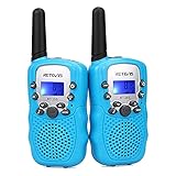 | Retevis RT388 Kids Walkie Talkies, Outdoor Toys for Kids Camping Essentials | Check Price On Amazon |
 | Cobra RX680 Walkie Talkies (2-Pack), IP54 Water Resistant Design | Check Price On Amazon |
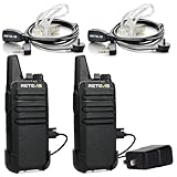 | Retevis RT22 Walkie Talkies Long Range Rechargeable with Earpiece (2 Pack) | Check Price On Amazon |
 | Midland GXT1000VP4 GMRS JIS4 Two-Way Radio, Black,2 Pack | Check Price On Amazon |
 | Retevis RT628 Walkie Talkies for Kids,Toys Gifts for 6-12 Years Old Boys Girls,Long Range 2 Way Radio 22CH VOX,Birthday Gift,Family Walkie Talkie for Camping Hiking Indoor Outdoor | Check Price On Amazon |