NOAA Weather Radio broadcasts emergency alerts 24 hours a day on seven dedicated frequencies between 162.400 and 162.550 MHz, but your radio can only protect you if it is tuned to the right local transmitter. Finding your nearest NOAA weather radio station takes less than two minutes using the official NOAA station locator tool, and it is the single most important setup step most weather radio owners skip.
This guide covers every method for finding your local station, explains how to program it correctly, and shows you what to do when your closest transmitter does not cover your area reliably.
| Photo | Popular Portable Walkie Talkies | Price |
|---|---|---|
 | SKIWARRIOR Multifunctional Smart Wireless Ski Goggles with Walkie-Talkie, Anti-Fog Zeiss Lens, Music & Call Function (Cylindrical Blue) | Check Price On Amazon |
 | SINORISE Super Mini Walkie Talkies, Two-Way Radios, 3 Pack | Check Price On Amazon |
 | KOSPET Tank M4C Smart Watch Rugged, Dual-Band GPS, 5ATM & IP69K Waterproof | Check Price On Amazon |
 | Retevis RT15 Walkie Talkies 3 Pack, Birthday Gift, Outdoor Adventure Kit | Check Price On Amazon |
 | Rechargeable Walkie Talkies Toys for Kids: DIY Astronaut Walkie Talkies for Boys Christmas Birthday Gifts for 3 4 5 6 7 8 9 10 Boy Walkie Talkie Outdoor Hiking Toy 2 Way Radio Camping Outdoor Game | Check Price On Amazon |
By the Numbers
NOAA Weather Radio All Hazards Network – Key Statistics
Sources: NOAA National Weather Service, FCC Part 11, FEMA IPAWS documentation
What Is the NOAA Weather Radio Station Locator and How Does It Work?
The NOAA Weather Radio station locator is a free tool hosted at the official NOAA National Weather Service website that identifies which NWR transmitter serves your specific address, county, or zip code. It returns the station call sign, broadcast frequency (in MHz), transmitter location, and the counties or zones covered by that station.
According to NOAA NWR documentation, the network operates more than 1,000 transmitters across all 50 states, Puerto Rico, the US Virgin Islands, and Guam. Each transmitter is assigned one of seven VHF frequencies between 162.400 and 162.550 MHz and broadcasts continuously, even when no active alerts are in progress.
The locator works by cross-referencing your input (zip code, county name, or state) against a database of transmitter coverage zones. Each zone is defined by FIPS (Federal Information Processing Standards) county codes, which are the same 6-digit codes used by S.A.M.E. (Specific Area Message Encoding) technology to filter alerts by location.
Understanding which transmitter covers your county is essential before programming a S.A.M.E.-capable weather alert radio, because the radio must receive the S.A.M.E. header from your local transmitter to trigger county-specific alerts.
Knowing your local station call sign and frequency is the starting point for every weather radio setup task covered in the rest of this guide.
How to Use the Official NOAA Station Locator Tool Step by Step
The official NOAA NWR station finder is located at nws.noaa.gov/nwr, under the “Station Listing” section. You can search by state and county, by zip code, or by browsing a clickable map of transmitter locations. The result page shows the station call sign (example: KEC93), the broadcast frequency, the transmitter city, and the full list of FIPS county codes served by that station.
Step-by-Step Guide
How to Find Your Local NOAA Weather Radio Station – Step by Step
6 steps · Estimated time: 3 minutes
Go to the NOAA NWR station listing page
Open a browser and navigate to nws.noaa.gov/nwr. Click “Station Listing” in the main navigation menu to access the searchable transmitter database.
Select your state from the dropdown menu
Choose your state from the alphabetical list. The page will reload and show every NWR transmitter operating in that state, listed by call sign and frequency.
Click the call sign link for the transmitter nearest your location
Each call sign (for example, WXL48 or KEC93) is a clickable link. Click it to open the full station detail page showing the broadcast frequency, transmitter address, and coverage zone list.
Confirm your county appears in the station’s coverage zone list
Scroll down to the “Counties/Zones Covered” table and verify your specific county is listed. If your county appears, this is your primary station. If it does not appear, go back and check the next nearest transmitter.
Write down the frequency and your county’s FIPS S.A.M.E. code
Record the 6-digit FIPS code next to your county name. You will need this exact code to program S.A.M.E. alerts on your weather radio so it only sounds for your county, not the entire state.
Tune your weather radio and test signal reception
Manually tune your weather radio to the frequency you recorded. A clear, uninterrupted voice broadcast confirms good reception. If you hear static or dropout, your location may be at the edge of the transmitter’s range and you may need to check for a secondary station.
Once you have confirmed your station and FIPS code, you have everything needed to program your radio for county-specific alerts instead of statewide broadcasts.
What Are All Seven NOAA Weather Radio Frequencies?
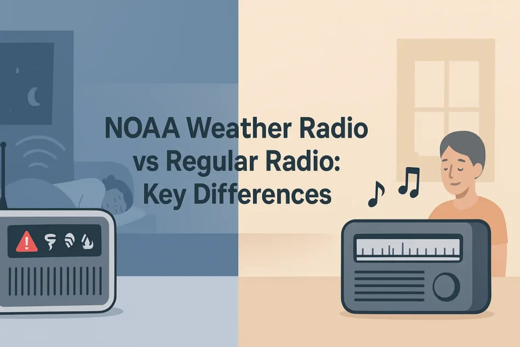
NOAA Weather Radio All Hazards broadcasts exclusively on seven VHF frequencies between 162.400 and 162.550 MHz. These frequencies are assigned by the FCC and are reserved solely for NWR use under federal law. No other radio service shares these channels, which is why a weather radio picks them up cleanly without interference from walkie-talkies or business radios.
According to FCC Part 11 and NOAA NWR technical documentation, each of the seven frequencies is designated WX1 through WX7 on consumer weather radios for ease of identification. The table below shows the full frequency list.
Use the table below to match the channel designation on your radio’s display to the actual MHz frequency broadcast by your local transmitter.
| Channel Designation | Frequency (MHz) | Notes |
|---|---|---|
| WX1 | 162.550 MHz | Most commonly assigned primary frequency |
| WX2 | 162.400 MHz | Second most widely used frequency |
| WX3 | 162.475 MHz | Common in Midwest and Southeast regions |
| WX4 | 162.425 MHz | Used in coastal and mountain terrain areas |
| WX5 | 162.450 MHz | Frequently used in western and plains states |
| WX6 | 162.500 MHz | Used in Pacific Northwest and Hawaii |
| WX7 | 162.525 MHz | Least commonly assigned primary frequency |
Your weather radio receives all seven frequencies regardless of which one your local station uses. The NOAA station locator result page always lists the exact MHz frequency for each transmitter, so you do not need to guess. For a complete breakdown of how these frequencies are allocated regionally, the detailed guide on all seven NWR broadcast frequencies and their regional usage patterns covers every transmitter band assignment in depth.
Programming the correct frequency directly into your radio guarantees it locks onto your local transmitter instead of scanning all seven channels and potentially latching onto a weaker distant station.
How to Find Your NOAA Station Without Internet Access
If you do not have internet access, you can find your local NOAA weather radio station by scanning all seven NWR frequencies with your weather radio and listening for the station that identifies itself with your state and county names during the broadcast. Every NOAA NWR transmitter announces its call sign and coverage area periodically throughout the broadcast cycle.
The fastest no-internet method is to set your weather radio to automatic scan mode. Most Midland WR120 and similar entry-level NOAA weather radios have a channel scan button that cycles through WX1 to WX7 and stops on the strongest signal.
This method works well in most locations, but it has one important limitation. The strongest signal is not always the transmitter whose coverage zone includes your specific county.
A transmitter 60 miles away on a hill may produce a stronger signal at your house than the transmitter 20 miles away in a valley. If you use the wrong transmitter for S.A.M.E. programming, your radio may not receive alerts for your county even though it receives the broadcast clearly.
The safest approach without internet access is to scan for signal strength first, then listen to the broadcast and wait for the station identifier. The announcement will say something similar to “This is NOAA Weather Radio station KEC93, broadcasting from [city], serving [county names].” If your county is named, you have the right station.
Write down the channel number your radio shows when locked onto that station (WX1 through WX7). Then cross-reference it with the frequency table above to confirm the MHz value before programming.
Scanning for the correct station before a storm season starts is one of the most important steps covered in the resource on why having a properly configured home weather radio matters for emergency preparedness.
The scan-and-listen method reliably identifies your local station in under five minutes even without any online tools.
What Information Does the NOAA Station Locator Give You?
The NOAA station locator returns five pieces of information for each transmitter: the FCC call sign, the broadcast frequency in MHz, the transmitter city and state, the ERP (effective radiated power) in watts, and the full list of counties and marine zones covered by that station. Each county entry includes the 6-digit FIPS S.A.M.E. code you need for county-level alert filtering.
ERP values for NWR transmitters typically range from 300 watts to 1,000 watts, according to NOAA NWR technical documentation. Higher ERP generally means wider coverage, but terrain, antenna height, and obstructions affect actual reception range more than raw power output.
The coverage zone list is the most important piece of data the locator provides. A single transmitter may cover anywhere from 3 to 30 counties depending on its location and power level.
If you live near a state border, you may find that a transmitter in a neighboring state covers your county more reliably than any in-state option. The locator searches by county and does not restrict results to same-state transmitters.
The FIPS codes listed next to each county are the exact 6-digit numbers you enter into a Uniden BC365CRS or comparable S.A.M.E. weather radio during programming. Without the correct FIPS code, the radio will alarm for every county the transmitter covers, not just yours.
Understanding what the S.A.M.E. system does with those FIPS codes is covered fully in the dedicated guide on how S.A.M.E. technology filters weather alerts by county.
The five data points from the locator give you everything needed to program your weather radio precisely for your location.
Which Weather Radios Work Best for Receiving Your Local NOAA Station?
Any weather radio that covers all seven NWR frequencies between 162.400 and 162.550 MHz will receive your local station. The meaningful difference between models is whether they include S.A.M.E. technology, which lets the radio decode county-specific FIPS codes and only trigger alerts for your location instead of all counties in the transmitter’s range.
A weather radio without S.A.M.E. capability will alarm for every alert broadcast by your local transmitter, including severe thunderstorm warnings 200 miles away. According to NOAA NWR consumer guidance, S.A.M.E. radios dramatically reduce false alarm fatigue, which is the primary reason people turn off or unplug their weather radios.
Entry-level S.A.M.E. radios in the $30 to $60 range include models like the Midland WR120 weather alert radio and the Uniden basic S.A.M.E. weather radio. These handle 25 alert event types and allow programming of one to three S.A.M.E. location codes.
Mid-range models in the $60 to $100 range, such as the Midland WR400 weather radio, add features like alarm clock integration, larger FIPS code memory (up to 50 location codes), and external antenna jacks for improved reception in fringe coverage areas.
Key Specifications for the Midland WR400:
- Frequency coverage: 162.400 to 162.550 MHz (all 7 NWR channels)
- S.A.M.E. alert types: 25 programmable event categories
- Location code memory: Up to 50 FIPS S.A.M.E. codes
- Power: AC adapter with 6x AA battery backup
- External antenna jack: Yes, 3.5mm auxiliary input
Premium models above $100 include units like the Sangean CL-100 tabletop weather alert radio, which adds AM/FM reception, digital display, and enhanced speaker output rated at 3 watts for audibility in noisy environments.
For locations at the edge of a transmitter’s range, models with an external antenna jack allow connection to a dedicated outdoor weather radio antenna, which can improve signal strength by 6 to 10 dB and eliminate reception dropouts in weak signal areas.
The radio that works best for your local station is the one with S.A.M.E. capability, battery backup, and enough FIPS code memory to store all the counties you need covered.
What to Do If Your Local NOAA Station Has Weak Signal or Poor Reception
Weak NOAA weather radio reception usually means your location is near the edge of the transmitter’s coverage radius or that obstructions like hills, buildings, or dense tree cover are attenuating the 162 MHz VHF signal. The fix depends on whether the problem is distance-related or obstruction-related.
This happens because VHF signals at 162 MHz propagate primarily via line-of-sight. Terrain above the direct path between the transmitter and your receiver blocks the signal, and no amount of radio sensitivity can overcome solid obstructions.
This only occurs when the transmitter is located at a lower elevation than the obstructing terrain, or when your receiver antenna is at ground level inside a building with exterior walls that attenuate the signal.
If the signal drops out, the result is missed alerts during active weather events. Fix it by raising the receive antenna above the obstruction or connecting an external antenna.
The following steps address the most common weak signal scenarios in order of cost and effort.
Step 1: Relocate the radio to a window-facing position. Placing the radio within 3 feet of a window facing the transmitter direction improves signal by 3 to 6 dB compared to interior placement, according to NOAA NWR reception guidance.
Step 2: Connect an external antenna. Any weather radio with a 3.5mm antenna jack accepts an external 162 MHz weather radio antenna. A simple half-wave dipole antenna mounted outside at roof level can improve signal by 10 to 15 dB over the internal antenna, which is often the difference between reliable reception and consistent dropout.
Step 3: Check for a secondary transmitter. Use the NOAA station locator to identify whether a second transmitter also covers your county. If two transmitters serve your area, test both frequencies and program the one with stronger reception as your primary station.
Step 4: Check the transmitter status page. NOAA maintains a transmitter outage and maintenance page at nws.noaa.gov/nwr. If your local station is offline for scheduled maintenance, reception problems are temporary and not equipment-related.
Step 5: Consider a combination scanner/weather radio. Dedicated scanner receivers like the Uniden HomePatrol-2 scanner with weather radio use more sensitive front-end tuner circuits than consumer weather radios, which can pull in weak VHF signals that entry-level weather radios cannot decode cleanly.
Addressing reception problems before severe weather season arrives ensures your radio functions as intended when alerts matter most.
How to Find NOAA Weather Radio Coverage for Specific States and Regions
NOAA NWR coverage varies significantly by state and region based on terrain, population density, and transmitter placement. Flat, open states like Kansas and Nebraska typically have fewer transmitters covering larger areas, while mountainous states like Colorado and West Virginia require more transmitters to fill terrain-blocked gaps. Coastal states have additional marine zone transmitters that cover offshore waters beyond the standard county grid.
The NOAA station locator’s state-by-state listing page provides the complete transmitter inventory for each state. For states with complex terrain or large geographic areas, the page may list 15 to 30 individual transmitters, each covering a distinct set of counties.
For Oklahoma specifically, the NWS Norman office operates multiple high-power transmitters covering the central plains area, which is one of the most tornado-active regions in the country. Residents in that region can find detailed transmitter assignments and coverage maps in the dedicated resource on Oklahoma City area NOAA weather radio stations and coverage zones.
Minnesota presents a different coverage challenge due to its northern latitude and large land area. The state has multiple transmitters spread across distinct climate zones, from the Twin Cities metro area to the Iron Range and the boundary waters region. Specific transmitter frequency assignments and coverage details for Minnesota residents are covered in the guide on Minnesota NOAA weather radio stations and county coverage.
Marine zone coverage is handled by a separate set of NWR transmitters with extended range and dedicated marine forecast broadcasts. If you live within 40 miles of a coast or major navigable waterway, the NOAA locator may show both a county-coverage transmitter and a marine zone transmitter for your location.
Understanding your region’s transmitter layout helps you identify backup stations and plan for gaps in coverage when traveling away from your home location.
Can a Baofeng or Handheld Ham Radio Receive NOAA Weather Radio Frequencies?
Yes, the Baofeng UV-5R and most dual-band VHF/UHF handheld ham radios can receive the seven NOAA NWR frequencies between 162.400 and 162.550 MHz in receive-only mode. The UV-5R covers VHF from 136 to 174 MHz, which includes the entire NWR band. You program each NWR frequency as a memory channel and set the radio to receive-only, since transmitting on 162 MHz is prohibited for non-licensed NWR users under FCC regulations.
The Baofeng UV-5R does not include S.A.M.E. decoding hardware. It receives the audio broadcast but cannot decode S.A.M.E. FIPS headers to trigger county-specific alerts or wake you with an alarm. Using it as a weather radio means keeping the volume on and monitoring manually, which makes it unsuitable as a standalone weather alert device for home use.
Key Specifications for the Baofeng UV-5R on NWR frequencies:
- VHF receive range: 136 to 174 MHz (covers all 7 NWR channels)
- Receive sensitivity: 0.2 microvolts at 12 dB SINAD
- S.A.M.E. decoding: None
- Transmit on 162 MHz: Not permitted (FCC restricted)
- Best use: Portable backup monitoring when away from home weather radio
To program NWR frequencies into a UV-5R using CHIRP software, you enter each MHz value (162.550, 162.400, 162.475, etc.) as a receive-only channel with no CTCSS tone (tone set to none) and squelch set to level 1 for maximum sensitivity on these low-power broadcast signals.
The detailed guide on using the Baofeng UV-5R to receive NOAA weather radio broadcasts covers every programming step, including CHIRP channel setup, squelch optimization, and battery management for extended monitoring use.
The UV-5R works well as a portable field monitor for NWR frequencies but should not replace a dedicated S.A.M.E. weather radio for home alert use.
Interactive Tool
Find the Right NOAA Weather Radio Setup for Your Situation
Answer 2 questions to get a recommendation matched to your location and needs.
How to Program Your NOAA Weather Radio After Finding Your Local Station
After identifying your local NOAA station frequency and FIPS county code, programming takes 3 to 10 minutes depending on your radio model. The process involves three steps: setting the reception frequency to your local station’s MHz value, entering your county FIPS code into the S.A.M.E. programming menu, and selecting which alert event types will trigger the alarm.
According to NOAA NWR consumer programming documentation, the most common programming error is entering the wrong FIPS code format. NOAA FIPS codes are always 6 digits in the format SSCCC, where SS is the 2-digit state code and CCC is the 3-digit county code. The full 6-digit code is required. Entering only the 3-digit county code without the state prefix will not work.
The following steps apply to most S.A.M.E. weather radios including the Midland WR series, Uniden BC365CRS, and Sangean CL-100.
Step 1: Access the programming menu. Press and hold the “Program” or “S.A.M.E.” button until the display shows a flashing FIPS code entry screen. On Midland radios, this button is labeled “SAME/PROG.” On Uniden models, it is the “PROG” button.
Step 2: Enter your 6-digit FIPS county code. Use the numeric keypad or channel up/down buttons to enter each digit. Confirm each entry with the “Enter” or “Set” button. The display should advance one digit position after each confirmation.
Step 3: Confirm the FIPS code and save. After entering all 6 digits, press “Enter” or “Set” one final time. The radio will display the stored code. Verify it matches the FIPS code from the NOAA station locator before exiting the menu.
Step 4: Set the frequency to your local station’s MHz channel. Navigate to the frequency or channel select menu. Select the WX channel number (WX1 through WX7) that corresponds to your local station’s frequency. Confirm the displayed MHz matches the value from the NOAA locator.
Step 5: Select alert event types. Navigate to the alert type menu and enable the event categories relevant to your region. At minimum, enable Tornado Warning, Severe Thunderstorm Warning, Flash Flood Warning, and Hurricane Warning. You can disable event types like Avalanche Warning if they are not relevant to your area.
Step 6: Test the programming. Press the “Test” or “Alert Test” button if available. The radio should display your stored FIPS code and the enabled alert types. Some models allow you to manually trigger a test alarm to confirm the speaker and alert LED function correctly.
Correct S.A.M.E. programming means the radio will wake you with an audible alarm only for alerts affecting your programmed counties, eliminating the false alarm fatigue that drives most people to unplug their weather radios.
NOAA Weather Radio Station Locator: Quick Reference Terms
The following terms appear throughout NOAA weather radio station resources. Each definition uses plain language to explain what the term means in practical use.
- NWR (NOAA Weather Radio All Hazards): The federal network of over 1,000 VHF transmitters that broadcasts weather and emergency alerts 24 hours a day across the United States.
- WX1 through WX7: The channel designations on consumer weather radios corresponding to the seven NWR broadcast frequencies between 162.400 and 162.550 MHz.
- S.A.M.E. (Specific Area Message Encoding): A digital header transmitted before each NWR alert that identifies which counties the alert applies to using 6-digit FIPS codes.
- FIPS code: A 6-digit Federal Information Processing Standards code that uniquely identifies each US county. The first two digits are the state code and the last three are the county code.
- ERP (Effective Radiated Power): The actual signal power output of an NWR transmitter in watts, accounting for antenna gain. NWR transmitters typically operate between 300 and 1,000 watts ERP.
- Call sign: The FCC-assigned identifier for each NWR transmitter, formatted as a letter-number combination (example: KEC93 or WXL48). The call sign is broadcast periodically in the audio stream.
- Coverage zone: The geographic area served by a specific NWR transmitter, defined as a list of county and marine zone FIPS codes.
- Alert event type: The category of emergency or hazard that triggers an NWR S.A.M.E. alert. The 25 standard event types include Tornado Warning, Flash Flood Warning, and Civil Emergency Message.
- EAS (Emergency Alert System): The federal public warning infrastructure that NWR is part of, alongside the Wireless Emergency Alert system that sends alerts to cell phones.
- IPAWS (Integrated Public Alert and Warning System): The FEMA-managed platform that aggregates and distributes alerts across EAS, NWR, and Wireless Emergency Alerts simultaneously.
- Fringe coverage area: A location near the outer edge of an NWR transmitter’s coverage radius where signal strength is adequate for audio reception but may not reliably trigger S.A.M.E. alert decoding.
- Marine zone: A defined offshore or coastal water area covered by NWR marine forecast broadcasts, identified by a marine zone FIPS code rather than a county code.
How Does NOAA Weather Radio Compare to Phone Weather Alerts?
NOAA Weather Radio and Wireless Emergency Alerts (the alerts sent to cell phones) both originate from the same IPAWS infrastructure, but they differ in reliability, coverage, and alert specificity in ways that matter during the emergencies when you need them most. NWR operates on dedicated VHF frequencies independent of cellular networks, which means it continues to function during cell tower outages, network congestion, and power grid failures.
Wireless Emergency Alerts sent to cell phones are limited to Tornado Warnings, Flash Flood Emergencies, and Extreme Wind Warnings at the Presidential and Imminent Threat alert levels under current FEMA IPAWS rules. NOAA Weather Radio broadcasts all 25 NWR alert event types, including Severe Thunderstorm Warnings, Winter Storm Warnings, Hazardous Materials Warnings, Civil Emergency Messages, and AMBER Alerts, which cell phone alerts do not always include.
Use the table below to compare the key differences between NWR and cell phone emergency alerts for your emergency preparedness planning.
| Feature | NOAA Weather Radio (NWR) | Wireless Emergency Alert (Cell Phone) |
|---|---|---|
| Infrastructure dependency | Independent VHF transmitters (no cell network) | Requires functioning cell towers |
| Power outage performance | Continues with battery backup in radio | Depends on phone battery and cell tower backup |
| Alert types covered | 25 NWR event categories | Limited to Presidential, Imminent Threat, AMBER tiers |
| Geographic precision | County-level via S.A.M.E. FIPS programming | Cell tower polygon (approximate county) |
| Works while sleeping | Yes, with dedicated alarm speaker | Only if phone is not silenced |
| Network congestion impact | None (dedicated federal frequency) | Delays possible during high-usage events |
| Recommended use | Primary home overnight alert system | Supplemental mobile alert when away from home |
NOAA Weather Radio is the more reliable primary alert system for home use, while cell phone alerts serve as a useful mobile supplement. Using both together provides the most complete coverage. The detailed case for keeping a dedicated receiver at home is made in the guide on the specific advantages weather radios have over smartphone alerts during power failures.
For overnight protection during severe weather season, a dedicated S.A.M.E. weather radio with battery backup is the only reliable option if your cell service is interrupted.
What Alerts Does Your Local NOAA Station Broadcast?
Every NOAA NWR transmitter broadcasts all 25 standard alert event types defined by NOAA and FEMA IPAWS, regardless of which specific hazards are common in your region. The transmitter does not filter by event type. Your weather radio’s S.A.M.E. programming determines which event types trigger your alarm.
According to NOAA NWR product descriptions and FEMA IPAWS documentation, the 25 alert event types are divided into three priority tiers: Warning (immediate threat to life or property), Watch (conditions favorable for a hazardous event), and Advisory/Statement (less severe conditions requiring awareness).
The most critical alert types that every S.A.M.E. radio should have enabled regardless of region include:
- Tornado Warning (TOR): Confirmed tornado on the ground or radar-indicated rotation with debris signature. Immediate action required.
- Flash Flood Warning (FFW): Flash flooding occurring or imminent. One of the leading causes of weather-related deaths in the US according to NWS records.
- Severe Thunderstorm Warning (SVR): Hail 1 inch or larger, or wind gusts 58 mph or greater, detected or indicated by radar.
- Hurricane Warning (HUW): Hurricane conditions (sustained winds 74 mph or greater) expected within 36 hours.
- Civil Emergency Message (CEM): Non-weather emergency requiring public action, such as a hazardous materials release or dam failure.
- National Information Center (NIC): Presidential-level emergency notification broadcast through the Emergency Alert System.
- AMBER Alert (CAE): Child abduction emergency broadcast through the NWR network.
Region-specific alert types worth enabling based on your location include Winter Storm Warning (WSW) for northern states, Tsunami Warning (TSW) for Pacific and Atlantic coastal areas, Extreme Wind Warning (EWW) for Plains states, and Avalanche Warning (AVW) for mountain regions.
A weather radio set to alarm for all 25 event types will trigger more frequently, including for events far from your county if your FIPS programming is incorrect. Correct S.A.M.E. county programming combined with selective alert type enabling gives you reliable protection without nuisance alarms.
The full picture of what NOAA Weather Radio is, how the network operates, and what distinguishes it from other public alert systems is covered in the foundational guide on what NOAA Weather Radio All Hazards is and how the broadcast network functions.
Selecting the right alert event types for your region is the final step in completing a fully functional weather radio setup after finding and programming your local station.
What Happens If You Live Between Two NOAA Weather Radio Transmitters?
If your location falls between two NWR transmitters, you may receive a strong signal from both. This is common near county borders, in river valleys between two transmitter sites, and in suburban areas at the boundary of two coverage zones. The practical effect is that your weather radio may lock onto whichever transmitter produces the stronger signal, which may or may not be the one whose coverage zone includes your county.
The solution is to program your radio to a fixed frequency rather than leaving it on auto-scan. Auto-scan mode selects the strongest signal at the moment of scan, which can change based on atmospheric conditions, time of day, or temporary transmitter power adjustments.
If both transmitters include your county in their coverage zone, program the stronger signal’s frequency as your primary channel. Both will broadcast alerts for your county with the same FIPS code, so either works correctly for S.A.M.E. alert triggering.
If only one transmitter covers your county, program that transmitter’s specific MHz frequency even if the signal is slightly weaker. A weather radio receiving the correct transmitter at moderate signal strength will decode S.A.M.E. headers reliably. Reception only fails when signal strength drops below approximately 0.5 microvolts at the antenna input, which corresponds to significant distance or terrain obstruction from the transmitter.
For radios with memory for multiple frequencies, store both transmitters. Some models, including the Midland WR300 weather radio, allow you to scan between programmed frequencies and default to the active alert broadcast when both transmitters are in range.
Living between two transmitters is an advantage for coverage redundancy, not a problem, as long as your primary frequency is set to a transmitter that includes your county in its FIPS zone list.
Is There a Mobile App Version of the NOAA Station Locator?
NOAA does not publish an official dedicated mobile app for the NWR station locator, but the NOAA Weather app (available for both iOS and Android) includes weather alert monitoring for your GPS location and allows you to look up active NWR station information by searching for your location in the app. The station locator web page at nws.noaa.gov/nwr is fully functional on mobile browsers.
Third-party apps that complement the NWR station locator include the American Red Cross Emergency app, which shows active NWR alerts by county, and Weather Underground, which displays NWS warning polygons overlaid on a map with county-level detail.
For the most direct station lookup experience on a mobile device, the NOAA NWR web page loads cleanly on all modern mobile browsers. Enter your zip code or county name in the search field and the result page returns the station call sign, frequency, and FIPS code list in a format readable on any screen size.
The NOAA Hazardous Weather Outlook page, linked directly from each transmitter’s station detail page, shows the extended forecast narrative from your local NWS office. This includes discussions of potential severe weather events 3 to 7 days in advance, which your weather radio will not broadcast until the event becomes imminent enough for a Warning or Watch issuance.
Apps are useful for active monitoring when you are away from your home weather radio, but they do not replace the dedicated alarm function of a S.A.M.E. weather radio for overnight and whole-home alert coverage.
Why Does My NOAA Weather Radio Not Alarm for Local Warnings?
A weather radio that does not alarm during an active local warning almost always has one of four problems: the wrong FIPS code is programmed, the wrong frequency is tuned, the alert event type for that warning category is disabled, or the radio’s battery backup is depleted and the radio lost its programming during a power interruption.
The first check is to verify the programmed FIPS code matches the 6-digit code from the NOAA station locator for your county. A single transposed digit in the FIPS code means the radio ignores every alert for your county while alarming for an entirely different county instead.
The second check is the tuned frequency. If the radio is on auto-scan or tuned to a weaker distant transmitter that does not cover your county, it will receive the audio broadcast but never decode a S.A.M.E. header with your county’s FIPS code.
The third check is alert event type settings. Navigate to the alert type menu and confirm that the event category for the warning you expected (for example, Severe Thunderstorm Warning, event code SVR) is enabled. A factory reset or battery replacement sometimes reverts alert type settings to a limited default set.
The fourth check is battery condition. Most S.A.M.E. weather radios store programming in non-volatile memory that survives battery removal, but some budget models store settings in volatile RAM that clears when power is interrupted. Replace the backup batteries annually even if the radio runs on AC power.
If all four checks pass and the radio still does not alarm, the problem may be insufficient signal strength to decode the S.A.M.E. digital header, even if the audio voice broadcast is audible. The S.A.M.E. decoder requires a cleaner signal than the audio circuit, so a weak but listenable broadcast may still fail to trigger the alarm. Connecting an external antenna is the solution in this case.
Correct FIPS code programming is the single most important variable in weather radio reliability, and the NOAA station locator is the only authoritative source for that code.
Can I Use One NOAA Weather Radio Station to Cover Multiple Locations?
Yes, S.A.M.E. weather radios that support multiple FIPS location codes can monitor alerts for several counties simultaneously using one radio tuned to a single transmitter. Most mid-range and premium models store between 5 and 50 FIPS codes, and the radio triggers an alarm if any programmed county code appears in a received S.A.M.E. alert header.
This capability is useful if you live near a county border, own property in more than one county, or want to monitor alerts for the counties where family members live. Program each county’s 6-digit FIPS code individually into separate memory slots in the S.A.M.E. programming menu.
The limitation is that all programmed counties must be covered by the same transmitter you are tuned to. If your second county is covered by a different transmitter on a different frequency, a single radio tuned to one frequency will not receive S.A.M.E. alerts for the second county.
In practice, most county pairs that fall within a 40-mile radius of each other are served by the same transmitter. Use the NOAA station locator to check whether both counties appear in the coverage zone list for the same call sign before programming multiple FIPS codes.
For families monitoring alerts across a wide geographic area, the most reliable approach is two separate weather radios, each programmed to the appropriate local transmitter frequency and FIPS codes for its respective area.
How Often Does NOAA Update the Station Locator Database?
NOAA updates the NWR station database when transmitters are added, relocated, or have their coverage zones modified. New transmitters are added periodically as NOAA fills gaps in coverage, particularly in rural and mountainous areas. Frequency changes and power output modifications are reflected in the database after the FCC license amendment is processed, which typically takes 30 to 90 days from the change date.
NOAA does not publish a specific update schedule for the web-based station locator. The most reliable way to confirm your station data is current is to visit the transmitter’s individual station detail page and check the “Last Modified” or version date if shown.
For most users in established coverage areas, the station data rarely changes. The frequency, FIPS zone list, and call sign for a transmitter that has been operating for several years are stable. Newly installed transmitters or recently expanded coverage zones are the scenarios most likely to produce outdated results if you rely on a cached or printed station listing.
Checking the NOAA station locator once per year, typically before the beginning of your region’s primary severe weather season, is sufficient to confirm your radio is programmed to the correct and current transmitter data.
What Is the Difference Between a NOAA Weather Radio Station and a NOAA Weather Forecast Office?
A NOAA NWR transmitter is a VHF broadcast station that continuously transmits audio weather information and S.A.M.E. digital alert headers on one of the seven NWR frequencies. A NOAA Weather Forecast Office (WFO) is a physical NWS office staffed by meteorologists who generate the forecasts, warnings, and alerts that are then sent to and broadcast by the NWR transmitter network. The WFO creates the content. The NWR transmitter delivers it.
There are 122 NWS Weather Forecast Offices across the United States, each responsible for a geographic county warning area (CWA). Each WFO feeds its alert and forecast content to the NWR transmitters within its CWA. One WFO may feed content to multiple transmitters, and in some cases a single transmitter may receive content from two adjacent WFOs for counties near CWA boundaries.
The NOAA station locator identifies transmitters, not WFOs. The transmitter’s station detail page includes a link to the responsible WFO, which is useful for accessing extended forecast discussions, severe weather outlooks, and technical meteorological analysis beyond what the audio broadcast provides.
Understanding this distinction matters when you hear conflicting information. If your local NWR broadcast mentions counties from two different states, it is because a WFO’s CWA crosses a state line, which is common in the Ohio Valley, Mid-Atlantic, and Great Plains regions.
The NWR transmitter is the device you tune to. The WFO is the team of meteorologists behind the broadcast content. Both are part of the same NOAA NWS infrastructure, and the station locator connects your location to both layers of that system.
Does NOAA Weather Radio Work During a Tornado Warning?
NOAA Weather Radio transmits tornado warnings within 2 to 4 minutes of the issuing NWS Weather Forecast Office releasing the alert, according to NOAA NWR operational documentation. The S.A.M.E. digital header is broadcast first, triggering the alarm on correctly programmed radios before the voice message begins. A properly configured weather radio will sound its alarm and wake you even if you are asleep before the meteorologist has finished reading the warning text.
This happens because the NWR broadcast system is directly integrated into the NWS alert issuance workflow. When a meteorologist issues a Tornado Warning in the WFO’s internal system, the S.A.M.E. header is generated automatically and pushed to the regional NWR transmitters in real time. No manual broadcast step is required.
This only occurs reliably when your radio is programmed with the correct FIPS code for the county where the tornado warning is issued. A radio tuned to the correct frequency but programmed with the wrong county code will receive the broadcast audio but the S.A.M.E. decoder will not trigger the alarm because the FIPS code in the header does not match your programmed code.
If this condition is not met, meaning your FIPS code is wrong or your radio is tuned to a transmitter that does not cover your county, the alarm will not sound. Fix it by re-entering the correct 6-digit FIPS code from the NOAA station locator for your county and confirming your radio is tuned to the specific MHz frequency of the transmitter listed as covering your county.
NOAA Weather Radio is the fastest public alert channel for tornado warnings, consistently outperforming cell phone Wireless Emergency Alerts by 60 to 90 seconds in most documented events, according to NWS post-storm surveys.
What Is a NOAA Weather Radio Station Call Sign and What Does It Tell You?
An NWR transmitter call sign is a 4 to 5 character FCC-assigned identifier in the format KXX## or WXXX#, where the letters and numbers identify the specific transmitter license. Examples include KEC93, WXL48, and KHB35. The call sign is broadcast in the audio stream of the NWR transmission and appears on the NOAA station locator result page as the primary identifier for each transmitter.
The call sign does not directly encode geographic location or frequency information. It is a license registration number assigned by the FCC when the transmitter is licensed. The useful information associated with a call sign, including frequency, coverage zone, ERP, and responsible WFO, is accessible by clicking the call sign in the NOAA station locator database.
Call signs beginning with “K” are used for transmitters licensed primarily for the western United States and some central states. Call signs beginning with “W” are used for the eastern United States. This follows the same geographic convention used for AM and FM broadcast stations under FCC Part 11 assignment rules, though the exact boundary is not strictly enforced for NWR stations.
Knowing your local station’s call sign is useful when reporting reception problems to NOAA, when checking the transmitter status page for outage information, and when cross-referencing coverage zone data between the station locator and third-party frequency databases like RadioReference.com.
The call sign is also the identifier used in NOAA’s transmitter outage notification system, which posts maintenance windows and unplanned outages at the NWR operational status page at nws.noaa.gov/nwr/outages.
How Far Can a NOAA Weather Radio Transmitter Reach?
A typical NWR transmitter with 1,000 watts ERP and an antenna mounted at 300 feet above ground level reaches approximately 40 miles in flat terrain under standard atmospheric conditions, according to NOAA NWR coverage design specifications. Terrain elevation, transmitter antenna height, and atmospheric ducting affect actual coverage radius significantly, with real-world coverage ranging from 20 miles in mountainous terrain to over 60 miles during atmospheric inversion events.
This happens because NWR operates at 162 MHz in the VHF band, where propagation is primarily line-of-sight. Terrain above the direct path between transmitter antenna and receiver blocks the signal through diffraction loss. Each 100 feet of terrain obstruction in the path reduces effective range by approximately 20 to 30 percent.
This only occurs at distances beyond the radio horizon, which for a transmitter at 300 feet antenna height is approximately 22 miles to a ground-level receiver. Beyond 22 miles, the signal relies on terrain clearance and atmospheric bending to reach the receiver.
If your location is beyond 40 miles from the nearest transmitter, the result is either no signal or signal that is too weak to decode S.A.M.E. headers reliably. Fix it by connecting an external antenna at the highest point available on your property, checking the NOAA locator for any secondary transmitter covering your county from a different direction, or using a portable hand-crank weather radio with high-sensitivity receive circuitry positioned for maximum line-of-sight to the transmitter.
The 40-mile typical coverage radius is the design target NOAA uses when siting new transmitters, with the goal of providing 95 percent of the US population with reliable NWR reception from at least one transmitter within that radius.
Can You Receive NOAA Weather Radio on a Regular FM Radio?
Standard consumer FM radios do not receive NOAA NWR broadcasts. FM broadcasting operates between 87.8 and 108 MHz, while NWR transmits exclusively between 162.400 and 162.550 MHz. There is no frequency overlap between the two bands. An FM radio’s tuner circuit is not designed to receive signals above approximately 108 MHz and will produce no output when pointed at 162 MHz.
Some combination radios marketed as “AM/FM/Weather” radios include a separate VHF receive circuit specifically for the NWR band alongside the standard AM and FM tuner. These combination units are distinct from pure FM radios. The weather band tuner in a combination radio is a separate circuit, not an extension of the FM tuner.
Shortwave radios and general coverage receivers that tune continuously from HF through VHF can reach 162 MHz and receive NWR audio. However, these receivers typically lack S.A.M.E. decoding capability, making them suitable for audio monitoring but not for alarm triggering.
The only way to receive NOAA Weather Radio on a standard radio is if the device specifically states it covers the “WX” or “weather band” in its specifications. Look for a dedicated WX button or WX channel selector on the device’s control panel as confirmation.
Attempting to tune an AM/FM radio to 162 MHz will produce static or silence because the frequency is outside the FM band entirely, not because of weak signal strength.
Is NOAA Weather Radio Free to Receive?
Yes, NOAA Weather Radio is a free public service funded by NOAA and broadcast on unencrypted VHF frequencies that anyone with an appropriate receiver can access without subscription, registration, or license. There is no fee to receive NWR broadcasts, program S.A.M.E. codes, or use the station locator tool. The only cost is the one-time purchase of a compatible weather radio receiver.
NOAA NWR operates under authority granted to NOAA by Congress as part of the National Weather Service’s public safety mission. FCC Part 11 governs the Emergency Alert System infrastructure that NWR is part of, and the seven NWR frequencies are reserved exclusively for federal government weather broadcasting under FCC regulations.
Using an NWR-capable receiver to listen to NWR broadcasts is fully legal for any person in the United States. Transmitting on NWR frequencies (162.400 to 162.550 MHz) is prohibited for non-authorized users and reserved exclusively for NOAA-licensed transmitters. No FCC license is required to receive NWR broadcasts.
The NOAA station locator tool is also free to use with no account or registration required. It is accessible at nws.noaa.gov/nwr from any device with a web browser.
How Do You Know If Your NOAA Weather Radio Is Receiving the Correct Station?
You can verify correct station reception in three ways: audio identification, S.A.M.E. test alert, and signal strength comparison. The most direct method is audio identification. Every NWR transmitter broadcasts its call sign and coverage counties in the audio stream at regular intervals, typically during the forecast update cycle. Tune to your programmed frequency and listen for the station announcement that names the transmitter call sign and the counties it serves.
If your county is named in the broadcast announcement, you are tuned to the correct station. If you hear a different county list that does not include your county, you are receiving a transmitter whose coverage zone does not include your location, and your S.A.M.E. programming will not trigger alerts for your county regardless of signal strength.
The second verification method is to use the weekly NOAA NWR test broadcast. Every Wednesday, NWR transmitters broadcast a test S.A.M.E. alert header at approximately 11:00 AM local time (specific time varies by transmitter). If your radio’s alarm triggers during the Wednesday test, your FIPS code, frequency, and alert settings are all configured correctly.
The third method is signal strength comparison. If your radio has a signal strength indicator, note the reading on your programmed frequency. Then manually tune to each of the other six NWR frequencies and compare readings. If a different frequency shows significantly higher signal strength, use the NOAA station locator to determine whether that stronger transmitter also covers your county. If it does, reprogramming to the stronger frequency improves reliability.
A confirmed Wednesday test alarm is the most definitive single verification that your weather radio is configured correctly and will alert you during real events.
Where Do You Place a NOAA Weather Radio for Best Reception and Alert Coverage?
Place your weather radio as high as practical in the room, within 3 feet of an exterior window facing the direction of your local NWR transmitter, on a flat surface with the antenna fully extended and oriented vertically. Interior placement in the center of a building, particularly on lower floors or in basements, reduces VHF signal strength by 6 to 15 dB compared to window placement.
The bedroom or sleeping area is the most important location for a weather radio because overnight tornado warnings and flash flood events occur when you are least likely to be monitoring other alert sources. A weather radio with an audible alarm loud enough to wake a sleeping adult (typically 85 dB or higher at 3 feet) placed in the bedroom provides the most reliable overnight protection.
If bedroom reception is poor due to interior building attenuation, connect a 162 MHz external weather radio antenna mounted outside or in an attic and run the coaxial cable to the radio’s antenna input jack. This approach eliminates building attenuation entirely and provides signal strength equivalent to outdoor antenna placement.
Multiple radios in different rooms are a practical solution for large homes or buildings. A second Midland WR120B or similar entry-level weather radio programmed to the same station and FIPS code as your primary unit provides coverage in a second sleeping area for under $40.
Optimal placement combined with correct S.A.M.E. programming gives you the fastest possible alert response time with the fewest false alarms.
What Is the Difference Between a NOAA Weather Radio Warning and a Watch?
A NOAA Weather Radio Warning means a hazardous weather event is occurring, is imminent, or is highly likely. Immediate protective action is required. A Watch means conditions are favorable for a hazardous event to develop, usually within the next 6 to 48 hours, and you should prepare and stay alert. Both are broadcast as S.A.M.E. alerts by your local NWR transmitter with distinct event codes that your weather radio can be programmed to alarm for.
According to NWS meteorological criteria, a Tornado Warning is issued when a tornado is confirmed by a trained spotter or indicated by radar velocity data showing rotation. A Tornado Watch is issued when atmospheric conditions across a large area are favorable for tornado development, giving you time to review shelter locations and check your weather radio programming before conditions deteriorate.
A Flash Flood Warning is issued when flooding is occurring or imminent based on rainfall rates, stream gauge readings, or spotter reports. A Flash Flood Watch is issued when heavy rainfall may cause flooding in the next 12 to 48 hours.
Your S.A.M.E. weather radio can be programmed to alarm for Warnings only, Watches only, or both. Setting the radio to alarm for Warnings only reduces nuisance alarms from Watch issuances but removes advance notice for developing situations. Most emergency management professionals recommend enabling both Warning and Watch alerts and relying on the distinct alarm tones most S.A.M.E. radios use to distinguish between them.
The Advisory level (below Watch) indicates less severe conditions, such as a Winter Weather Advisory or Dense Fog Advisory. Most weather radios can be programmed to alarm for Advisories, but doing so significantly increases alarm frequency and is generally not recommended for overnight alarm use.
How Do I Find the FIPS Code for My County?
The FIPS (Federal Information Processing Standards) code for your county is available directly on the NOAA station locator result page. When you click your local transmitter’s call sign in the station listing, the coverage zone table shows each county name alongside its 6-digit FIPS code. Your county’s FIPS code is the number in that table next to your county name.
FIPS county codes follow the format SSCCC, where SS is the 2-digit state FIPS code and CCC is the 3-digit county FIPS code. For example, Cook County, Illinois has FIPS code 017031, where 017 is Illinois’s state code and 031 is Cook County’s county code. Nebraska’s Douglas County (home of Omaha) uses FIPS code 031055.
An alternative source is the US Census Bureau’s official FIPS county code list, which provides every county code in a downloadable table. The NOAA station locator is the more convenient single-source option because it shows both your county’s code and confirms which transmitter covers it in one step.
Always use the full 6-digit code when programming your weather radio. Some radio manuals show a 7-digit format that prepends a leading zero to create a 7-character entry. Check your radio’s manual for the exact digit count it expects, as entering a 6-digit code into a radio expecting 7 digits (or vice versa) will result in a programming error that silently fails without any alert.
The 6-digit FIPS code from the NOAA station locator is the definitive source for weather radio S.A.M.E. programming, and the locator is the only step needed to obtain it.
What Should You Do When a NOAA Weather Radio Alert Sounds?
When your weather radio alarm sounds, listen to the broadcast message immediately without silencing the alarm until you have heard the county and event type. The S.A.M.E. voice message begins with “The National Weather Service in [city] has issued a [event type] for [county names]” followed by the effective time, expiration time, and protective action instructions. This sequence gives you the information you need to decide whether to take immediate shelter or continue monitoring.
For a Tornado Warning affecting your county, move immediately to your predetermined shelter location (interior room on the lowest floor, away from windows) before attempting to gather additional information. Tornado warnings typically have 13-minute lead times on average according to NWS performance data, but that time is consumed by traveling to shelter, not by monitoring additional broadcasts.
For a Severe Thunderstorm Warning, move away from windows and avoid using corded electronics. A severe thunderstorm warning is not typically a shelter-now event unless the warning includes a Tornado Possible statement.
For a Flash Flood Warning, avoid driving. More than half of flash flood fatalities in the United States involve vehicles being swept off roads according to NWS flood safety statistics. Move to higher ground if you are in a low-lying area.
After taking initial protective action, tune the radio to the continuous broadcast to monitor for updates, cancellations, or new warnings. NWR broadcasts update the warning status in real time as the event evolves.
Silence the alarm only after you have confirmed the event type and confirmed the warning affects your programmed county. A correctly programmed radio does not alarm for events in other counties, so every alarm event warrants immediate attention.
What Is the NOAA Weather Radio Network and How Is It Funded?
The NOAA Weather Radio All Hazards network is a federally operated VHF broadcast infrastructure maintained by the National Oceanic and Atmospheric Administration (NOAA) under the Department of Commerce. It is funded through NOAA’s annual Congressional appropriation as part of the National Weather Service’s operational budget. There is no per-user fee, subscription model, or advertising revenue involved in the network’s operation.
NOAA operates and maintains all transmitter hardware, including antenna towers, transmitter equipment, and backup power systems. Each transmitter has battery backup and in many cases diesel generator backup to maintain broadcast continuity during power grid failures. The network’s mandate, defined by Congress and implemented through FEMA’s IPAWS program, is to provide continuous broadcast capability during any hazard event, including those that cause widespread power and telecommunications failures.
The network is integrated with the Emergency Alert System (EAS) and FEMA’s Integrated Public Alert and Warning System (IPAWS). When a NWS Weather Forecast Office issues a Warning, Watch, or Advisory, the alert is simultaneously sent to NWR transmitters, broadcast television and radio stations through the EAS, and cell towers for Wireless Emergency Alerts. NWR is the dedicated always-on component of this three-channel system.
NOAA’s NWR documentation describes the network as the “voice of NOAA” for direct public communication. With over 1,000 transmitters and 95 percent population coverage, it remains the most reliable broadcast infrastructure for direct public emergency warning in the United States.
A portable hand-crank emergency weather radio with battery backup is one of the most cost-effective ways to access this federally maintained broadcast infrastructure during power outages when other alert channels fail.
Frequently Asked Questions
What frequency does my local NOAA weather radio station broadcast on?
Your local NOAA weather radio station broadcasts on one of seven frequencies between 162.400 and 162.550 MHz. The exact frequency for your nearest transmitter is listed on the NOAA NWR station locator page at nws.noaa.gov/nwr when you search by your state and county. The most commonly used frequency in the US is 162.550 MHz (channel WX1), but your local station may use any of the seven designated NWR channels.
To find your specific station’s frequency, navigate to the NOAA NWR station listing, select your state, and click the call sign of the transmitter nearest your location. The station detail page shows the MHz frequency, the transmitter city, and the list of counties covered.
Knowing the exact frequency allows you to manually program your weather radio to lock onto your local station rather than relying on auto-scan, which may select a stronger but geographically incorrect transmitter.
What is the difference between WX1 and WX2 on a weather radio?
WX1 through WX7 are the channel label designations that consumer weather radios use to represent the seven NOAA NWR broadcast frequencies. WX1 corresponds to 162.550 MHz and WX2 corresponds to 162.400 MHz. The channel numbers are simply display labels on the radio, not separate content streams. Each of the seven channels carries a different transmitter’s broadcast.
Your local transmitter may be on any of the seven WX channels depending on which frequency the FCC assigned to that specific station. Two transmitters in neighboring counties might use WX1 and WX3 respectively, even though both transmit NOAA weather information. Check the NOAA station locator to confirm which WX channel number corresponds to the transmitter covering your county.
Can I use my weather radio to receive alerts when I travel to a different state?
Yes, but you must reprogram the FIPS code and frequency for each new location if you want county-specific alerts. A weather radio with its home county FIPS code programmed will not alarm for alerts in a different county when you travel, even if the radio is receiving the local transmitter’s broadcast clearly. The S.A.M.E. decoder compares received FIPS codes against your programmed codes, and a code mismatch means no alarm.
Before traveling, look up the FIPS code and transmitter frequency for your destination county using the NOAA station locator. Program these values into an additional memory slot on your radio if it supports multiple location codes. After returning home, you can leave the travel codes stored or overwrite them without affecting your home county programming.
Some premium weather radios with GPS capability, such as certain Midland models, automatically update the active FIPS code based on your current GPS coordinates, eliminating the need for manual reprogramming when traveling.
Why does my weather radio alarm for counties I do not live in?
Your weather radio is alarming for the wrong counties because it is either programmed with no FIPS code at all (factory default monitors all counties the transmitter covers) or programmed with an incorrect FIPS code that matches a different county. A weather radio with no FIPS code programmed alarms for every county in the transmitter’s coverage zone, which may include 5 to 30 counties depending on the transmitter’s power and location.
The fix is to program your specific 6-digit FIPS county code from the NOAA station locator into the S.A.M.E. programming menu on your radio. Access the radio’s SAME programming menu (button label varies by model, typically “SAME/PROG” or “PROG”), clear any existing codes, and enter your county’s FIPS code. After saving, the radio will only alarm for alerts that include your programmed county in the S.A.M.E. header, eliminating alarms for surrounding counties.
How do I find the FIPS S.A.M.E. code for my county?
The FIPS S.A.M.E. code for your county is displayed on the NOAA NWR station locator at nws.noaa.gov/nwr. Search by your state, click your nearest transmitter’s call sign, and locate your county in the coverage zone table. The 6-digit number next to your county name is the FIPS code you enter into your weather radio’s S.A.M.E. programming menu.
FIPS codes never change unless a county is dissolved or renamed by state legislation, which is extremely rare. Once you have the correct code from the NOAA station locator, it will remain valid indefinitely for your county. The two-digit state prefix followed by the three-digit county code always produces a 5-digit FIPS number, but NOAA and most weather radios use a 6-digit format by prepending a leading zero to create a code like 017031 for Cook County, Illinois.
What is the difference between a weather radio and a weather alert radio?
A weather radio receives and plays NOAA NWR audio broadcasts on the seven NWR frequencies, but does not have automatic alert triggering. A weather alert radio includes a S.A.M.E. decoder that monitors the broadcast continuously in standby mode and sounds an alarm automatically when a S.A.M.E. alert header matching your programmed FIPS code is received. The alarm function works even when the radio is in standby with the speaker muted.
For home emergency preparedness, a weather alert radio with S.A.M.E. capability is the relevant category because manual monitoring is not practical overnight. A basic weather radio that only plays audio without alarming provides no overnight protection. When purchasing, verify the product description includes “S.A.M.E.” or “SAME alert” capability, not just “weather band reception.”
Is my NOAA weather radio required to be on a specific channel for S.A.M.E. to work?
Yes. Your weather radio’s S.A.M.E. decoder can only receive and process S.A.M.E. headers from the specific frequency it is tuned to. The radio must be tuned to a transmitter that covers your county, and that transmitter must be the one broadcasting S.A.M.E. headers containing your county’s FIPS code. Tuning to the wrong frequency, even if it receives a clear audio signal from a different transmitter, means the FIPS codes in that transmitter’s S.A.M.E. headers will not match your county code and the alarm will not trigger.
Set your radio to a fixed frequency matching your local transmitter’s MHz value from the NOAA station locator rather than leaving it on auto-scan. Auto-scan can switch to a stronger signal from a different transmitter that does not cover your county, silently disabling your S.A.M.E. alert capability without any indication on the display.
Can I receive NOAA weather radio alerts on a GMRS or FRS walkie-talkie?
Standard FRS walkie-talkies operating on 462-467 MHz cannot receive NOAA NWR broadcasts at 162 MHz because their receive circuitry is designed exclusively for the FRS/GMRS frequency band. GMRS radios have the same limitation. Neither service’s hardware is designed to cover the 162 MHz NWR band, and no firmware change or channel programming can make an FRS or GMRS radio receive 162 MHz signals.
Dual-band amateur radios like the Baofeng UV-5R cover VHF from 136 to 174 MHz and can receive NWR audio in receive-only mode after programming the NWR frequencies as memory channels. However, these radios lack S.A.M.E. decoding capability and cannot trigger an automatic alarm. For S.A.M.E. alert capability, a dedicated weather alert radio is required regardless of what other radios you own.
What does it mean when my weather radio broadcasts a Required Monthly Test?
A Required Monthly Test (RMT) is a scheduled test of the Emergency Alert System conducted by NOAA and broadcast via NWR transmitters once per month. The test includes a S.A.M.E. header with event code RMT followed by a test broadcast message. A Required Weekly Test (RWT) is a shorter test broadcast every Wednesday at approximately 11:00 AM local time with event code RWT.
If your weather radio alarms during an RMT or RWT, this confirms three things: the radio is receiving your local transmitter correctly, the S.A.M.E. decoder is functioning, and your FIPS code is correctly matching the test broadcast. If the radio does not alarm during the Wednesday RWT, something is wrong with your frequency, FIPS code, or alert type settings, and you should troubleshoot before relying on the radio for real emergency alerts.
You can disable RMT and RWT alarms in your radio’s alert type settings if the test broadcasts are disruptive. Disabling tests does not affect your radio’s response to actual warnings and watches, but it removes the weekly confirmation that your setup is working correctly.
Can two counties share the same FIPS S.A.M.E. code?
No. FIPS county codes are unique identifiers assigned by the US Census Bureau. Each county in the United States has a distinct 5-digit FIPS code (displayed as 6 digits with a leading zero in NWR format). No two counties share the same code. Independent cities in Virginia, for example, are assigned their own unique FIPS codes distinct from the surrounding county codes, even when they share the same name.
The only scenario where code confusion arises is when a county has the same name as a county in another state. For example, both Virginia and Illinois have a county named Calhoun, but they have different 2-digit state prefixes in their FIPS codes, making them completely distinct. Always include the full 6-digit code including the state prefix to avoid any ambiguity in weather radio programming.
How do I check if my local NOAA transmitter is currently online and broadcasting?
NOAA maintains an NWR transmitter outage page at nws.noaa.gov/nwr/outages that lists transmitters currently offline for scheduled maintenance or unplanned outages. Search the page for your local station’s call sign to check its current status. NOAA also posts scheduled maintenance windows in advance, typically 24 to 48 hours before the outage begins.
You can also verify transmitter status by tuning your weather radio to your local station’s frequency and listening for 30 seconds. An active transmitter produces a continuous audio broadcast. Silence or static on a frequency that normally carries a clear broadcast indicates either a transmitter outage or a reception problem on your end.
If the NOAA outage page shows no planned outage but your radio receives no signal, try the next nearest transmitter covering your county as a temporary backup. Most counties served by one transmitter are also partially covered by at least one adjacent transmitter, providing backup reception during outages.
Do NOAA weather radio stations broadcast international weather alerts?
NOAA NWR transmitters broadcast weather and hazard alerts exclusively for US territories, including the 50 states, Puerto Rico, the US Virgin Islands, Guam, and American Samoa. International weather information is not broadcast on NWR. If you live near a US-Canada or US-Mexico border and need weather alerts for cross-border travel, the NWR broadcast may cover the US side of the border but Canadian or Mexican alerts require separate monitoring through Environment Canada’s Weatheradio Canada or Mexico’s equivalent services.
Weatheradio Canada operates on the same seven frequencies as NOAA NWR (162.400 to 162.550 MHz) using compatible S.A.M.E. technology. A US weather radio correctly programmed with Canadian FIPS-equivalent codes will receive Weatheradio Canada alerts near the border. The Weatheradio Canada station finder at weather.gc.ca provides the same lookup functionality as the NOAA station locator for Canadian transmitters.
Using a properly tuned and programmed S.A.M.E. weather radio remains your most reliable emergency alert option on either side of the US-Canada border, given the two networks’ shared frequency and encoding standards.
Your local NOAA weather radio station is one lookup away, and the information it gives you, a specific frequency and a six-digit FIPS code, is all you need to turn a basic weather radio into a fully configured emergency alert system for your exact county.
Spend three minutes on the NOAA station locator, write down your transmitter’s MHz frequency and your county’s FIPS code, and program them into your radio today. Then confirm the setup is working by waiting for the next Wednesday Required Weekly Test alarm.
| Photo | TOP RATED WALKIE TALKIES | Price |
|---|---|---|
 | Retevis RT628 Kids Walkie Talkies, Toys Gifts for 4-12 Year Old Girl Boy | Check Price On Amazon |
 | Cobra ACXT545 Weather-Resistant Walkie Talkies, Rechargeable, 22 Channels | Check Price On Amazon |
 | Retevis RT388 Kids Walkie Talkies, Outdoor Toys for Kids Camping Essentials | Check Price On Amazon |
 | Cobra RX680 Walkie Talkies (2-Pack), IP54 Water Resistant Design | Check Price On Amazon |
 | Retevis RT22 Walkie Talkies Long Range Rechargeable with Earpiece (2 Pack) | Check Price On Amazon |
 | Midland GXT1000VP4 GMRS Two-Way Radios with Headsets, Black, 2 Pack | Check Price On Amazon |
 | Retevis RT628 Walkie Talkies for Kids,Toys Gifts for 6-12 Years Old Boys Girls,Long Range 2 Way Radio 22CH VOX,Birthday Gift,Family Walkie Talkie for Camping Hiking Indoor Outdoor | Check Price On Amazon |